Navigacija po spletni strani
Pridobite to turo v svoj mobilni telefon
Zemljevid
GR® de Pays de la Déodatie (South Loop) - Grandes Echappées Vosgiennes

srednja
Pohodništvo v daljavo
169.17 km
Skenirajte kodo QR in začnite navigacijo v aplikaciji bergfex.
QR Code
Pohodništvo in sledenje
Prenos za iOS
Prenos za Android

GR® de Pays de la Déodatie (South Loop) - Grandes Echappées Vosgiennes
srednja
Pohodništvo v daljavo
Zemljevid
Razdalja
169.2 km
Trajanje
55:00 h
Ascent
4,898 hm
Morska gladina
336 - 1,001 m
Prenos skladbe
Zemljevid
GR® de Pays de la Déodatie (South Loop) - Grandes Echappées Vosgiennes
srednja
Pohodništvo v daljavo
169.17 km

Fotografije naših uporabnikov

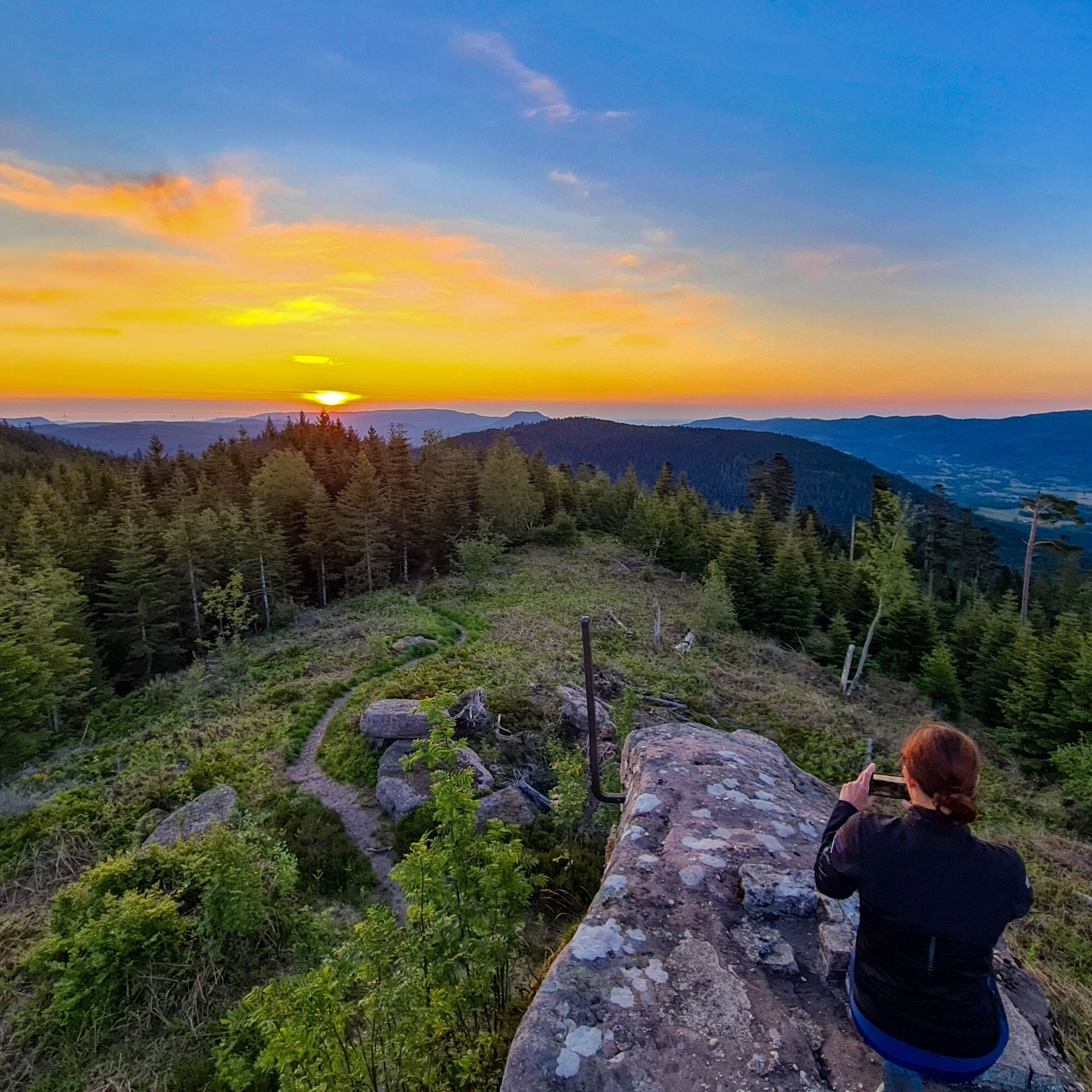
This walking circuit is a true invitation to discover the highest Lorraine slopes of the Vosges. Starting from the capital of the massif, Saint-Dié-des-Vosges, the path will gradually reveal the beauty...

Opis

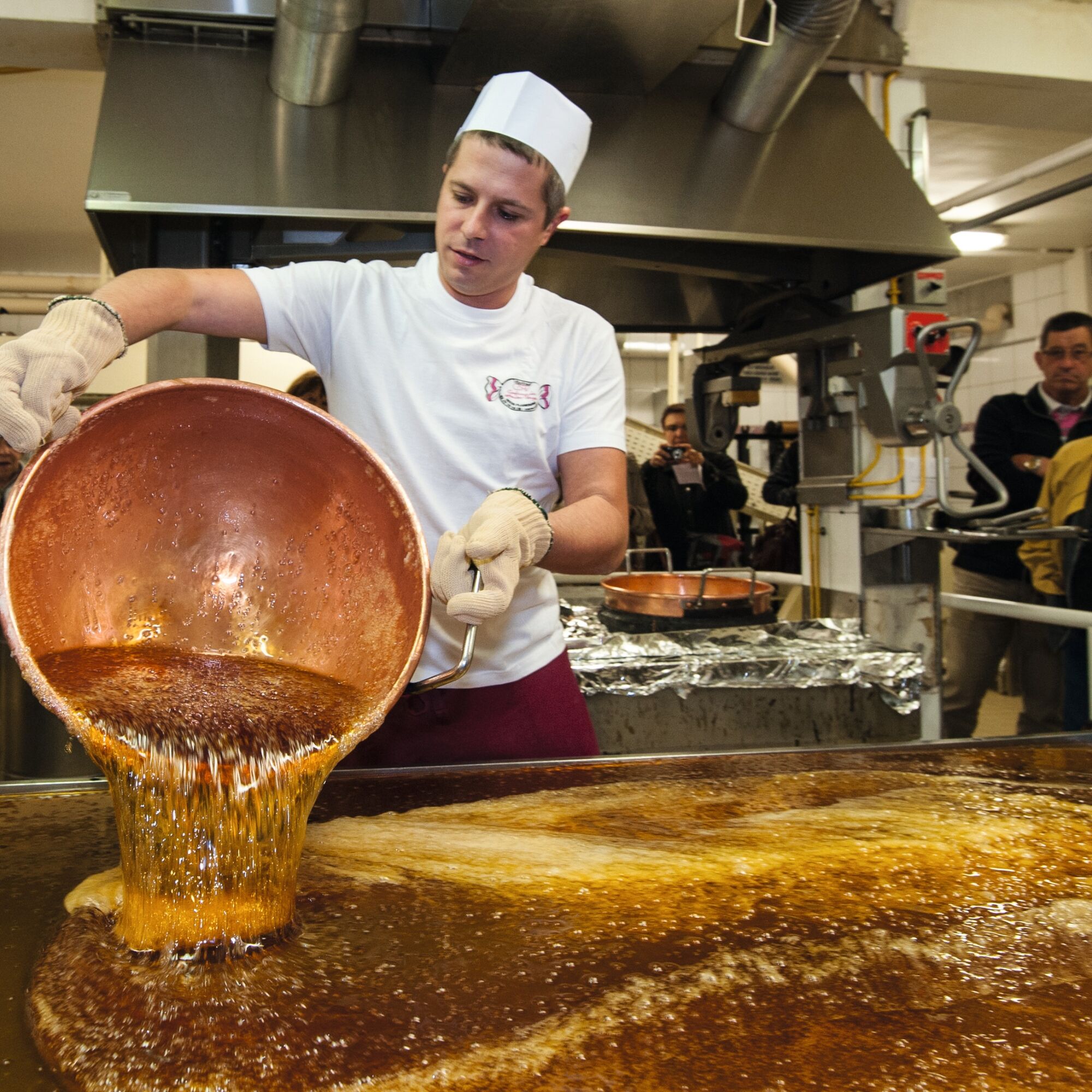
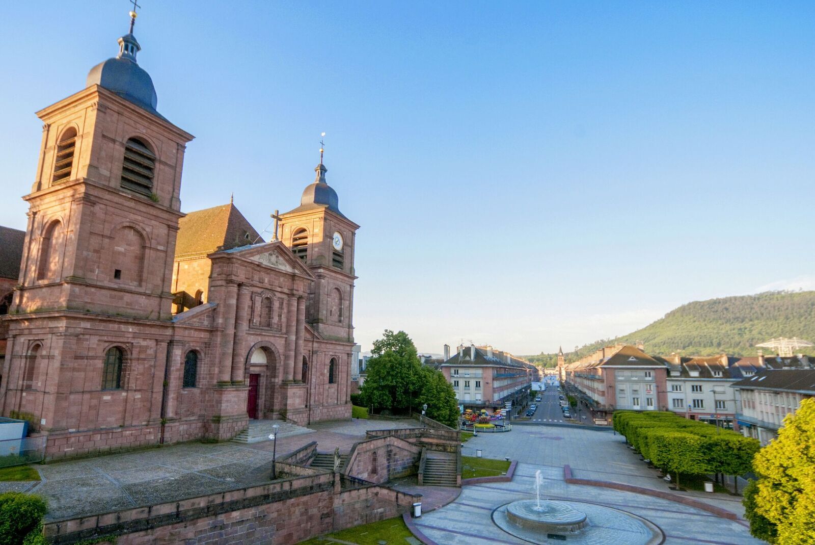
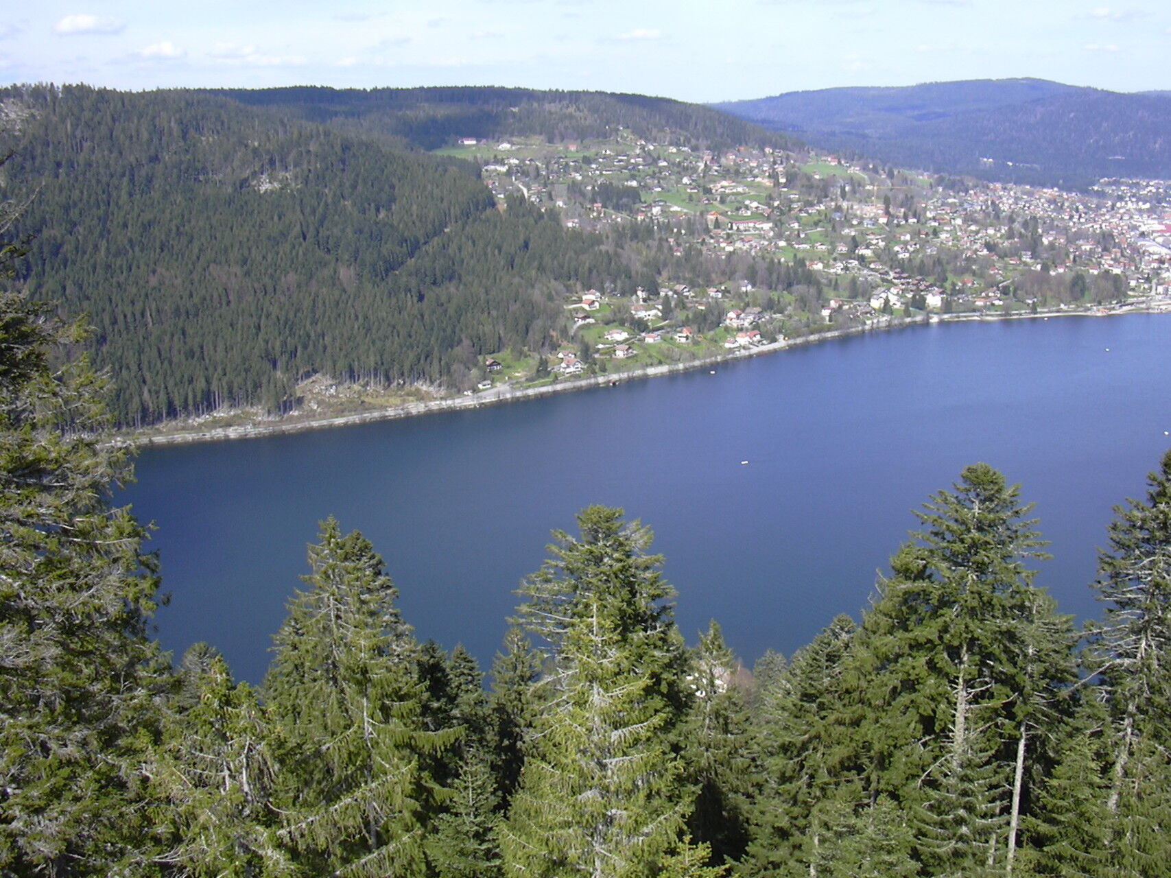
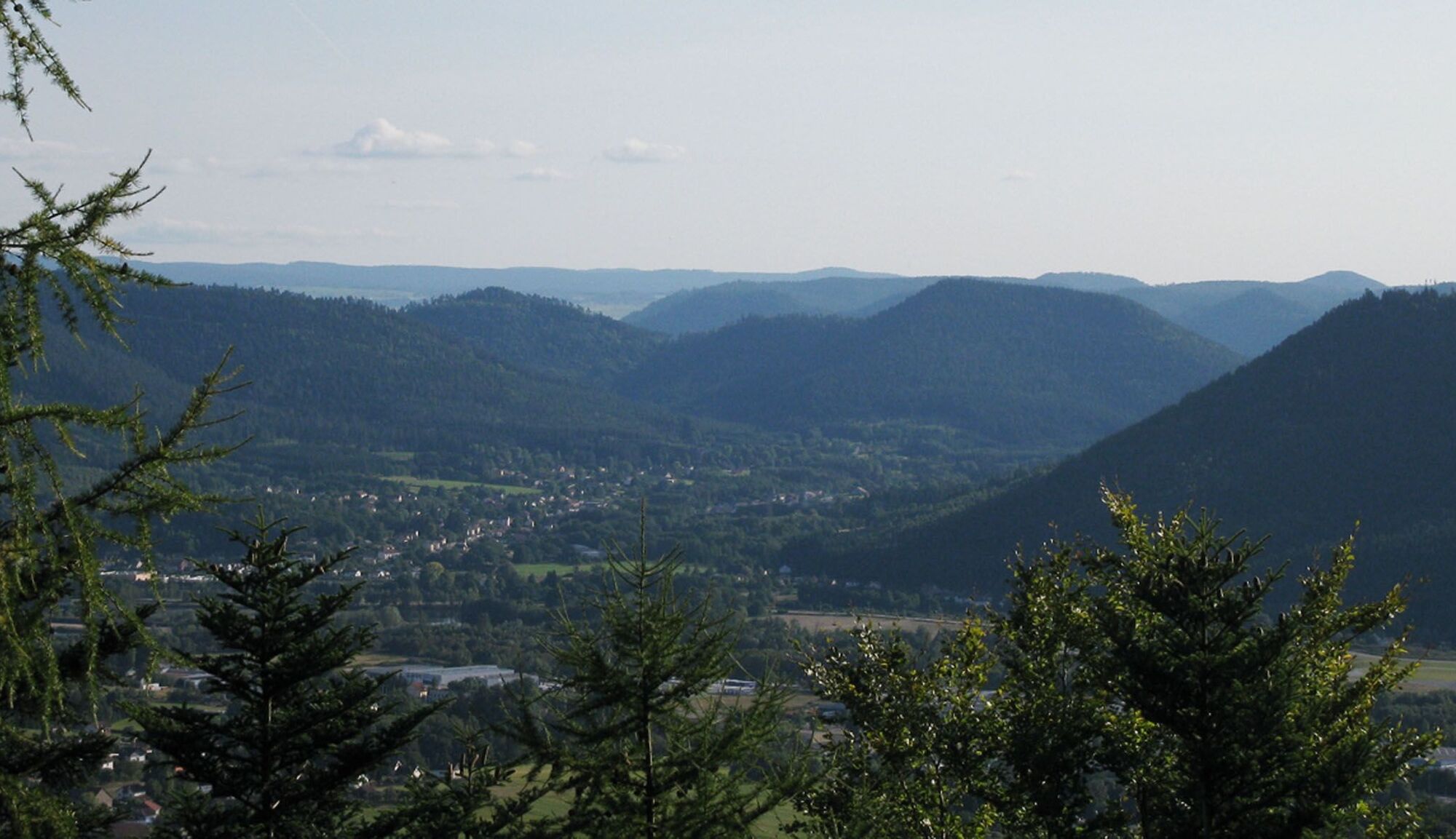
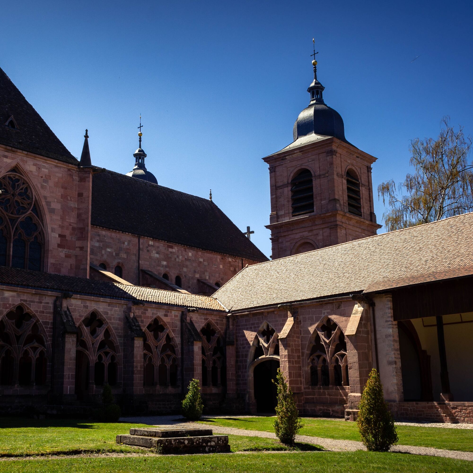
This walking circuit is a true invitation to discover the highest Lorraine slopes of the Vosges. Starting from the capital of the massif, Saint-Dié-des-Vosges, the path will gradually reveal the beauty and richness of the Vosges territory. You will be able to discover many natural curiosities such as the impressive Straiture gorge, and appreciate magnificent panoramas that will certainly amaze you. Midway, once you reach the heart of the High Vosges, the towns of Gérardmer and Xonrupt-Longemer will present themselves to you with their lake and multiple activities offered to visitors. Finally, this GR® de Pays will guide you to other unmissable and fascinating places. A visit to the Lançoire sawmill will reveal the secrets of a place bearing witness to a rich industrial and rural past, while the famous Confiserie des Hautes Vosges will satisfy your sweet tooth with the discovery of the famous Vosges candies.

Pot
Pot
Zemljevid
GR® de Pays de la Déodatie (South Loop) - Grandes Echappées Vosgiennes
srednja
Pohodništvo v daljavo
169.17 km
Saint-Dié-des-Vosges
(337 m)
Mesto
0.2 km
Carrefour de la Chartreuse
(409 m)
Koridor/teren
1.2 km
Col Saint-Martin
(559 m)
Gorsko sedlo
2.1 km
Fontaine des chevaux
(580 m)
Vir:
2.7 km
Col du Kiosque
(690 m)
Gorsko sedlo
3.2 km
Roche du Kiosque
(715 m)
Pogled
3.4 km
Col de Ronde Tête
(697 m)
Gorsko sedlo
3.8 km
Le Haut de l’Enclume
(722 m)
Koridor/teren
4.7 km
Col sans nom
(730 m)
Gorsko sedlo
5.3 km
Roche d'Anozel
(711 m)
Pogled
5.8 km
Patte d'Oie de Grandrupt
(440 m)
Koridor/teren
8.0 km
Cense de Grandrupt
(470 m)
Koridor/teren
9.0 km
Col de Climont
(516 m)
Gorsko sedlo
10.3 km
Rougiville
(359 m)
Soseska
12.6 km
Église Saint-Jean-Baptiste
(413 m)
Kraj čaščenja
20.3 km
Les Rouges-Eaux
(419 m)
Vas
20.4 km
Bois-de-Champ
(405 m)
Vas
21.4 km
Bout du Milieu
(450 m)
Poravnava
27.6 km
Mortagne
(454 m)
Vas
28.6 km
Église Saint-Mathieu
(458 m)
Kraj čaščenja
28.6 km
Mortagne Bout du Dessous
(442 m)
Poravnava
28.7 km
L'Orme
(423 m)
Poravnava
33.0 km
Domfaing
(377 m)
Vas
38.2 km
L’Haugraye
(524 m)
Koridor/teren
39.6 km
Col des Huttes
(646 m)
Gorsko sedlo
48.5 km
Le Pinau
(488 m)
Koridor/teren
50.5 km
La Scierie Mougeot
(482 m)
Koridor/teren
50.8 km
La Houssière
(485 m)
Vas
51.0 km
Bas des Prés Frames
(485 m)
Koridor/teren
51.0 km
Église Sainte-Madeleine
(486 m)
Kraj čaščenja
51.1 km
À La Mairie
(485 m)
Koridor/teren
51.3 km
La Haloche
(485 m)
Koridor/teren
51.7 km
Les Prés Pierelle
(491 m)
Koridor/teren
51.9 km
Les Gras Champs
(531 m)
Koridor/teren
52.6 km
La Xavée
(557 m)
Koridor/teren
53.4 km
Moyennel Mont
(768 m)
Vrh
54.6 km
Le Parler
(637 m)
Koridor/teren
55.2 km
Col de la Gueule du Loup
(638 m)
Gorsko sedlo
55.3 km
Le Joli Champ
(610 m)
Koridor/teren
55.6 km
Thiriville
(564 m)
Poravnava
56.3 km
L'Os du Foin
(547 m)
Koridor/teren
56.5 km
L'Enclos
(540 m)
Koridor/teren
56.9 km
Le Champ Saint-Jacques
(539 m)
Koridor/teren
57.0 km
Le Haut des Grandes Royes
(538 m)
Koridor/teren
57.3 km
Les Vœds
(527 m)
Koridor/teren
57.8 km
Les Malettes
(530 m)
Koridor/teren
58.4 km
La Marquise
(522 m)
Koridor/teren
59.0 km
La Ville
(538 m)
Koridor/teren
59.5 km
Meixa Chénée
(538 m)
Koridor/teren
59.9 km
Corcieux
(538 m)
Vas
60.0 km
Champs le Cuir
(556 m)
Koridor/teren
60.3 km
La Croix Egline
(557 m)
Poravnava
60.4 km
Tiripré
(593 m)
Koridor/teren
62.3 km
Champ Deleral
(581 m)
Koridor/teren
62.4 km
Le Haute de la Crasse
(587 m)
Koridor/teren
63.4 km
Pré des Tilles
(579 m)
Koridor/teren
63.5 km
Zidegoutte
(589 m)
Koridor/teren
63.6 km
Tihaugoutte
(592 m)
Koridor/teren
67.5 km
Pré Genet
(508 m)
Koridor/teren
68.3 km
Les Champs Saint-George
(505 m)
Koridor/teren
68.5 km
Les Paires
(504 m)
Koridor/teren
68.6 km
Église Saint-Georges
(502 m)
Kraj čaščenja
68.9 km
Granges sur Vologne
(501 m)
Vas
69.1 km
Au Mays Claudel
(502 m)
Koridor/teren
69.2 km
Jardins Devant les Cherrières
(507 m)
Koridor/teren
69.6 km
Sur la Voye
(510 m)
Koridor/teren
69.9 km
Au Rotet
(510 m)
Koridor/teren
69.9 km
Blanchefeigne
(512 m)
Poravnava
70.1 km
Sur la Voye
(513 m)
Koridor/teren
70.2 km
Blanche Faine
(524 m)
Koridor/teren
71.0 km
Le Champ de la Faine
(533 m)
Koridor/teren
71.2 km
Les Prés du Champ du Jardin
(540 m)
Koridor/teren
71.8 km
Les Évelines
(547 m)
Poravnava
71.9 km
Les Champs Claude
(569 m)
Koridor/teren
72.1 km
Champ Broquant
(653 m)
Koridor/teren
72.9 km
Champ de la Croix
(661 m)
Koridor/teren
73.0 km
Sur le Rain des Évelines
(671 m)
Koridor/teren
73.1 km
Gadémont
(658 m)
Poravnava
73.6 km
La Passée
(684 m)
Koridor/teren
74.4 km
Haut du Faing Simon
(770 m)
Koridor/teren
75.1 km
Le Page
(805 m)
Poravnava
76.3 km
Étang Marirose
(775 m)
Koridor/teren
78.3 km
Auberge de Liézey
(772 m)
Restavracija
78.4 km
Auberge Le Relais des Bûcherons
(760 m)
Restavracija
78.9 km
Église Saint-Nicolas et Saint-Gérard
(756 m)
Kraj čaščenja
79.3 km
Liézey
(761 m)
Vas
79.3 km
Pré Rouan
(884 m)
Koridor/teren
81.3 km
Église Saint-Barthélemy
(674 m)
Kraj čaščenja
87.0 km
Gérardmer
(670 m)
Mesto
87.1 km
Bas des Rochires
(678 m)
Koridor/teren
88.3 km
Le Petit Xonrupt
(688 m)
Koridor/teren
89.1 km
Au 2 Sapins
(689 m)
Restavracija
89.9 km
Au Relais Boulas
(688 m)
Restavracija
89.9 km
Saut des Cuves
(683 m)
Slap
89.9 km
Le Rein des Cuves
(706 m)
Koridor/teren
90.0 km
Xonrupt-Longemer
(724 m)
Vas
91.1 km
Église Sainte-Bernadette
(724 m)
Kraj čaščenja
91.3 km
Chapelle Saint-Florent
(740 m)
Kraj čaščenja
92.9 km
Carrefour Irénée Duvois
(924 m)
Koridor/teren
96.9 km
Col des Charbonniers
(921 m)
Gorsko sedlo
97.0 km
Habeaurupt
(614 m)
Poravnava
112.3 km
Sous Bramont
(675 m)
Koridor/teren
119.8 km
Devant Vieille Charrière
(685 m)
Koridor/teren
120.4 km
La Côte
(885 m)
Koridor/teren
122.8 km
Haut du Bonhomme
(927 m)
Koridor/teren
123.0 km
Auberge du Col du Bonhomme
(948 m)
Restavracija
123.2 km
Relais Vosges-Alsace
(949 m)
Restavracija
123.3 km
Les Ponsez
(704 m)
Poravnava
127.0 km
Tête des Raqués
(690 m)
Vrh
132.0 km
La Behouille
(611 m)
Poravnava
133.5 km
Omégoutte
(586 m)
Poravnava
134.3 km
Coinchimont
(519 m)
Poravnava
136.3 km
Marimont
(414 m)
Poravnava
138.2 km
Ban-de-Laveline
(430 m)
Vas
138.8 km
Église de l'Assomption-de-Notre-Dame
(433 m)
Kraj čaščenja
138.8 km
Gemaingoutte
(443 m)
Vas
141.5 km
Église Saint-Barthélemy
(481 m)
Kraj čaščenja
142.3 km
Wisembach
(482 m)
Vas
143.4 km
Diarupt
(528 m)
Poravnava
143.9 km
Croix le Prêtre
(706 m)
Koridor/teren
145.5 km
Le Village
(423 m)
Koridor/teren
150.7 km
Devant le Moulin
(425 m)
Koridor/teren
150.7 km
Lusse
(430 m)
Vas
150.9 km
Le Centre
(431 m)
Poravnava
151.1 km
Provenchères-sur-Fave
(404 m)
Vas
154.4 km
Carrefour du Bostryche
(563 m)
Koridor/teren
157.2 km
Auberge du Spitzemberg
(585 m)
Restavracija
157.7 km
Carrefour Mehari
(820 m)
Koridor/teren
159.4 km
Tête de Raves
(874 m)
Vrh
160.3 km
Col des Peutes Ouesses
(840 m)
Gorsko sedlo
160.6 km
Roche des Abris
(824 m)
Pogled
161.0 km
Le Faux Col
(800 m)
Gorsko sedlo
161.1 km
Tête du 10ème B.C.P.
(874 m)
Vrh
161.5 km
Col du Chariot
(832 m)
Gorsko sedlo
162.0 km
Tête du Chariot
(888 m)
Vrh
162.3 km
Roche du Sapin Sec
(901 m)
Vrh
163.1 km
Col du Sapin Sec
(885 m)
Gorsko sedlo
163.2 km
Roche des Cailloux
(869 m)
Pogled
163.8 km
Col des Cailloux
(830 m)
Gorsko sedlo
164.0 km
Carrefour de Bellevue
(625 m)
Koridor/teren
165.1 km
Abri de la Pépinière du Paradis
(510 m)
Zatočišče (brez upravljanja)
166.1 km
Pépinière du Paradis
(510 m)
Koridor/teren
166.1 km
Saint-Dié-des-Vosges
(337 m)
Mesto
168.6 km
Église Saint-Martin
(339 m)
Kraj čaščenja
169.0 km
Informacije o turneji

Located at the crossroads of the GR® de Pays de La Ligne Bleue des Vosges crossing the Vosges territory, this walking route is a true invitation to discover the highest Lorraine slopes of the Vosges. Starting from the capital of the massif, the path will gradually reveal the beauty and richness of this area. Unmissable, breathtaking, fascinating, and steeped in history places, this path offers you countless discoveries! Starting from Saint-Dié-des-Vosges, this 177 km route can be covered in 13 days of walking.

Tehnologija
n.a.
Stanje
4 / 6
Pokrajina
5 / 6
Izkušnje
4 / 6
Najboljši letni čas
Jan
Feb
Mar
Apr
Maj
Jun
Jul
Avg
Sep
Okt
Nov
Dec
Skupna turneja
Zemljevid
GR® de Pays de la Déodatie (South Loop) - Grandes Echappées Vosgiennes
srednja
Pohodništvo v daljavo
169.17 km
Napaka
Zgodila se je napaka. Prosimo, poskusite znova.
Informacije o poti
Pot

Departure Saint-Dié-des-Vosges -177 kilometers – 13 days

Geološki poudarki

Da

Oprema

Clothing adapted to the season and conditions (cold, hot, humid…)
Hiking shoes suitable for the terrain (even for children!)
Hiking poles (useful for stability and to relieve joints)
Mobile phone and spare battery

Varnostna navodila

Before leaving:

Check the general and local weather, ensuring no precipitation

Inform yourself about the approach walk, height of the route, travel time, possible escape (IGN map, GPS, guidebook, etc.)

Assess possible risks by asking mountain professionals, refuge, lodgings

Inform a close person of your goal and contact them in case of change: departure and return times, number of participants with each phone number, vehicle(s), parking

Avoid going alone, use equipment suitable for the activity, adjusted and in good condition, headlamp, complete first aid kit, survival blanket, etc.

In case of problem, call 112 (European emergency number)

Informacije o prihodu
Prihod

Take the N59 to reach Saint-Dié

Javni prevoz

Saint-Dié SNCF train station

Parkirišče

Free parking near Saint-Dié train station

Dodatne informacije in nasveti
Dodatne informacije

"To discover the things to do and see along the route, visit the map available here: https://bit.ly/30I8Yas

www.massif-des-vosges.com

https://deodatie.com/randonneurs/

Nasveti

Discover this mountain territory suitable for hiking, close to the major cities of Nancy, Metz, and Strasbourg, within the Ballons des Vosges Regional Natural Park.

Pohodništvo in sledenje

Pohodništvo in sledenje

prenos za iOSprenos za Android
Pohodništvo in sledenje
Zaradi več kot 550.000 predlogov izletov, podrobnih zemljevidov in intuitivnega načrtovanja poti je aplikacija obvezna oprema za vse ljubitelje narave.
bergfex