







09 BELLAVISTA HILL from the Plotzn junction - Sappada
The proposal is interesting because, despite the rather low altitude, it leads to one of the most valid panoramic points. The view is beautiful and complete over the entire Valle del Sole, the Siera, Creta...
The proposal is interesting because, despite the rather low altitude, it leads to one of the most valid panoramic points. The view is beautiful and complete over the entire Valle del Sole, the Siera, Creta Forata, Cimon groups and the uninterrupted stretch of fir trees that is the Longrone forest. The walk is simple, short, not tiring at all, ideal for those wishing to reach an excellent viewpoint without having to get up too early or having any special training. The current path, a broad somewhat monotonous cart track, only minimally retraces the original route, which was instead a delightful little path that climbed discreetly through the woods.
Author: © Giovanni Borella
C.A.I. Sappada/Plodn
Interreg V Italy-Austria - CLLD Dolomiti Live.Project “Safe mountain – mountain adventure” ITAT 4019 CUP B43J16000270004

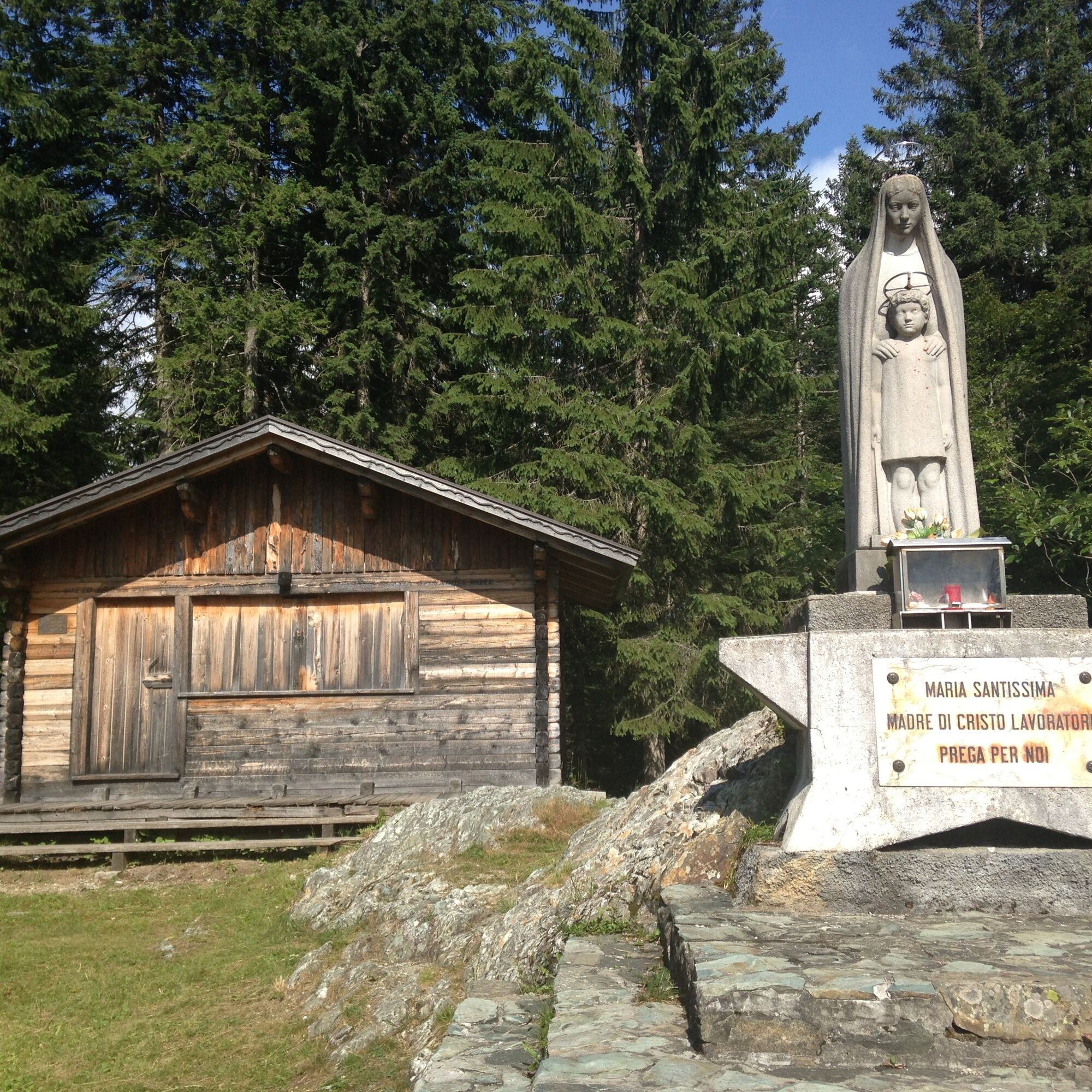
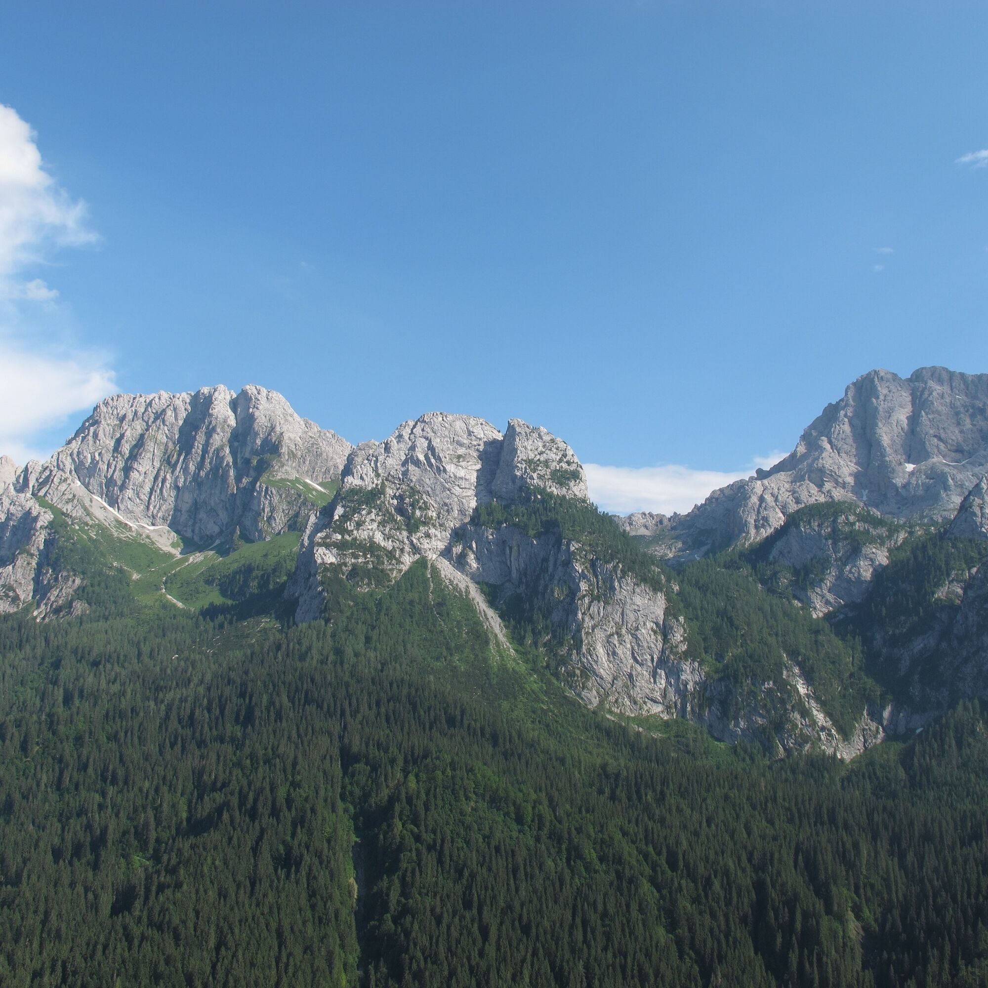
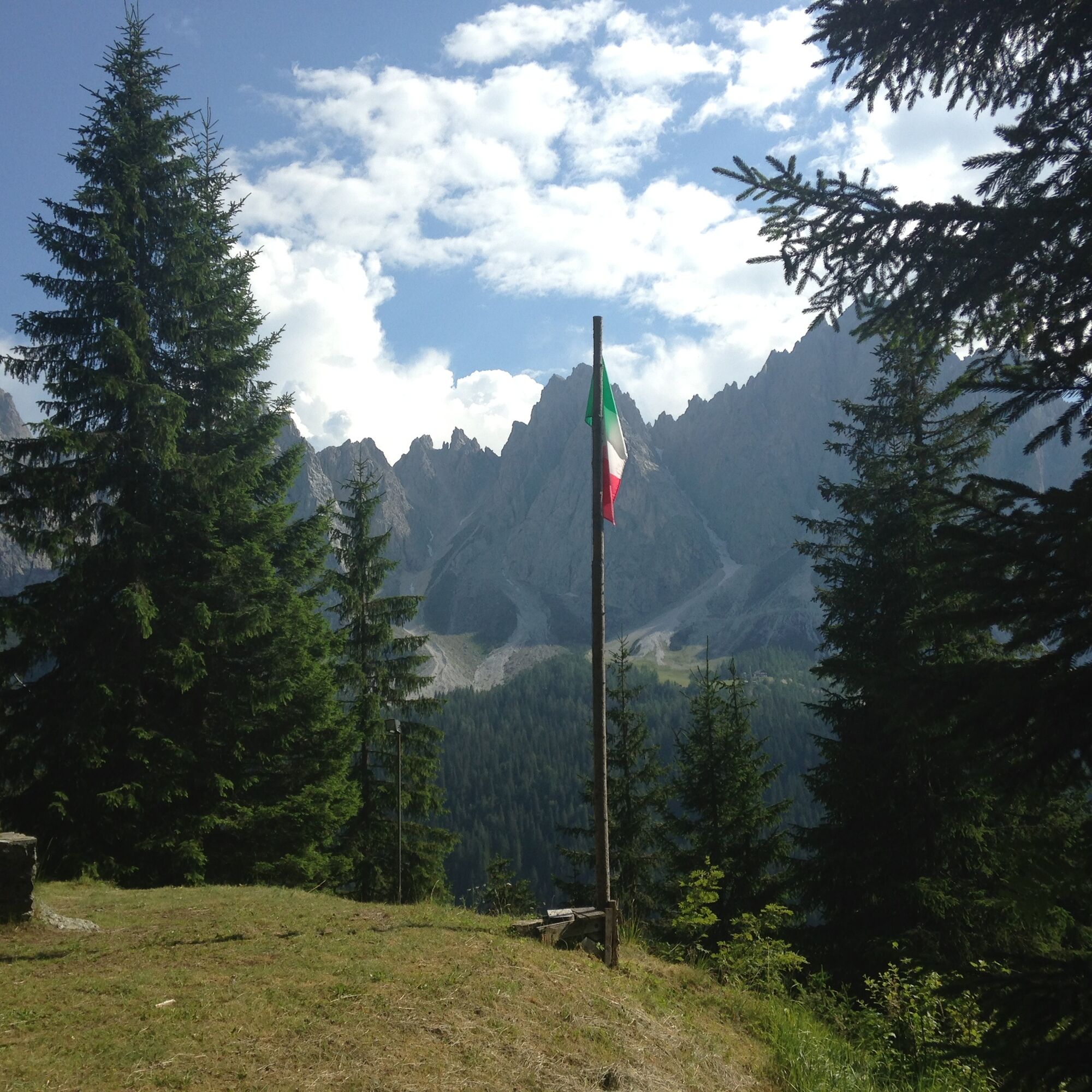

From the small square of Cima, leave the village following the signs indicating “Val Sesis”, “Piave springs”, “Calvi refuge”. After about a hundred meters from the last house, a sign fixed to the right on a fir tree indicates the start of the cart track which first with some switchbacks, then with a long, steep diagonal, climbs the thick forest on the north side of the hill. Beyond this first steep section, with another crossing this time heading west on a mild slope, you reach the statue of the Virgin and the hut. Even if from this point the panorama is already beautiful, remember to follow a track on the left that leads to the panoramic terrace overlooking the valley. It is worth it!.
The return can take place along the same route or the following one.
Author: © Giovanni Borella
Even if the hike is simple (for example a route in search of mushrooms), always wear appropriate footwear with sculpted non-slip soles. Also always carry additional clothing for possible weather changes.
Difficulty: T
Hours: ascent 0:30-0:40 descent 0:20-0:30 total 0:50-1:10
MARKINGS: forest road
DIFFICULTY SCALE
The technical data sheet of each route includes the acronyms commonly used in mountain guides (T- E - EE- EEA - A). Some routes may have a double acronym (e.g., T/E or E/EE) as they present characteristics of both categories
T (tourist) indicates routes almost always short and easy that follow forest roads and/or well-marked or otherwise evident paths that do not require particular training
E (hiking) indicates routes, sometimes quite long, which follow mule tracks and/or paths often above 2000 meters, evident but not always with marker blazes. They have no significant difficulty but can sometimes present a somewhat exposed or tricky section or single passage. Adequate equipment, some experience and training are required
EE (for experienced hikers) indicates routes generally at altitudes above 2000 meters, which may run on tricky terrain and/or in rugged areas, often characterized by exposed and/or equipped passages or stretches, sometimes on rocks with grade 1 difficulty. Experience, surefootedness, sense of orientation, good equipment, and psycho-physical preparation are required.
EEA (for experienced hikers with equipment) indicates routes equipped with metal cables, rungs, ladders. Exposure is almost always constant. Experience, training and appropriate equipment including helmet and via ferrata set are mandatory. Gloves are useful.
A (for alpinists) indicates rock routes leading to peaks with low alpine difficulties (grade 1/2). They require technical skills, good experience, physical preparation, suitable equipment (helmet, some slings, always useful also a piece of rope 20-30 meters long)
WARNINGS
The information below cannot replace the presence of a professional mountain guide The mountain is a wonderful environment but not without risks, so always approach it with the utmost caution In the Warnings of the Guides of the Mountains of Italy C.A.I./T.C.I. it is stated that the classification of difficulties "remains essentially indicative and should be considered as such", being a subjective element. This also applies to the routes proposed on the site The classification of difficulties and walking times refer to a hiker/climber of average level regarding training, experience, skills, and fitness When undertaking a specific route, carefully evaluate the difficulties, your abilities, and your level of training Before attempting a route (which is not a short walk) it is good practice: 1) to check the Dolomiti Weather of Arpav, connecting to the website http://www.arpa.veneto.it or calling the number 049 8239399 (Option 2). The bulletin, unlike national weather bulletins, offers a fairly reliable local forecast. 2) to gather information from the Tourist Office, the local C.A.I. section, mountain guides and refuge managers. Indeed, the state of passability of a route and its difficulty level can vary significantly even in a very short time due to natural events (landslides, unfavorable weather conditions) and/or contingent situations (deterioration of signs, fixed equipment, presence of residual snowfields, etc.) The mobile phone can give a false sense of security because there are areas without phone coverage In the unfortunate event of an accident, illness, or inability to continue, contact only and exclusively the emergency number SUEM 118
Pridobite vpogled
Vedno v živo na mestu z več kot 9.500 spletnimi kamerami. bergfex Kot uporabnik Pro si lahko zdaj ogledate ustrezne spletne kamere za številne izlete v aplikaciji izleti iz. Tako si lahko neposredno ogledate trenutne razmere.
Priljubljeni izleti v okolici
-
4.5
Karnischer Höhenweg – Etappe 4: Hochweißsteinhaus – Wolayersee Hütte
težkoPohodništvo v daljavo 15.9 km -
4.7
Obergail - Obergailer Alm - Obergailer Lake - Enderberg hut - Source for Health & Peace - Madonna circular hiking route - Obergail
srednjaPohodništvo 11.4 km -
4.9
Karnischer Hauptkamm - Hohe Warte 2.780m - Hike and Bike
težkoGorski pohodništvo 19.5 km -
4.3
Mountain bike route from the Hubertus Chapel to the Wolayersee
težkoMountainbike 9.06 km -
5.0
Carnic altitude trail. Stage 4: Porzehütte – Hochweißsteinhaus
težkoPohodništvo 17.5 km -
3.9
Circular hike Obergail - Gamskofel - Obergail Alm - Obergail
srednjaPohodništvo 13 km -
3.8
Karnischer Höhenweg KHW 403 - "Weg des Friedens"
srednjaPohodništvo 46.7 km -
4.5
Bread & Morende Trail
srednjaPohodništvo 11.3 km -
5.0
Valentin-Wolayersee-Runde
srednjaPohodništvo 12.4 km -
4.5
03 Südalpenweg, 24. Etappe: Valentinalm - Wolayerseehütte
srednjaPohodništvo v daljavo 9.63 km
Pohodništvo in sledenje


Ne zamudite ponudb in navdiha za naslednje počitnice
Vaš e-poštni naslov je bil dodan na poštni seznam.





