







Etappe 32: Alpina Antica Trail | ET32: Valvasone - Sesto al Reghena
Stopnja težavnosti: T1

From historical village to historical village – with the wonderful old town of San Vito al Tagliamento as highlight
A tour of culture: On your last stage on the Alpine Antica Trail, you will hike through...
A tour of culture: On your last stage on the Alpine Antica Trail, you will hike through the history of Friuli. The start in the historic centre of Valvasone below the Castello sets expectations high - and they are not disappointed. On your trail southwards towards the Adriatic parallel to the Tagliamento, you will pass historic villages and towns with centuries-old buildings. No wonder: the famous river has always been a lifeline. Casarsa delle Delizia, the first town you pass through, and in particular the small town of San Vito al Tagliamento, offer impressive insights and Italian flair. And your destination of Sesto al Reghena with its abbey and small historic centre is a wonderful place at the end of the Alpina Antica Trail.


Proceed straight on this street crossing Roggia Mulini for about 450 meters. You will come to a small traffic circle, take the first exit on the right continuing on Maiaroff Street and reach the village of the same name after about 460 meters. You pay attention and cross the road proceeding straight ahead. After 200 meters you come to a traffic circle, proceed to the left and then take the first dirt road to the right. Go straight for about 1.4 km and proceed on going straight at a junction with another dirt road meet a dirt road. You ignore the detours and continue straight on this road, which after 1.8 km leads to the traffic circle with provincial road 1. You continue straight on via Valvasone toward the center of Casarsa della Delizia and after 450 meters you reach the parish church. Going straight ahead, you cross the center of town and after 260 meters you reach the traffic light in Piazza Italia. You pass it using the crosswalk and continue 100 m to a roundabout. Continue straight and go left at the next possibility. Here you can pass the railway by a subway, reach the train station and exit onto Viale della Rimembranza. You follow it straight for about 280 meters until you reach the traffic circle. You proceed straight for about 100 meters to Piazzale G. L. Bernini where you turn left behind a COOP market and then immediately right onto Via I Maggio. Continue to the end of this street and then turn left onto Via A. Mantegna.
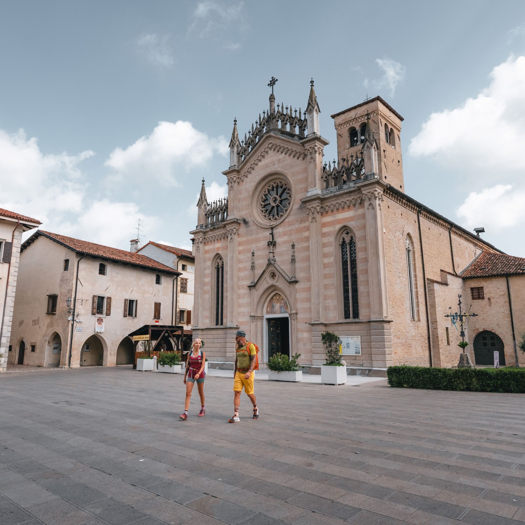
After 50 meters we turn right, following the pedestrian walkway that is in the park. This passage skirts the soccer field and allows us to arrive, after a hundred meters, behind the church of St. John in Victory Square. You continue left to the end of the street. You turn left onto Via Versutta, walking along it for about 150 meters. You now turn right into Zorutti Street, which makes a wide curve to the right. You now turn left into Aviotte Street on a bicycle/pedestrian path that you follow in the countryside for about a kilometer to the hamlet of San Floriano. At the end of the path, there is a big roundabout. You cross it by using a subway for cyclists/pedestrians and go left on a bicycle/pedestrian path, the first section of which is dirt at the bottom, in the direction of San Vito al Tagliamento. Go straight ahead along this road until you reach the traffic circle that intersects Provincial Road 1 and continue straight ahead in the direction of the center. After 200 meters turn right passing under the ancient gate and thus arriving at the Cathedral of San Vito al Tagliamento. You are now in the marvellous historic center of San Vito al Tagliamento. Take your time, it´s worthwhile!
From the Cathedral, turn just before the square opposite a church turn left into Via Antonio Altan and follow it all the way until you come out of the town gate. Beyond the gate you go straight along the paved bicycle/pedestrian path, via Savorgnano. Follow it for about 2.2 km until you reach the Church of San Rocco. Leaving it on the left, you reach the center of the hamlet of Savorgnano. At a roundabout nearby the Church of St. James the Apostle you turn left into via Bagnarola and after 50 meters turn right into via Melmose. This street crosses the countryside and after 2.1 km, past a ditch, you turn left and go along the Sinigaglia reclamation canal to locality Melmosa Alta (we are already in via XXX Aprile). At the first crossroads turn left onto Via Verdi and after about 400 meters turn right again, arriving at locality Melmosa Bassa. Here you follow the road for about 1.8 km, reaching the intersection with Via Giotto di Borbone in Sesto al Reghena. Turn left until you reach the forecourt of Abbazia Santa Maria In Sylvis in the municipality of Sesto al Reghena. Frfom here, the stage continues to the right on Via Roma and at the town gate you reach your stage destination in the center of Sesto al Reghena.
T1
Sesto al Reghena: Der Stempel befindet sich, wenn man über die Brücke geht, im Abbazia Santa Maria in Silvis oder in der Comune di Sesto al Reghena (45°50'53.1"N 12°48'56.6"E). Hier ist auch das Ende der Stempel-Standorte.
Priljubljeni izleti v okolici
-
FVG6 Kolesarska pot ob reki Tagliamento (C600)
srednjaKolesarjenje na dolge razdalje 136.9 km -
5.0
Vodni vaški obroč (R025)
srednjaKolesarjenje na dolge razdalje 33.6 km -
Spilimbergo - San Vito al Tagliamento (C602)
svetlobaKolesarjenje na dolge razdalje 31.9 km -
Melioracijski obroč Veneto (R026)
srednjaKolesarjenje na dolge razdalje 38.8 km -
Prstan Resurgence (R023)
svetlobaKolesarjenje na dolge razdalje 25.4 km -
Pasolinski prstan (R021)
svetlobaKolesarjenje na dolge razdalje 9.11 km -
Vključujoča pot – Svoboda gibanja skupaj
svetlobaKolesarjenje 20 km -
Prstan s patriarhom in trto (R020)
srednjaKolesarjenje na dolge razdalje 32.1 km -
Zgodovinska pot – Po sledeh časa
svetlobaKolesarjenje 63.8 km -
Enogastronomska pot – Okusi podeželske rečne pokrajine
svetlobaKolesarjenje 114.1 km
Pohodništvo in sledenje


Ne zamudite ponudb in navdiha za naslednje počitnice
Vaš e-poštni naslov je bil dodan na poštni seznam.





