


16 CRETON DI TUL - Sappada

The proposal deserves consideration because, although a modest summit in altitude and not particularly attractive in its shape (except for the western side) and somewhat enclosed by the imposing masses...
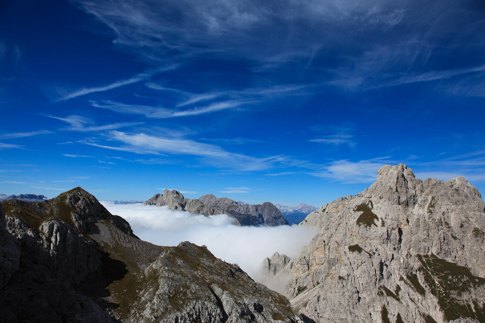
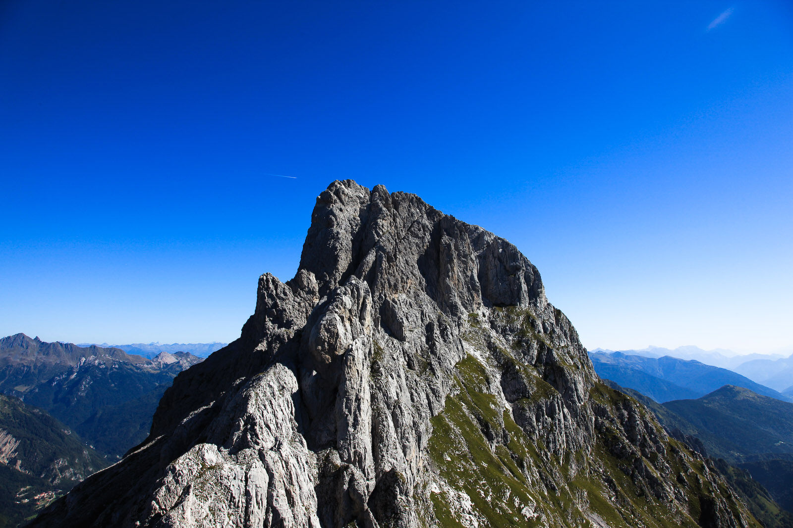
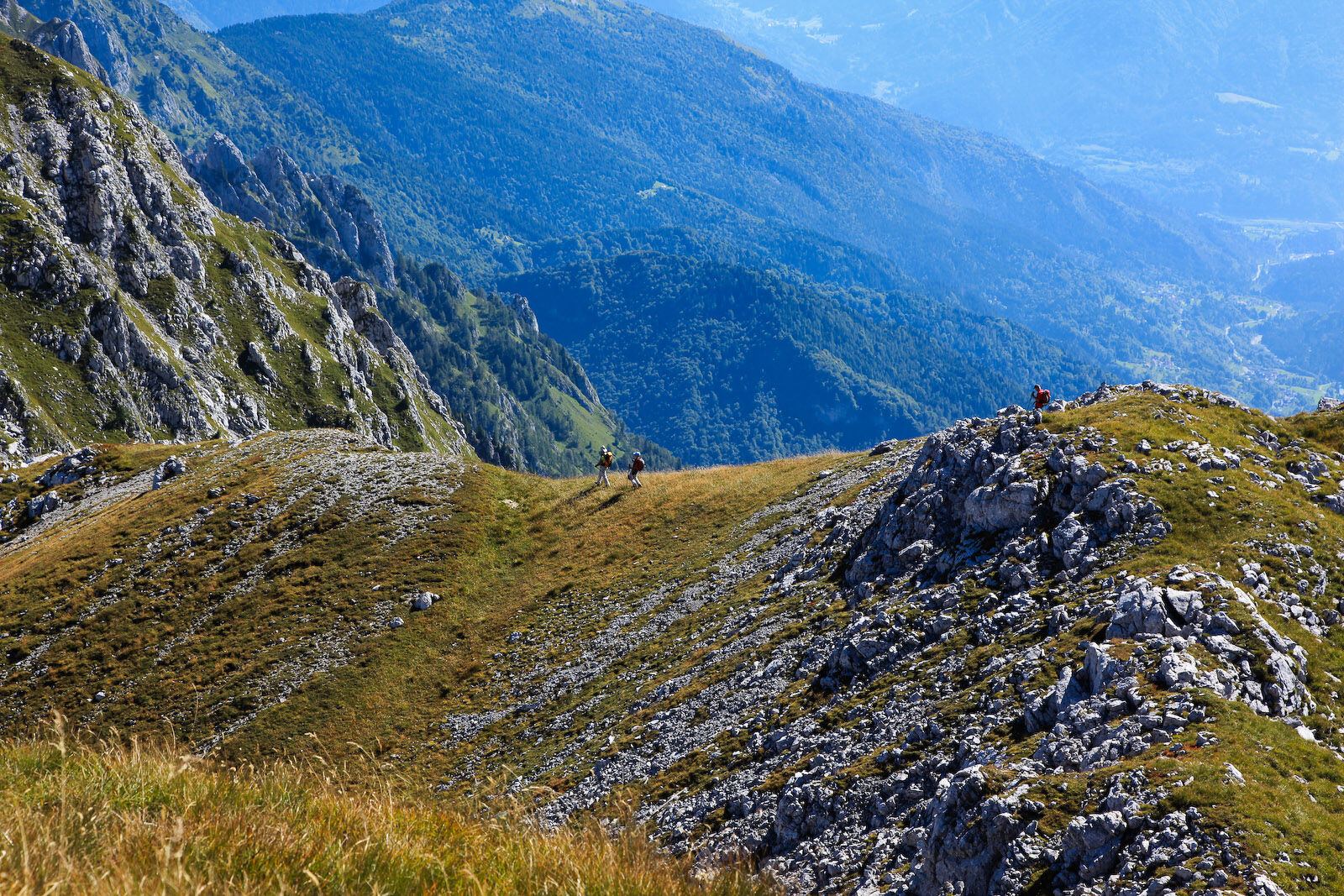
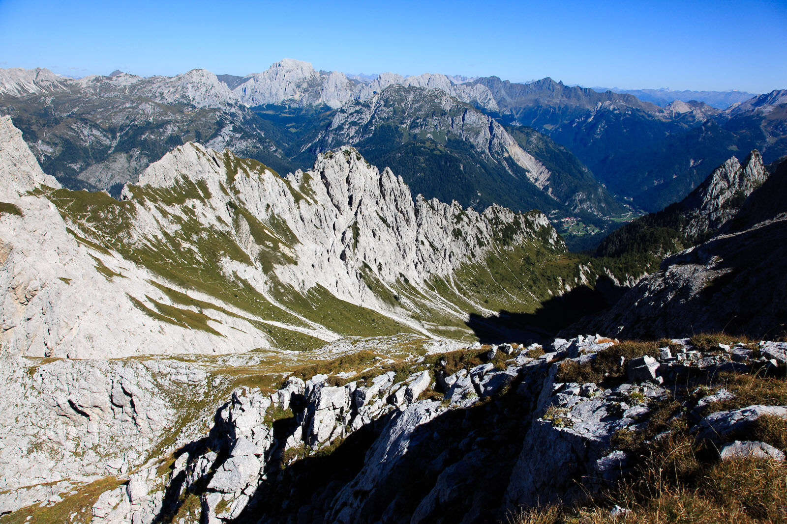
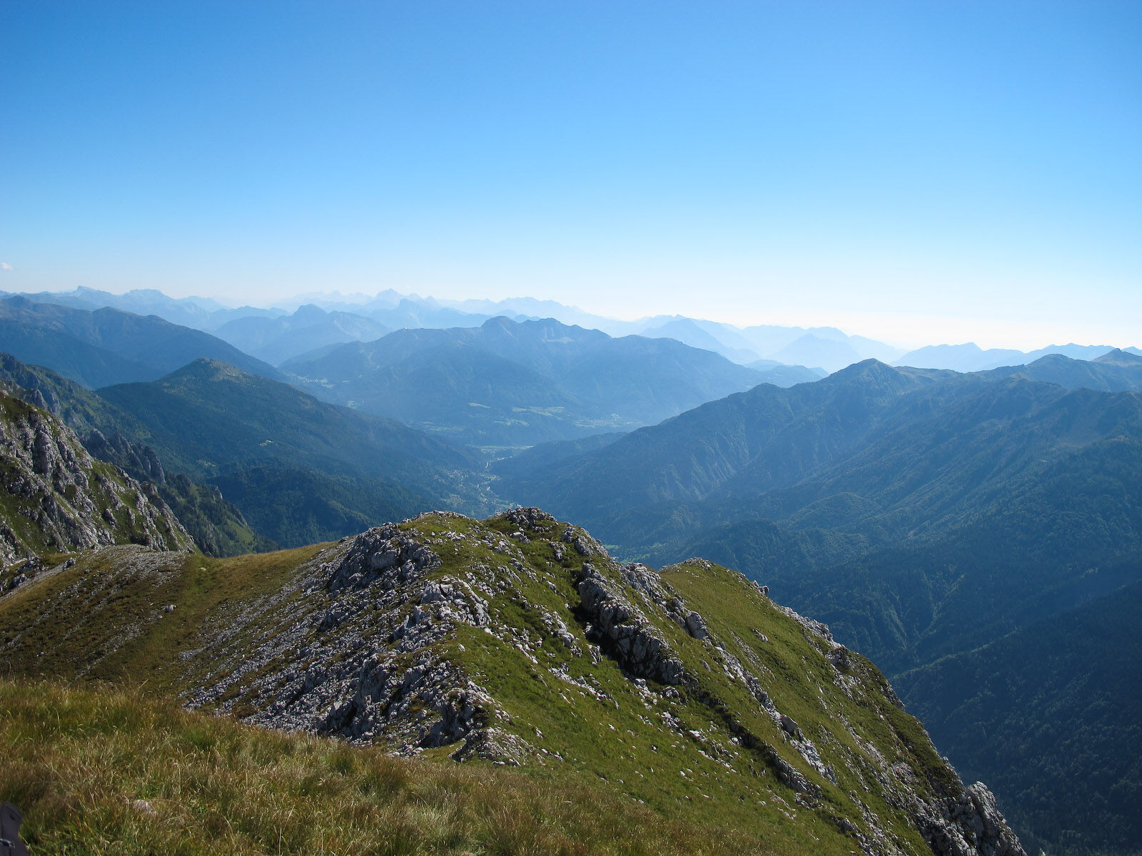
The proposal deserves consideration because, although a modest summit in altitude and not particularly attractive in its shape (except for the western side) and somewhat enclosed by the imposing masses of Creta Forata and Piccolo Siera, it offers the pleasant surprise of a very wide and unexpected panorama that opens towards the Dolomites of the Pesarina valley, the Coglians, the mountains of Volaia, the Peralba-Chiadènis-Avanza group, the Bivera-Tudaio, and even the distant Dolomites beyond the Piave river. The route is, wrongly, very little used due to the presence of the nearby Creta Forata. It is sunny, varied, not strenuous, and will lead you to another delightful and secluded corner of the Sappada mountains, in a realm of silence and solitude, with the chance, if you are lucky, to also see some chamois. You will also enjoy a small taste of adventure as the last part of the route has neither path nor markings.
Return
The return to the Siera refuge and to the Sappada Peak is along the same route or, alternatively, via the Geu hut, reachable by the last part of route no. 17 along the equipped Geu path (see route no. 19 diff. EE). You can also return by a longer but easier route first reaching the Geu hut, then the Tuglia hut with route no. 18 in reverse and from there with route no. 8 (in the Walks section), always in reverse, taking about 2:30-2:45 hours.
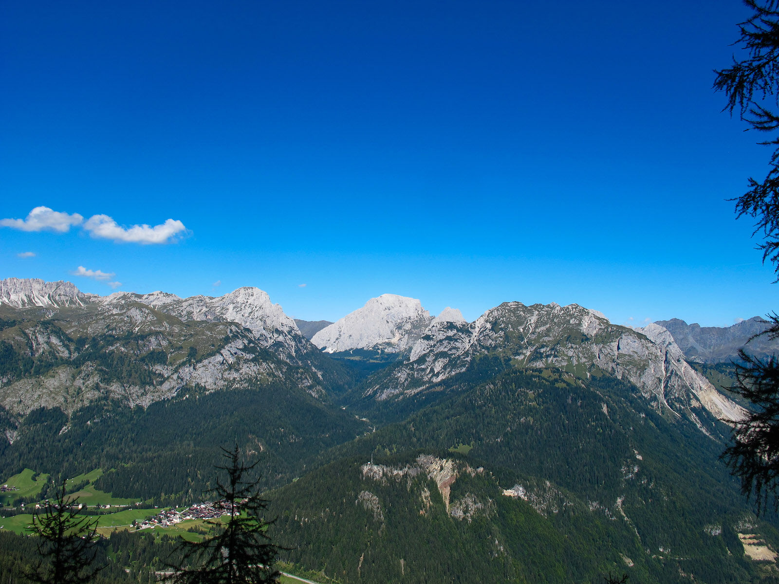
Near the start of the Monte Siera chairlift
WARNINGS
The information below cannot substitute the presence of a professional alpine guide The mountain is a wonderful environment but not free from risks, so it must always be approached with the utmost caution In the Warnings of the CAI/TCI Mountains of Italy Guides it reads that the difficulty classification “remains essentially indicative and must be considered as such”, as it is a subjective element. This also applies to the itineraries proposed on the site The classification of difficulties and travel times refer to a hiker/mountaineer of average level regarding training, experience, skills, training When undertaking a certain route, carefully assess difficulties, your own skills, and your level of training Before tackling an itinerary (unless it is a short walk) it is good practice: 1) to consult the Dolomiti weather by Arpav, by connecting to the site http://www.arpa.veneto.it or calling 049 8239399 (Option 2). Unlike national weather forecasts, this bulletin offers a rather reliable local forecast. 2) to obtain information from the Tourist Office, the local CAI section, alpine guides, refuge managers. Indeed, the state of passability of an itinerary and its difficulty level may undergo significant changes even within a very short period due to natural events (landslides, unfavorable weather conditions) and/or contingent situations (deterioration of signs, fixed equipment, presence of residual snowfields, etc.) The mobile phone can give a false sense of security, because there are areas without phone coverage In the unfortunate case of accident, illness, inability to proceed, contact only and exclusively SUEM 118Priljubljeni izleti v okolici
- 4,5
Karnischer Höhenweg – Etappe 4: Hochweißsteinhaus – Wolayersee Hütte
težkoPohodništvo v daljavo 15,9 km - 4,7
Obergail - Obergailer Alm - Obergailer Lake - Enderberg hut - Source for Health & Peace - Madonna circular hiking route - Obergail
srednjaPohodništvo 11,4 km - 4,3
Mountainbiketour von der Hubertuskapelle zum Wolayersee
težkoMountainbike 9,06 km - 5,0
Carnic altitude trail. Stage 4: Porzehütte – Hochweißsteinhaus
težkoPohodništvo 17,5 km - 3,8
Karnischer Höhenweg KHW 403 - "Weg des Friedens"
srednjaPohodništvo 46,7 km - 3,8
Circular hike Obergail - Gamskofel - Obergail Alm - Obergail
srednjaPohodništvo 13 km - 4,5
03 Südalpenweg, 24. Etappe: Valentinalm - Wolayerseehütte
srednjaPohodništvo v daljavo 9,63 km - 2,9
Wolayersee
težkoPohodništvo 7,90 km - 4,2
Hochweißsteinhaus - Monte Peralba
težkoPohodništvo 3,31 km - 5,0
Skitour Frohntal - Hochalpl
srednjaSmučarska tura 7,21 km
Pohodništvo in sledenje


Ne zamudite ponudb in navdiha za naslednje počitnice
Vaš e-poštni naslov je bil dodan na poštni seznam.