






Hike - Weichser circular route
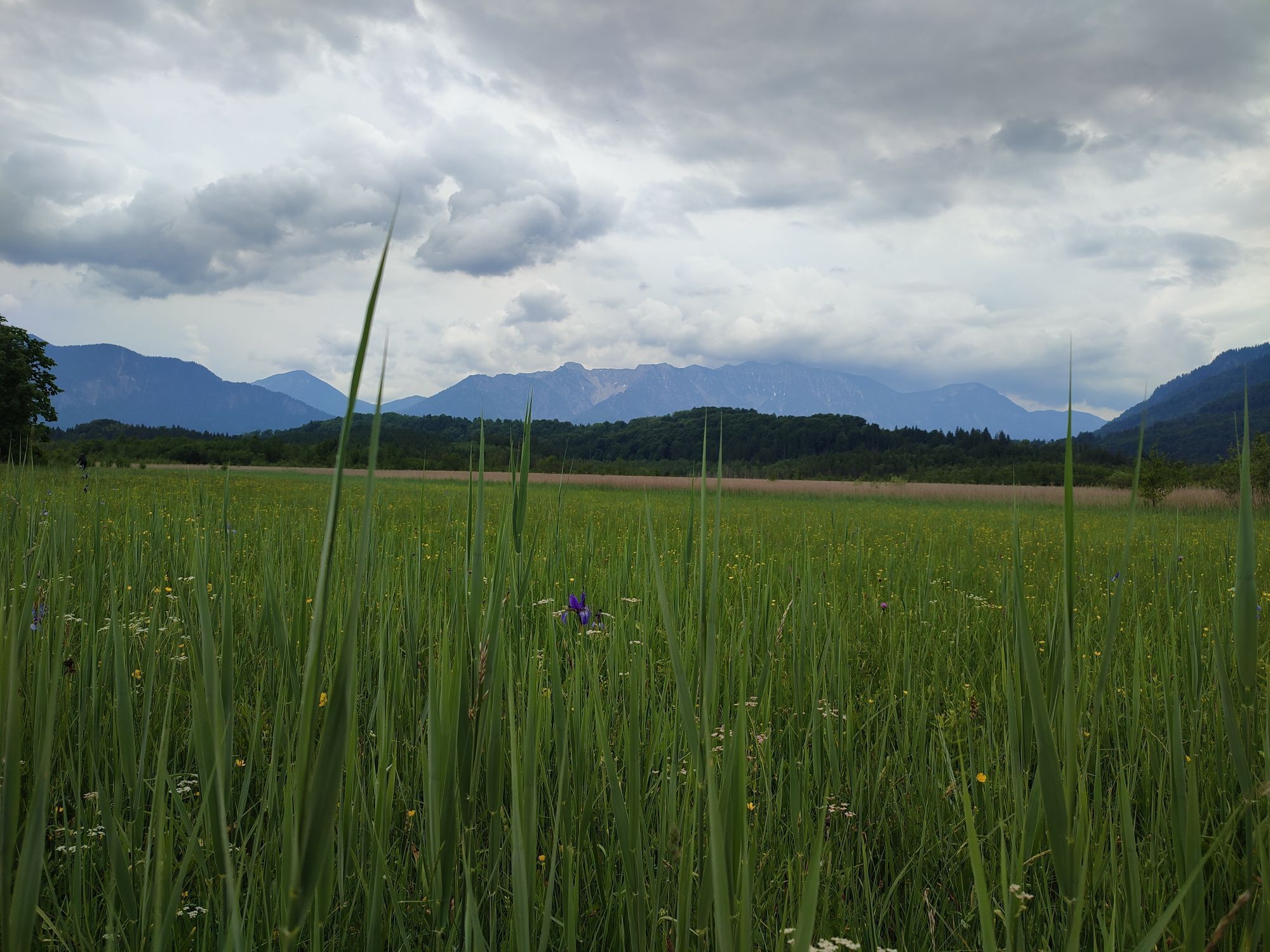



The circular route first leads along Weichser Street to the hamlet of Weichs. Just before the railway crossing, turn right, past the Weichs Church (one of the oldest in Bavaria) to Haarsee. 500 m after Haarsee, turn right, slightly uphill through the forest, then you reach open, flat terrain again with a magnificent view of the surrounding mountains and the Wetterstein mountains with the Zugspitze. Then it goes back to Ohlstadt.
In case of emergency, please contact the nearest emergency control center. Regardless of location, you can reach it nationwide in Germany by dialing the phone number 112.
The hiking and cycling paths described by us primarily serve forest management; their use is at your own risk (§ 14 Para. 1 BWaldG).
Coming from Munich via the A95 (exit Murnau/Kochel) as well as from Garmisch-Partenkirchen via the B2.
Bus stop: Ohlstadt town center
Bus lines: 9607 Murnau - Ohlstadt - Ettal and back (Note: operation only on Saturdays during school days of the Ettal monastery school!)
9611 Kochel - Schlehdorf - Großweil - Ohlstadt - Murnau (Note: The Glentleiten open-air museum is only served from April to October!)
Guests of the "Das Blaue Land" region as well as the "Ammergau Alps" can use a variety of bus lines as well as train lines from Murnau to Oberammergau and from Uffing to Garmisch-Partenkirchen free of charge with the electronic guest card or the KönigsCard. Further information is available at: https://www.dasblaueland.de/Service/mobil
In the center of Ohlstadt
Pridobite vpogled
Vedno v živo na mestu z več kot 9.500 spletnimi kamerami. bergfex Kot uporabnik Pro si lahko zdaj ogledate ustrezne spletne kamere za številne izlete v aplikaciji izleti iz. Tako si lahko neposredno ogledate trenutne razmere.
Priljubljeni izleti v okolici
-
4.4
Kuhfluchtwasserfälle
srednjaPohodništvo 1.32 km -
4.7
Mountain route - Laber via Soilasee
svetlobaPohodništvo 11.8 km -
4.8
Rundweg Heimgarten und Herzogenstand
srednjaPohodništvo 15.0 km -
4.8
Jochberg
svetlobaPohodništvo 7.56 km -
4.6
Murnauer Moos
svetlobaPohodništvo 11.5 km -
4.6
Laber - Ettaler Mandl
svetlobaPohodništvo 9.10 km -
4.2
Mountain tour - Kofel
srednjaPohodništvo 11.3 km -
4.6
Mountain route - Heimgarten via Käseralm
srednjaPohodništvo 10.8 km -
4.7
Herzogstand
srednjaPohodništvo 7.28 km -
4.0
Jachenau Talwanderung
Pohodništvo 14.8 km
Pohodništvo in sledenje


Ne zamudite ponudb in navdiha za naslednje počitnice
Vaš e-poštni naslov je bil dodan na poštni seznam.





