
Of Romans, Princes and Poachers
srednja
Pridobite to turo v svoj mobilni telefon
Of Romans, Princes and Poachers
srednja
Pohodništvo
12.88
km
Skenirajte kodo QR in začnite navigacijo v aplikaciji bergfex.


Pohodništvo in sledenje





Of Romans, Princes and Poachers
srednja
Razdalja
12.88
km
Trajanje
04:30
h
Ascent
276
hm
Morska gladina
282 -
534
m
Prenos skladbe
Of Romans, Princes and Poachers
srednja
Pohodništvo
12.88
km
The Romans in the Odenwald (Monthly hike April 2018)
After the victory over the Chatti 83-85 AD, Emperor Domitian ordered the construction of a border line from Wörth over the heights of the Odenwald to...
Opis
The Romans in the Odenwald (Monthly hike April 2018)
After the victory over the Chatti 83-85 AD, Emperor Domitian ordered the construction of a border line from Wörth over the heights of the Odenwald to Bad Wimpfen to control the border crossing and protect the Roman provinces from raids by the Germanic tribes. This border line was secured by watchtowers, forts, and palisades. The locations of the watchtowers were chosen so that the immediate foreground and the Limes line could be overlooked up to the next watchtower. The 4-5 man tower crew had the task of sounding the alarm when enemy troops approached and passing it from tower to tower to the next fort.
After the victory over the Chatti 83-85 AD, Emperor Domitian ordered the construction of a border line from Wörth over the heights of the Odenwald to Bad Wimpfen to control the border crossing and protect the Roman provinces from raids by the Germanic tribes. This border line was secured by watchtowers, forts, and palisades. The locations of the watchtowers were chosen so that the immediate foreground and the Limes line could be overlooked up to the next watchtower. The 4-5 man tower crew had the task of sounding the alarm when enemy troops approached and passing it from tower to tower to the next fort.
Pot
Schloßau
(510 m)
Vas
0.0 km
Ernsttal
(270 m)
Poravnava
3.7 km
Waldleiningen
(356 m)
Poravnava
6.1 km
Pot
Of Romans, Princes and Poachers
srednja
Pohodništvo
12.88
km
Avtor
Zagotavlja Naturpark Neckartal-Odenwald
Za ogled Of Romans, Princes and Poachers poskrbi outdooractive.com.

Informacije o poti
Pot
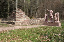
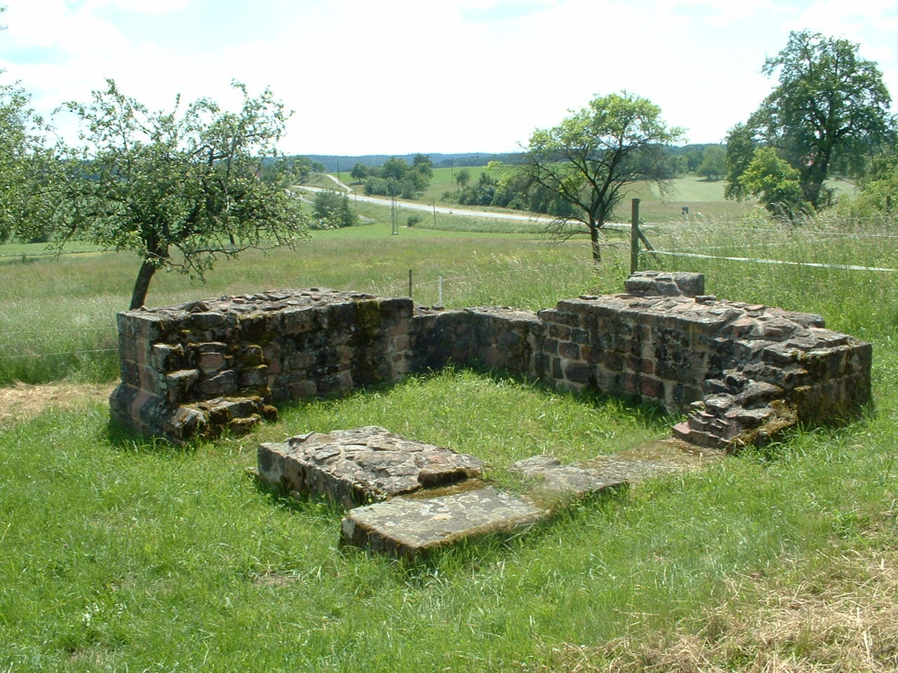
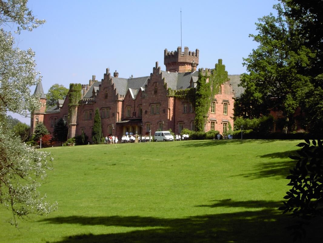
Schloßau (km0; time 0; elevation 510m): The syllable "Schloß" in the place name Schloßau refers to considerable ruins of the former Numerus fort. Only sparse remains are left today. Opposite the church, we follow the local marking SL5 along Mörschenhardter Straße. At the exit of the village, we turn left and go down the Teufelsklinge to Ernsttal, the former Neubrunn, where there is a place to rest. Ernsttal (km3.7; time 1:10; elevation 295m): In 1830 Prince Karl of Leiningen decided to buy Galmbach (Eduartsthal) and Neubrunn (Ernsttal). Both places lay in the middle of his game park and were a thorn in his side due to numerous wood thefts and poaching. In Ernsttal, we turn left into a side valley and walk it upwards to Waldleiningen. Waldleiningen (km2.7; time 0:50; elevation 360m): In 1808 Prince Emich Karl had a large game park laid out here and built a hunting lodge. After his death, his son Karl had the current castle complex built. Only the exterior is still in its original state; the interior was completely converted into a clinic. The circular route SL5 leads us past the castle upwards to the Seitzenbuche. Seitzenbuche (km3.2; time 1:10; elevation 460m): The name recalls forester Seitz, who was ambushed by poachers, tied to a beech tree, and killed. At the intersection, there was a small Roman fort. From here we follow our circular route uphill over the crossing to watch post 10/37. Watch post 10/37 (km0.8; time 0:20; elevation 500m): The watch post "In der Schneidershecke" is the only one on the Odenwald Limes with two stone tower foundations. However, the larger foundation is actually a sanctuary with statues of Mars, Victoria, and Salus. From here we return to Schloßau. Schloßau (km 2.9; time 1:00; elevation 510 m): Start and finish of the circular hike.
Total distance: 13.3 km; time: 4:30; difficulty: medium
Oprema
Obviously: Please wear sturdy footwear and clothing adapted to the weather!
Vrednotenja

Priljubljeni izleti v okolici
-
4.0
Amorbach Waldromantikweg aka. A9
srednjaPohodništvo 9.95 km -
5.0
Beerfelden Auto überholt
srednjaDownhill 63.7 km -
Aufstieg zum Vulkan - Katzenbuckel-Weg im Hohen Odenwald
Pohodništvo 12.8 km -
Zum Katzenbuckel
težkoPohodništvo 18.0 km -
Eberbach Holdergrund und Wildgehege
Pohodništvo 2.17 km -
Mountainbike-Strecke "Rund um Amorbach"
težkoMountainbike 30.3 km -
Smart Trail Odenwald
srednjaKolesarjenje 19.7 km -
Vespertour Leon Scholl Direktvermarktung, Eberbach - Wanderung
Pohodništvo 11.7 km -
5.0
Mudau: Ein verschwundenes Dorf
Pohodništvo 9.23 km -
Vespertour Hofgut Robern, Fahrenbach - Wanderung
Pohodništvo 17.0 km
Pohodništvo in sledenje

Zaradi več kot 550.000 predlogov izletov, podrobnih zemljevidov in intuitivnega načrtovanja poti je aplikacija obvezna oprema za vse ljubitelje narave.

Ne zamudite ponudb in navdiha za naslednje počitnice
Naročite se na novice
Napaka
Zgodila se je napaka. Prosimo, poskusite znova.
Zahvaljujemo se vam za prijavo
Vaš e-poštni naslov je bil dodan na poštni seznam.
Izleti po vsej Evropi
Avstrija
Švica
Nemčija
Italija
Slovenija
Francija
Nizozemska
Belgija
Poljska
Lihtenštajn
Češka
Slovaška
Španija
Chorvátsko
Bosna in Hercegovina
Luksemburg
Andora
පෘතුගාලය
අයිස්ලන්තය
එක්සත් රාජධානිය
අයර්ලන්තය
ග්රීසිය
ඇල්බේනියාව
North Macedonia
Malta
Norway
Montenegro
Moldova
කොසෝවො
හන්ගේරියානු සමුහාණ්ඩුව
San Marino
රුමේනියාව
එස්ටෝනියා
ලැට්වියාව
බෙලාරස්
සයිප්රස්
Lithuania
Serbia
බල්ගේරියාව
Monaco
ඩෙන්මාර්කය
Sweden
ෆින්ලන්තය





