


Kaiser Barbarossa circular route
Stopnja težavnosti: T2
Fotografije naših uporabnikov
 © Ernst SchmidUstvarjeno na 22.03.2026
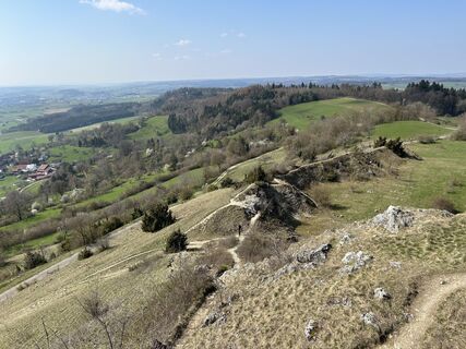 © Ernst SchmidUstvarjeno na 22.03.2026
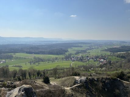 © Ernst SchmidUstvarjeno na 22.03.2026
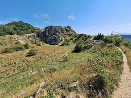
 © Hermann E.Ustvarjeno na 20.08.2023
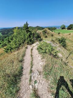 © Hermann E.Ustvarjeno na 20.08.2023
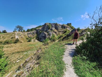 © Hermann E.Ustvarjeno na 20.08.2023
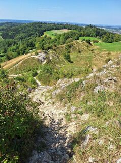 © Hermann E.Ustvarjeno na 20.08.2023
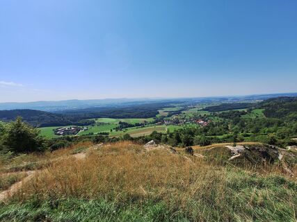 © Hermann E.Ustvarjeno na 20.08.2023
 © Hermann E.Ustvarjeno na 20.08.2023


You can embark on nine beautiful hiking trails in Göppingen: The Göppingen circular hiking routes attract with impressive views, varied landscapes, and impressive nature. Seven circular routes, between...
You can embark on nine beautiful hiking trails in Göppingen: The Göppingen circular hiking routes attract with impressive views, varied landscapes, and impressive nature. Seven circular routes, between 3.5 and 23 kilometers long, offer hiking fun for almost every taste.
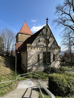
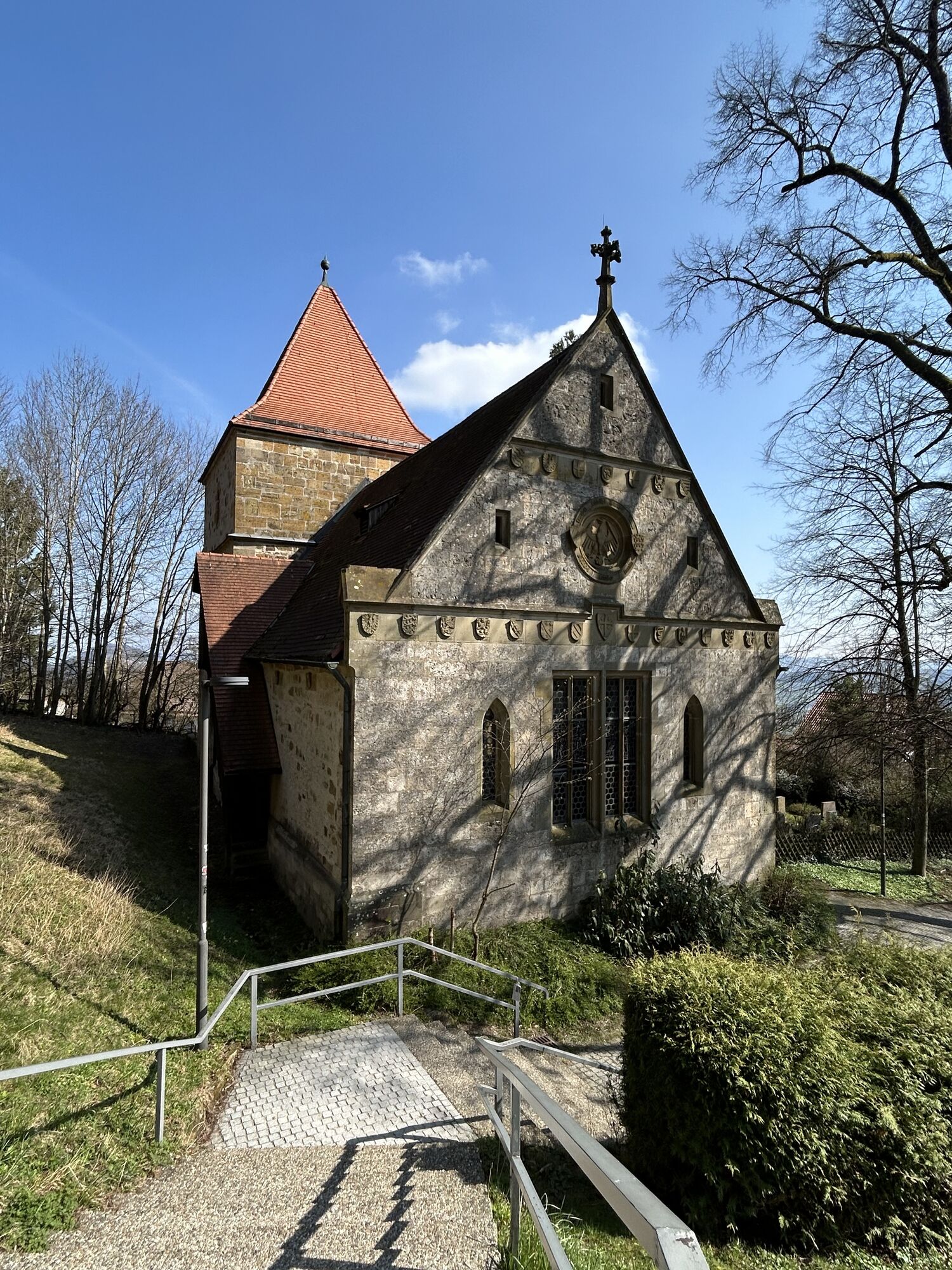
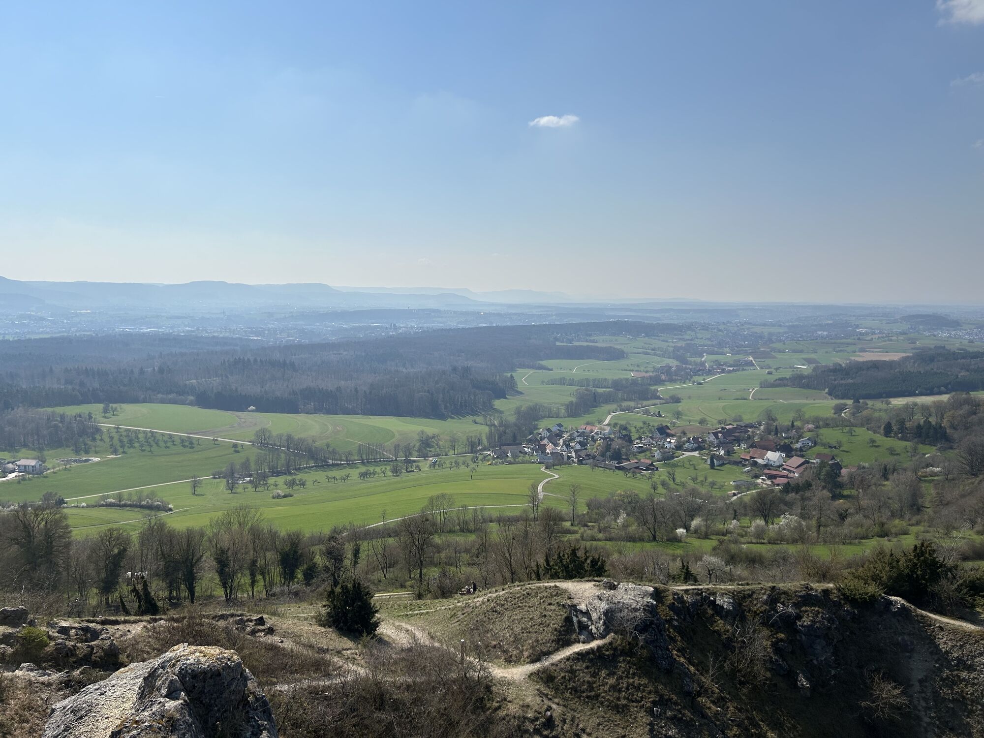
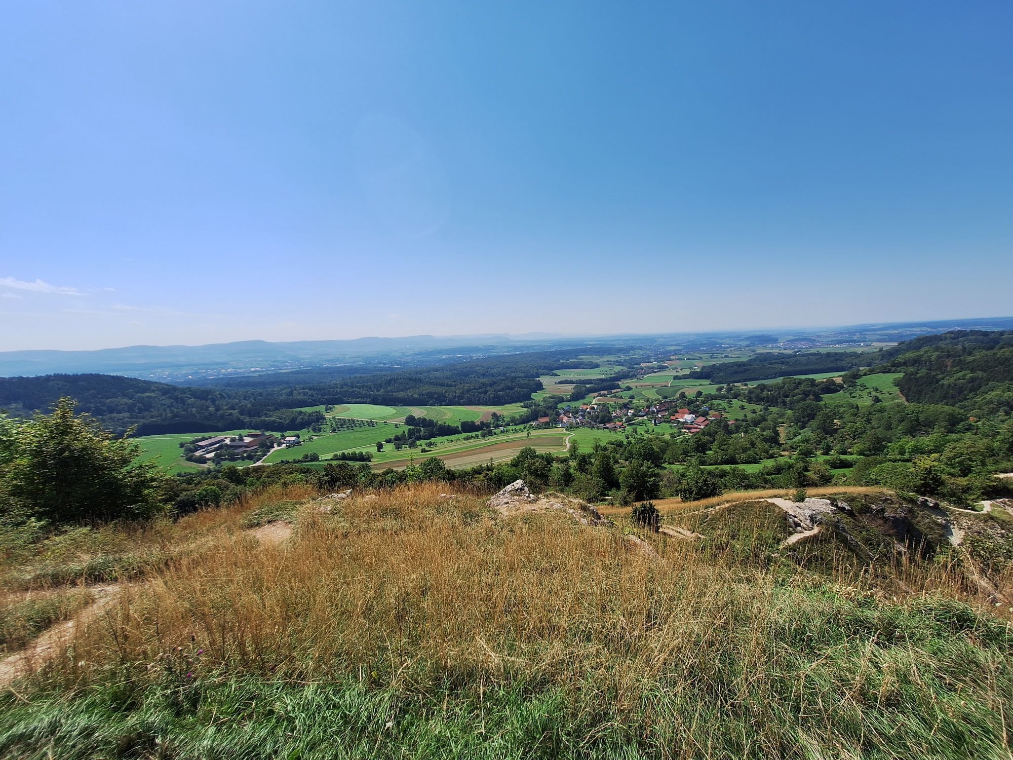
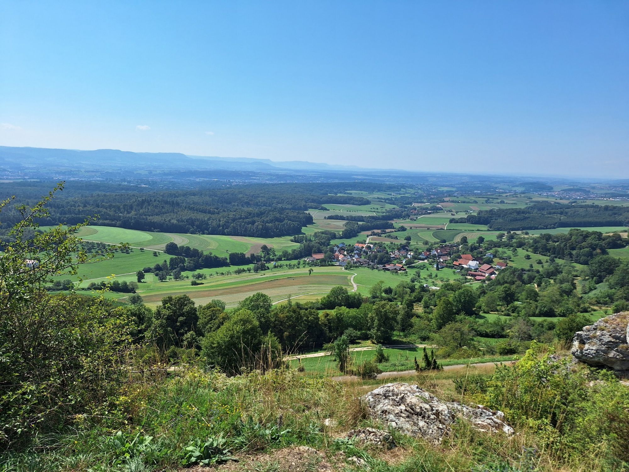
The Kaiser Barbarossa circular route in Hohenstaufen is approximately a 13.6 kilometers long route that starts at the Grabengasse/Reichsdorfstraße parking lot. The tour with a lot of elevation offers hikers an impressive panoramic view over the Filstal valley to the Swabian Alb and passes directly by the historic parish church of St. Sebastian in Ottenbach.
ipunkt in the town hall
Hauptstraße 1 | 73033 Göppingen
07161 650-4444 | ipunkt@goeppingen.de | www.goeppingen.de

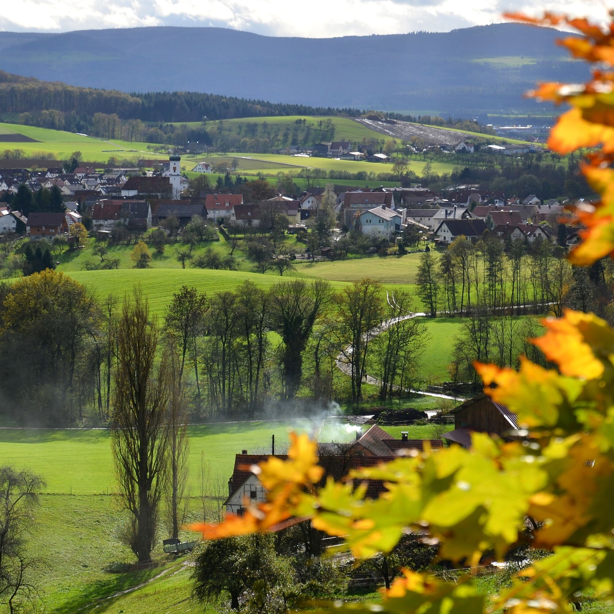
The 13.6 kilometer route starts in Hohenstaufen at the village square, from there we first walk to the right along Reichsdorfstraße and then turn into Ottenbacherstraße. The circular path leads us into the "Allgäu of the Göppingen district", into the Valley of Love Ottenbach. Surrounded by the Kaiser mountains Hohenstaufen and Rechberg, Ottenbach is scenically situated amidst green mountain slopes and a considerable number of surrounding farms. Worth seeing is the parish church of St. Sebastian in the middle of the village.
Across meadows and forests, the route continues through the so-called "Immenreich" to the Wannenhof with a forest cafe, where you can stop for a wonderful break. In the further course of the tour we continue hiking towards Göppingen and pass by Linsenholzsee. Enchanted in the Upper Woods, it invites you to another rest in the midst of nature before continuing through the forest to Hohrein. Having left Hohrein behind, the path climbs uphill through the heath forest into the magnificent Spielburg nature reserve. Upon reaching Spielburg, you are rewarded with a magnificent panoramic view over the Filstal valley all the way to the Swabian Alb.
To conclude, once again around Göppingen’s local mountain, the Hohenstaufen, and downhill over the Kaiserbergsteige, we return to our starting point.
If you still have enough energy, you can also climb the summit of Göppingen’s local mountain and end the day with Maultaschen with potato salad and a cool drink, reflecting on the day.
Da
Wear sturdy, slip-resistant footwear and weather-appropriate clothing. A backpack with water, snacks, and a first aid kit is recommended.
Paths can be slippery and dangerous when wet. Watch your steps and use hiking poles for stability if necessary.
Coming from Stuttgart or Ulm on the B10, take the Göppingen exit (near Möbel Rieger), then follow Heininger Straße and Hohenstaufenstraße to Hohenstaufen.
From the A8, take the Kirchheim unter Teck-Ost exit onto B297. In Bartenbach take Lerchenberger Straße and via L1075 to Hohenstaufen.
The starting point of the tour in Hohenstaufen can be reached by RE 5 or MEX 16 via Göppingen station and bus line 933. From the stop "Hohenstaufen, Dorfplatz", it is about a 2-minute walk to the starting point of the tour.
You can find the district timetable at: www.vvs.de/fahrplan
Parking is available directly in Grabengasse in Hohenstaufen. Please observe the signed parking guidance system.
T2
Respectful coexistence in Göppingen district.
Code of Conduct:
Respect trail closures and the quiet zones developed in the leisure trail concept. Leave no traces such as litter or animal waste, treat your trail carefully. Act with foresight and consideration. Adapt your behavior to the respective situation. Safety first. Respect other users of forest and fields. Take care of animals and plants. Plan ahead and use daylight. Try to avoid dawn and dusk. Observe the ban on entering agricultural land during the growing season. Stay on designated paths and avoid forest edges to help wild animals get used to humans better.More information at ruecksicht-macht-wege-breiter.de
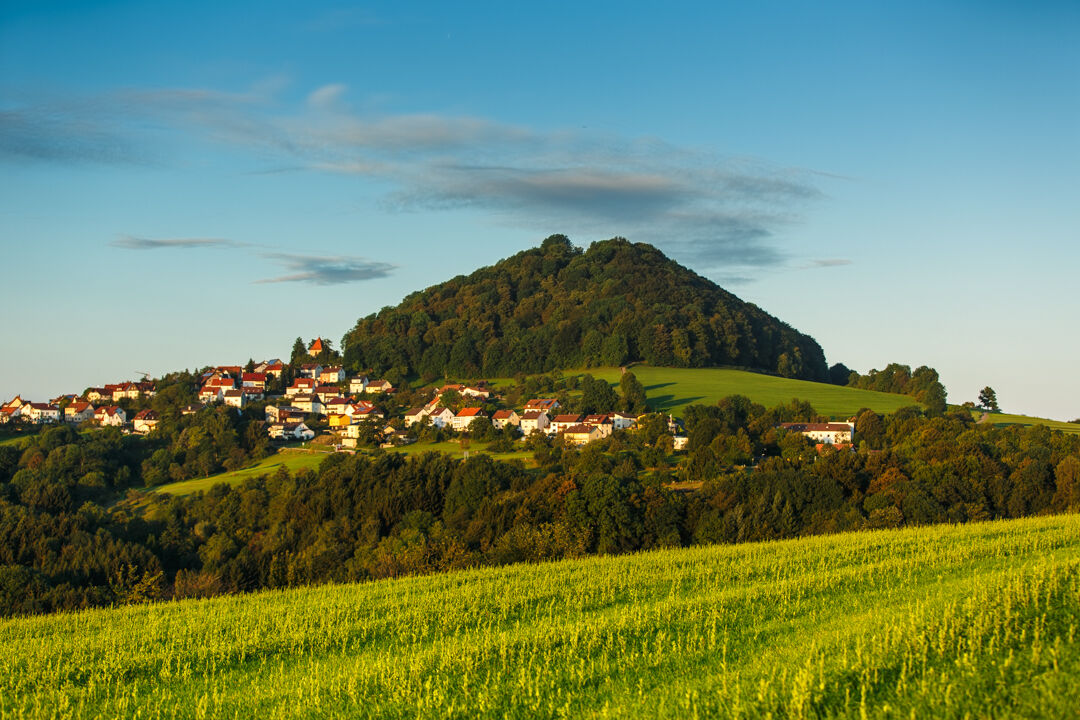
Staufer Exhibition Hohenstaufen
Those who want comprehensive information about the powerful and worldwide known Staufer dynasty are in the Staufer Exhibition at the foot of the Hohenstaufen just right.
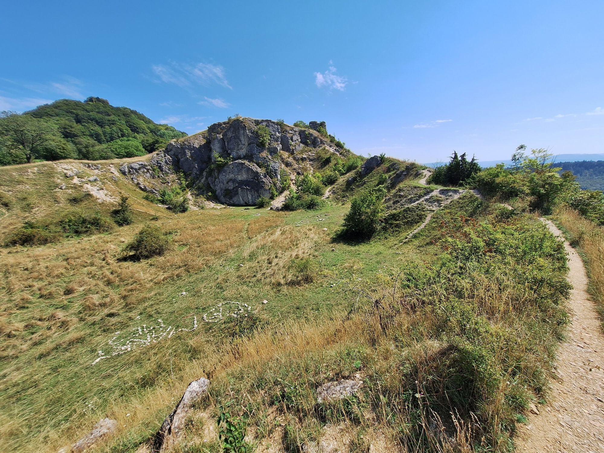
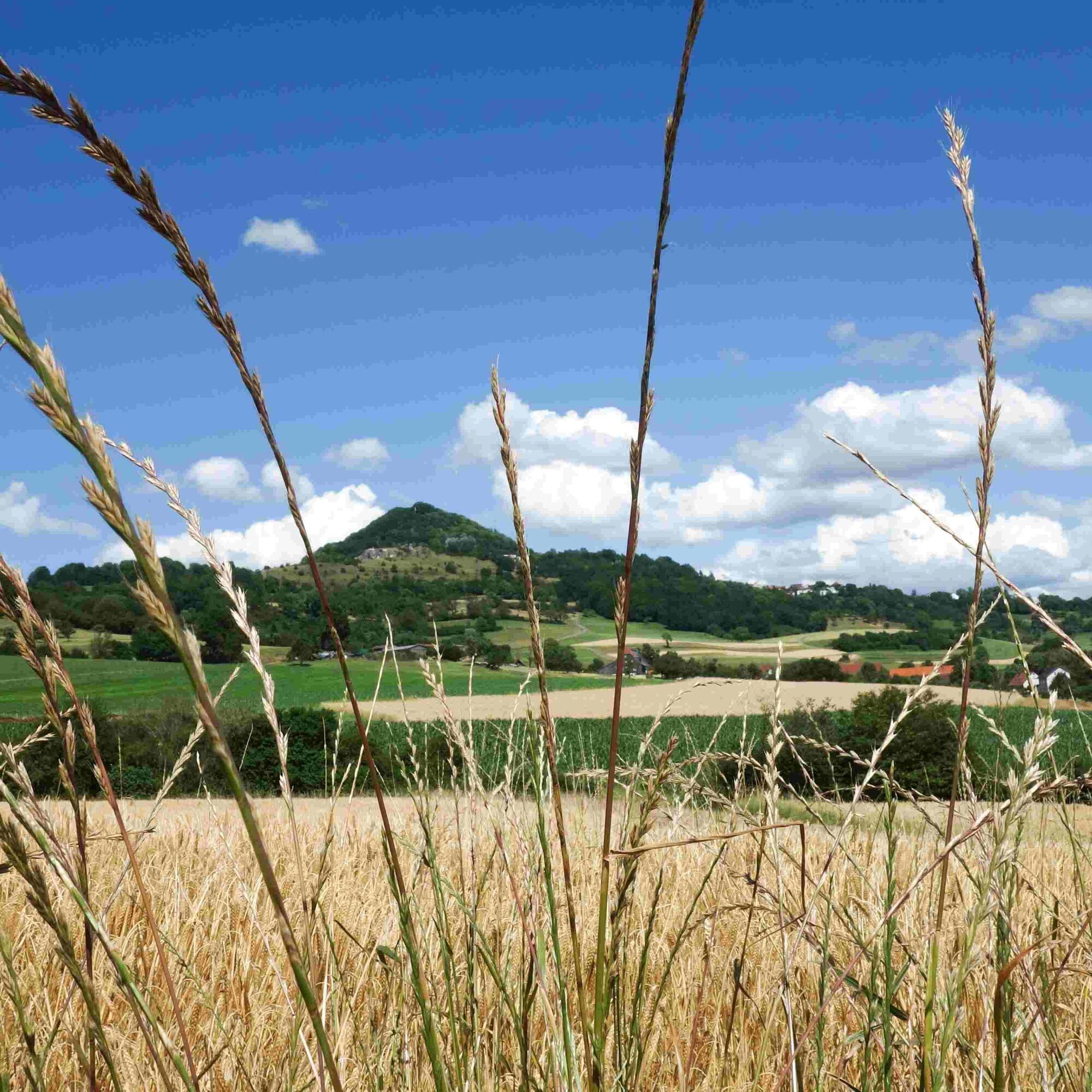
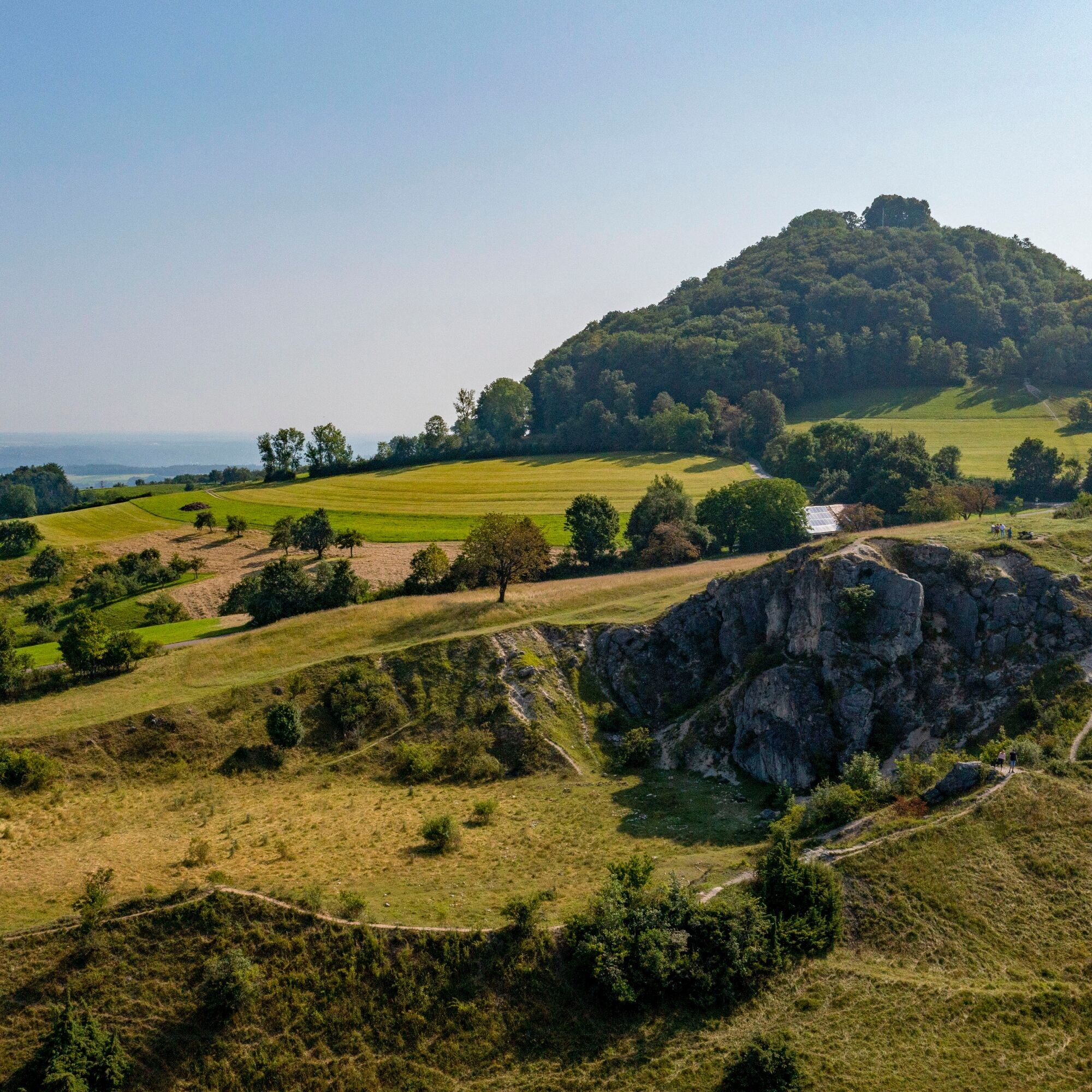
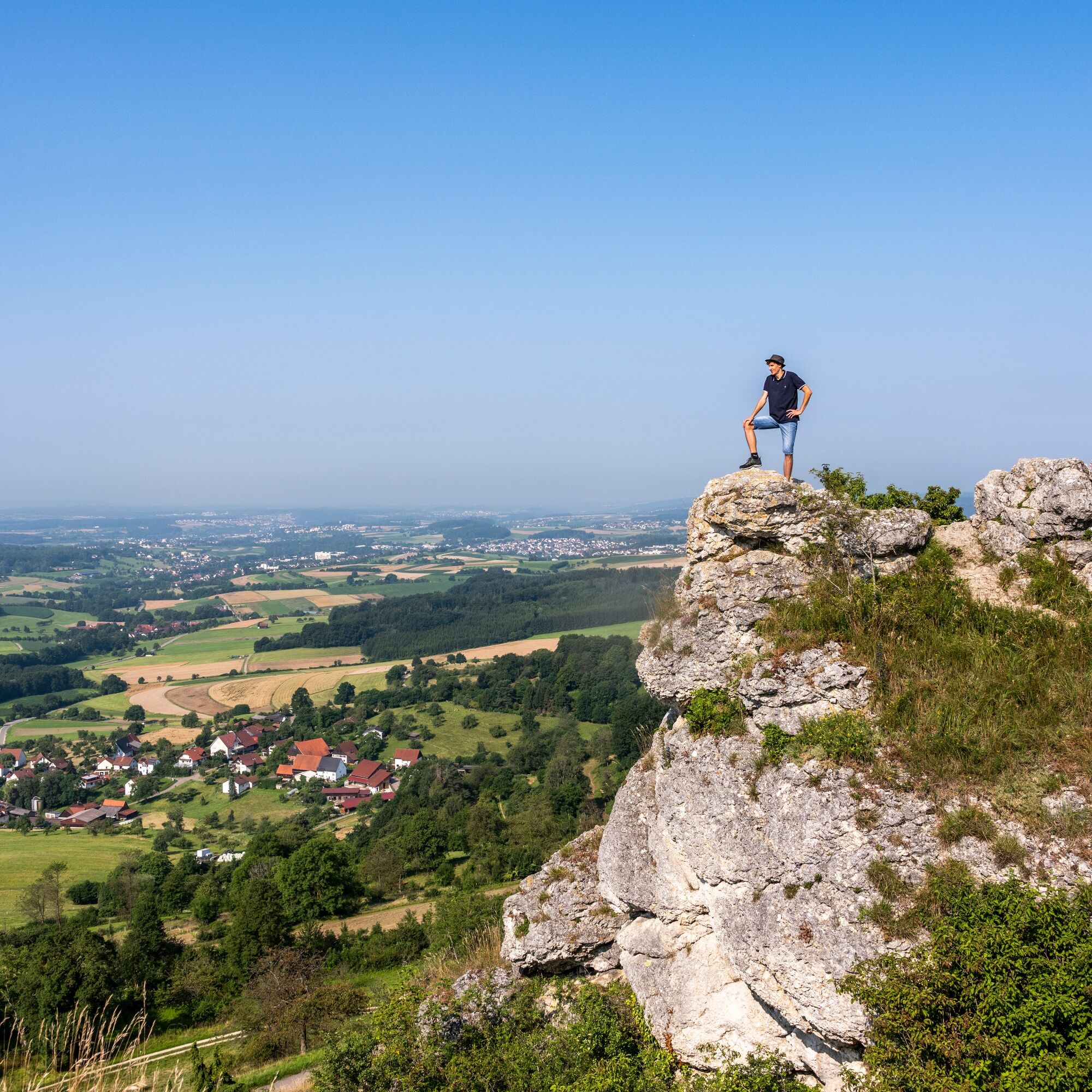
Spielburg Nature Reserve
Below Göppingen’s landmark, the Hohenstaufen, is the Spielburg. Once the top limestone layer of the summit, it today forms a great viewpoint with a rock height of 15 meters. Today the rock is embedded in a nature reserve and offers a breathtaking view over valleys and meadows. During the day you can enjoy the idyll and tranquility above the roofs of Göppingen. In the evening hours, romantic moments under the starry sky can be experienced at Spielburg.
Priljubljeni izleti v okolici
- 4.5
Löwenpfad "Orchideenpfad" - Herbs, Pasqueflower and Juniper Heathlands
srednjaPohodništvo 9.33 km - 4.9
Löwenpfad "Staufer-Runde" - Barbarossa's traces before a dreamlike backdrop
srednjaPohodništvo 11.3 km - 5.0
Lion trail "Berta-Hörnle-Tour" - castle stories in a dreamlike setting
težkoPohodništvo 14.7 km - 5.0
Löwenpfad "Heldentour" - The king stage of the Löwenpfade
težkoPohodništvo 23.6 km - 4.5
Löwenpfad "Weitblick-Tour" - High up and far-reaching view
težkoPohodništvo 12.0 km - 3.7
Löwenpfad "Wasserberg-Runde" - pure panorama and typical Swabian Jura landscapes
težkoPohodništvo 12.0 km - 3.5
Lion trail "Messelberg tour" - hiking with impressive views
srednjaPohodništvo 7.72 km - 1.0
Nordalbrunde
srednjaPohodništvo 4.76 km - 3.0
Circular route Drei-Kaiserberge
težkoPohodništvo 25.7 km - 5.0
Blicklestour Lauterstein
težkoPohodništvo 13.8 km

Pohodništvo in sledenje


Ne zamudite ponudb in navdiha za naslednje počitnice
Vaš e-poštni naslov je bil dodan na poštni seznam.