


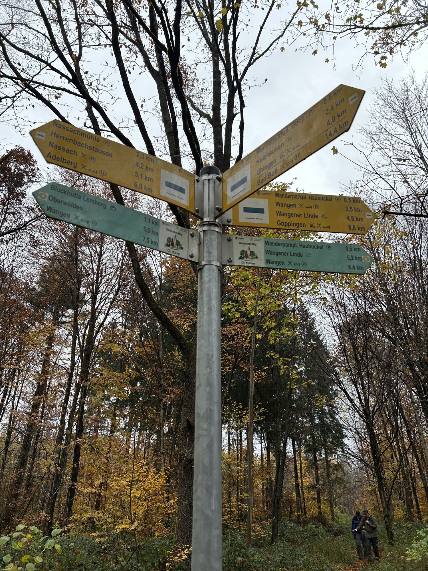
Haubuckelweg
Stopnja težavnosti: T1
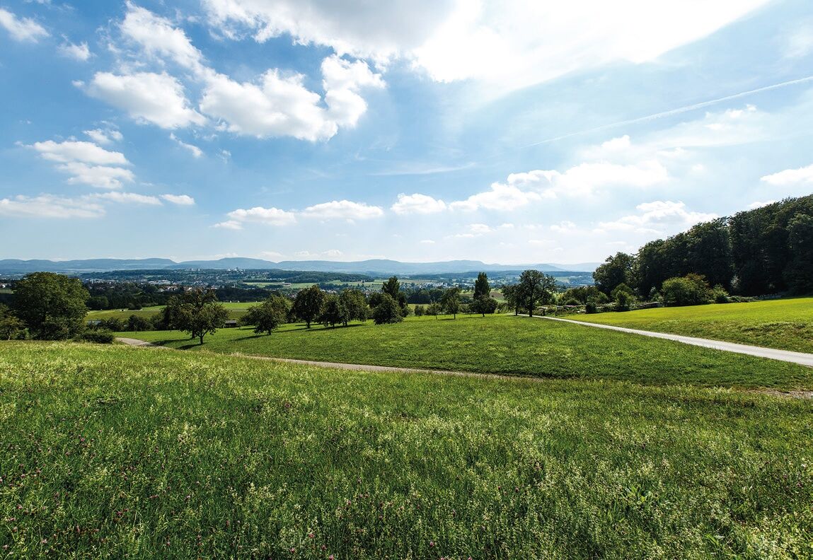
Wangen is picturesquely located on a hill above the Fils valley at the edge of the Schurwald. Embedded in an environment of meadows, fields, and extensive scattered fruit tree plantations, Wangen was purely...
Wangen is picturesquely located on a hill above the Fils valley at the edge of the Schurwald. Embedded in an environment of meadows, fields, and extensive scattered fruit tree plantations, Wangen was purely agricultural for many centuries.
In 1971, Oberwälden was incorporated into the municipality, and its village structure still exists today, supported by targeted village development measures. Oberwälden was honored in the competition "Our village should become more beautiful" with three state gold awards, a federal bronze, and a federal silver medal.
Municipality of Wangen
Pfarrberg 2 | 73117 Wangen
07161/ 91418 - 0 | rathaus@gemeinde-wangen.de | www.gemeinde-wangen.de


The starting point of the circular route is at the Municipality Haubuckel, located between Oberberken and Holzhausen. From there, the path leads shaded through the Köngentobel forest and runs slowly past the Lemberg towards the village of Oberwälden and the Oberwälder Lake. Particularly worth seeing is the Nikolaus Church from the 13th century, which impresses with its valuable wall paintings in the choir area. These paintings, depicting scenes from the life of Jesus, are among the most important of their kind north of the Alps from this era. The return path runs via the Wangen Reutgarten, passing the village sideways, and finally leads back to the starting point.
This list is designed for a short circular hike. For longer or more demanding routes, you should expand your equipment accordingly.
Paths can be slippery and dangerous when wet. Watch your steps and use hiking poles for stability if necessary.
RE5/MEX16 to Göppingen, then bus line 912 to "Wangen Holzhäuser Straße"; MEX16 to Faurndau, then also bus line 912 to Wangen. From the stop you can reach the starting point in about 30 minutes on foot. Alternatively, you can start the circular hike directly at the stop.
The local timetable can be found at: www.vvs.de/fahrplan
At the starting point.
T1
Respectful coexistence in the district of Göppingen.
Code of conduct:
Respect trail closures and the quiet zones developed in the leisure trail concept. Leave no traces such as litter or animal droppings, treat your path gently. Act prudently and considerately. Adapt your behavior to the respective situation. Safety comes first. Respect other users of forest and countryside. Take care of animals and plants. Plan ahead and use daylight. Try to avoid dawn and dusk. Observe the prohibition of entering agricultural land during the vegetation period. Stay on designated paths and avoid forest edges so that wild animals can better get used to humans.More information at ruecksicht-macht-wege-breiter.de
Wangen lime tree
Priljubljeni izleti v okolici
- 4.9
Löwenpfad "Staufer-Runde" - Barbarossa's traces before a dreamlike backdrop
srednjaPohodništvo 11.3 km - 4.7
Löwenpfad "Orchideenpfad" - Herbs, Pasqueflower and Juniper Heathlands
srednjaPohodništvo 9.33 km - 5.0
Lion trail "Berta-Hörnle-Tour" - castle stories in a dreamlike setting
težkoPohodništvo 14.7 km - 3.0
Circular route Drei-Kaiserberge
težkoPohodništvo 25.7 km - 5.0
Löwenpfad "Spielburg-Runde" - Around the mountain Hohenstaufen
svetlobaPohodništvo 3.53 km - 5.0
Boßler circuit
srednjaPohodništvo 8.59 km Mills & Lakes Route Adelberg
svetlobaPohodništvo 9.56 km- 4.0
Herrenstausee Runde
srednjaPohodništvo 10.5 km - 3.0
Hohenstaufen
srednjaPohodništvo 22.0 km Löwentrail "Teufelsloch-Runde" - up to Kornberg and Boßler
srednjaMountainbike 29.8 km

Pohodništvo in sledenje


Ne zamudite ponudb in navdiha za naslednje počitnice
Vaš e-poštni naslov je bil dodan na poštni seznam.