


Hiking in Bugey: up to Chanduraz from Charaillin
Stopnja težavnosti: T2
This hike, which does not go through the summit or the Grand Colombier pass, offers the possibility of discovering more private paths and panoramas that are inaccessible by car.
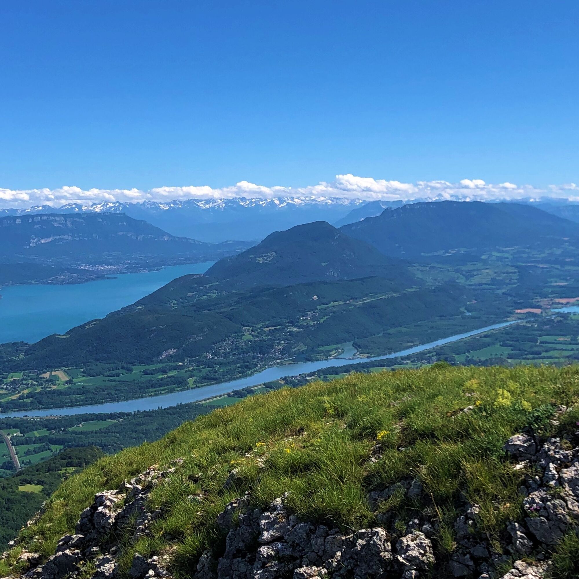
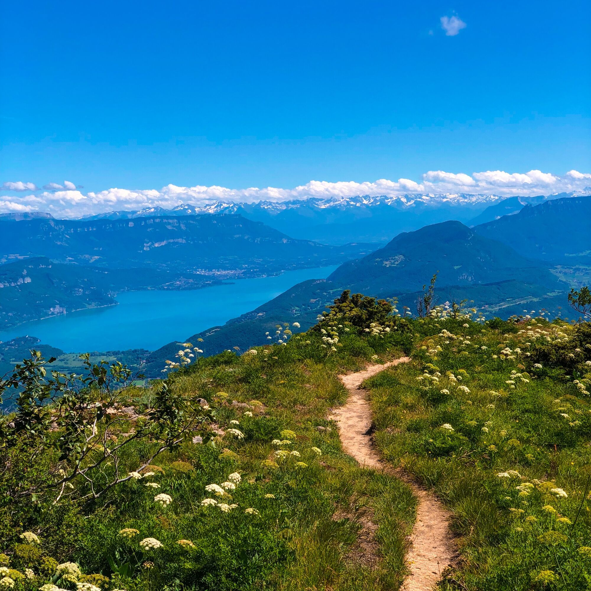
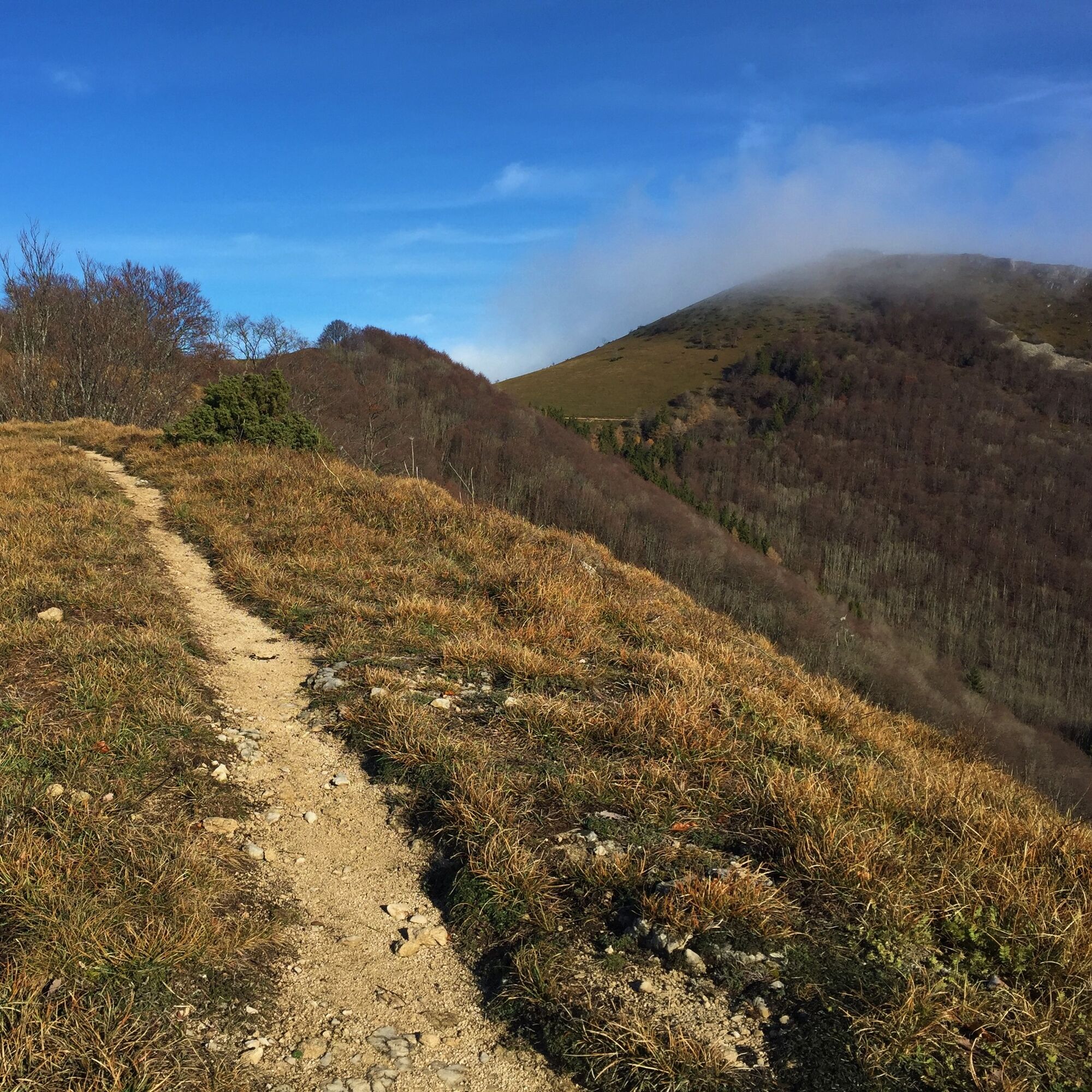
The steady climb of 5 kilometers...
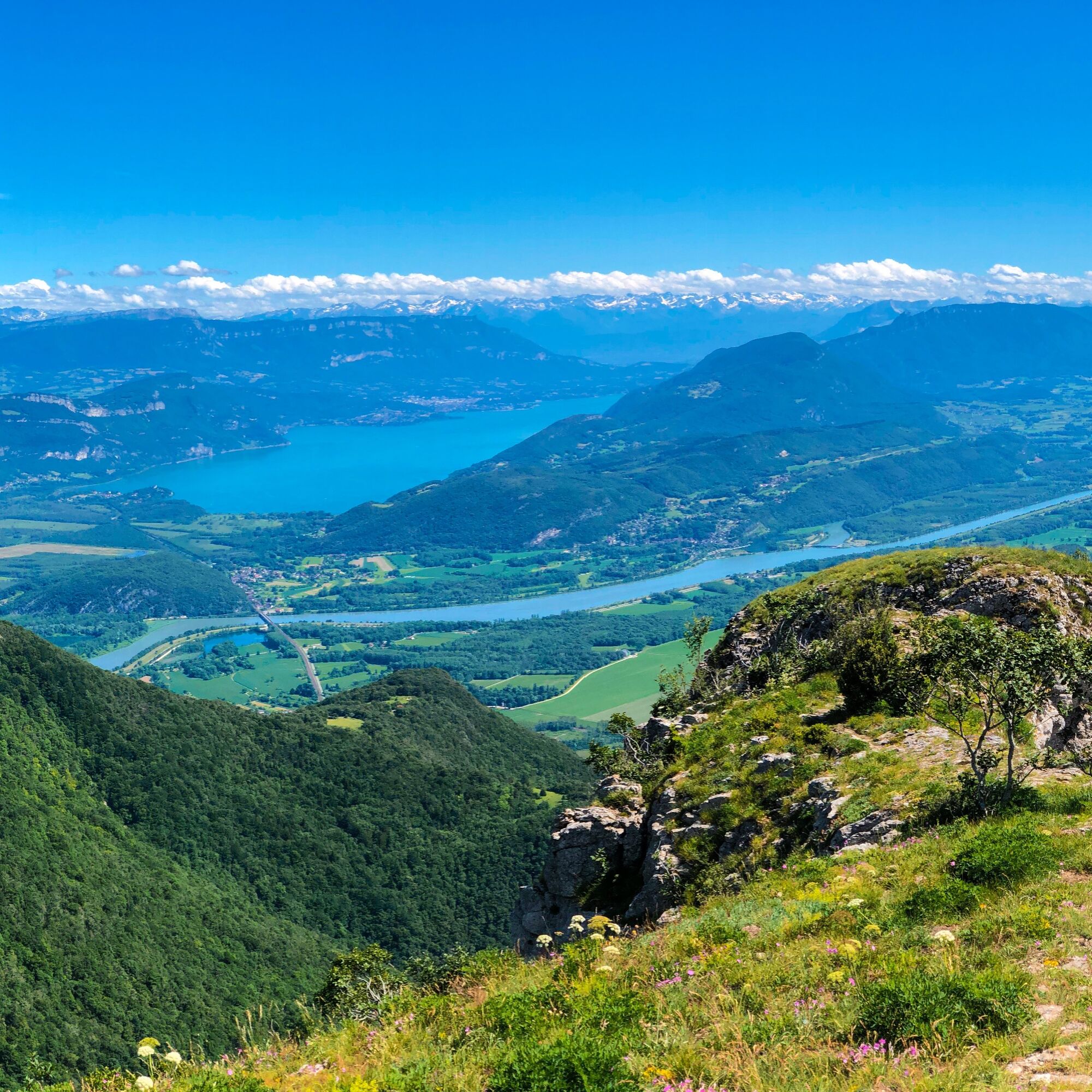
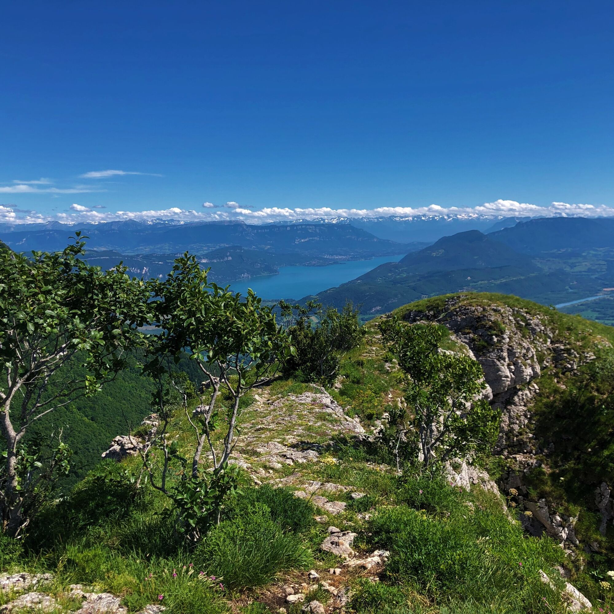
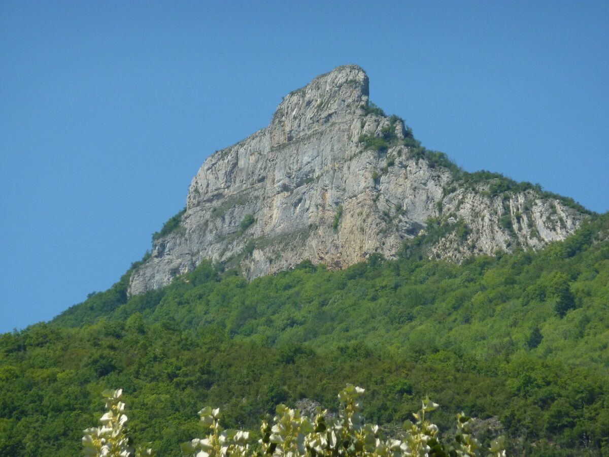
The steady climb of 5 kilometers for an elevation gain of 800 meters will reward you with a breathtaking view of the Lac du Bourget, the Alps, the Rhône river from the rock of Chanduraz.
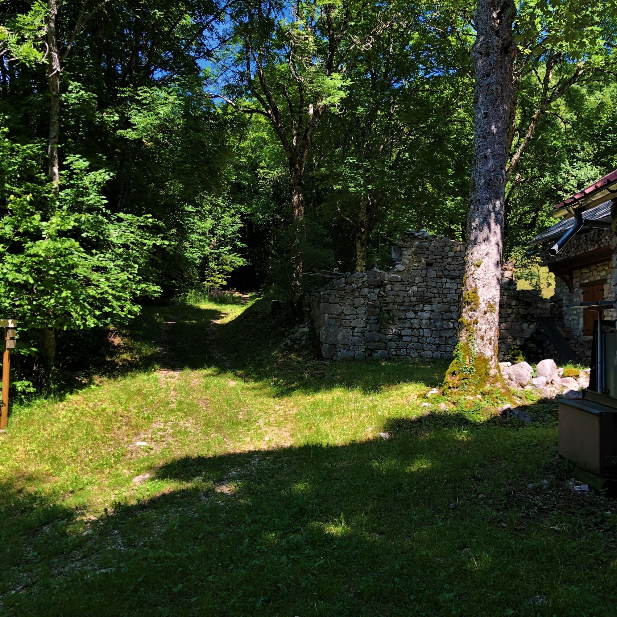
The climb is mainly in the coolness of the forests of the Grand Colombier.
(Be careful, the southern end of the rock is inaccessible).
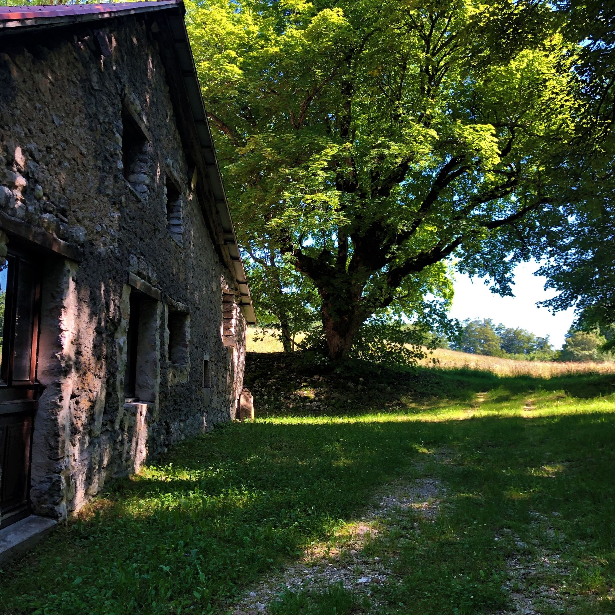
The hike follows the Parnaud nature trail on its lower part, you will discover the wine-growing tradition of the village of Chavornay: low walls, stone stairs, barns and old plots testifying to this recent past.
Yellow and yellow / red markings
Follow the signs with the initials "CC".
Da
Da
The hike is not feasible if you are not properly shod.
Cap, sunglasses and windbreaker are strongly recommended.
Warning: the extremity of the Roche de Chanduraz is not accessible, be vigilant with children, some parts of the trail are close to the edge.
Be careful if you have to cross herds, avoid sudden gestures and go around the cows.
Defective markings, incidents / safety, conflicts of use, illegal dumping? : locate and share the problem encountered on the national alert system via the SURICATE app or through the website https://sentinelles.sportsdenature.fr/
Chavornay is located 1 hour 30 minutes from Lyon, 1 hour from Geneva, Annecy, and Chambéry.
Chavornay is not accessible by public transport.
Park in Chavornay near the former town hall, the boule court, and the war memorial.
T2
To visit nearby:
- The Bugey Valromey Museum
- The Comté Dairy in Valromey
- The Lavours Marsh
- The Montvéran Castle in Culoz
- The Lèbe Observatory
And many more!
Priljubljeni izleti v okolici
-
1.0
Hike of the Clairefontaine waterfall
svetlobaPohodništvo 5.46 km -
Hike: Gorges de Thurignin
težkoPohodništvo 14.2 km -
Cycling tour : Marshes and vineyards in Bugey
svetlobaCestno kolo 33.1 km -
Hike starting from Parves-et-Nattages: le circuit du Sorbier
svetlobaPohodništvo 11.4 km -
3.0
Hike: on the ridge of the Grand Colombier (circuit des crêtes)
srednjaPohodništvo 11.3 km -
Hike: A wolf life.
svetlobaPohodništvo 7.22 km -
Hike of the Grand Colombier starting from Munet
težkoPohodništvo 16.0 km -
3 day-hike in Jura: hiking trails through Plateau de Retord and Grand Colombier
težkoPohodništvo 50.9 km -
Hike : Lake and vineyards
svetlobaPohodništvo 9.76 km -
E-mountainbike loop 8 - Marais d'Aignoz - Espace FFC Ain Forestière
težkoMountainbike 44.6 km
Pohodništvo in sledenje


Ne zamudite ponudb in navdiha za naslednje počitnice
Vaš e-poštni naslov je bil dodan na poštni seznam.