Walking loop to Col de Bramanette
težko
Pridobite to turo v svoj mobilni telefon
Walking loop to Col de Bramanette
težko
Pohodništvo
15.58
km
Skenirajte kodo QR in začnite navigacijo v aplikaciji bergfex.


Pohodništvo in sledenje





Walking loop to Col de Bramanette
težko
Razdalja
15.58
km
Trajanje
06:00
h
Ascent
1,262
hm
Morska gladina
1,640 -
2,835
m
Prenos skladbe
Walking loop to Col de Bramanette
težko
Pohodništvo
15.58
km
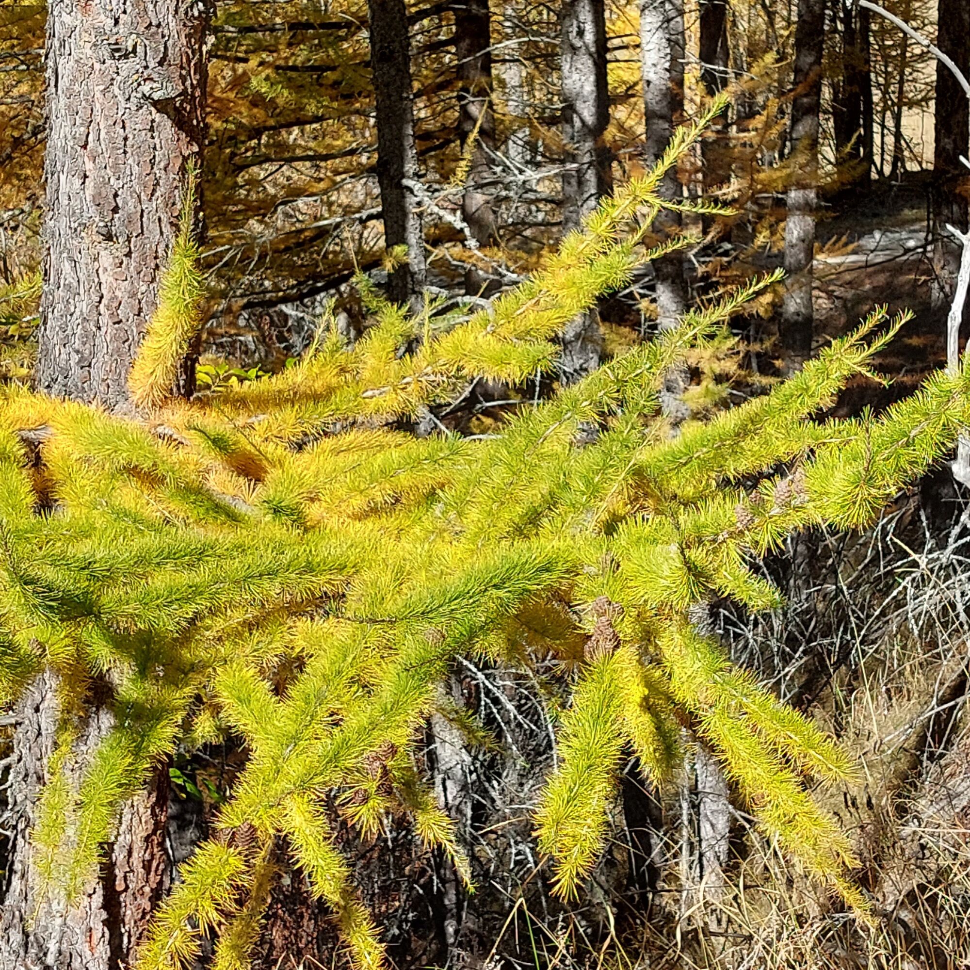
The downhill start provides a comfortable warm-up kilometer before a serious climb in the cool of the forest. The smell of humus moistened by morning dew gives you the energy you need to reach the Bramanette...
Opis
The downhill start provides a comfortable warm-up kilometer before a serious climb in the cool of the forest. The smell of humus moistened by morning dew gives you the energy you need to reach the Bramanette refuge and take a well-deserved break. Take time to scan the ridges of the Dent Parrachée on the already sunny side of Aussois. The shepherd of the mountain pasture might even let you meet his sheep. But never fear! His faithful patous require
only the distance necessary for the well-being of their flock. Leave the chalets typical of high-altitude pastures. Your stride becomes
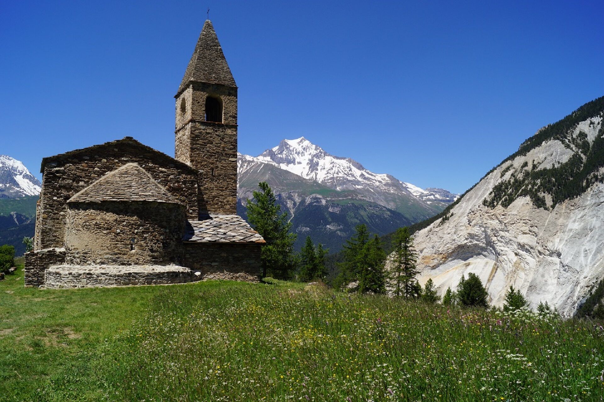
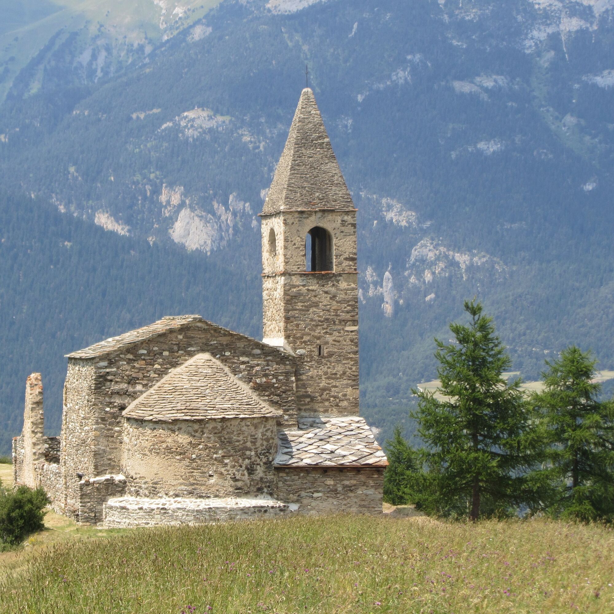
to reach the pass at 2855m. You may be lucky enough to catch a glimpse of some chamois, accustomed to the surrounding slopes. The eastern slope now offers you the wild scenery of the Dents d'Ambin. So characteristic from their 3369 m altitude, they seem so close! Off you go to Lac du Liael and then the Montbas mountain pasture. Treat yourself to a truly contemplative rest. The sound of birdsong beckons you on your final descent through the forest to the church of St-Pierre-d'Extravache.
only the distance necessary for the well-being of their flock. Leave the chalets typical of high-altitude pastures. Your stride becomes
to reach the pass at 2855m. You may be lucky enough to catch a glimpse of some chamois, accustomed to the surrounding slopes. The eastern slope now offers you the wild scenery of the Dents d'Ambin. So characteristic from their 3369 m altitude, they seem so close! Off you go to Lac du Liael and then the Montbas mountain pasture. Treat yourself to a truly contemplative rest. The sound of birdsong beckons you on your final descent through the forest to the church of St-Pierre-d'Extravache.
Pot
Montbas
(2,062 m)
Poravnava
0.2 km
Les Combes
(1,625 m)
Poravnava
2.2 km
Bramanette
(2,083 m)
Poravnava
5.2 km
Refuge de Bramanette
(2,101 m)
Zavetišče
5.3 km
Montbas
(2,062 m)
Poravnava
15.4 km
Refuge Lo Tsamou
(2,061 m)
Zavetišče
15.4 km
Pot
Walking loop to Col de Bramanette
težko
Pohodništvo
15.58
km
Avtor
Zagotavlja Haute Maurienne Vanoise
Za ogled Walking loop to Col de Bramanette poskrbi outdooractive.com.


Informacije o poti
Pot
To guide you in the field, consult the "step-by-step" directional diagram provided in pdf.
Dodatne informacije in nasveti
Dodatne informacije
The duration of hiking trails is calculated using reference paces: 300 m/h ascent, 500 m/h descent and 4 km/h on the flat.
As hazards may occur at any time on the routes, the GPX tracks provided are not contractual. They are given for information only. Riders use them at their own risk, depending on their level of technological proficiency and their understanding of the terrain.
As hazards may occur at any time on the routes, the GPX tracks provided are not contractual. They are given for information only. Riders use them at their own risk, depending on their level of technological proficiency and their understanding of the terrain.
Še ni pregledov
Priljubljeni izleti v okolici
-
5.0
BARDONECCHIA Colle Sommeiller
srednjaMountainbike 25.4 km -
5.0
BARDONECCHIA Forte Jafferau Loop
težkoMountainbike 36.8 km -
5.0
BARDONECCHIA Decauville
srednjaPohodništvo 7.29 km -
BARDONECCHIA Monte Jafferau
težkoPohodništvo 11.6 km -
little 'Haute-Maurienne Vanoise' circuit
težkoCestno kolo 32.0 km -
BARDONECCHIA Rochemolles Dam - Scarfiotti Refuge
srednjaPohodništvo 7.77 km -
4.0
BARDONECCHIA Sentiero dei Cosetti by Luciano Ferraris
svetlobaPohodništvo 3.24 km -
BARDONECCHIA Frejusia Basins - Decauville - Rochemolles Dam
svetlobaMountainbike 7.54 km -
5.0
BARDONECCHIA Decauville
svetlobaSnežni čevlji 4.11 km -
Refuge du Fond d'Aussois - a wild valley in the Vanoise - 2-day hike
svetlobaPohodništvo 9.22 km
Pohodništvo in sledenje

Zaradi več kot 550.000 predlogov izletov, podrobnih zemljevidov in intuitivnega načrtovanja poti je aplikacija obvezna oprema za vse ljubitelje narave.

Ne zamudite ponudb in navdiha za naslednje počitnice
Naročite se na novice
Napaka
Zgodila se je napaka. Prosimo, poskusite znova.
Zahvaljujemo se vam za prijavo
Vaš e-poštni naslov je bil dodan na poštni seznam.
Izleti po vsej Evropi
Avstrija
Švica
Nemčija
Italija
Slovenija
Francija
Nizozemska
Belgija
Poljska
Lihtenštajn
Češka
Slovaška
Španija
Chorvátsko
Bosna in Hercegovina
Luksemburg
Andora
පෘතුගාලය
අයිස්ලන්තය
එක්සත් රාජධානිය
අයර්ලන්තය
ග්රීසිය
ඇල්බේනියාව
North Macedonia
Malta
Norway
Montenegro
Moldova
කොසෝවො
හන්ගේරියානු සමුහාණ්ඩුව
San Marino
රුමේනියාව
එස්ටෝනියා
ලැට්වියාව
බෙලාරස්
සයිප්රස්
Lithuania
Serbia
බල්ගේරියාව
Monaco
ඩෙන්මාර්කය
Sweden
ෆින්ලන්තය





