Orgère discovery trail on foot
svetloba
Pridobite to turo v svoj mobilni telefon
Orgère discovery trail on foot
svetloba
Tematska pot
4.75
km
Skenirajte kodo QR in začnite navigacijo v aplikaciji bergfex.

Pohodništvo in sledenje


Orgère discovery trail on foot
svetloba
Razdalja
4.75
km
Trajanje
02:00
h
Ascent
165
hm
Morska gladina
1,881 -
2,068
m
Prenos skladbe
Orgère discovery trail on foot
svetloba
Tematska pot
4.75
km
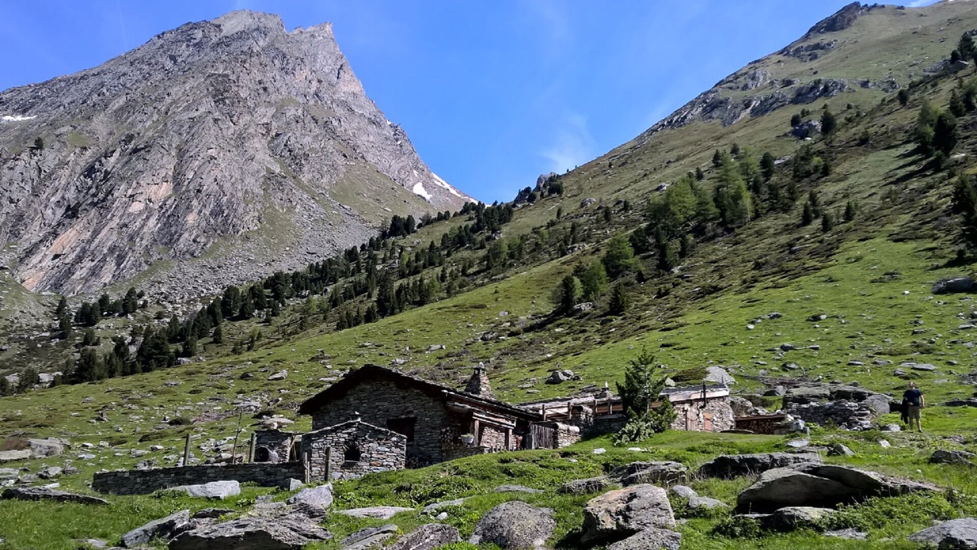
As the whole family ventures onto this easy path, the valley's very own song
welcomes you: this place is home to tits, crickets, and other wild inhabitants.
Some of you may decide to hang out with Benoît...
Opis
As the whole family ventures onto this easy path, the valley's very own song
welcomes you: this place is home to tits, crickets, and other wild inhabitants.
Some of you may decide to hang out with Benoît sheep on the valley floor;
others, to go down on the path that leads to the stream and play around
on the way back to the Orgère refuge. And for those who prefer a terraced
route, just a few loops will take you uphill to enjoy a breathtaking view of
the valley amidst the majestic Arolla pine trees of Haute Maurienne Vanoise.
Handsomely decked out in dark gray scale-like bark, these trees proudly
colonise the slope, sending out resinous fragrances as the sun warms their
backs. Guess the size of the largest trunk you'll come across!
And who knows, you might just be greeted by the spotted nutcracker in this
Arolla orchard, so typical of alpine high-altitude forests... But what's this bird,
who seems so fond of pine cones, in the midst of all these Arolla pines?
Pot
Le Fournet
(1,949 m)
Koridor/teren
0.1 km
Refuge de l'Orgère
(1,932 m)
Zavetišče
4.6 km
Pot
Orgère discovery trail on foot
svetloba
Tematska pot
4.75
km
Le Fournet
(1,949 m)
Koridor/teren
0.1 km
Refuge de l'Orgère
(1,932 m)
Zavetišče
4.6 km
Avtor
Zagotavlja Haute Maurienne Vanoise
Za ogled Orgère discovery trail on foot poskrbi outdooractive.com.

Informacije o poti
Pot
To guide you in the field, consult the "step-by-step" directional diagram provided in pdf.
Enosmerna tura
Da
Dodatne informacije in nasveti
Dodatne informacije
All-terrain stroller and wheelchair access to the end of the valley and back only.
The duration of hiking trails is calculated using reference paces: 300 m/h ascent, 500 m/h descent and 4 km/h on the flat.
As hazards may occur at any time on the routes, the GPX tracks provided are not contractual. They are given for information only. Riders use them at their own risk, depending on their level of technological proficiency and their understanding of the terrain.
Še ni pregledov
Priljubljeni izleti v okolici
BARDONECCHIA Rochemolles Dam - Scarfiotti Refuge
srednjaPohodništvo 7.77 kmRefuge du Fond d'Aussois - a wild valley in the Vanoise - 2-day hike
svetlobaPohodništvo 9.22 km- 5.0
The Builder's Trail on foot
svetlobaTematska pot 7.23 km Col du Mont Cenis from Modane
težkoCestno kolo 34.8 km- 5.0
Girarde footpath
svetlobaPohodništvo 8.10 km Sentier pédestre des Sculptures - Land Art Montagne
svetlobaTematska pot 5.16 kmAscent to 'Plan du Lac'
težkoCestno kolo 15.6 kmChemin du Petit Bonheur mountain bike trail from Bonneval/Arc to Modane
težkoMountainbike 47.2 kmLittle ascent of Plan d'Aval
težkoCestno kolo 6.37 kmCircuit of 'Esseillon'
težkoCestno kolo 33.0 km
Pohodništvo in sledenje

Zaradi več kot 550.000 predlogov izletov, podrobnih zemljevidov in intuitivnega načrtovanja poti je aplikacija obvezna oprema za vse ljubitelje narave.

Ne zamudite ponudb in navdiha za naslednje počitnice
Naročite se na novice
Napaka
Zgodila se je napaka. Prosimo, poskusite znova.Zahvaljujemo se vam za prijavo
Vaš e-poštni naslov je bil dodan na poštni seznam.
Izleti po vsej Evropi
Avstrija Švica Nemčija Italija Slovenija Francija Nizozemska Belgija Poljska Lihtenštajn Češka Slovaška Španija Chorvátsko Bosna in Hercegovina Luksemburg Andora පෘතුගාලය අයිස්ලන්තය එක්සත් රාජධානිය අයර්ලන්තය ග්රීසිය ඇල්බේනියාව North Macedonia Malta Norway Montenegro Moldova කොසෝවො හන්ගේරියානු සමුහාණ්ඩුව San Marino රුමේනියාව එස්ටෝනියා ලැට්වියාව බෙලාරස් සයිප්රස් Lithuania Serbia බල්ගේරියාව Monaco ඩෙන්මාර්කය Sweden ෆින්ලන්තය