


From Malga Boer to Fuciade, among huts warmed by Ladin hospitality


At first, the ascent might make you work a little, but as the trail becomes more level, you'll find yourself surrounded by an emerald-green landscape, fragrant with colourful flowers in the summer, or...
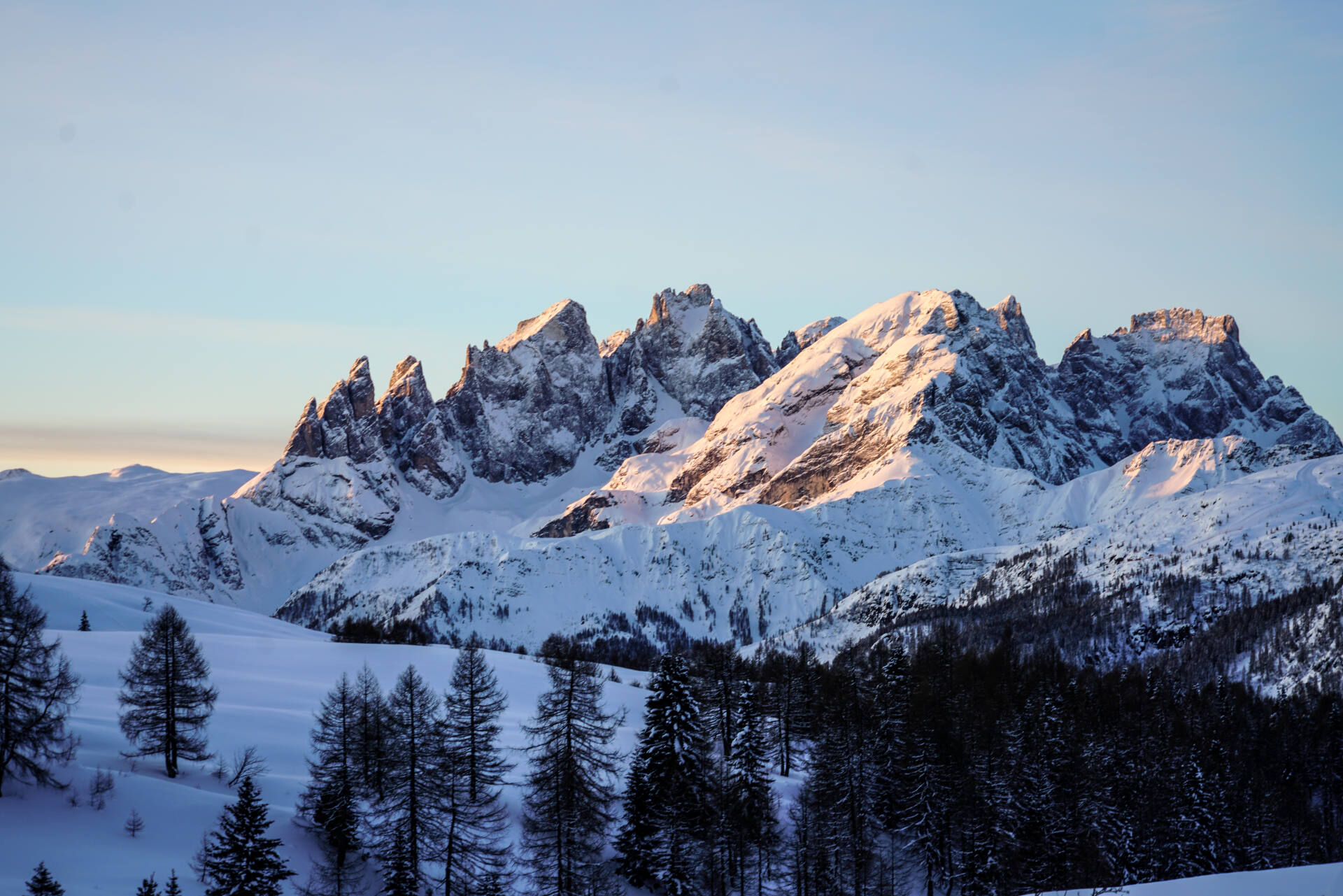
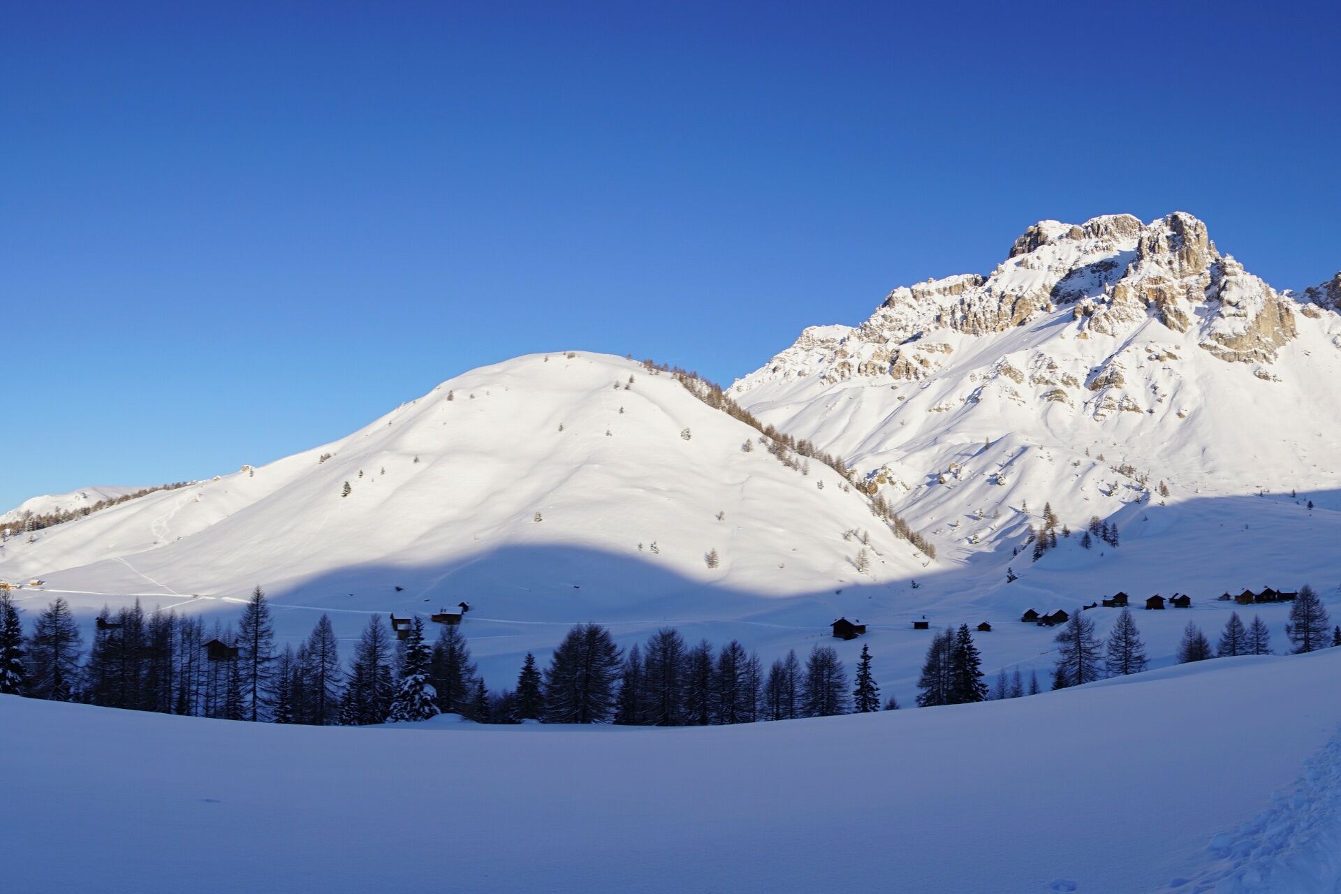
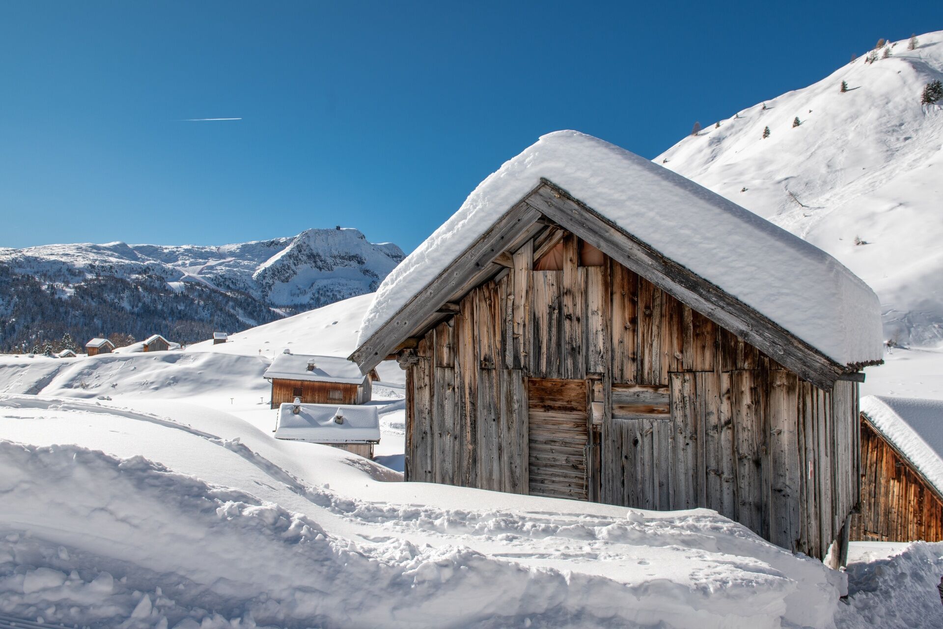
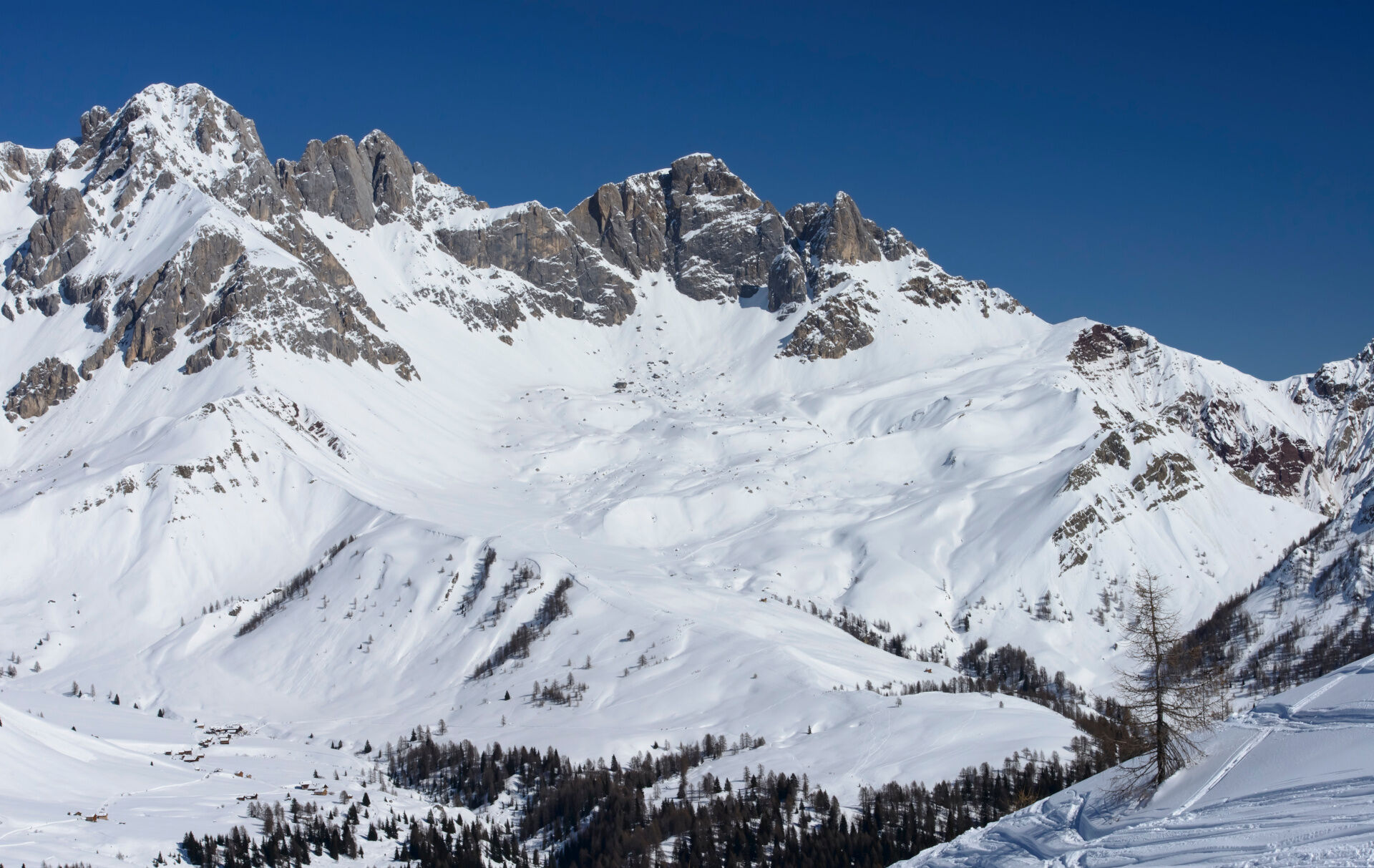
At first, the ascent might make you work a little, but as the trail becomes more level, you'll find yourself surrounded by an emerald-green landscape, fragrant with colourful flowers in the summer, or pristine and gleaming with snow in the winter. Yet, no matter how many times you've already reached it, the Fuciade basin always manages to surprise. This territory was once the pasture of Soraga, where the meadows provided hay for the winter. Here stood numerous barns, the famous "baic", now restored and transformed into rustic mountain chalets. One of these is your destination: Fuciade Rifugio, which has managed to preserve the soul of the place and pass it on to new generations. Dropping by is a must! And all around, the Costabella range, with views stretching to the Pale di San Martino and Col Margherita, completes the conquest.

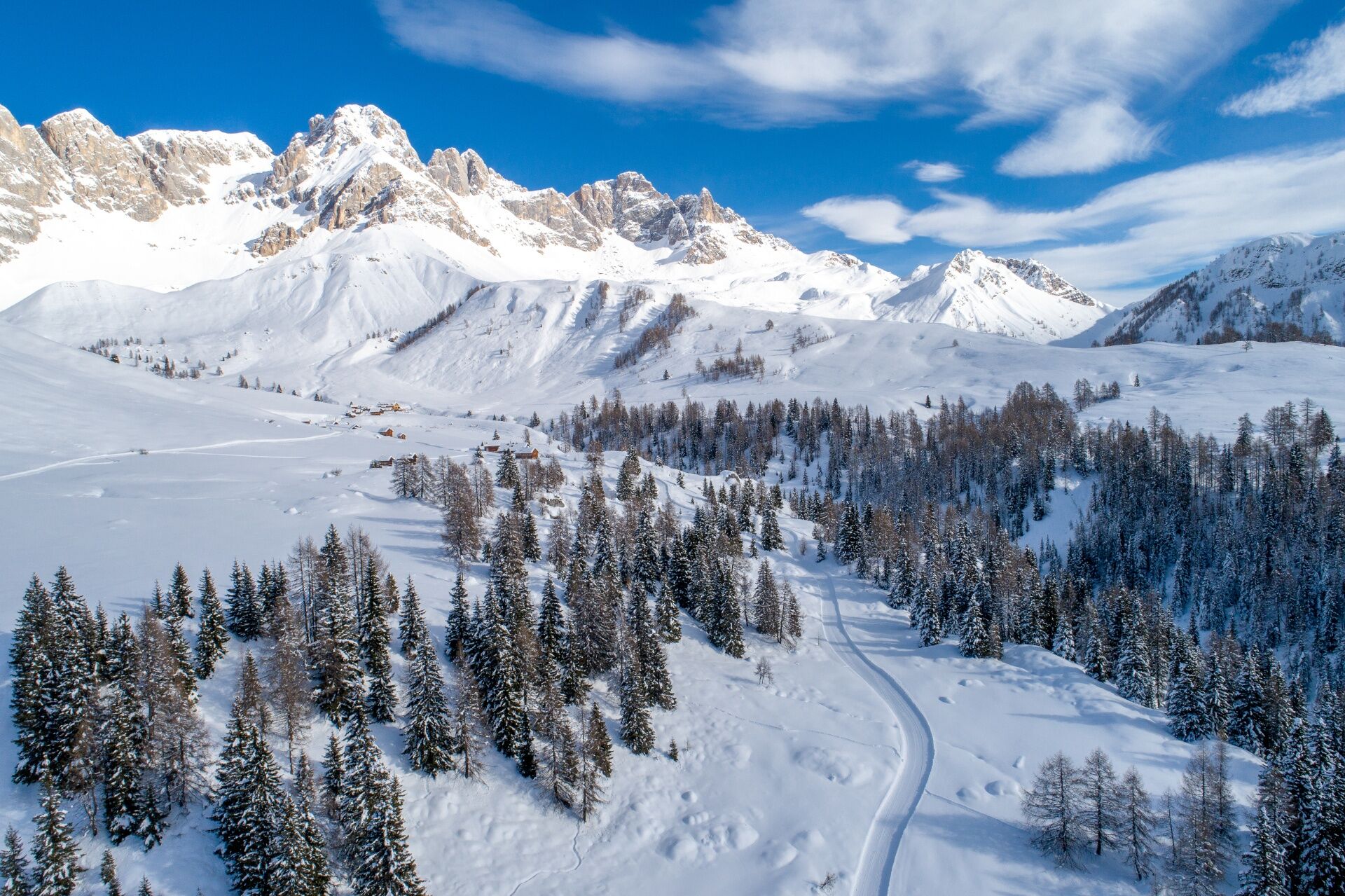
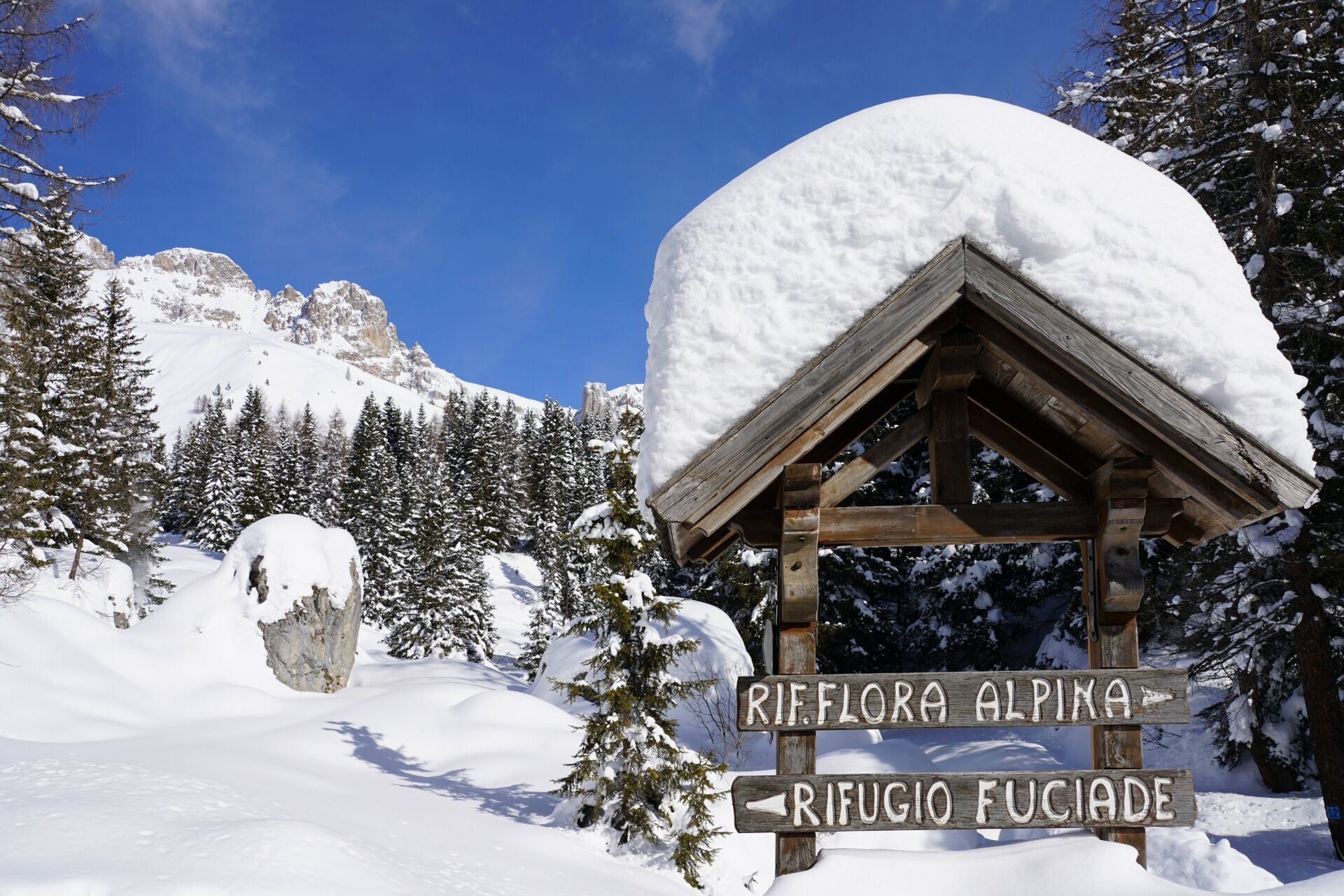
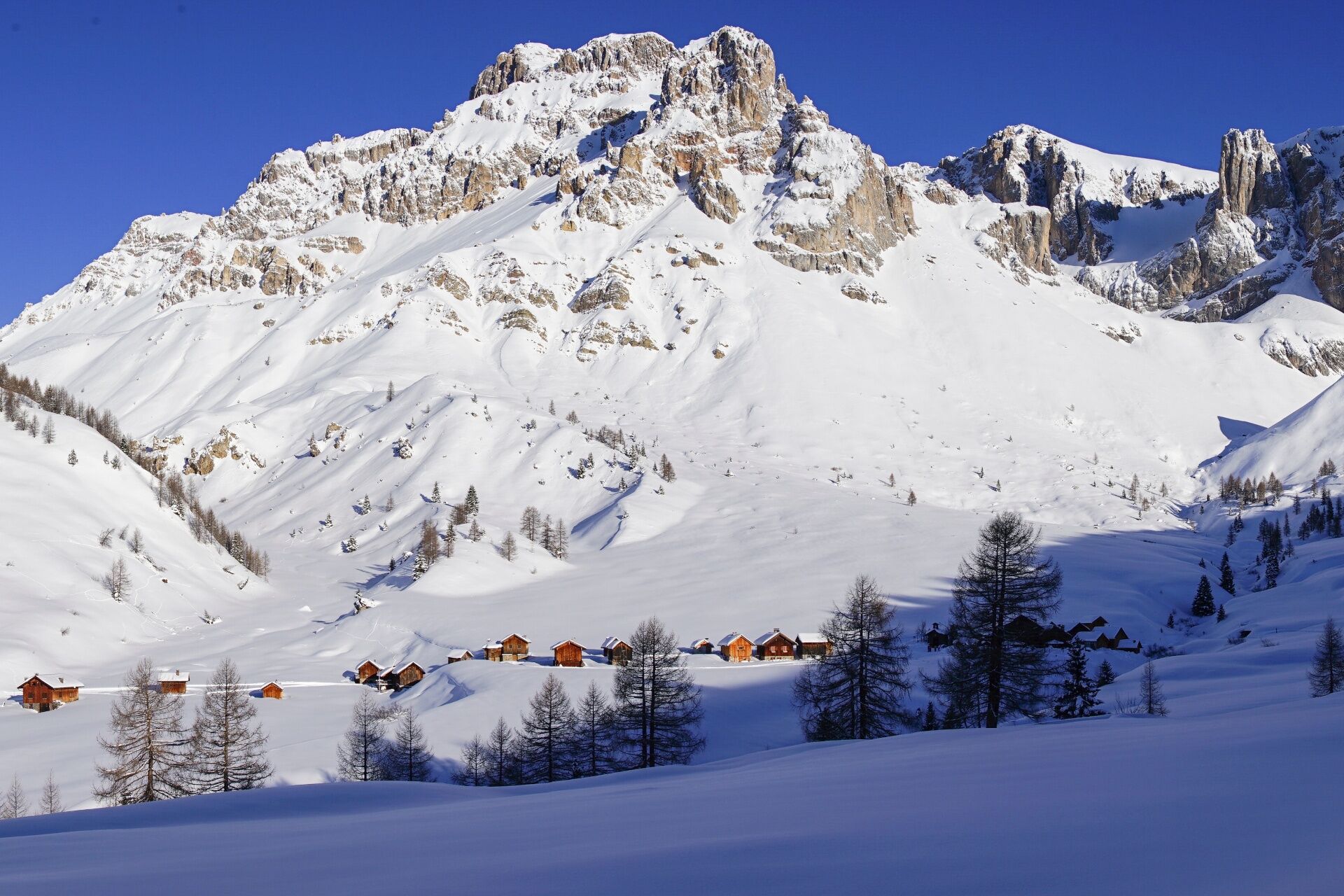
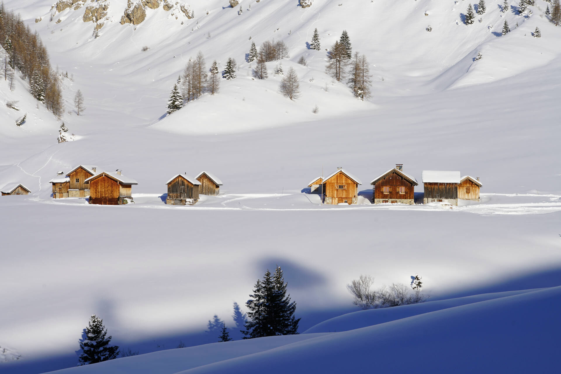
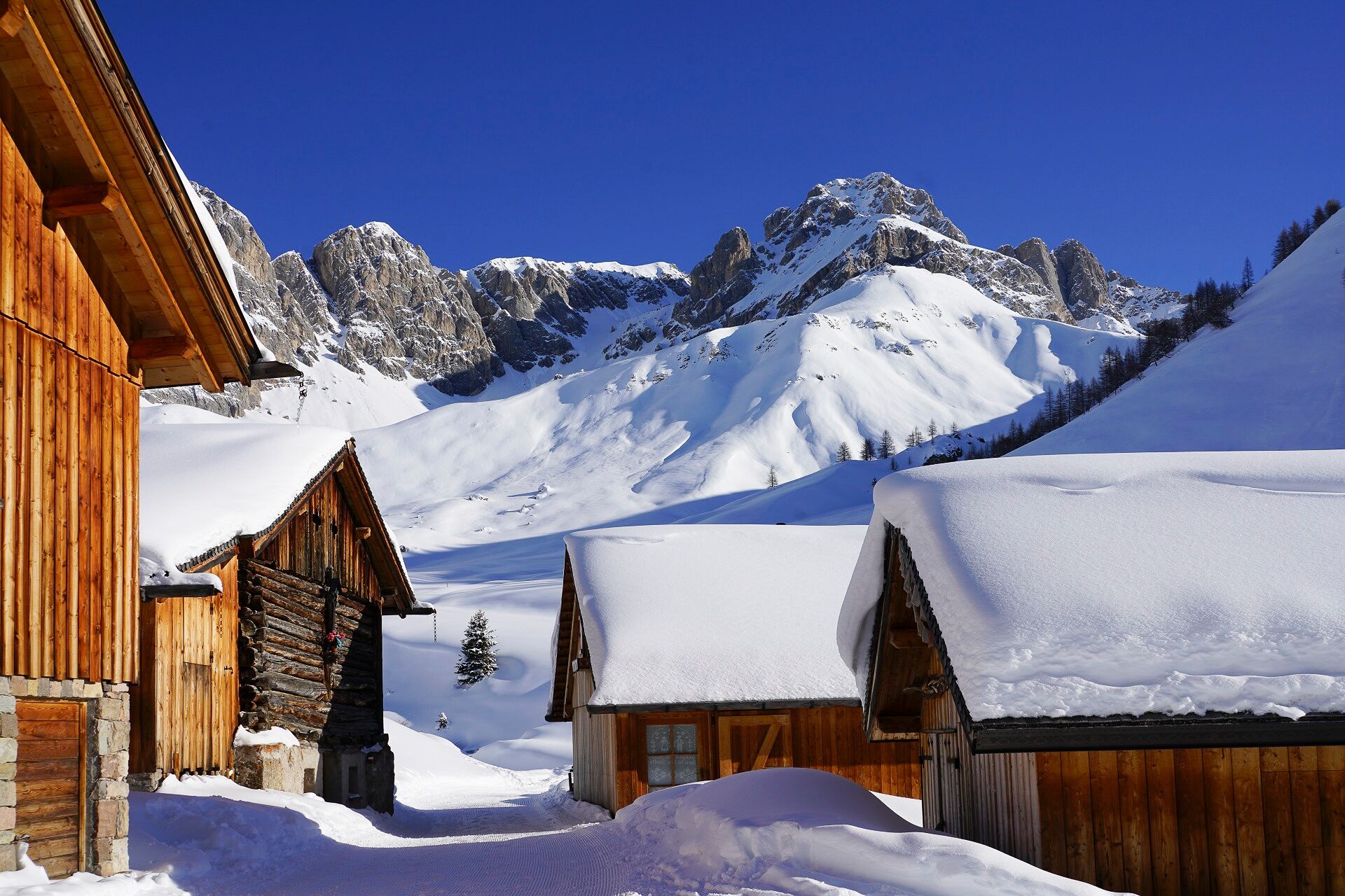
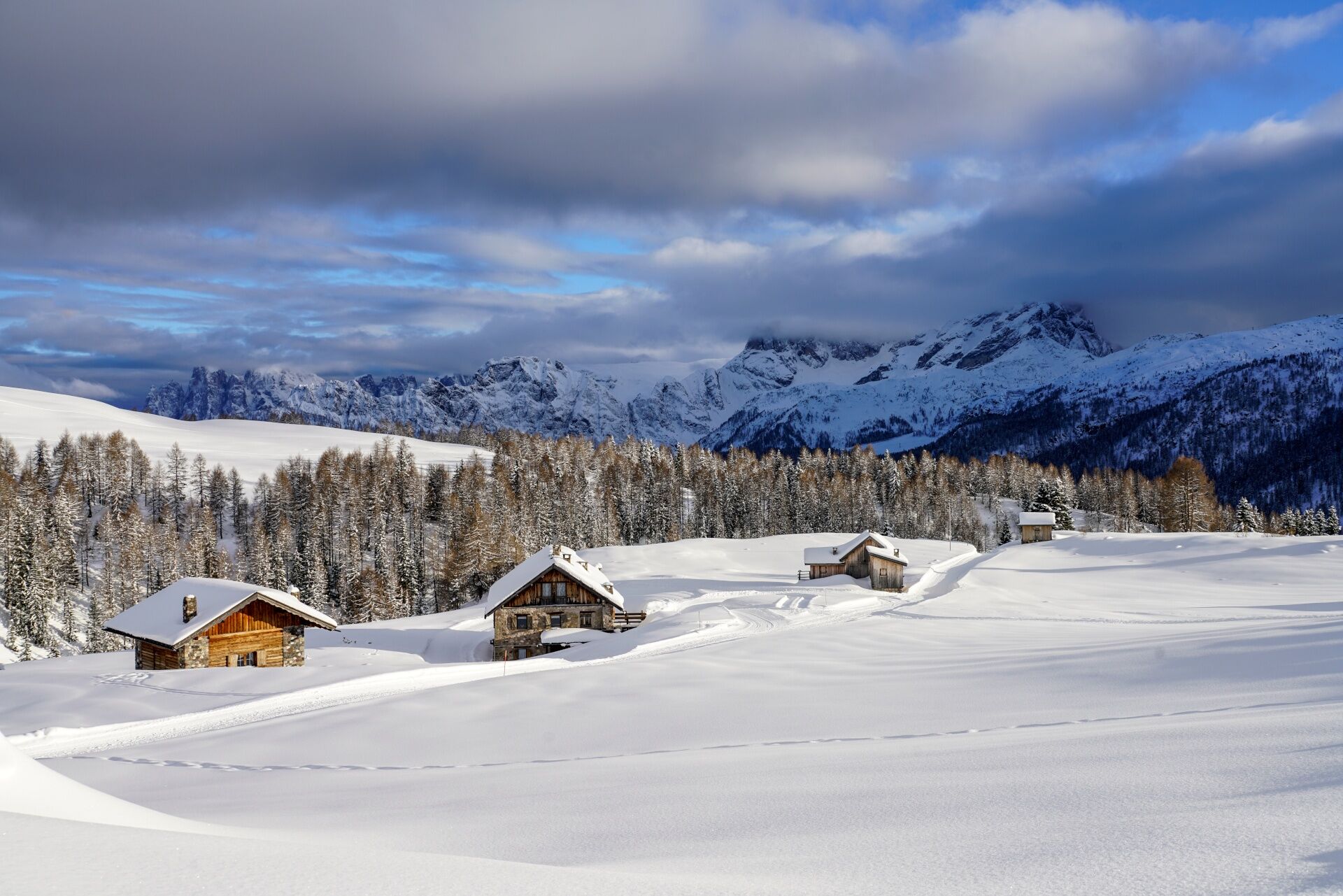
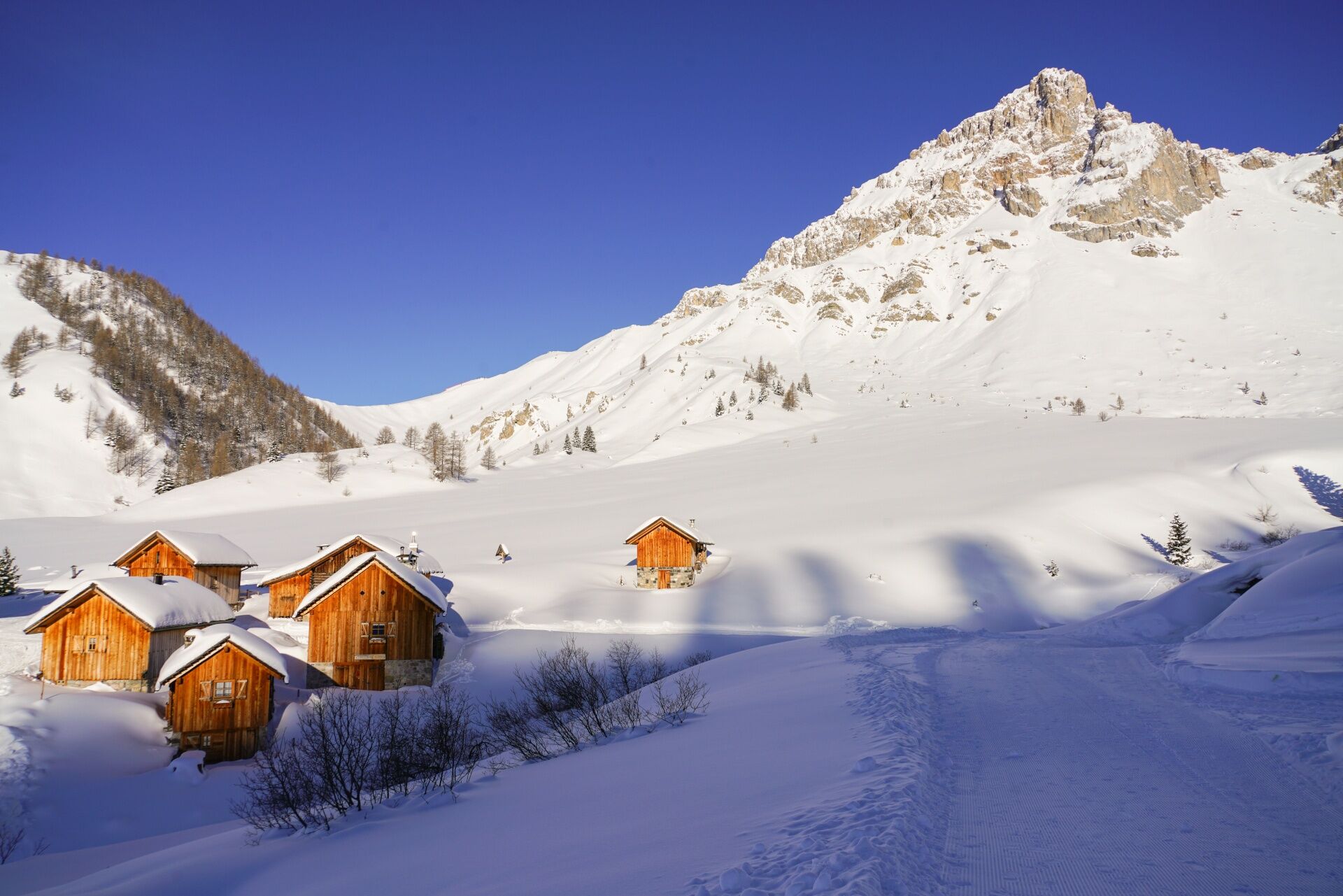
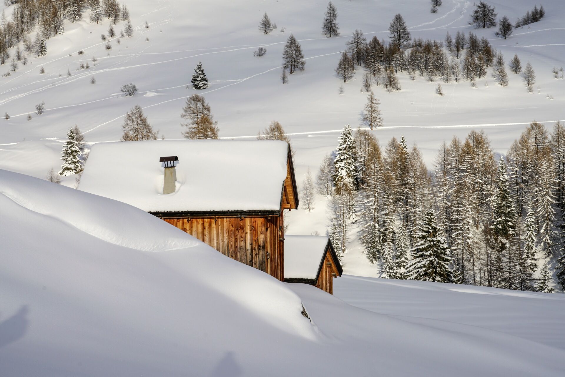
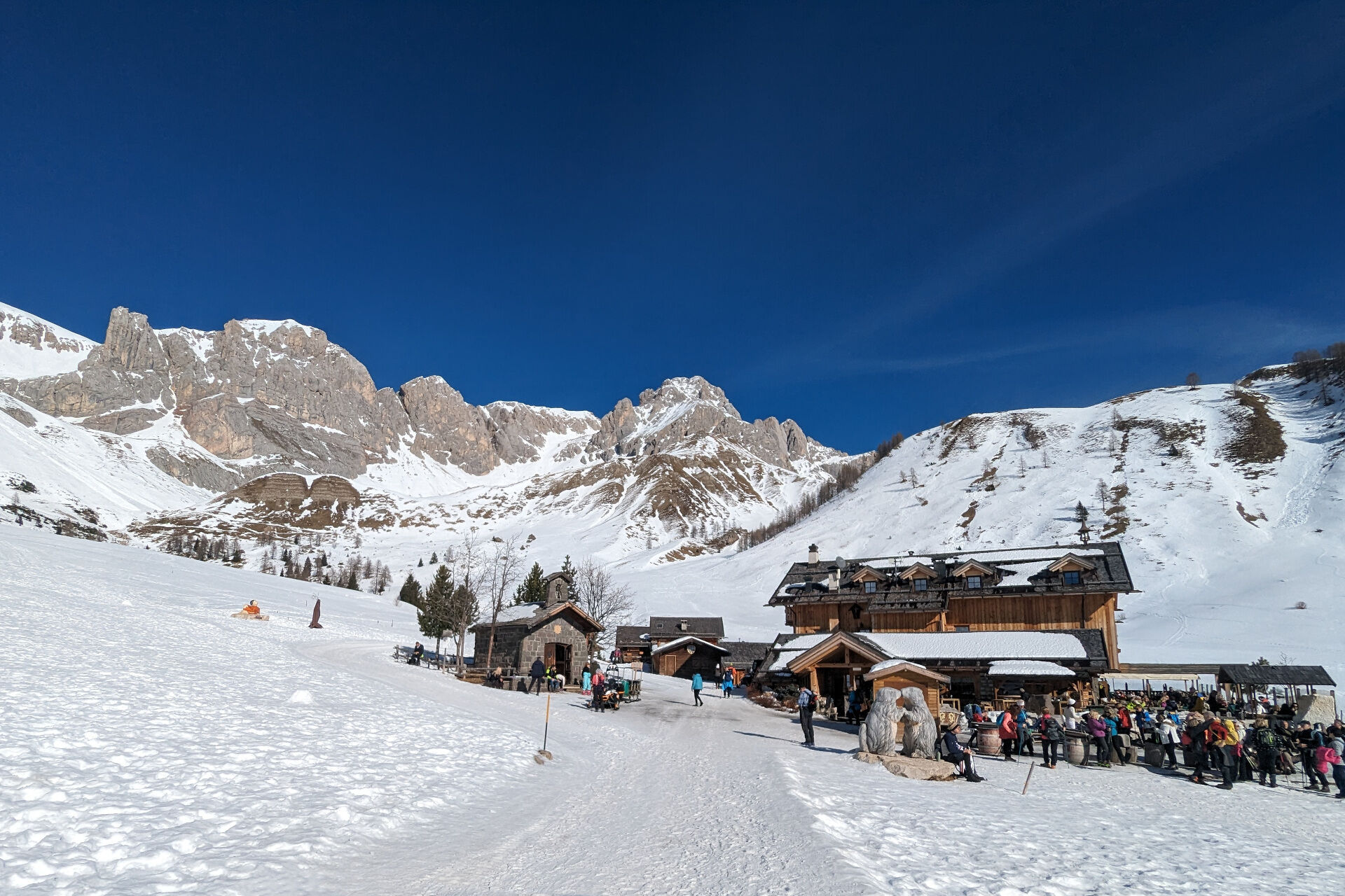

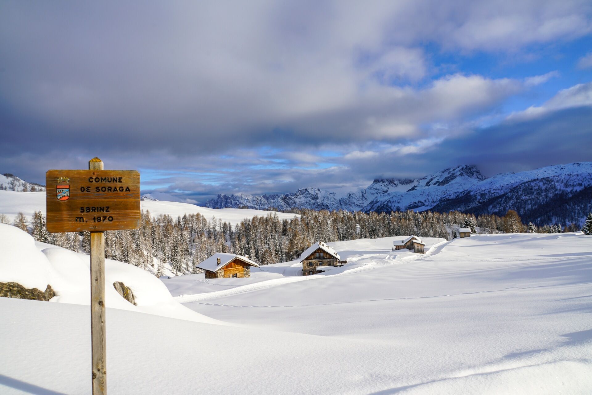
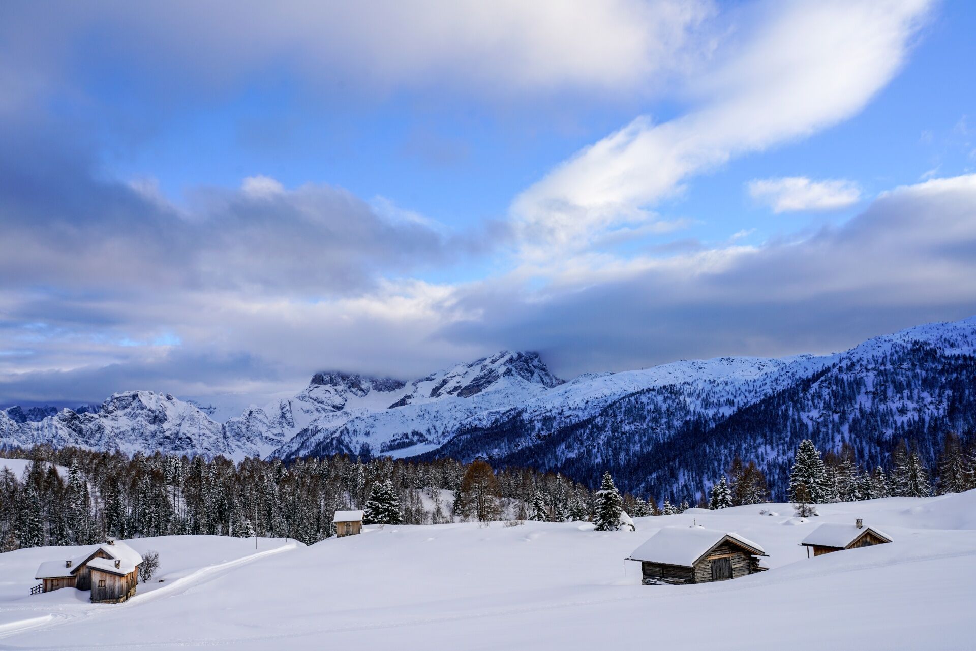
From Moena, by car, reach the San Pellegrino Pass (about 11 km). After crossing the pass and the Col Margherita cable car square, take the asphalt road on the left towards the Fuciade and Flora Alpina mountain refuges. After passing Malga Boer, just before the small bridge, climb the short ramp on the left that leads to the parking area, where you can leave your car. From here, tackle with determination the road that climbs steeply up the slope. Then the path turns to the right, the ascent eases, and it follows the undulating contours of the meadows until you reach the first huts, where you join the road coming from the pass. A gentle descent, a flat stretch, and a final ramp separate you from the mountain refuge and the Madonna della Neve chapel, built in 1959 in memory of the inhabitants of Soraga, who were rounded up by the Nazis in 1944 but managed to survive. Built with squared stone blocks, the chapel is topped by a small sail-like bell tower and houses some works by the great Gardesan master Adolf Vallazza.
The return follows the same route.
The tracks are primarily beaten only by foot traffic and are not subject to mechanical maintenance or grooming services. Specific signs marking the itinerary are not present along the route.
Pay close attention to the terrain at all times, as icy and slippery sections can occur, especially in shaded areas.
Ensure you are properly equipped with hiking boots, crampons, and poles.
1. Plan your hike according to your abilities, the weather, the characteristics and conditions of the itinerary as well the avalanche risk.
2. Always prefer being accompanied by somebody. If possible, rely on a professional mountain guide.
3. Make sure you have suitable clothes and equipment (boots, shoe spikes and poles).
4. Inform somebody of your itinerary, return time and possible changes.
5. Take it easy, enjoy the landscape and the silence.
6. If uncertain about the direction, turn back.
7. Stay out of cross-country and alpine skiing slopes.
8. Respect the environment around you. Bring back your rubbish.
9. Bring your pet along but keep it on a leash.
10. Help those in need. Call the European emergency number 112 only in case of real necessity.
exit Ora/Egna, S.S. 48 delle Dolomiti - San Lugano Pass - Val di Fiemme - Val di Fassa (distance 45 km). At the roundabout in Moena (industrial area), proceed towards Canazei exit Bolzano Nord, S.S. 241 Grande Strada delle Dolomiti - Carezza Pass - Vigo di Fassa (distance 40 km). From Vigo, head north for Canazei, head south for Soraga di Fassa and Moena
Other access points to Val di Fassa:
from A27 motorway (Venezia), exit Belluno/Ponte nelle Alpi, S.S. 203 to Agordo and S.P. 346 to San Pellegrino Pass - Moena (Val di Fassa). At the roundabout in Moena, proceed towards Canazei from A27 motorway (Venezia), exit Belluno/Ponte nelle Alpi, S.S. 203 to Agordo/Alleghe/Rocca Pietore. S.P. 641 to Fedaia Pass - Canazei coming from Arabba, S.S. 48 to Pordoi Pass - Canazei from Val Gardena, S.S. 242 to Sella Pass - Canazei
line no. 101 Canazei - Cavalese - Trento line no. 104 Cavalese - Ora - Trento line no. 123 Moena - San Pellegrino Pass - Falcade
Public transport lines SAD - Val di Fassa:
line no. 180 Vigo di Fassa - Carezza Pass - Bolzano
- Nearest ski bus stop: San Pellegrino Pass > Col Margherita Impianti
After passing the Malga Boer, just before the small bridge, turn left and drive up the short ramp to the free car park.
Tourist Board Val di Fassa
Strèda Roma, 36
38032 Canazei (TN)
Phone +39 0462 609500
info@fassa.com
www.fassa.com
The stretch from Fuciade to the crossroads at "Sbrinz" is also traversed by snowmobiles, snowcats, and a horse-drawn sleigh. Pay attention to the transit of these vehicles, sledges and the presence of ski mountaineers.
At the start of the route, there’s a Girsberger Artva checkpoint, allowing mountaineering skiers and snowshoers, equipped with self-rescue equipment, to check the state of their device. The checkpoint also keeps track of the passages, in order to know exactly how many people pass through this route and how many of them have the Artva.
Spletne kamere s turneje
-
Marmolada
-
Col Margherita
-
Col Margherita
-
Col Margherita
-
Falcade
-
Arrivo funivia col Margherita
-
Lago Cavia
-
Seggiovia Lago cavia Col Margherita
-
Col Margherita
-
Col Margherita
-
Col Margherita
-
Col Margherita
-
Moena - San Pellegrino Pass / Chalet Isabella
-
Cima Uomo
-
Cima Uomo
-
Cima Uomo
-
Cima Uomo
-
Cima Uomo
-
Cima Uomo
-
Cima Uomo
-
Cima Uomo
Priljubljeni izleti v okolici
-
4.7
Anello Passo Pordoi-Forcella P-Piz Boè
srednjaPohodništvo 10.6 km -
4.6
Passo Pordoi - Sass Pordoi - Forcella Pordoi - Piz Boè - Rifugio Boè - Forcella Pordoi - Passo Pordoi
težkoPohodništvo 8.39 km -
4.4
Dolomiten Sellagruppe, Alb. Col di Lana, Sas de Pordoi, Piz Boé retour 22.06.2016
srednjaPohodništvo 5 km -
5.0
Ciampedie - Gardeccia - Passo Principe - Antermoia Refuge - Val Duron - Campitello
težkoPohodništvo 18.7 km -
5.0
Langkofel Klettersteig/Ferrata Furcela de Saslonch
težkoVia ferrata 7.07 km -
4.8
Cavallazza Peak
srednjaPohodništvo 7.82 km -
4.5
Passo San Pellegrino - Fuciade - Val Fredda - Malga Boer - Passo San Pellegrino
srednjaPohodništvo 11.1 km -
4.7
Finanzieri (C/D) Colac 2715m
Via ferrata 4.10 km -
3.5
Col Rodella Klettersteig (C/D)
srednjaVia ferrata 2.60 km -
5.0
The amazing Val Venegia and Baita Segantini - Tour 934
srednjaMountainbike 18.6 km
Pohodništvo in sledenje


Ne zamudite ponudb in navdiha za naslednje počitnice
Vaš e-poštni naslov je bil dodan na poštni seznam.