


Historic Mountain Routes | Old Street of Sant'Ignazio


The route is ideal in spring or on clear autumn days, when the clarity of the atmosphere allows you to best appreciate the beautiful 360° views.
As well as along the ancient roads, it can also be travelled...
The route is ideal in spring or on clear autumn days, when the clarity of the atmosphere allows you to best appreciate the beautiful 360° views.
As well as along the ancient roads, it can also be travelled by car, stopping at the most characteristic points.
These include the Sanctuary built in 1629 to commemorate some miracles attributed to the intervention of St Ignatius of Loyola, frequented by the main Turin saints of the 19th century, including St John Bosco, St Giuseppe Cafasso, St Leonardo Murialdo and Blessed Allamano.

The starting point is the large car park located at the entrance to the municipal capital of Monastero di Lanzo (823 m), which can be accessed from Lanzo Torinese following the signs for Monastero-Chiaves.
Passed in front of the town hall and the municipal schools; leave the carriage road at the first hairpin bend towards the mountain and follow the secondary road on the left, which shortly leads to the hamlet of Mas. Above, on the right of the town, the mule track marked with the n. 403 which goes up flanked by votive pillars until it intersects the carriage road at the important hamlet of Fornelli (976 m). Once you have crossed the road, take the mule track again, heading towards the chapel from which you continue slightly uphill along the wall which opens with an arched door which is still partly decorated, through which you can see the oldest sundial (1715) in the Valleys of Lanzo.
Continuing between the houses you come out again on the carriage road, which at this point must necessarily be followed upstream until you reach the square of Chiaves (1049 m – 30 minutes from Monastero), the parish seat and always the main hamlet of Monastero.
You enter between the houses and from the church square you go up the imposing access staircase. Walking along the left (east) side of the church, you pass by the small cemetery, descending to the road to Tortore and following it on level ground, ignoring the secondary branches that branch off to the right, until you find a large dirt square (former quarry) on the left of the road, where a sign indicates the entrance to path 350A to Punta Serena.
After a very steep first stretch, it winds along the north-west ridge of the mountain (carefully follow the white-red signs and the cairns to stay on the best track) and, keeping to the right in the last part, reaches the top of the Serena tip (30 minutes from Chiaves, 1 hour from Monastero), where a large votive pylon stands.Continue following the red-white trail signs, lowering along the south-east ridge to the hill below, among birches and larches; here the path bends sharply to the right and descends steeply onto the Chiaves-Tortore carriage road, at a clearing. Walk along the asphalt road to the left, ignoring a first branch; after approximately 200 metres, still on the left, a few meters of uphill path (entrance not very visible) allow you to connect to the old mule track which proceeds on level ground downstream of a retaining wall and ends on a dirt road; continuing straight, in a few meters you reach the nearby houses of Balma.
If you are unable to find the entrance to the mule track, simply continue along the carriage road for about 50 metres, taking the second dirt road on the left which you come across after the clearing; at the first crossroads you turn right and you still reach the Balma houses.Following the main route in the small town, after crossing another dirt road you continue on a pleasant flat mule track, which offers a beautiful view of the sanctuary of Sant'Ignazio and arrives at the hamlet of Tortore di Pessinetto (913 m), right next to the chapel of San Giorgio.
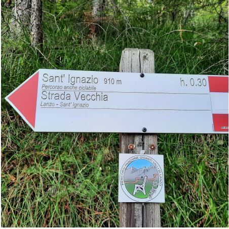
From the small square below, the directions and trail signs lead you down between the houses and onto the large square downstream from the sanctuary, near which stands an interesting Art Nouveau style votive pillar dating back to 1907, the work of the engineer Antonio Vandone of Cortemilia.Along the carriage road, or rather and more quickly, along the mule track that starts on the left, you quickly go up to the eighteenth-century sanctuary of Sant'Ignazio, built on the top of Mount Bastia (932 m – 45 minutes from Punta Serena, in total 1, 45 hours from Monastero), open and visitable in the summer period.
There are several possibilities for continuing the trip: you can go down to Gisola and then to Pessinetto along the Pellegrini path (trail sign 350), or to Biò di Traves on path 351C, or again to Germagnano on path 351A. For the return it may be convenient to return to Chiaves, following the quiet road in the second part, without going up from the clearing at Punta Serena.
Rivoli exit - ss25 | A55 tangenziale nord di Torino | Falchera-Rivoli-Trofarello | 24.97 km from the centre
Savonera exit | A55 tangenziale nord di Torino | Falchera-Rivoli-Trofarello | 25.17 km from the centre
Coming from highways the nearest exits are:
Caselle Airport exit | RA 10 junction Turin-Caselle | Turin-Caselle Airport | 21.11 km from the centre
Exit 4 Caselle - Leini | RA 10 junction Torino-Caselle | Torino-Aeroporto di Caselle | 21.88 km from the centre
The starting point is the large car park at the entrance to the municipal capital of Monasterodi Lanzo (823 m), accessed from Lanzo Torinese by following the signs for Monastero-Chiaves.
Romanesque bell tower of the parish church of Sant'Anastasia (11th-12th cent.),
18th-century Church dedicated to St John the Evangelist
Sanctuary of Saint Ignatius
Priljubljeni izleti v okolici
- 5,0
Ovarda Lakes Ring
težkoPohodništvo15,9 km ALPETTE Monte Soglio e cima Mares da Balmassa
srednjaPohodništvo10,9 kmColle della Dieta - ring from Germagnano
Cestno kolo41,7 kmFrassa Ring from Chialamberto
srednjaPohodništvo10,1 kmVal Grande Nature Trail from Ceres to Forno Alpi Graie
srednjaKolesarjenje40,7 kmLake Monastero from Pessinetto Outside
srednjaKolesarjenje30,9 kmRing of Monte Castello from La Cassa
srednjaPohodništvo11,0 kmAlpine Ring from the Lys Pass
srednjaPohodništvo15,3 kmCeres sentiero natura sino a Forno Alpi Graie
srednjaMountainbike36,1 kmCa' Bianca and Big Bench from Monasterolo di Cafasse
svetlobaPohodništvo4,13 km
Pohodništvo in sledenje


Ne zamudite ponudb in navdiha za naslednje počitnice
Vaš e-poštni naslov je bil dodan na poštni seznam.