


RANDONNÉE DU SENTIER DES DEUX LACS - GR® DE PAYS ENTRE DEUX LACS AVÈNE - SALAGOU


Between Parc Naturel Régional du Haut-Languedoc and Grand Site Salagou - Cirque de Mourèze, 4 days of hiking between the most unknown and the most famous lake in the Hérault...And to discover Avène and...
Between Parc Naturel Régional du Haut-Languedoc and Grand Site Salagou - Cirque de Mourèze, 4 days of hiking between the most unknown and the most famous lake in the Hérault... And to discover Avène and its thermal baths, the wide open spaces of the forests and pastures of the Monts d'Orb, the Orb and Gravezon valleys, and the ruffes of the Upper Salagou Valley. So little time for such a great journey...
The Sentier des Deux Lacs is the main component of the GR® de Pays Entre Deux Lacs Avène - Salagou: two lake tours over 2 or 3 days, and a Sentier des 2 lacs that can be completed in 3, 4 or 5 days. Wonderful slow-motion journeys through the nature and geology of the Hérault region, in the heart of the Terres d'Hérault Geopark.


1
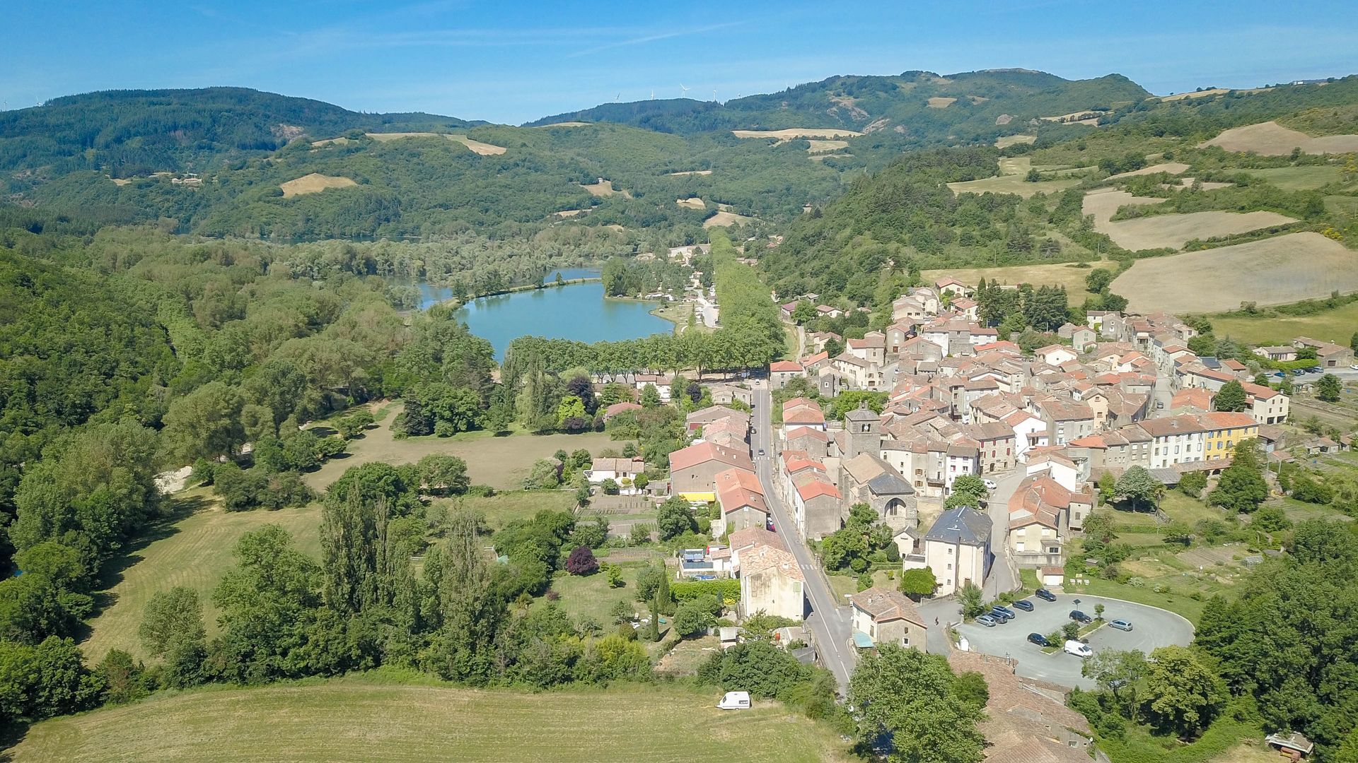
Ceilhes In Ceilhes, take the time to stroll through the village's medieval streets and soak up the calm. A pretty maze, a magnificent church, beautiful gates, a refreshing fountain: what a beautiful village! After enjoying the shores of the Bouloc lake and the pleasures of the beach in fine weather, an alternation of paths and tracks in the cool atmosphere of a north-facing forested slope leads to the heights of the eastern shore of the lake.
2
Mont Redon At just over 750m above sea level, this is the summit of the area. Here, too, the panorama of the lake and the sheep-like landscape of forests and pastures is breathtaking! From Mont Redon, you can see far in all directions. Another fine panorama on the descent to the hamlet of Rouvignac (make a detour to admire the beautiful church and cemetery). The descent along a comfortable track takes you to the shores of the lake. After a short climb, you'll reach the viewpoint over the dam.
3
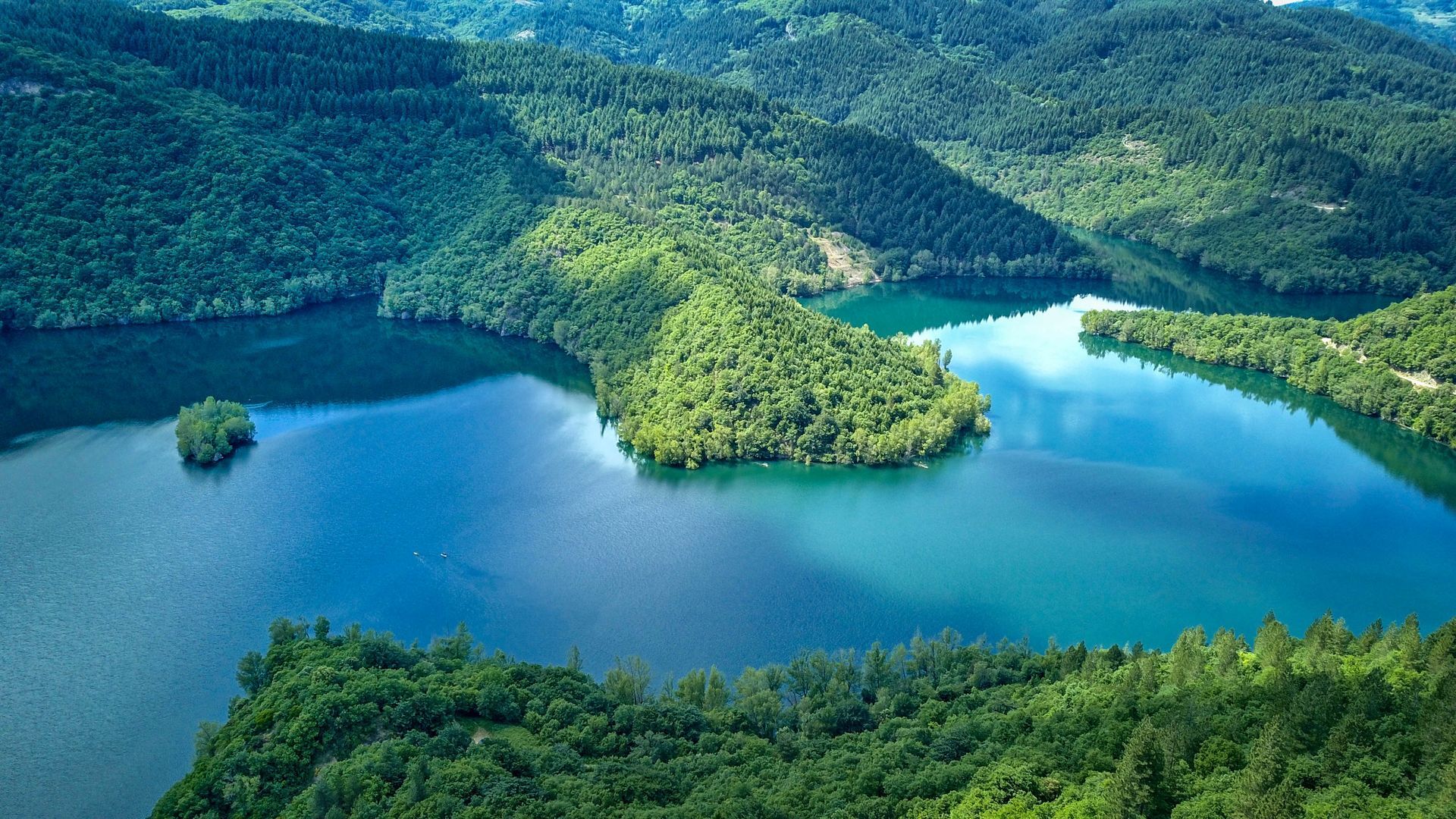
Lac des Monts d'Orb dam Created in 1962 to generate hydroelectric power and regulate the course of the Orb, the Lac des Monts d'Orb is 6 kilometers long and covers 190 hectares. A former lead and silver mine now lies beneath the lake: mining and its exploitation were a source of wealth for the Orb valley from ancient times until the 1950s. It's time to leave the lake, passing through the pretty hamlet of Brès, and head back down to Avène.
4
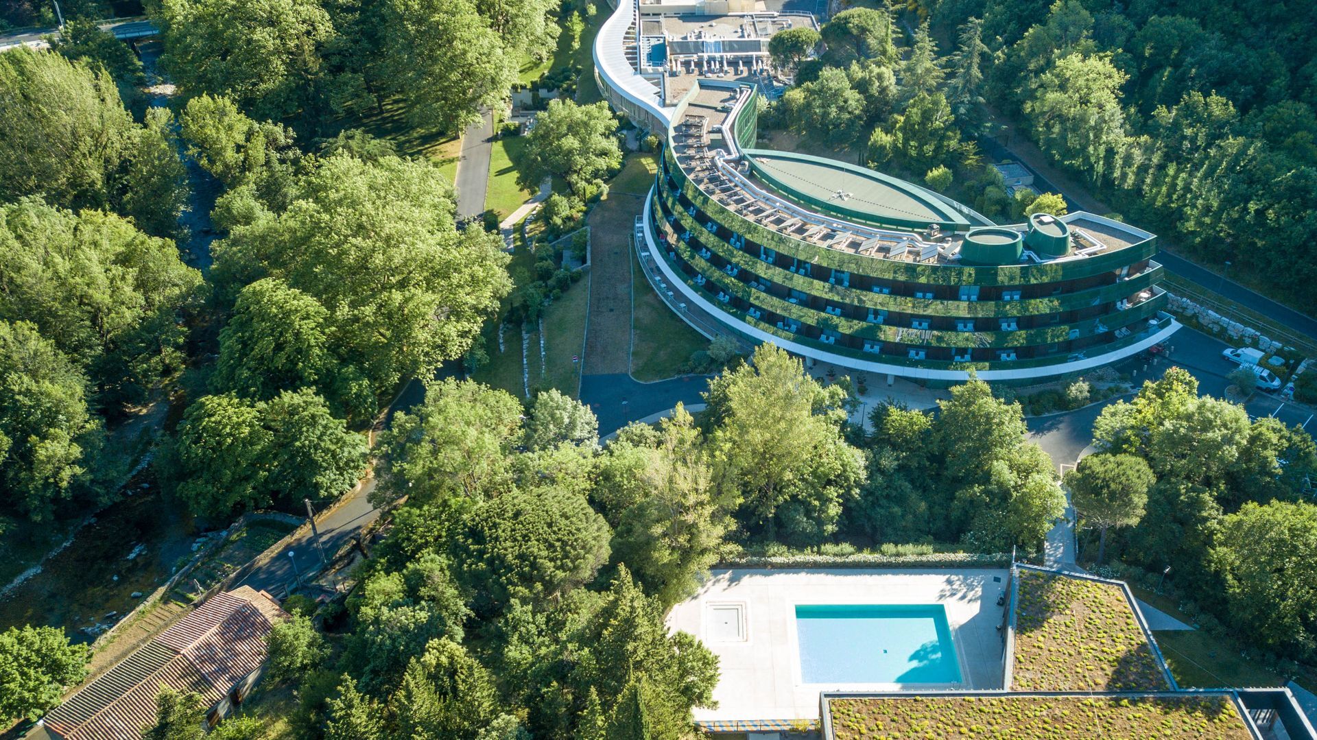
Avène and its thermal baths Avène's economy was based on mining activity from ancient times until 1954. Today, it's mainly nature that provides Avène with one of its benefits: water from the depths of the Languedoc soil. After strolling through the pretty narrow streets topped by magnificent porches of this circular village, nestled in a meander of the Orb, the path leads to the Thermes site: peaceful, relaxing... just like the Avène brand's range of wellness and beauty products. In addition to the spa, there's a magnificent hotel and an excellent restaurant! The establishment is committed to a truly eco-responsible approach, using local products and making innovative, energy-saving architectural and technical choices... A wellness break is welcome, because afterwards, it's all uphill! After passing through the pretty hamlet of Les Planes and admiring the beautiful communal oven, the path changes to a more Mediterranean environment to reach the hamlet of Saint Barthélémy, then skirt the hamlet of La Dalmerie.
5
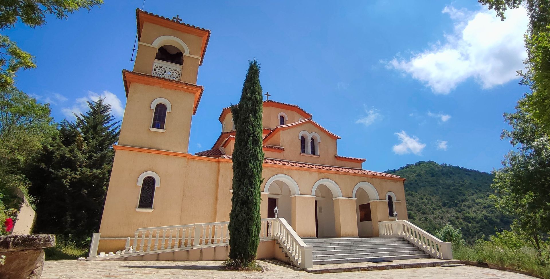
La Dalmerie and its Orthodox monastery An Orthodox monastery in the heart of the Parc Naturel Régional du Haut-Languedoc? No wonder. Peaceful and well-preserved, the area invites contemplation and many communities have settled between Monts d'Orb, Larzac and Escandorgue. A few kilometers away, as the crow flies, in Roqueredonde, you can visit a Buddhist temple (the Lerab Ling, one of the nuggets of Lodévois et Larzac). A detour is also possible to get a closer look at the Orthodox monastery of Saint-Nicolas, before a solid climb leads to a marvellous panorama of the Monts d'Orb, Escandorgue and Gravezon valley. A change of scenery: we switch to a new valley on the south-facing slope, which is full of surprises.
6
Joncels After admiring a beautiful railway viaduct and passing through the hamlet of Joncelets, a comfortable track takes you to Joncels, where you can admire a pretty valley with a Mediterranean atmosphere and vineyards... it's the South! A village of superior interest, Joncels overlooks the Gravezon valley, and is criss-crossed by narrow streets and picturesque houses. A stopover for pilgrims on their way to Compostela from Lodève, Joncels has preserved the remains of a Benedictine abbey dating back to the 8th century, which in the Middle Ages was one of the most important in Languedoc. After crossing the cloister, the path leads to Lunas, following the Voie d'Arles to Compostelle.
7
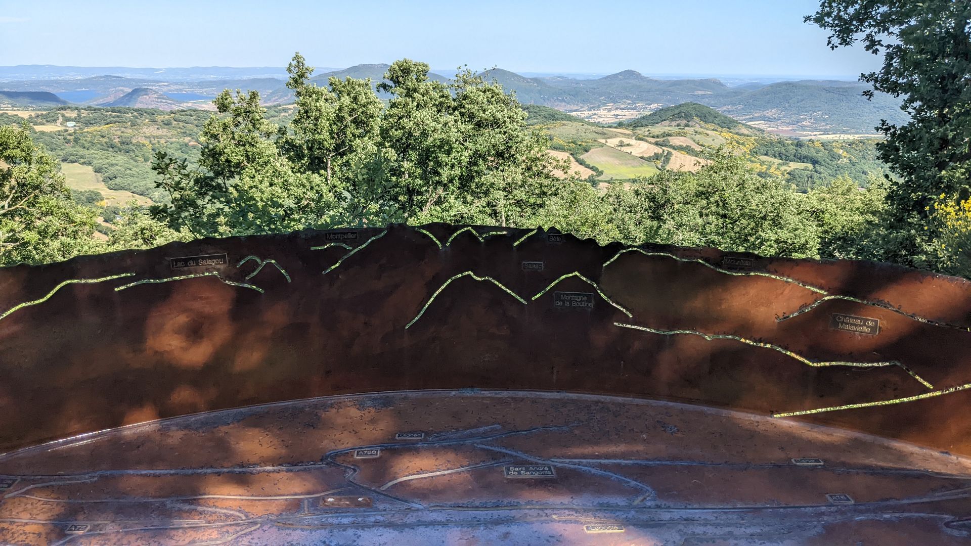
Lunas A pretty village nestled at the confluence of the Gravezon, Nize and Dourdou rivers! The history of Lunas dates back to the Roman road linking the Lower Languedoc to Rouergue. Probably the successor to a Gallo-Roman oppidium, castrum Lunarenses is mentioned as early as 806 in a charter from the abbey of Gélone (Saint-Guilhem-le-Désert). The town is dominated by the Redondel rock, an ancient fortified castle belonging to the Baron de Faugères, Viscount of Béziers. Razed in 1627, it was rebuilt on the banks of the Gravezon in 1641 by Henry de Narbonne. A true summary of Languedoc history, and a very pleasant cultural, refreshing and gastronomic stopover... A short detour to enjoy the Prades leisure park, and a pause at the site of the Saint-Georges chapel, then a steep climb to reach the Dio plateau, in the salutary shade of the Monts d'Orb national forest. We leave the route of the Grandes Traversées VTT du Massif Central et de l'Hérault to enjoy beautiful views over the Orb valley, reaching a magnificent panorama at the Montjoux paragliding launch: Bédarieux, the Caroux...
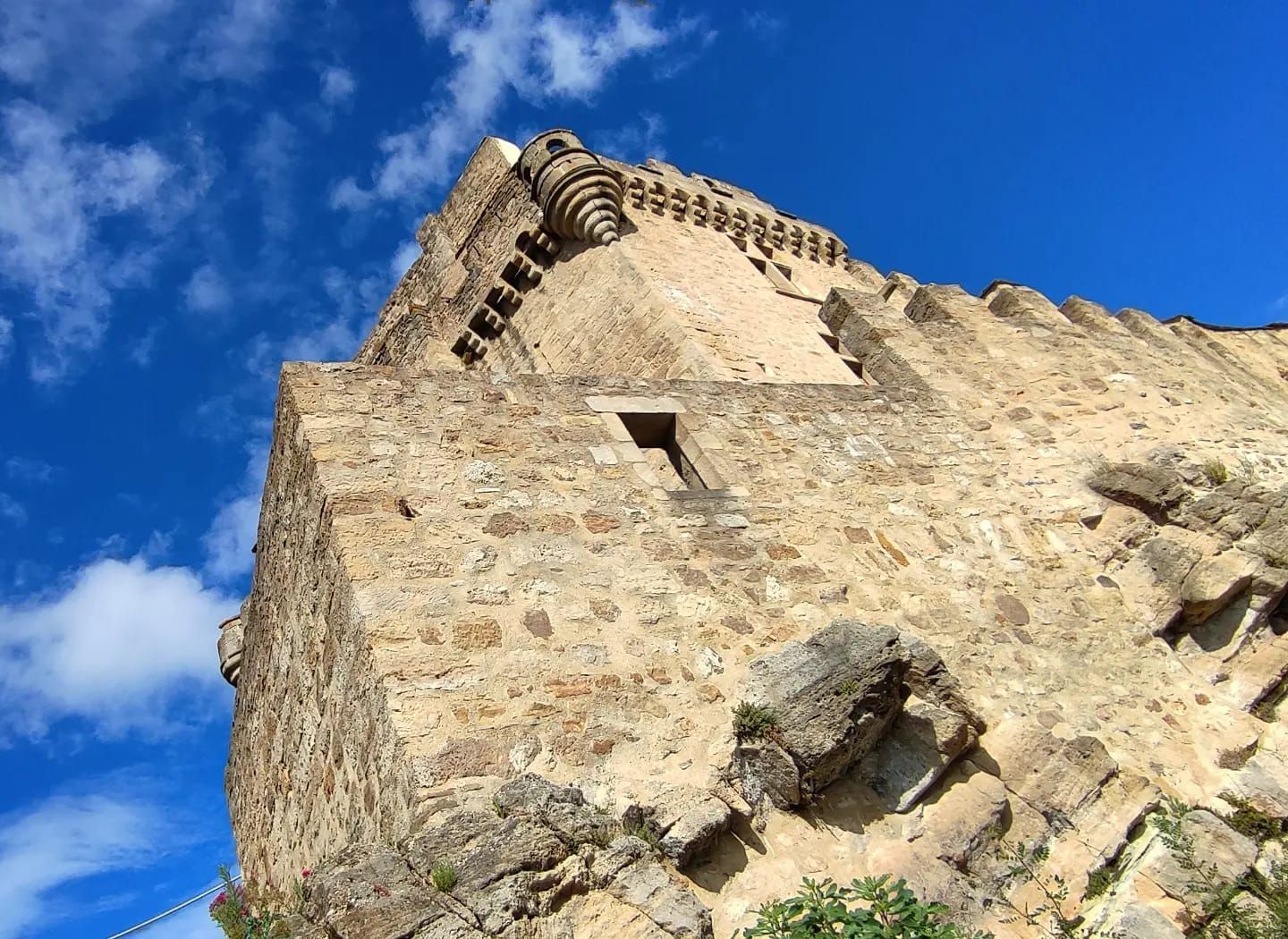
8
Dio A pretty path, then a visual shock: you've reached Dio! Sheltered by white limestone cliffs and emerging from the red earth of the Lac du Salagou area, the village nestles beneath the imposing silhouette of its castle, a veritable fortress of legend. Its construction began in the 11th century to defend the border between Aquitaine, now possessed by the English, and Languedoc. Renovated over the last twenty years by its current owner, the château hosts events and guided tours. The medieval hamlet is also being restored, and is home to several tourist accommodations. Tip from a friend: stop off at Le Castelou, where Fred and Michel are passionate about the great outdoors and make perfect hosts! On the way to Brenas, we finally catch a glimpse of the Lac du Salagou: a special treat on the way over the Montbringues ridge...
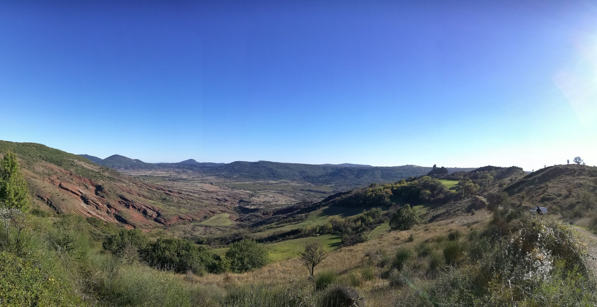
9
Brenas From Montbringues, a track leads gently down to Brenas: don't miss the beautiful orientation table built by a local craftsman. Brenas is a place 'apart', a hinge between the Monts d'Orb and the Lac du Salagou, with a charm all of its own. The village overlooks the Salagou valley and its cattle and sheep farms, which supply the milk for Roquefort cheese. The source of the Salagou river is at the Col de la Merquière, on the commune boundary with Dio Valquières and Carlencas. On the descent past Brenas and Mas Bas, an impressive view of a canyon of ruffes: in the background, the castellas of Mérifons, erected on a volcanic peak. In spring, the color contrasts are striking. The bright yellow of the flowering broom blends with the green of the holm oak and the red of the ruffe: welcome to the Grand Site Salagou - Cirque de Mourèze!
10
Octon Octon is one of our favorite villages, symbolic of the special atmosphere of the Grand Site villages. Its multicolored stone houses, wine cellars (Mas des chimères, Mas du Salagou, Trois terres...) and charming fountain in the square give this lively village a Mediterranean feel in summer. Café de la Place or restaurant La Calade: 2 atmospheres in a relaxing setting just a stone's throw from the lake.
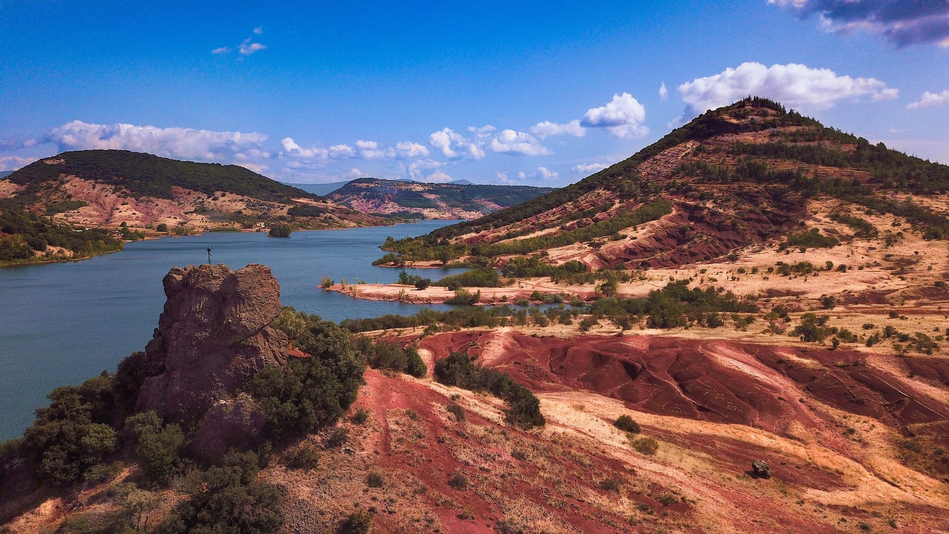
11
The shores of Lac du Salagou The end of the Sentier des 2 lacs is here: level with the Arcades campsite and the 'totem' of the Grande Traversée du Massif Central mountain bike route. A remarkable view of Lac du Salagou awaits you: reed beds, Neck de la Roque... In summer, a few hectometres to the left will take you to the marvellous Relais Nautique guinguette, where you can swim, pedal-boat or stand-up paddle... and enjoy a lovely meal! Take the time to chat with the friendly Relais Nautique team: they're passionate, and a little bit crazy... just like the Salagou landscape.
Our suggested "coup de coeur" stages: - Day 1: Ceilhes - Avène (17km) - Day 2: Avène - Joncels (18km) - Day 3: Joncels - Dio (14 km) - Day 4: Dio / Salagou (18 km)
Another suggestion, in 3-day randotrail mode - Day 1: Ceilhes - Avène (17km) - Day 2: Avène - Lunas (22.5 km) - 4th day: Lunas / Octon (25km, + 2.5 km to reach the shores of the lake, in 'active' recovery mode)
GR® and GR® de Pays are registered trademarks of the FFRandonnée, designating routes identified as "GR®", marked with white-red markings; and as "GR® de Pays", marked with yellow-red markings. These routes are the creations of FFRandonnée. Their unauthorized reproduction, as well as the GR® and GR® de Pays trademarks, constitutes an infringement liable to prosecution. Find all GR® routes on mongr.fr
White and red GR
Yellow and red GR de pays
+33 4 67 23 43 38
Office de Tourisme Grand Orb - Avène Information Office
GRP - FFR
Priljubljeni izleti v okolici
RANDONNEE DE LAVAL DE NIZE
svetlobaPohodništvo6,07 kmRANDONNEE DE L'ARBORETUM DE L'ESPAZE
srednjaPohodništvo12,3 kmCORNICHES DE LAUROUX HIKE
srednjaPohodništvo13,8 kmRANDONNÉE DE L'ORB À L'ESCANDORGUE
srednjaPohodništvo16,9 kmTRAIL LES CORNICHES DE LAUROUX
srednjaTrailrunning13,8 kmRANDONNEE DU PORTAIL DE ROQUANDOUIRE
srednjaPohodništvo10,5 kmRANDONNÉE DU CIRQUE DE LABEIL
svetlobaPohodništvo3,94 kmFROM LARZAC TO THE MEDITERRANEAN BY MOUNTAIN BIKE ON THE GTMC: COMPLETE ITINERARY
srednjaMountainbike261,1 kmCIRCUIT LE PUECH - ESPACE VTT - FFC LODÉVOIS ET LARZAC
srednjaMountainbike29,9 kmRANDONNÉE DU PLATEAU DU GRÉZAC
srednjaPohodništvo14,0 km
Pohodništvo in sledenje


Ne zamudite ponudb in navdiha za naslednje počitnice
Vaš e-poštni naslov je bil dodan na poštni seznam.