90.02 Graubünden Bike Stage 2 Laax - Untervaz
težko
Mountainbike
Navigacija po spletni strani
Pridobite to turo v svoj mobilni telefon
Zemljevid
90.02 Graubünden Bike Stage 2 Laax - Untervaz
težko
Mountainbike
54,66 km
Skenirajte kodo QR in začnite navigacijo v aplikaciji bergfex.
QR Code
Pohodništvo in sledenje
Prenos za iOS
Prenos za Android

90.02 Graubünden Bike Stage 2 Laax - Untervaz

Razdalja
54,66 km
Trajanje
17:31 h
Ascent
1.801 hm
Morska gladina
567 - 1.424 m

Stopnja težavnosti: S2

Prenos skladbe
Zemljevid
90.02 Graubünden Bike Stage 2 Laax - Untervaz
težko
Mountainbike
54,66 km

This mountain bike route takes you from Laax to Untervaz through the breathtaking landscape of Graubünden. The route covers a total distance of 54 kilometers and offers a varied mix of asphalt roads, natural...


Opis

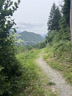
This mountain bike route takes you from Laax to Untervaz through the breathtaking landscape of Graubünden. The route covers a total distance of 54 kilometers and offers a varied mix of asphalt roads, natural paths, and exciting single trails.

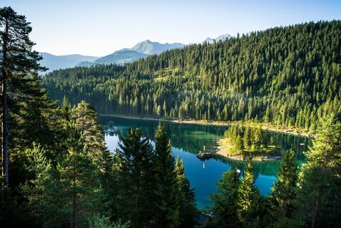
The starting point is the picturesque Laax, a popular destination for outdoor enthusiasts. From here, you first pass through Conn, where you can enjoy the beauty of alpine landscapes. The route then leads to Cresta Lake, an idyllic mountain lake perfect for a short break and to relax.

After a refreshing pause, you continue your ride to Trin Mulin. Here begins the exciting part of the route, as you now ride on trails taking you through untouched nature. The single trails offer an intense riding experience and challenge your skills on the bike.

The next section leads you to Tamins, where you conquer a climb to the Kunkelspass. This ascent rewards you with spectacular views of the surrounding mountains and valleys – an unforgettable experience for every mountain bike enthusiast.

From there you descend through the high valley, past Mapargg Lake and through St. Margrethenberg. The descent offers high speeds and thrills on trails and alpine roads that lead you all the way to Untervaz.

Untervaz marks the end of this adventurous route, where you cover a total of 1,600 meters in ascent and 2,100 meters in descent. After an action-packed day on the bike, you can relax here and reflect on the day’s experiences.

Please note that this route requires some mountain biking experience and participants should wear appropriate protective gear. Also, respect nature and leave no trace to preserve the beauty of the landscape for future generations.

Pot
Pot
Zemljevid
90.02 Graubünden Bike Stage 2 Laax - Untervaz
težko
Mountainbike
54,66 km
Murschetg
(1.083 m)
Poravnava
0,0 km
Caschligna Sut
(873 m)
Koridor/teren
7,2 km
Gasthaus Crestasee
(859 m)
Restavracija
7,5 km
Trin Mulin
(828 m)
Vas
9,2 km
Digg
(850 m)
Poravnava
13,1 km
Trin
(876 m)
Vas
14,1 km
Falarauscha
(744 m)
Koridor/teren
16,0 km
Platta
(766 m)
Koridor/teren
16,1 km
Masals
(727 m)
Koridor/teren
16,6 km
Crestis
(668 m)
Koridor/teren
17,2 km
Tamins
(657 m)
Vas
18,1 km
Passherberge Überuf
(1.358 m)
Restavracija
23,9 km
Kunkelspass
(1.357 m)
Koridor/teren
23,9 km
Eggwald
(1.133 m)
Restavracija
26,2 km
Hotel Restaurant Tamina
(944 m)
Restavracija
31,7 km
Vättis
(943 m)
Vas
31,7 km
Auen
(918 m)
Koridor/teren
32,8 km
Mapragg
(881 m)
Koridor/teren
37,6 km
Vadura
(968 m)
Poravnava
38,7 km
Bläs
(1.080 m)
Poravnava
39,1 km
Ragol
(914 m)
Poravnava
40,4 km
Tristeli
(1.186 m)
Restavracija
42,5 km
Skilift Tristeli
(1.190 m)
Postaja gondole
42,7 km
St. Margrethenberg
(1.199 m)
Poravnava
42,9 km
Sennhaus
(1.247 m)
Koridor/teren
44,3 km
Kapelle St. Margaretha
(1.253 m)
Kraj čaščenja
44,4 km
Buura - Beizli
(1.262 m)
Restavracija
44,8 km
Höf
(1.265 m)
Koridor/teren
44,8 km
Fürggli
(1.315 m)
Koridor/teren
45,5 km
Sesel
(1.199 m)
Koridor/teren
48,8 km
Untervaz
(564 m)
Vas
54,6 km
Opis

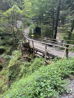
A classic bike route over the Kunkelspass: The steep climb is rewarded with great views and a long descent through the wild and romantic Taminatal. The final section leads high above the Bündner Rhine Valley between Landquart and Chur to Untervaz.

Tehnologija
3 / 6
Stanje
6 / 6
Pokrajina
6 / 6
Izkušnje
4 / 6
Najboljši letni čas
Jan
Feb
Mar
Apr
Maj
Jun
Jul
Avg
Sep
Okt
Nov
Dec
Skupna turneja
Zemljevid
90.02 Graubünden Bike Stage 2 Laax - Untervaz
težko
Mountainbike
54,66 km
Napaka
Zgodila se je napaka. Prosimo, poskusite znova.
Informacije o poti
Pot

Laax - Trin Mulin - Trin Digg - Tamins - Kunkelspass - Taminatal - St. Margretenberg - Untervaz

Dodatne informacije in nasveti
Stopnja težavnosti

S2

Dodatne informacije

Note: unlit tunnel at the Kunkelspass.

Nasveti

Stop at the restaurant at the pass height and enjoy local delicacies.

Še ni pregledov
Napišite pregled

Mnenja pomagajo drugim uporabnikom pri izbiri naslednje pustolovščine. Ocenite samo izlet, ne pa tudi vremena ali prigrizka.

Izberite eno od zvezdic, da ocenite ogled
Slaba turneja
Šibka turneja
Povprečna turneja
Dobra tura
Odlična tura
bergfex logoPridobite vpogledVedno v živo na mestu z več kot 9.500 spletnimi kamerami. bergfex Kot uporabnik Pro si lahko zdaj ogledate ustrezne spletne kamere za številne izlete v aplikaciji izleti iz. Tako si lahko neposredno ogledate trenutne razmere.
Pohodništvo in sledenje

Pohodništvo in sledenje

prenos za iOSprenos za Android
Pohodništvo in sledenje
Zaradi več kot 550.000 predlogov izletov, podrobnih zemljevidov in intuitivnega načrtovanja poti je aplikacija obvezna oprema za vse ljubitelje narave.
Pohodništvo in sledenje