


Uina-Bernina Bike-Tour Etappe 1: Scuol – Sta. Maria
Stopnja težavnosti: S3


Fotografije naših uporabnikov
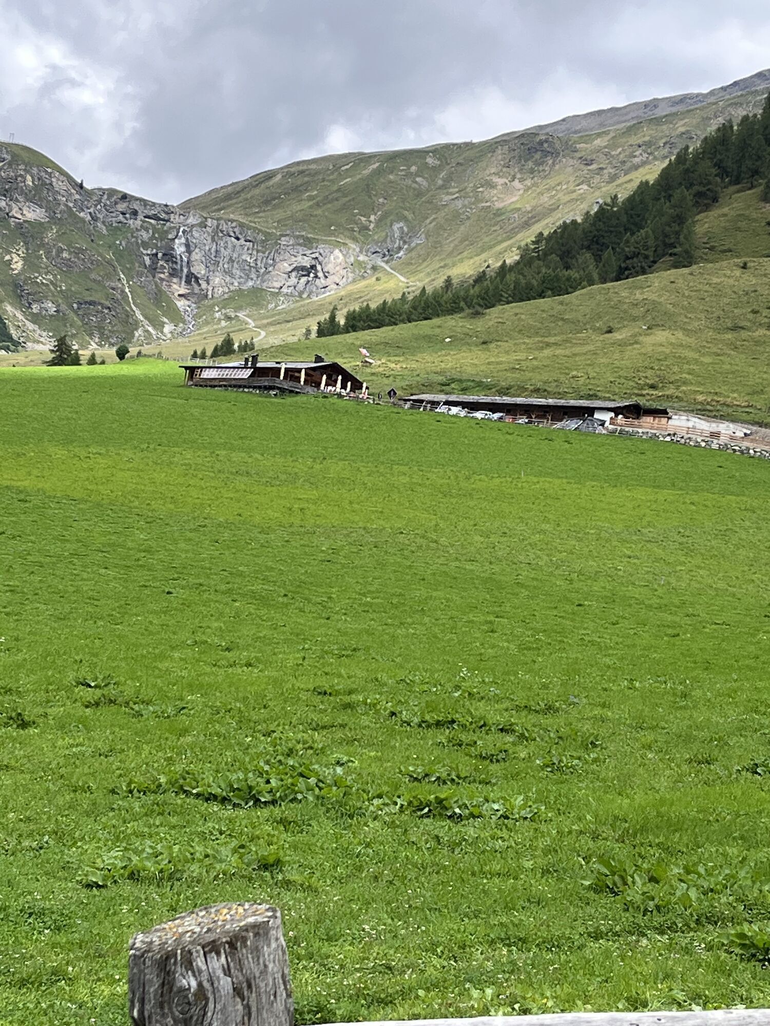
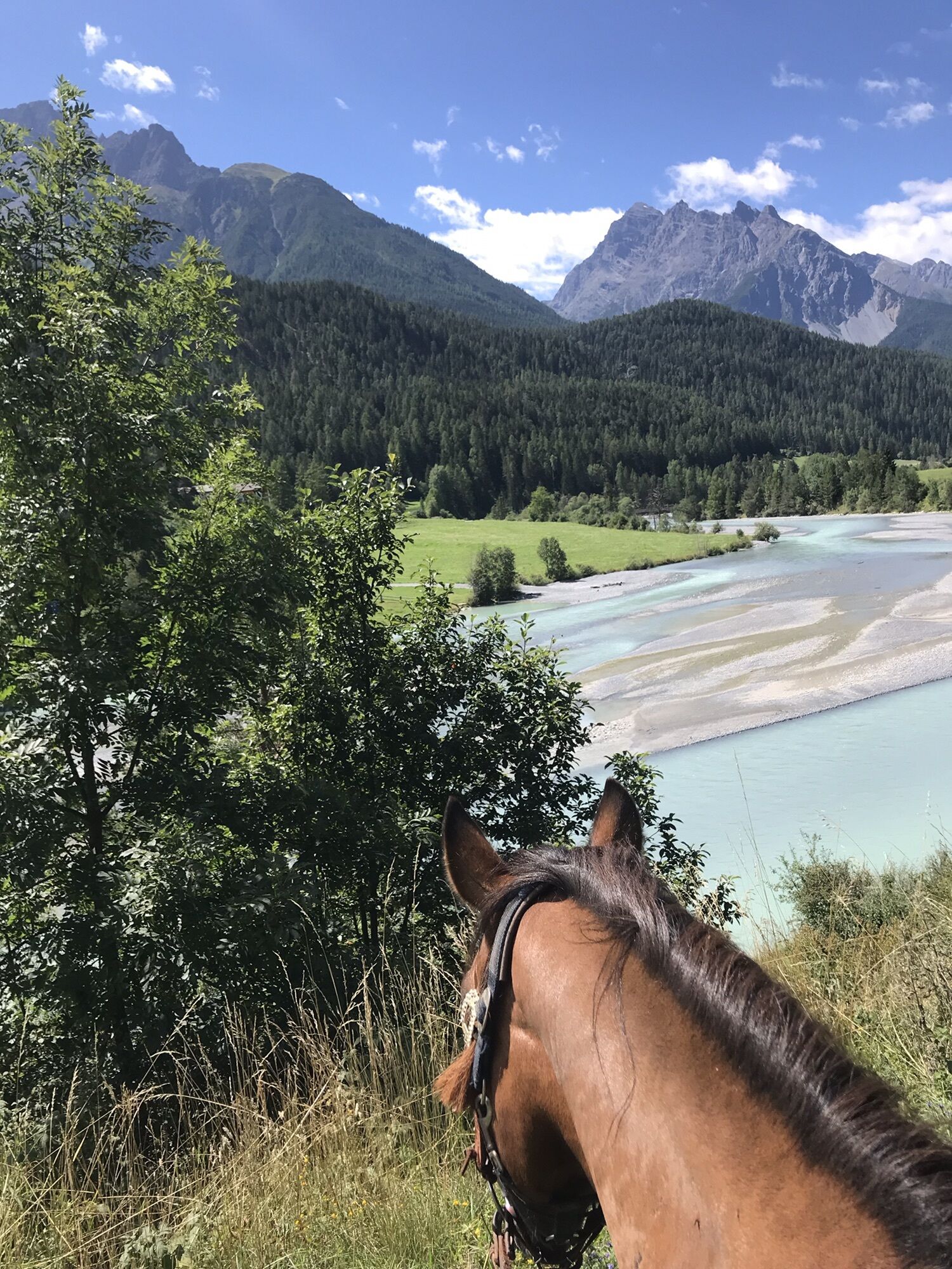
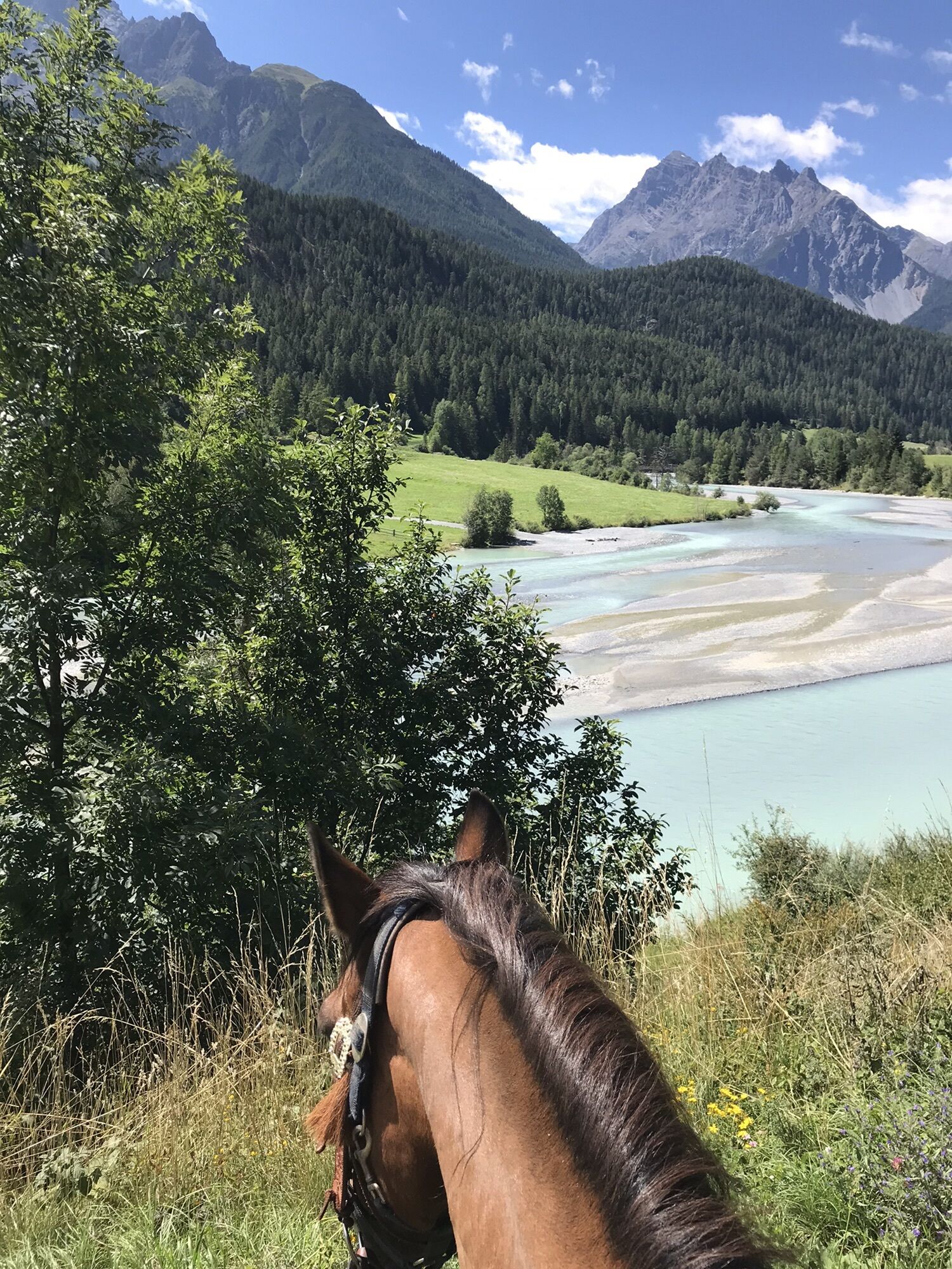
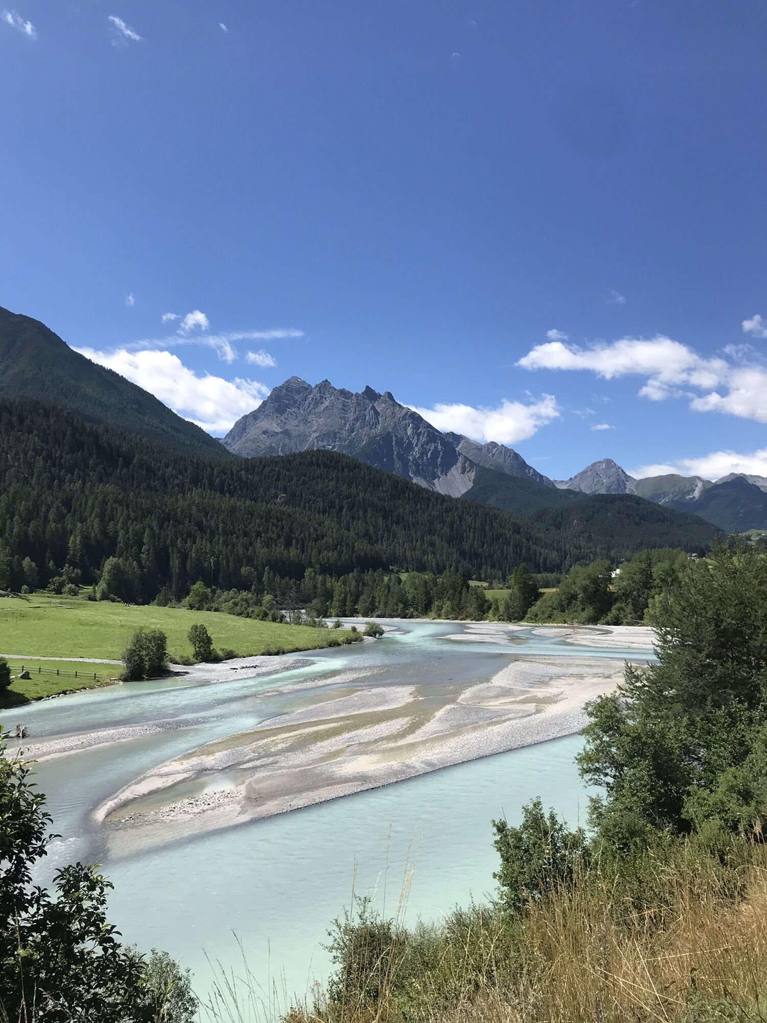
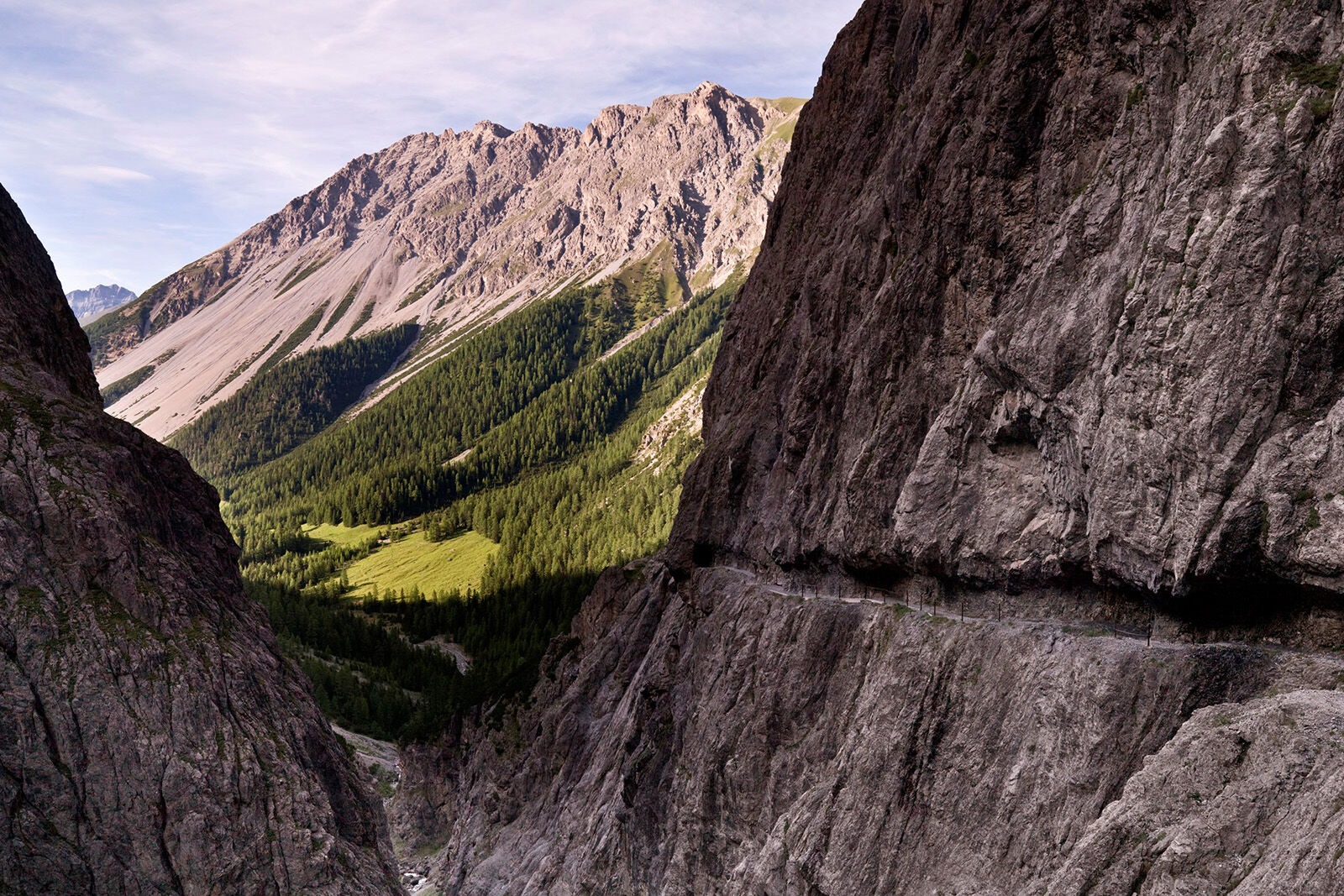
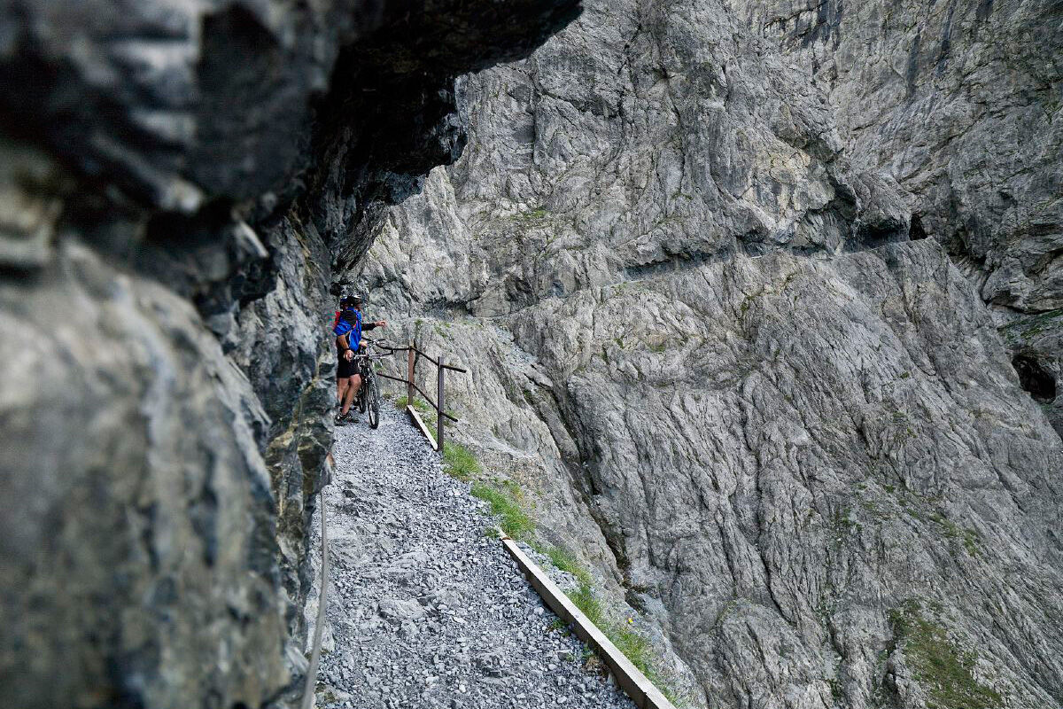
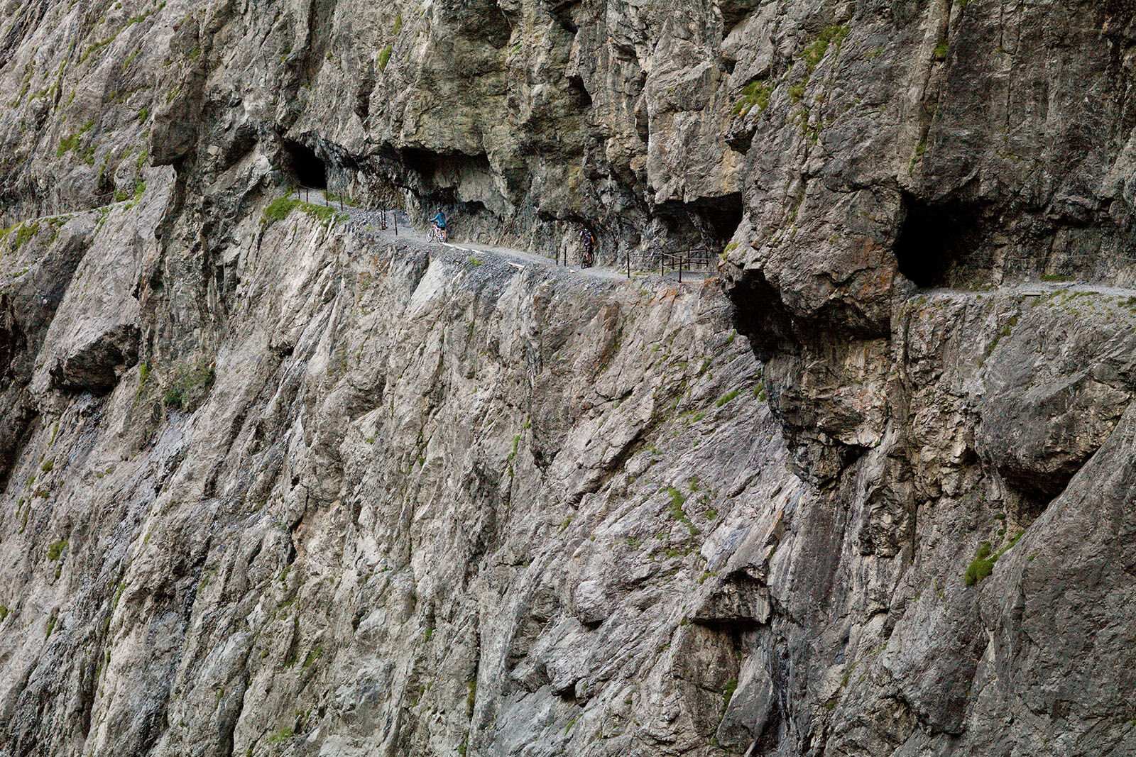
The tour begins on an impressive smugglers' path carved into the rock in the Val d'Uina. 100 metres above the bottom of the gorge, you need to be sure-footed and have a head for heights, despite being...
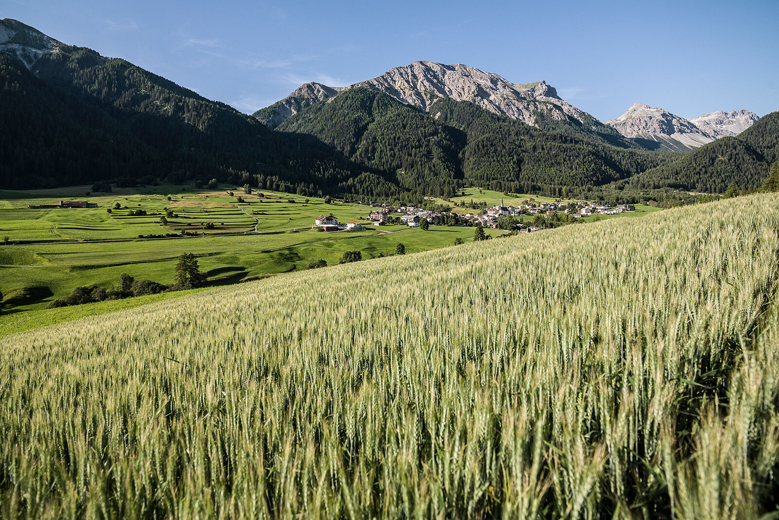
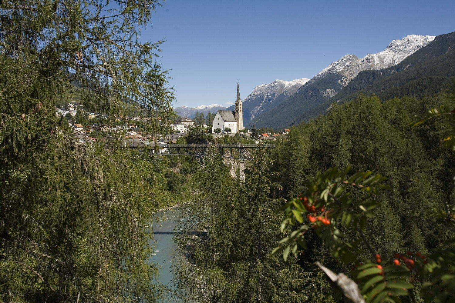
The tour begins on an impressive smugglers' path carved into the rock in the Val d'Uina. 100 metres above the bottom of the gorge, you need to be sure-footed and have a head for heights, despite being secured by chains and handrails. The following singletrail leads to the cosy Sesvenna hut (2256 m). The rest of the route, mostly on gravel and a short stretch on the main road, leads down to the South Tyrolean village of Laatsch (1250 m). Following the Rom stream, you reach your destination for the day in Val Müstair.
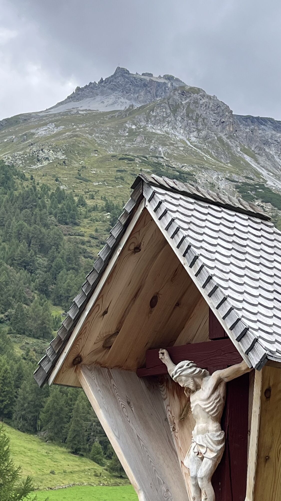
The Schellen-Ursli filming location: Alpine cattle driving and lumberjack work
The crash of the loaded wagon and part of the Alpine descent were filmed at Puntins Ots below the adventure and culture trail of the same name in Val d'Uina.
You can find all the locations for the Schellen-Ursli film here.

From Scuol-Tarasp railway station to Gurlaina (sports centre)
Continue to Pradella and Sur En
From Sur En turn right into Val'Uina
From the end of the gorge singletrail to Sesvennahütte (2256 m)
Continue towards Laatsch (1250 m), via Schlinig (short stretch of main road)
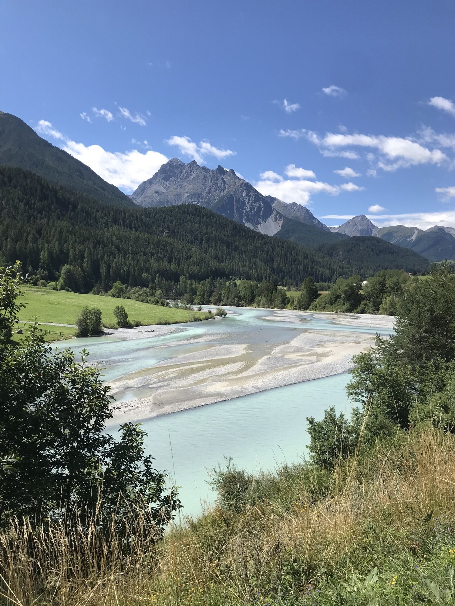
Along the river Rom to Sta. Maria in Val Müstair
Helmet, gloves, good shoes, goggles, rain and sun protection, water bottle, repair kit, first aid kit
The tour was assessed in favourable weather conditions, the current weather conditions and weather forecasts must be taken into account before starting the tour. This tour requires a high degree of riding safety, balance and technical ability.
The section on the ‘il Quar’ rocky path is a compulsory pushing passage. The narrow path is not secured in this area and does not permit riding!
Emergency call:
144 Emergency call, first aid
1414 Mountain rescue REGA
112 International emergency call
Be considerate when crossing and overtaking hikers.
Most of the mountain bike routes in Graubünden are on single trails that are also signposted as hiking trails. Hikers always have right of way.
Von Norden: Über Landquart – Klosters per Autoverlad durch den Vereinatunnel (Selfranga - Sagliains) oder über den Flüelapass ins Unterengadin auf H27
von Osten: via Landeck / Österreich in Richtung St. Moritz auf H27
Von Süden: via Reschenpass (Nauders-Martina) oder Ofenpass (Val Müstair-Zernez) auf H27
Scuol liegt direkt an der Engadiner Strasse H27 (25 Minuten Fahrzeit ab Vereina Südportal)
Mit der Rhätischen Bahn (von Chur, Landquart/Prättigau oder aus dem Oberengadin) stündlich bisBahnhof Scuol-Tarasp
Mit dem PostAuto (ab Martina, Sent, Ftan oder Tarasp) stündlich bis zum Bahnhof Scuol-Tarasp
Kostenpflichtige Parkplätze am Bahnhof und bei den Bergbahnen in Scuol
Kostenlose Parkplätze Porta und Punt (Scuol Sot)
S3
Bike packages in the holiday region
Spletne kamere s turneje
Motta Naluns
Gasthaus Alpenrose - Minschuns
Scuol
Schloss Tarasp
Ftan Prui
Mals im Vinschgau - Hotel Greif
Taufers im Münstertal
Fuldera - Hotel Landgasthof Staila
Fuldera
Mals - Sockerhof
Hotel Belvédère
Watles
Piz Chavalatsch
Motta Naluns
Motta Naluns
Motta Naluns
Motta Naluns
Motta Naluns
Motta Naluns
Ftan
Mals Vinschgau
Camping Mals
Müstair - Hotel Helvetia
Sent
Ftan
Tarasp - Engadin
Sent
Taufers im Münstertal
Müstair
Mot da Ri
Mot da Ri
Mot da Ri
Mot da Ri
Mot da Ri
Priljubljeni izleti v okolici
- 4,1
Panoramaweg Schöneben Haider Alm
svetlobaPohodništvo5,78 km - 5,0
Mountain restaurant Plantaptasch (without Lift)
srednjaPohodništvo3,42 km - 5,0
Spitzige Lun
srednjaPohodništvo12,4 km - 4,5
Rundwanderweg Wattles und Sesvenna
svetlobaPohodništvo16,4 km - 4,2
Reschensee
svetlobaPohodništvo15,6 km - 5,0
Plamort
svetlobaPohodništvo8,25 km - 5,0
Edelweißsteig- Leitenwool- Muntaschinig- Gongelegg - Schluderns
svetlobaPohodništvo14,0 km - 4,0
Süsom Givè - Chaschlot - Valbella - Süsom Givè
srednjaPohodništvo9,73 km - 4,0
001.01 Alpine Bike Stage 1 Scuol - Tschierv
srednjaMountainbike31,4 km - 5,0
3 Länder Tour Uinaschlucht MTB
težkoMountainbike74,6 km
Pohodništvo in sledenje


Ne zamudite ponudb in navdiha za naslednje počitnice
Vaš e-poštni naslov je bil dodan na poštni seznam.