


Buch path
Stopnja težavnosti: T1


The village is one of the oldest settlements in the Göppingen district, based on its first mention in historical written sources. As early as 861, "Mulenhuson" was mentioned in the founding document of...
The village is one of the oldest settlements in the Göppingen district, based on its first mention in historical written sources. As early as 861, "Mulenhuson" was mentioned in the founding document of the Wiesensteig monastery. The place name contains the Old High German term "muli" for mill, which in turn derives from "mul" meaning crushed. The suffix "-hausen" indicates that the settlement already existed in the 7th century, at least 200 years before the first mention. According to the place name, Mühlhausen developed around one or more mills that were operated here on the Fils. Today, Mühlhausen im Täle is a modern, thriving community offering many opportunities for relaxation, hiking, endurance sports, and various discoveries of the unique nature.
Municipality of Mühlhausen im Täle
Gosbacher Straße 16 | 73347 Mühlhausen i.T.
07335 9601-0 | gemeinde@muehlhausen-taele.de | www.muehlhausen-taele.de

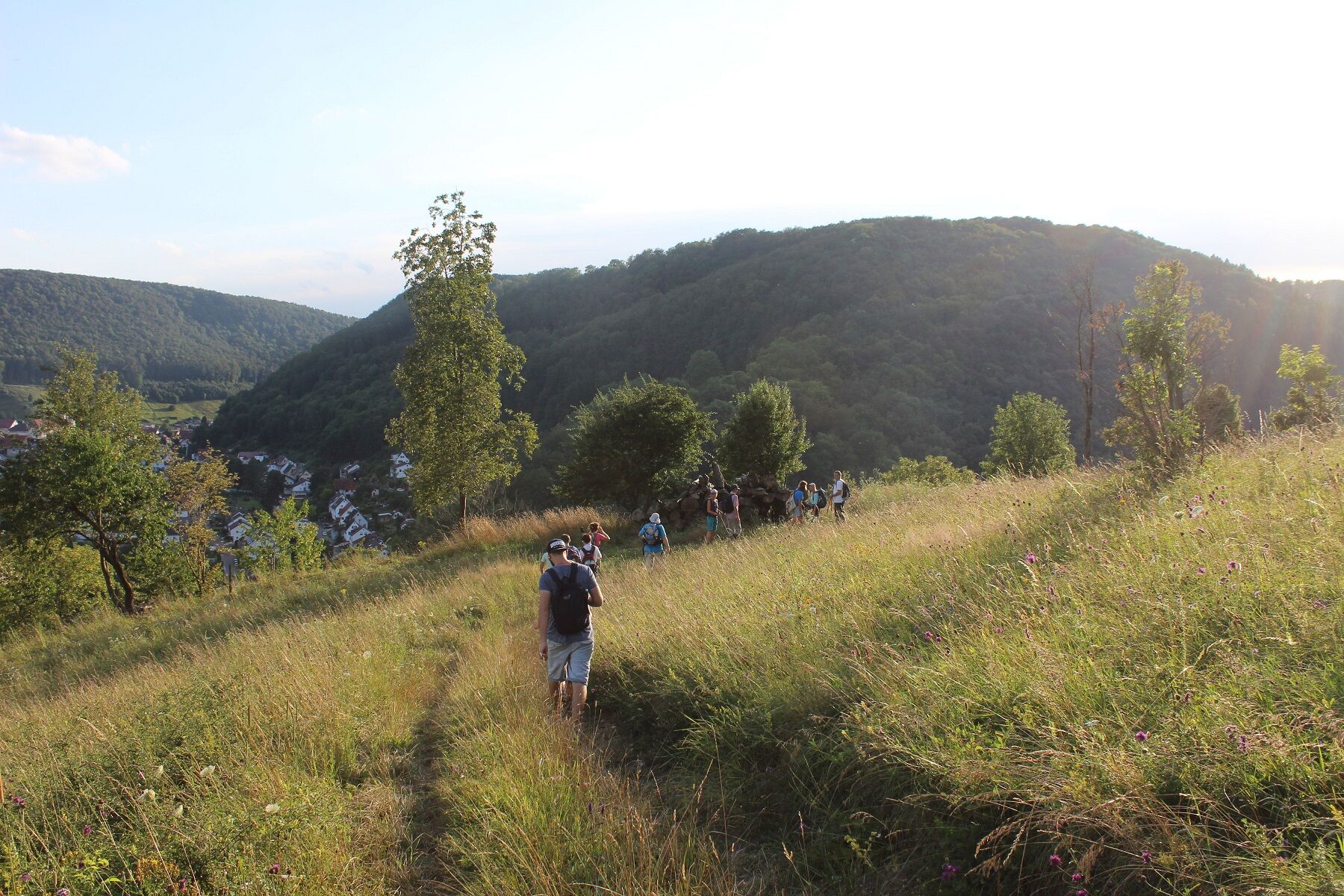
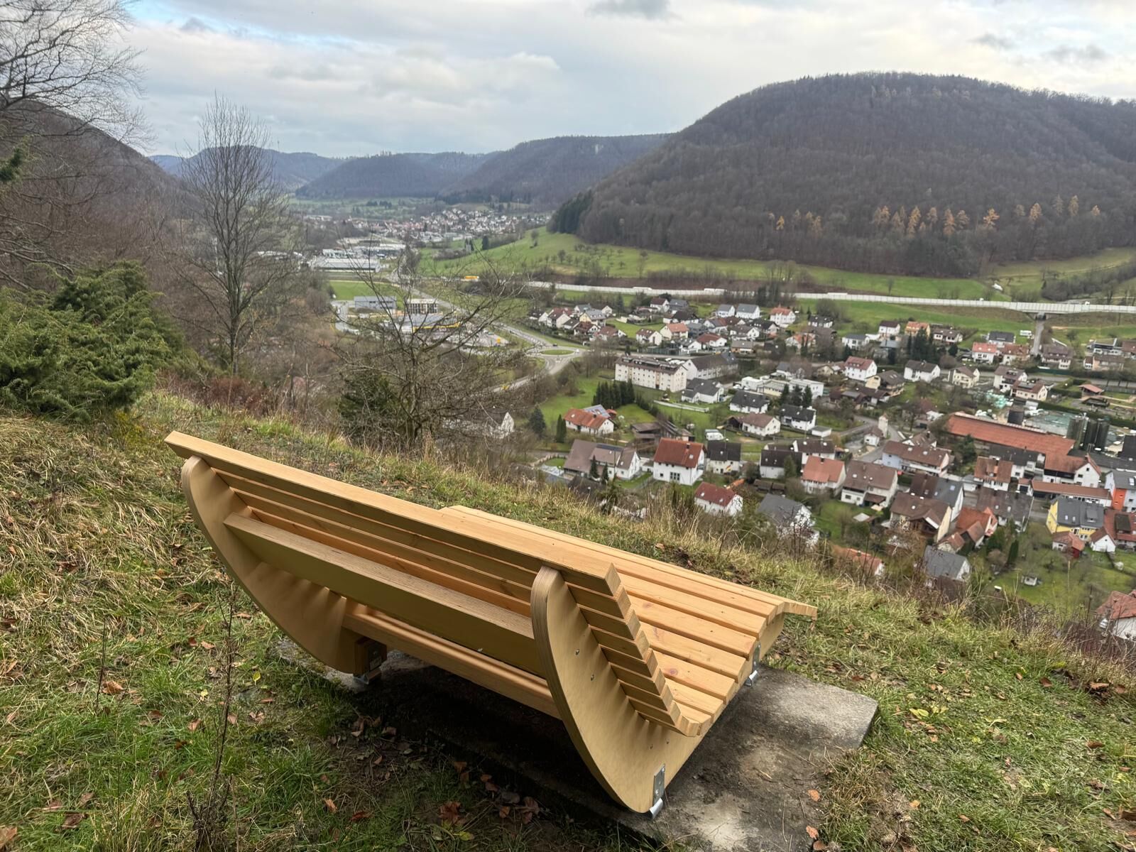
From the "Höhenblick" car park, the circular hiking route leads directly to the picturesque Buch plateau. From the open space at Sommerhalde, there is a unique view of the village of Mühlhausen as well as the ramp of the A8 motorway. Located at Sommerberg is also the Hutewald with a beautiful juniper heath that significantly shapes and reflects the landscape at the Albtrauf. With open meadows and hedgerows on the Buch plateau, the route then returns. Towards Sterneck in Wiesensteig, you pass the impressive structures of the new Wendlingen-Ulm railway line. Just above the Buch portal, there are impressive views of the railway tunnels and both Filstal bridges.
Da
Wear sturdy, slip-resistant footwear and weather-appropriate clothing. A backpack with water, snacks, and a first aid kit is recommended.
Some paths can be slippery and dangerous when wet. Watch your step and use hiking sticks for stability if necessary.
Via the A8, exit Mühlhausen im Täle.
Take RE 5 or MEX 16 to Göppingen or Geislingen. Then take bus line 981 from Göppingen or line 966 from Geislingen to Mühlhausen im Täle to the stop "Kirche".
You can find the district timetable at: www.vvs.de/fahrplan
Car park at the starting point.
T1
Respectful coexistence in the Göppingen district.
Code of Conduct:
Respect path closures and the quiet zones developed in the recreational trail concept. Leave no traces such as litter or animal droppings; treat your path gently. Act proactively and considerately. Adapt your behavior to the situation. Safety first. Respect other users of the forest and fields. Show consideration for animals and plants. Plan ahead and use daylight. Avoid dawn and dusk times. Observe the trespassing ban on agricultural land during the growing season. Stay on designated paths and avoid forest edges so wild animals can better get used to humans.
More information at ruecksicht-macht-wege-breiter.de
A visit to the "Sommer-Hansens-Keller" is recommended - a half-cave along the inner Albtrauf.
Priljubljeni izleti v okolici
- 5.0
Löwenpfad "Berta-Hörnle-Tour" - Castle stories in a dreamlike setting
srednjaPohodništvo14.5 km - 5.0
Löwenpfad "Filsursprung-Runde" - pure nature around Reußenstein
srednjaPohodništvo14.0 km - 4.6
Löwenpfad "Orchideenpfad" - Herbs, pasqueflower and juniper heather
srednjaPohodništvo9.33 km - 5.0
Löwenpfad "Filstalgucker" - Views from the heart of the Filstal
srednjaPohodništvo13.1 km - 4.3
Löwenpfad "Steigen-Tour" - Along the Swabian century building
težkoPohodništvo17.2 km - 5.0
Lenningen: Weiße Lauter, Wasserfels, Guttenberger-,Gußmannshöhle, Schopflocher Moor, Hohgreutfels, Ruine Wielandstein
srednjaPohodništvo15.7 km - 3.8
Löwenpfad "Ave-Weg" - a touch of pilgrimage on the Albtrauf
srednjaPohodništvo8.58 km Löwenpfad "Höhenrunde" - Hiltenburg and pure Albtrauf
srednjaPohodništvo10.7 km- 5.0
Breitensteinrunde
svetlobaPohodništvo10.3 km - 5.0
Boßler circuit
srednjaPohodništvo8.59 km
Pohodništvo in sledenje


Ne zamudite ponudb in navdiha za naslednje počitnice
Vaš e-poštni naslov je bil dodan na poštni seznam.