

© Warth-Schröcken Tourismus - Ratko Fotografie und mehr

© Warth-Schröcken Tourismus - Ratko Fotografie und mehr

- Kratek opis
-
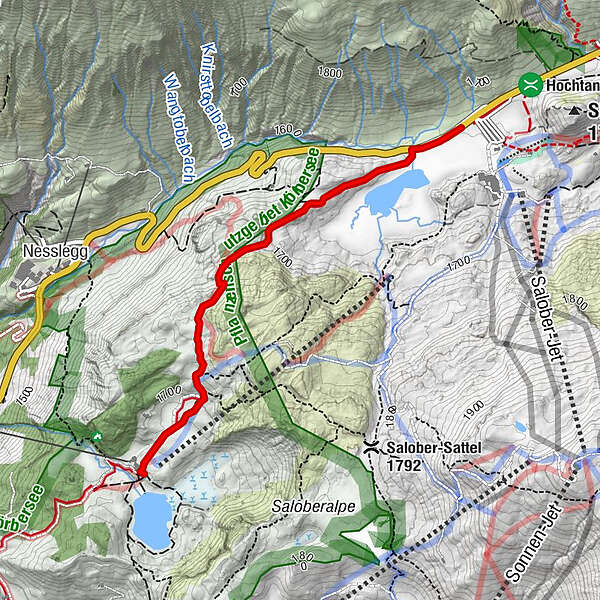
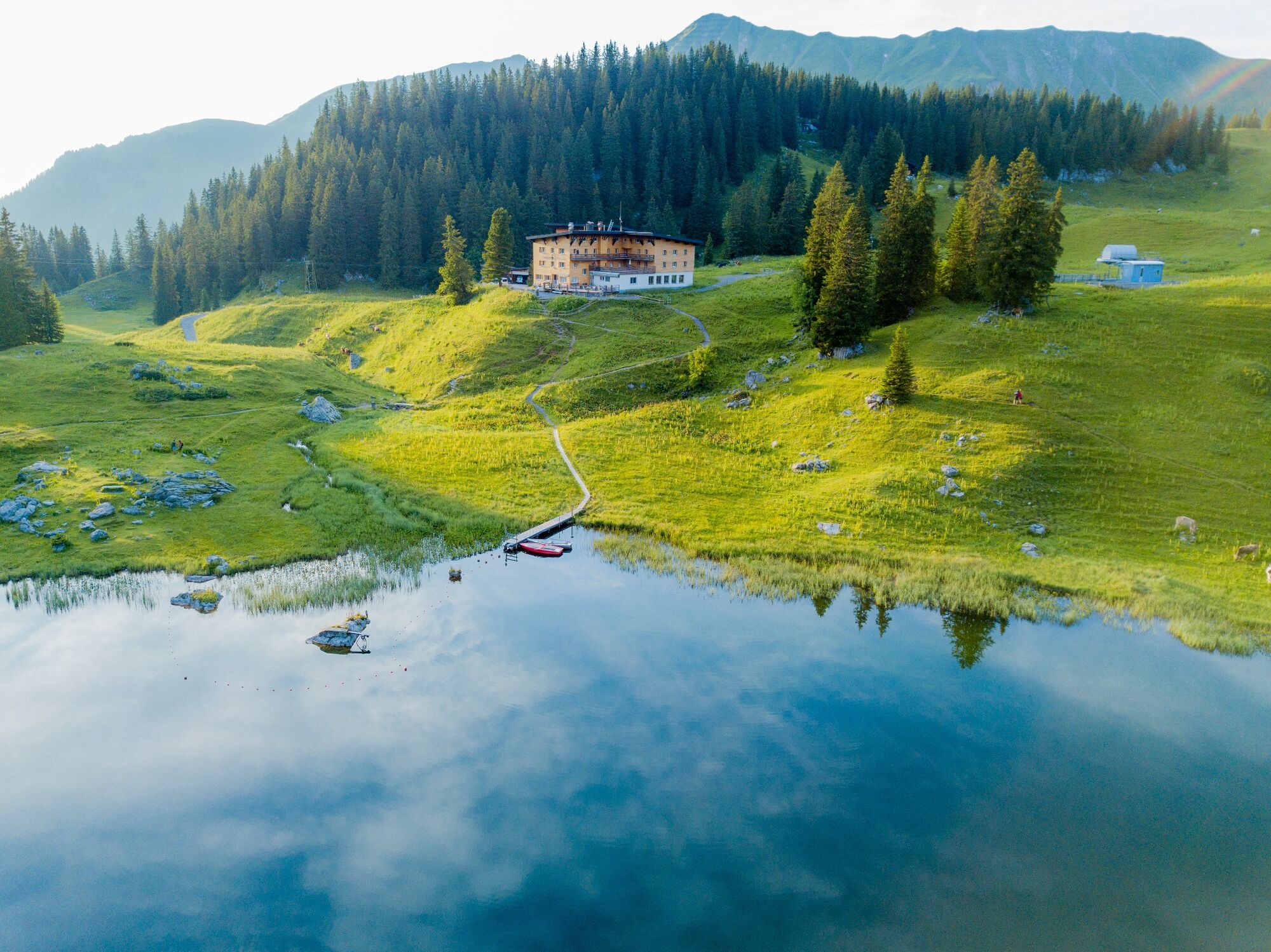
At the Hochtannbergpass the path leads you past Kalbelesee to the picturesque Körbersee. The mountain hotel invites you to take a break before you walk back up the same path.
- Težavnost
-
enostavno
- Ocenjevanje
-
- Najboljša sezona
-
janfebmaraprmajjunjulavgsepoktnovdec
- Najvišja točka
- 1.741 m
- Destinacija
-
Hochtannbergpass
- Profil nadmorske višine
-


- Avtor
-
Turneja From Kalbelesee to Körbersee and retour uporablja outdooractive.com na spletni strani ..
GPS Downloads


Splošne informacije
Postanek za osvežitev
Flora
Favna
Obetavno
Več izletov v regijah


