Kaunergrat hut 2817 m

Logotip Kaunergrat hut 2817 m
Datumi turnej
5,2km
1.658 - 2.812m
Distanz
1.195hm
Ascent
04:30h
 
Trajanje
Kratek opis

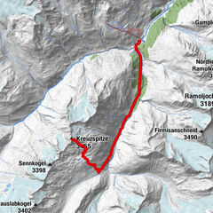
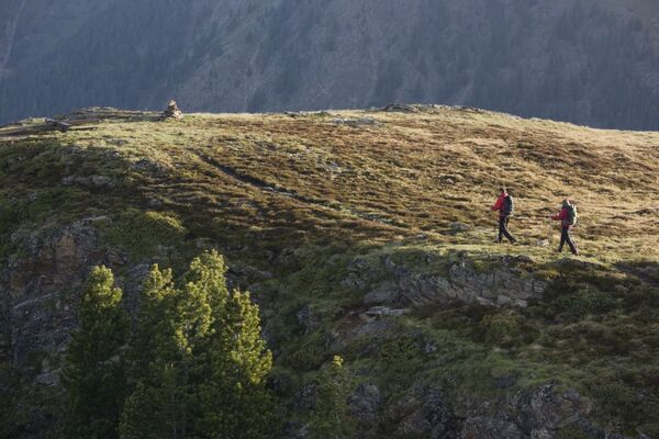
A high alpin Tour with a fantastic crag- and ice landscape.

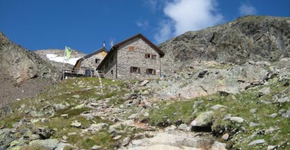
The ascent to the hut takes 4 h. There is a 1201 altitude difference. The anticlimax takes 2,5 h.

A trip to the Parstlewand takes 2,5 to 3 h. Back from there takes 1 to 1,5 h.

The anticlimax over the Mttelbergsee to Trenkwald.

Pot
Pfarrkirche Plangeross
0,0 km
Plangeross
0,0 km
Winterraum
4,7 km
Kaunergrathütte
4,7 km

Najvišja točka
2.812 m
Profil nadmorske višine

Avtor
Turneja Kaunergrat hut 2817 m uporablja outdooractive.com na spletni strani ..

Splošna ocena

5

0

%

4

0

%

3

0

%

2

0

%

1

0

%

Napaka
Zgodila se je napaka. Prosimo, poskusite znova.
Zahvaljujemo se vam za vaš pregled

Ocena je bila izbrisana

GPS Downloads
  • GPX GPS Exchange Format (XML)
  • KML Google Earth, Google Maps
Kode za prenos QR za mobilne telefone
Več izletov v regijah

Priljubljeni izleti na območju

Vent - Kreuzspitze

Pohodništvo
20,6km | 1475hm | 09:30h

Hohe Geige über Gawinden und den Westgrat

težko Pohodništvo
14,27km | 1752hm | 08:30h

Kreuzspitze

težko Pohodništvo
11,64km | 1472hm | 05:00h

Stuibenfall hike - Umhausen

enostavno Pohodništvo
2,95km | 392hm | 01:45h