European E5 long-distance hiking trail – King's Segment – Vent to Obergurgl (alternative route)
težko
Navigacija po spletni strani
Navigacija po spletni strani
Pridobite to turo v svoj mobilni telefon
European E5 long-distance hiking trail – King's Segment – Vent to Obergurgl (alternative route)
težko
Pohodništvo v daljavo
20,24
km
Skenirajte kodo QR in začnite navigacijo v aplikaciji bergfex.

Pohodništvo in sledenje


European E5 long-distance hiking trail – King's Segment – Vent to Obergurgl (alternative route)
težko
Razdalja
20,24
km
Trajanje
09:30
h
Ascent
1.519
hm
Morska gladina
1.883 -
3.167
m
Stopnja težavnosti: T4
Prenos skladbe
European E5 long-distance hiking trail – King's Segment – Vent to Obergurgl (alternative route)
težko
Pohodništvo v daljavo
20,24
km
Fotografije naših uporabnikov
 © Hanno MenzUstvarjeno na 20.09.2025
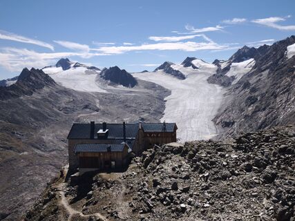 © Hanno MenzUstvarjeno na 20.09.2025
 © Hanno MenzUstvarjeno na 20.09.2025
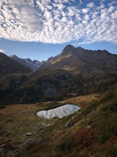 © Hanno MenzUstvarjeno na 20.09.2025
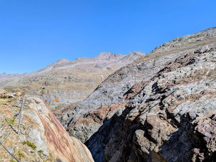
 © Sabrina HackelUstvarjeno na 19.09.2025
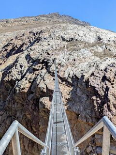 © Sabrina HackelUstvarjeno na 19.09.2025
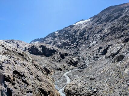 © Sabrina HackelUstvarjeno na 19.09.2025
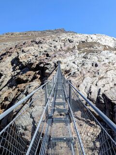 © Sabrina HackelUstvarjeno na 19.09.2025
 © Sabrina HackelUstvarjeno na 19.09.2025
 © Sabrina HackelUstvarjeno na 19.09.2025
 © Sabrina HackelUstvarjeno na 19.09.2025
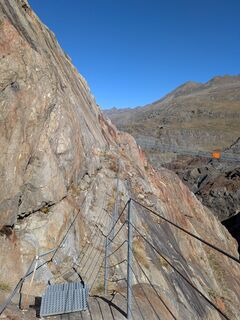 © Sabrina HackelUstvarjeno na 19.09.2025
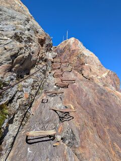 © Sabrina HackelUstvarjeno na 19.09.2025
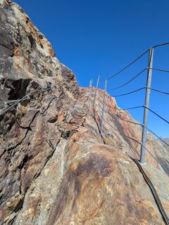 © Sabrina HackelUstvarjeno na 19.09.2025
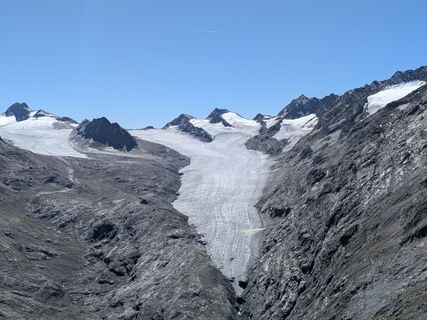 © Sabrina HackelUstvarjeno na 19.09.2025
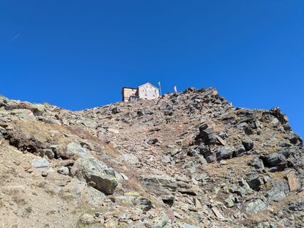 © Sabrina HackelUstvarjeno na 19.09.2025
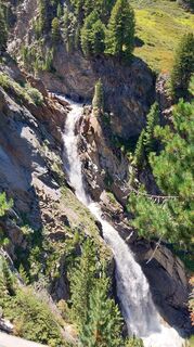
 © Desirée AuerUstvarjeno na 08.08.2025
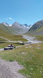 © Desirée AuerUstvarjeno na 08.08.2025
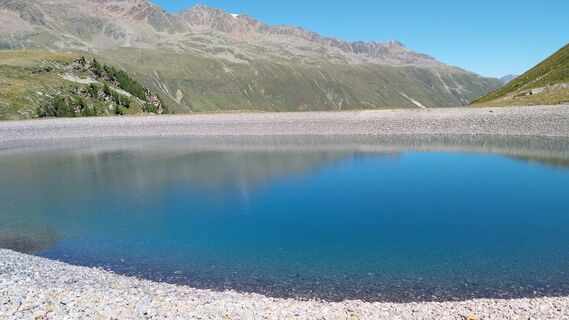 © Desirée AuerUstvarjeno na 08.08.2025
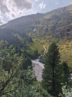
 © okidoki1980Ustvarjeno na 06.08.2025
 © okidoki1980Ustvarjeno na 06.08.2025
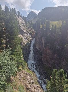 © okidoki1980Ustvarjeno na 06.08.2025
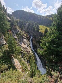 © okidoki1980Ustvarjeno na 06.08.2025
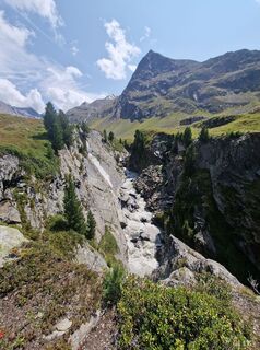 © okidoki1980Ustvarjeno na 06.08.2025
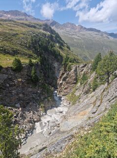 © okidoki1980Ustvarjeno na 06.08.2025
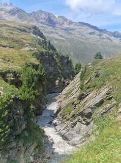 © okidoki1980Ustvarjeno na 06.08.2025
 © Jonas KaufmannUstvarjeno na 27.07.2025
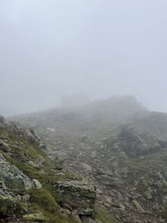 © Jonas KaufmannUstvarjeno na 27.07.2025
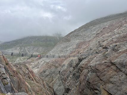 © Jonas KaufmannUstvarjeno na 27.07.2025
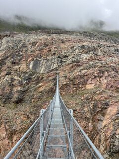 © Jonas KaufmannUstvarjeno na 27.07.2025
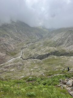 © Jonas KaufmannUstvarjeno na 27.07.2025
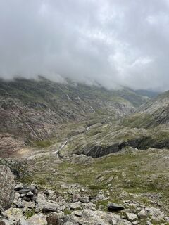 © Jonas KaufmannUstvarjeno na 27.07.2025
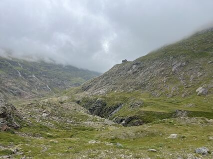 © Jonas KaufmannUstvarjeno na 27.07.2025
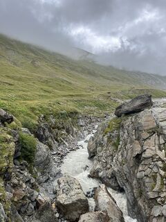 © Jonas KaufmannUstvarjeno na 27.07.2025
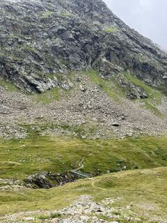 © Jonas KaufmannUstvarjeno na 27.07.2025
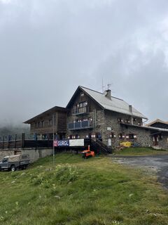 © Jonas KaufmannUstvarjeno na 27.07.2025
 © Jonas KaufmannUstvarjeno na 27.07.2025
 © Jonas KaufmannUstvarjeno na 27.07.2025
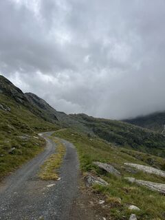 © Jonas KaufmannUstvarjeno na 27.07.2025
 © Jonas KaufmannUstvarjeno na 27.07.2025
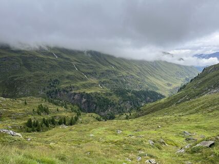 © Jonas KaufmannUstvarjeno na 27.07.2025
 © Jonas KaufmannUstvarjeno na 27.07.2025
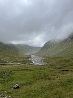 © Jonas KaufmannUstvarjeno na 27.07.2025
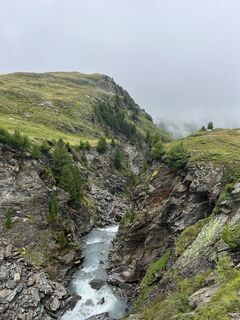 © Jonas KaufmannUstvarjeno na 27.07.2025
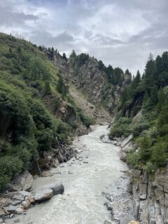 © Jonas KaufmannUstvarjeno na 25.07.2025
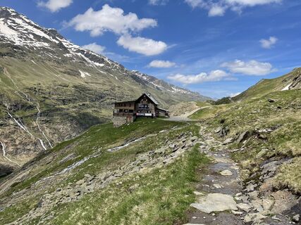
 © Ralf UmmingerUstvarjeno na 09.07.2024
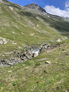 © Ralf UmmingerUstvarjeno na 09.07.2024
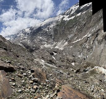 © Ralf UmmingerUstvarjeno na 09.07.2024


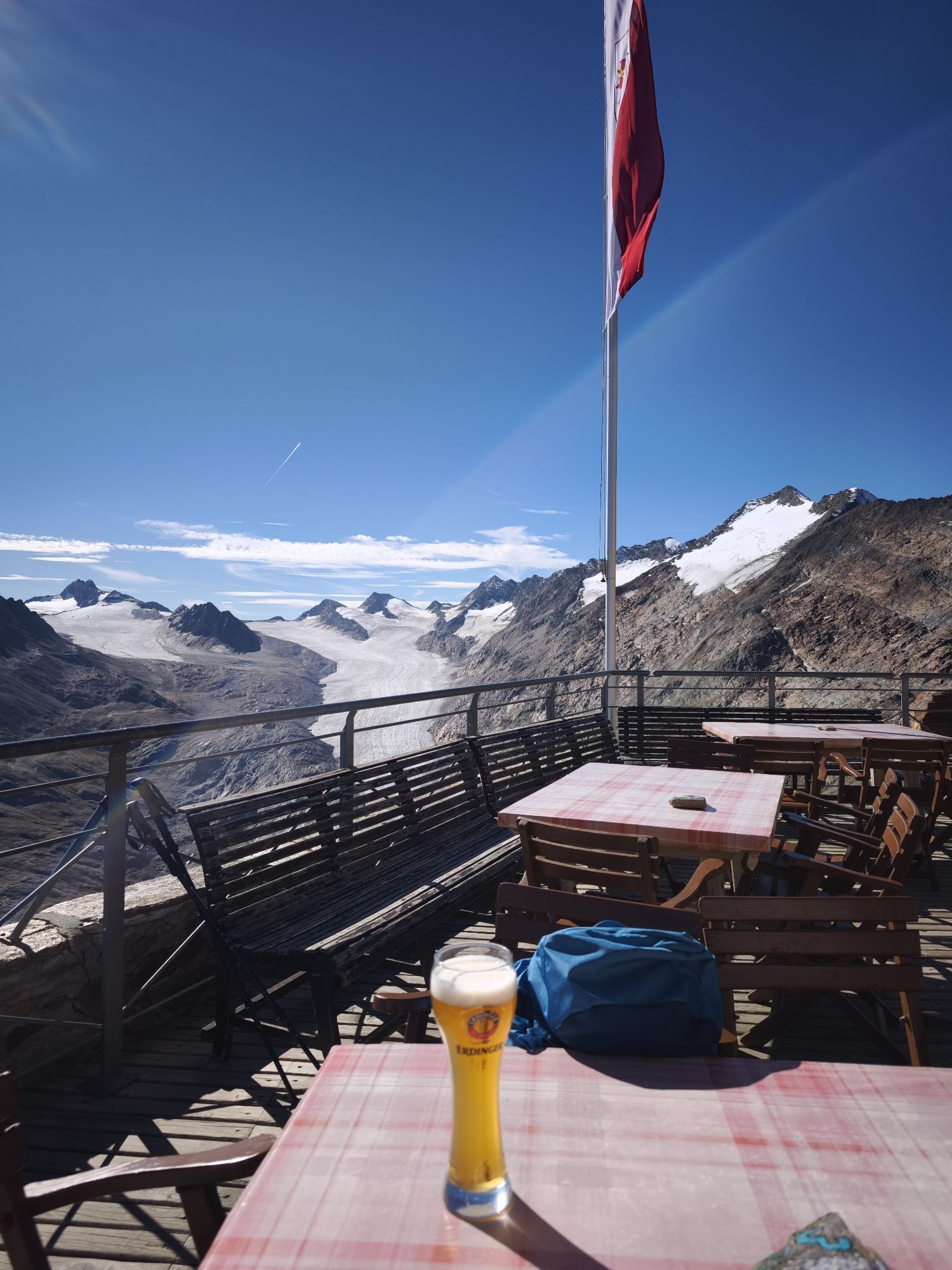
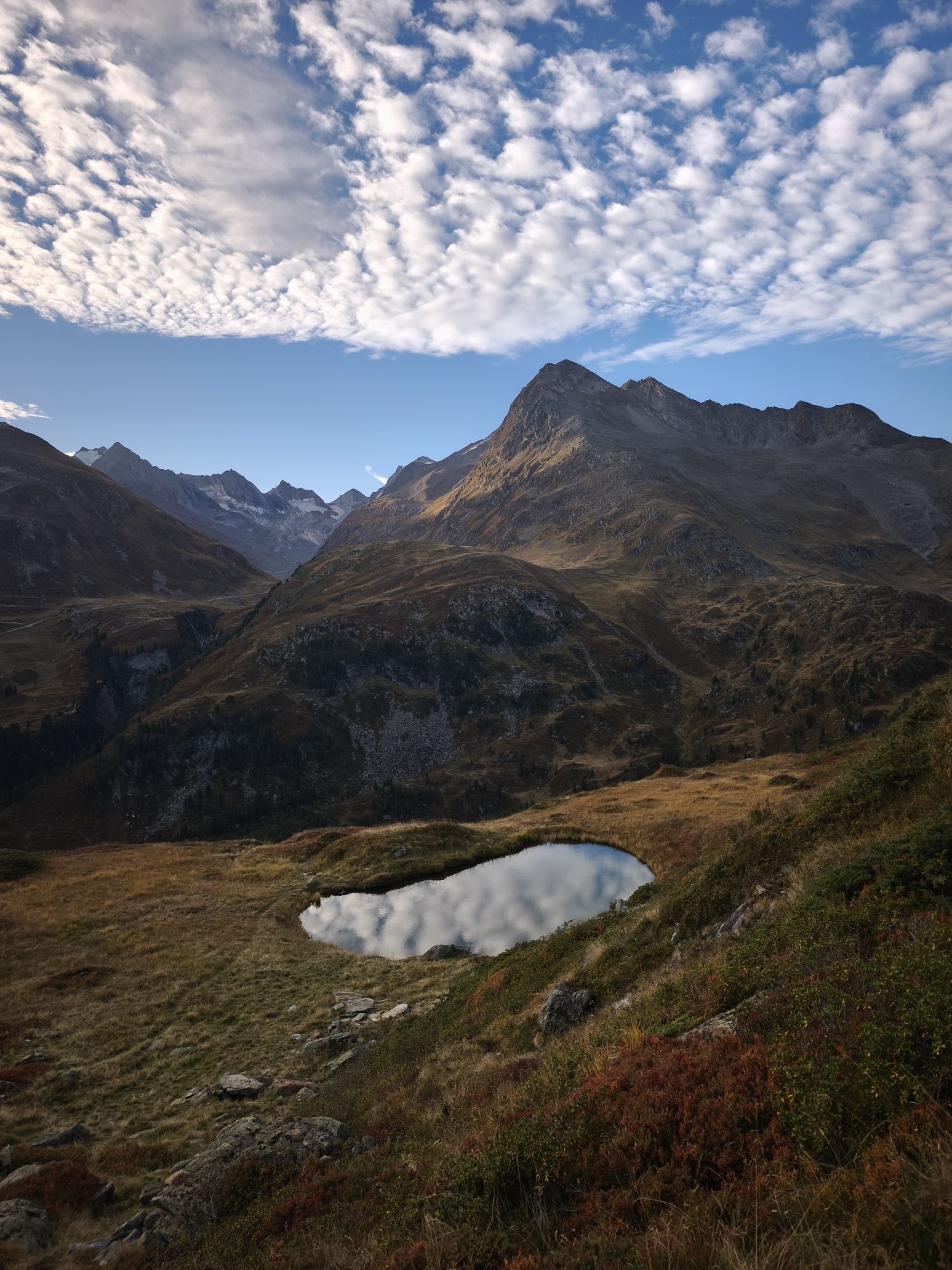
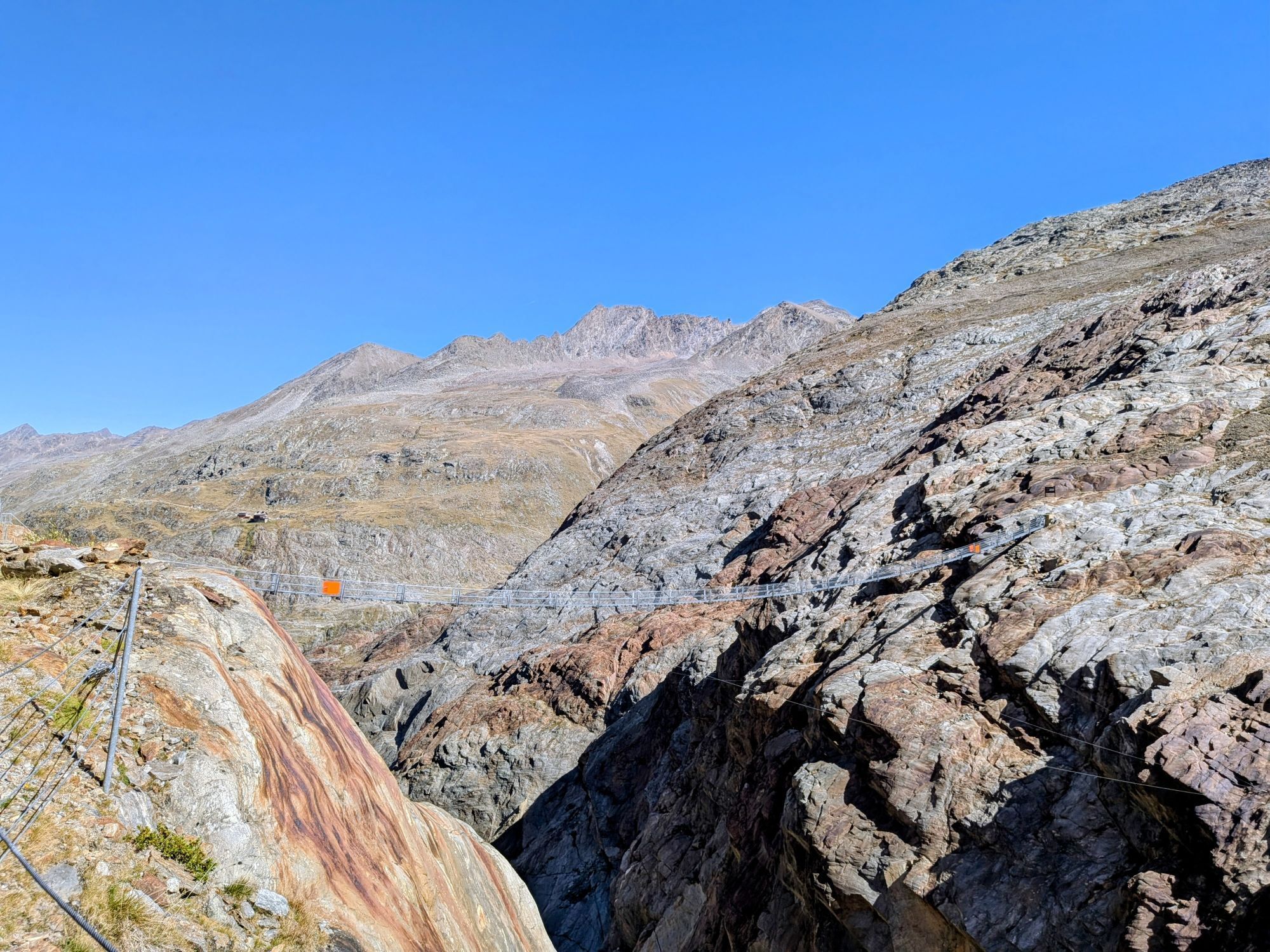

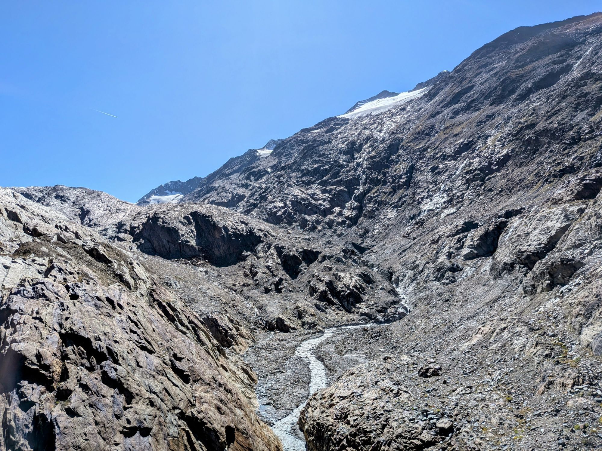


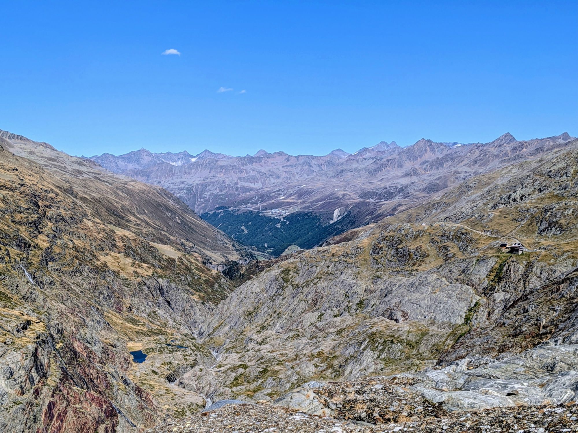
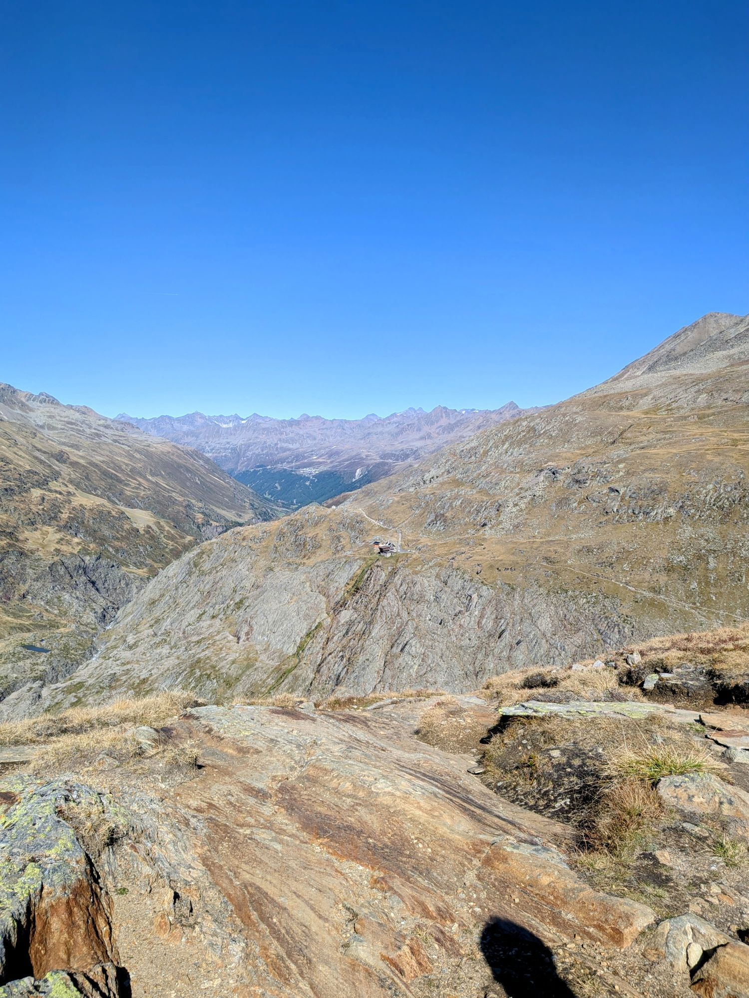
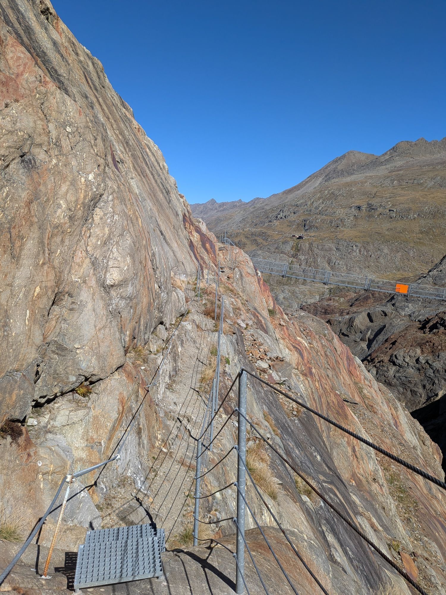


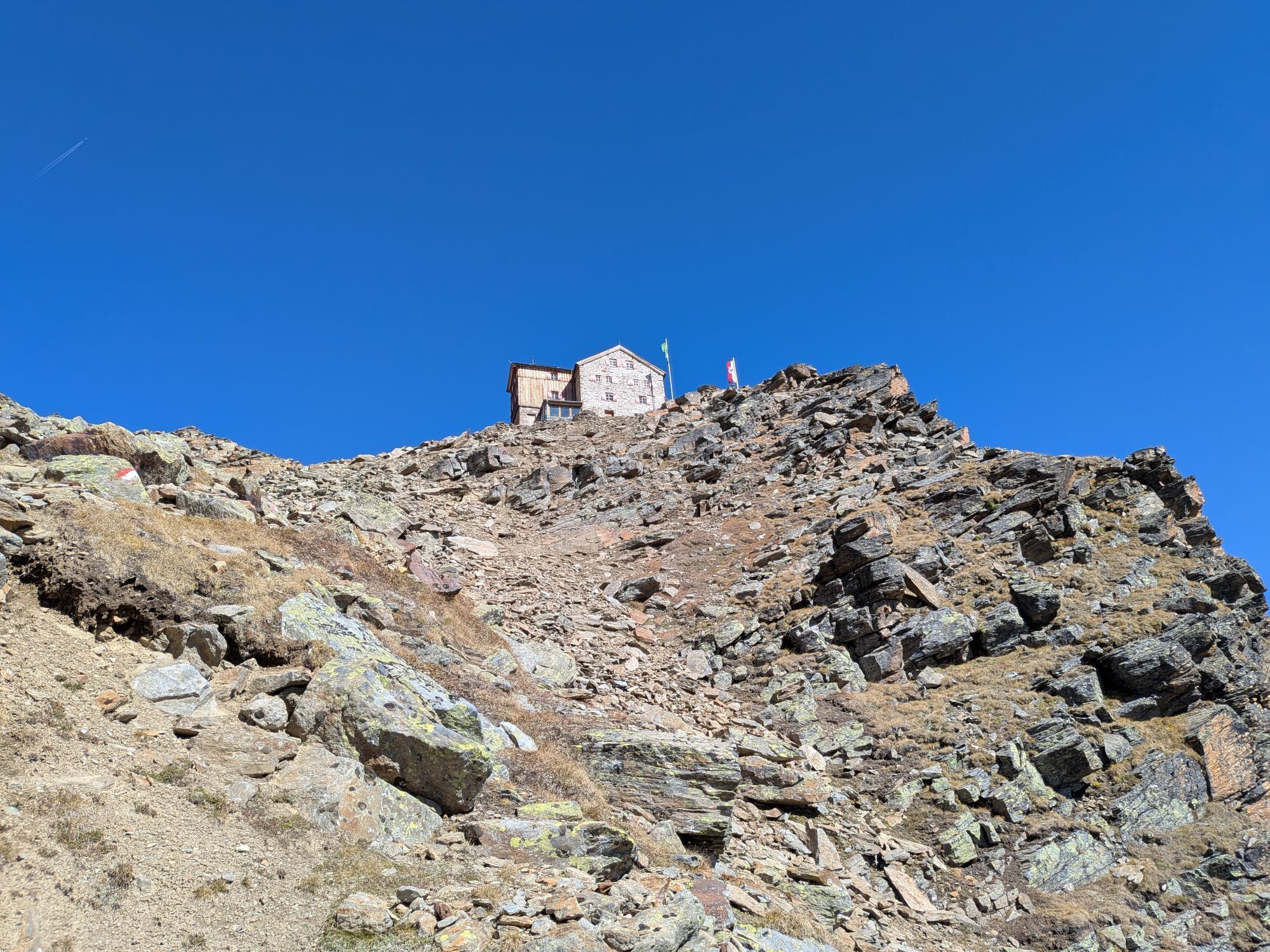


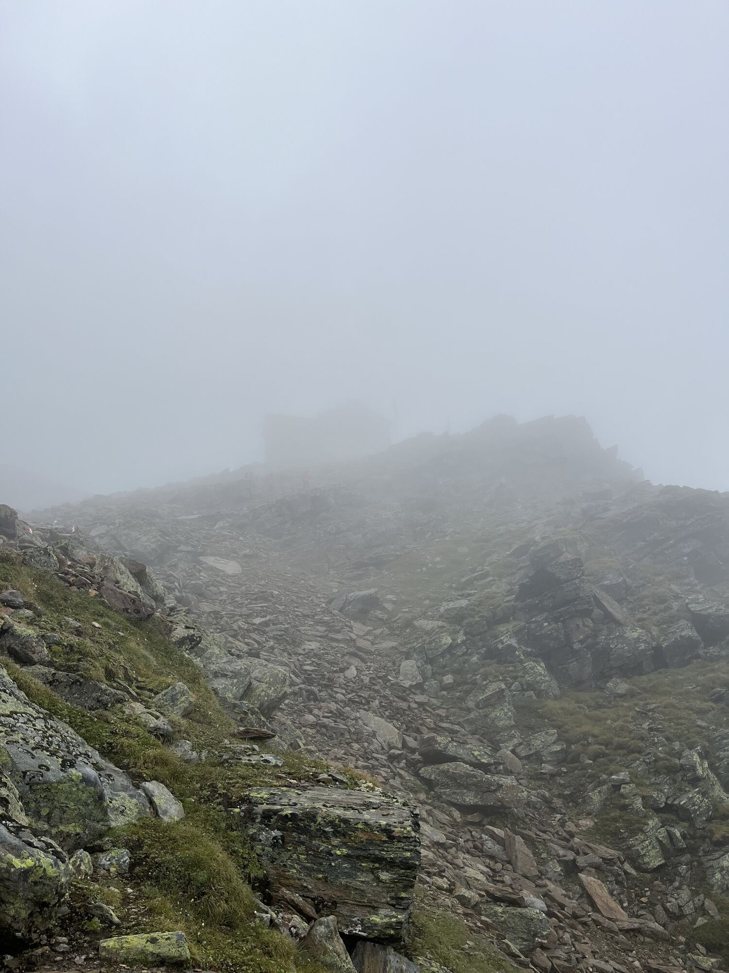
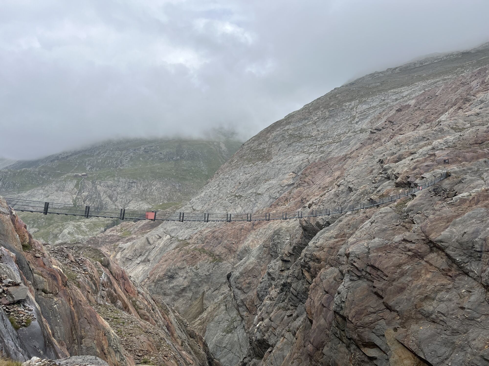


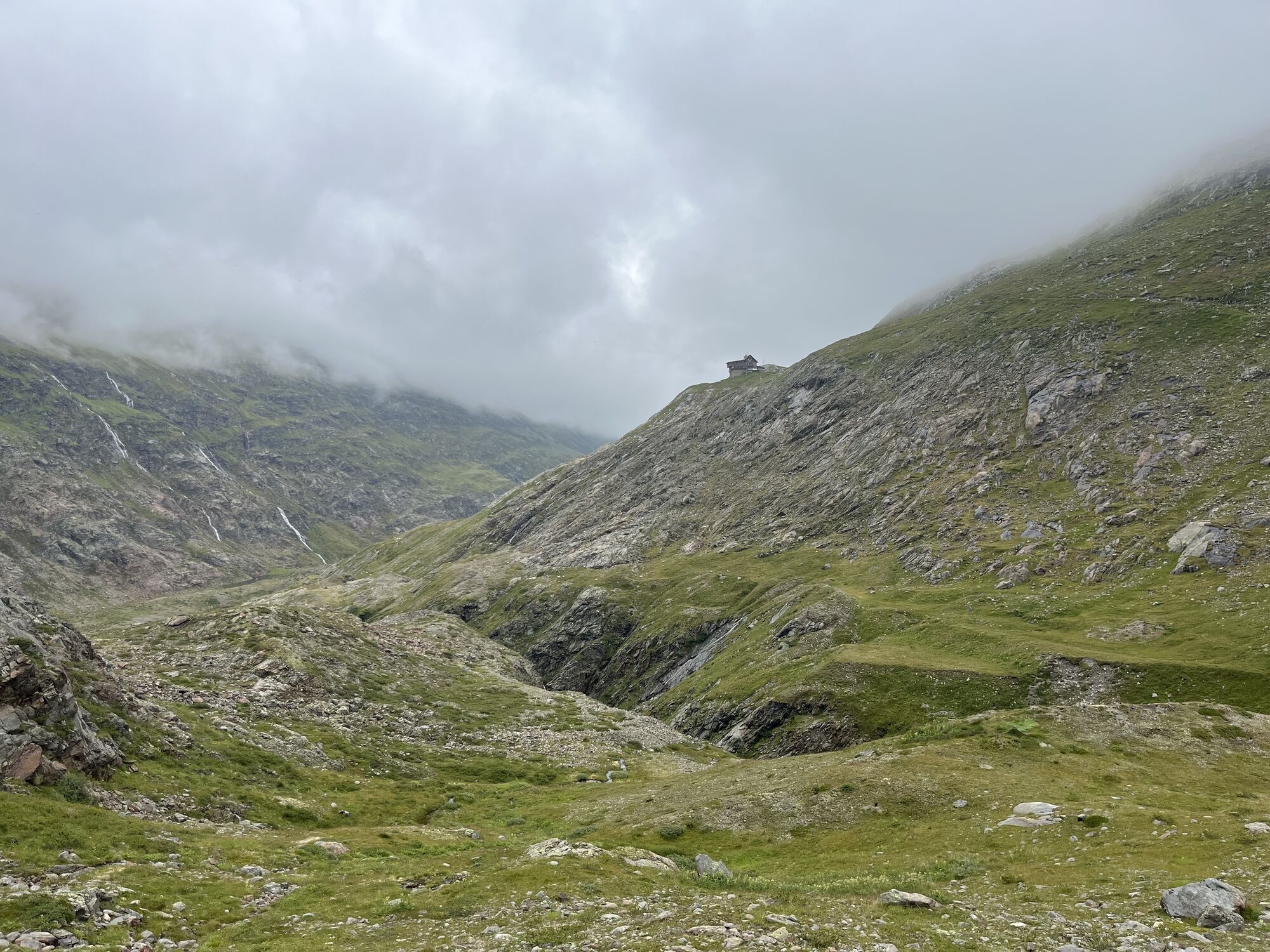


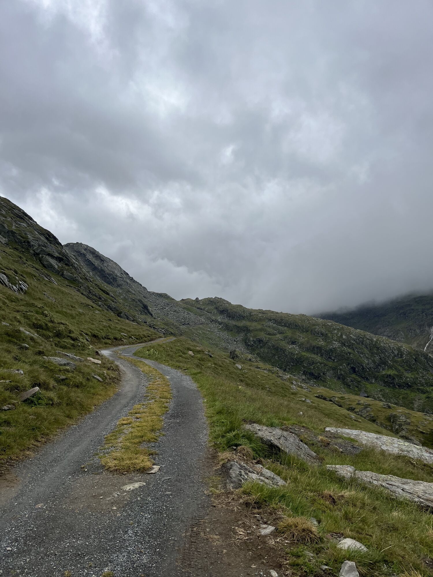


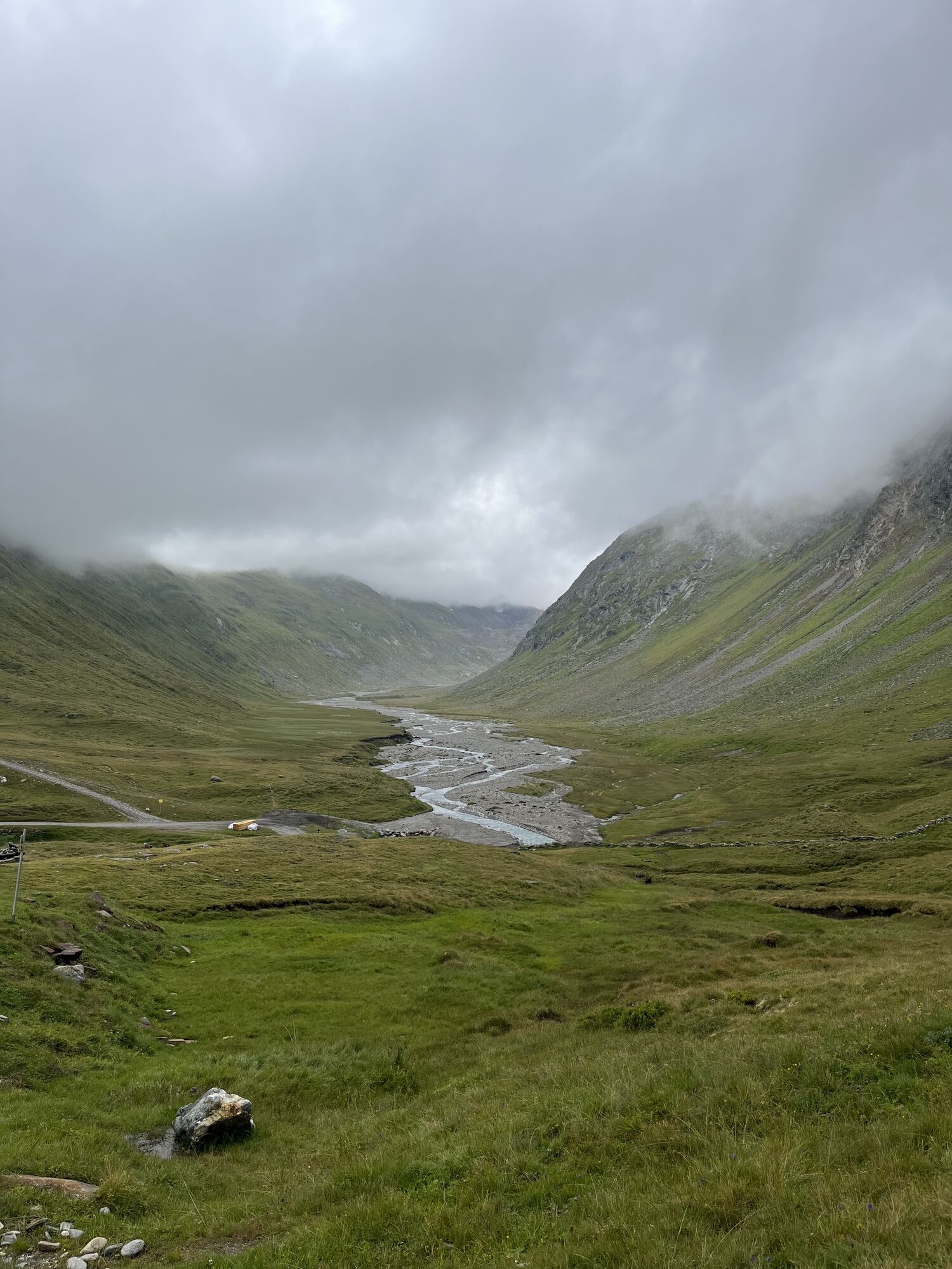
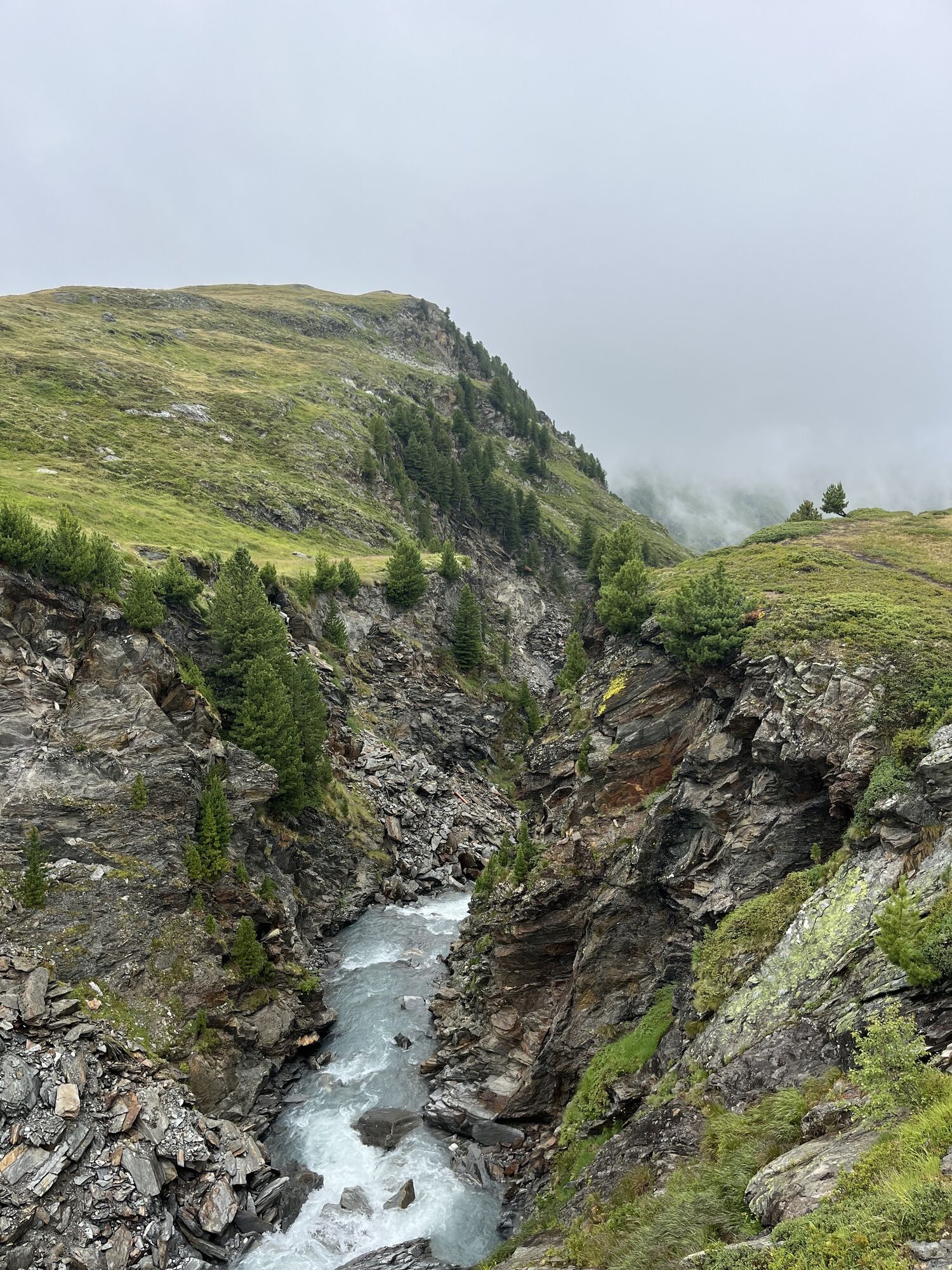
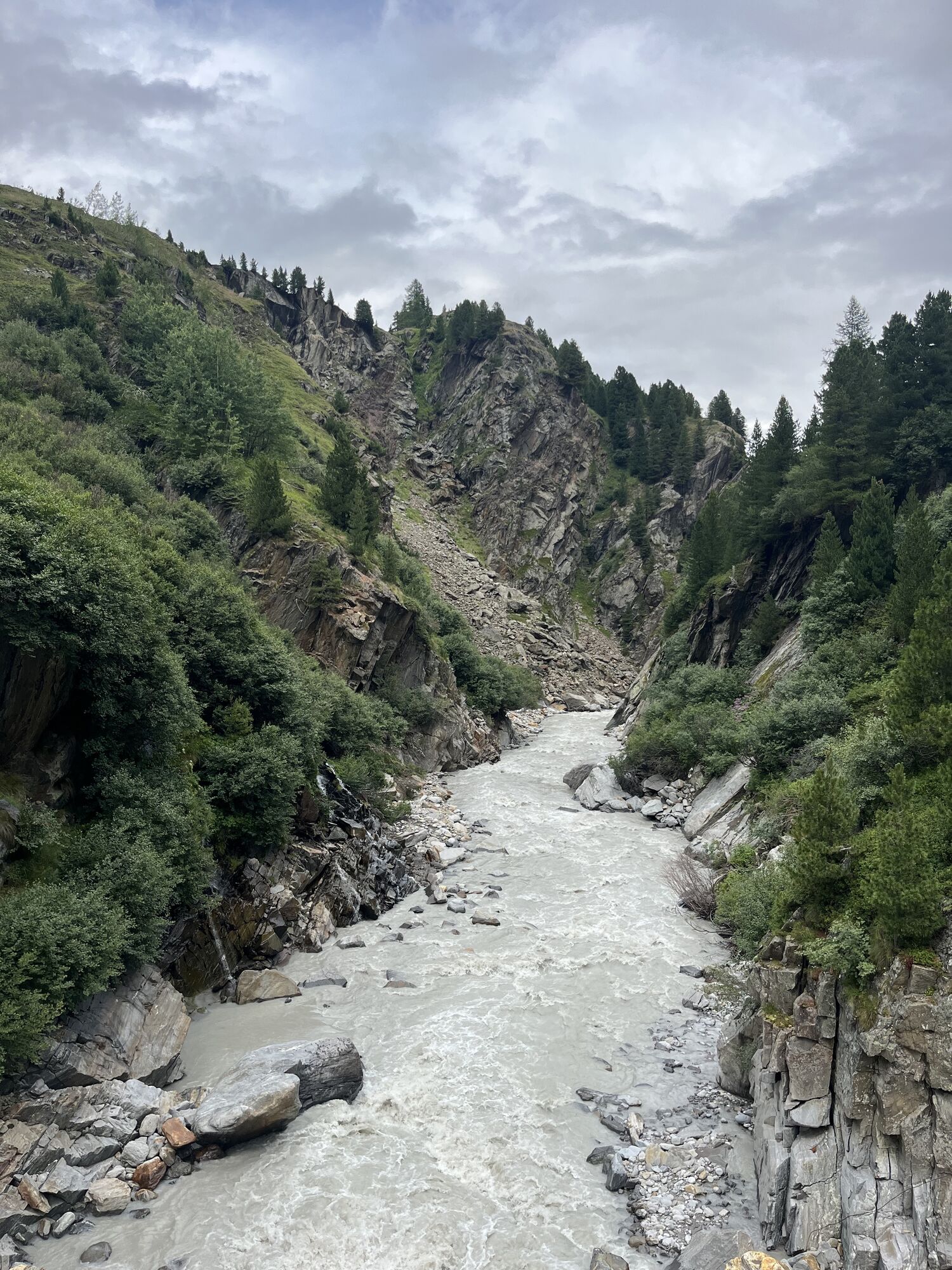

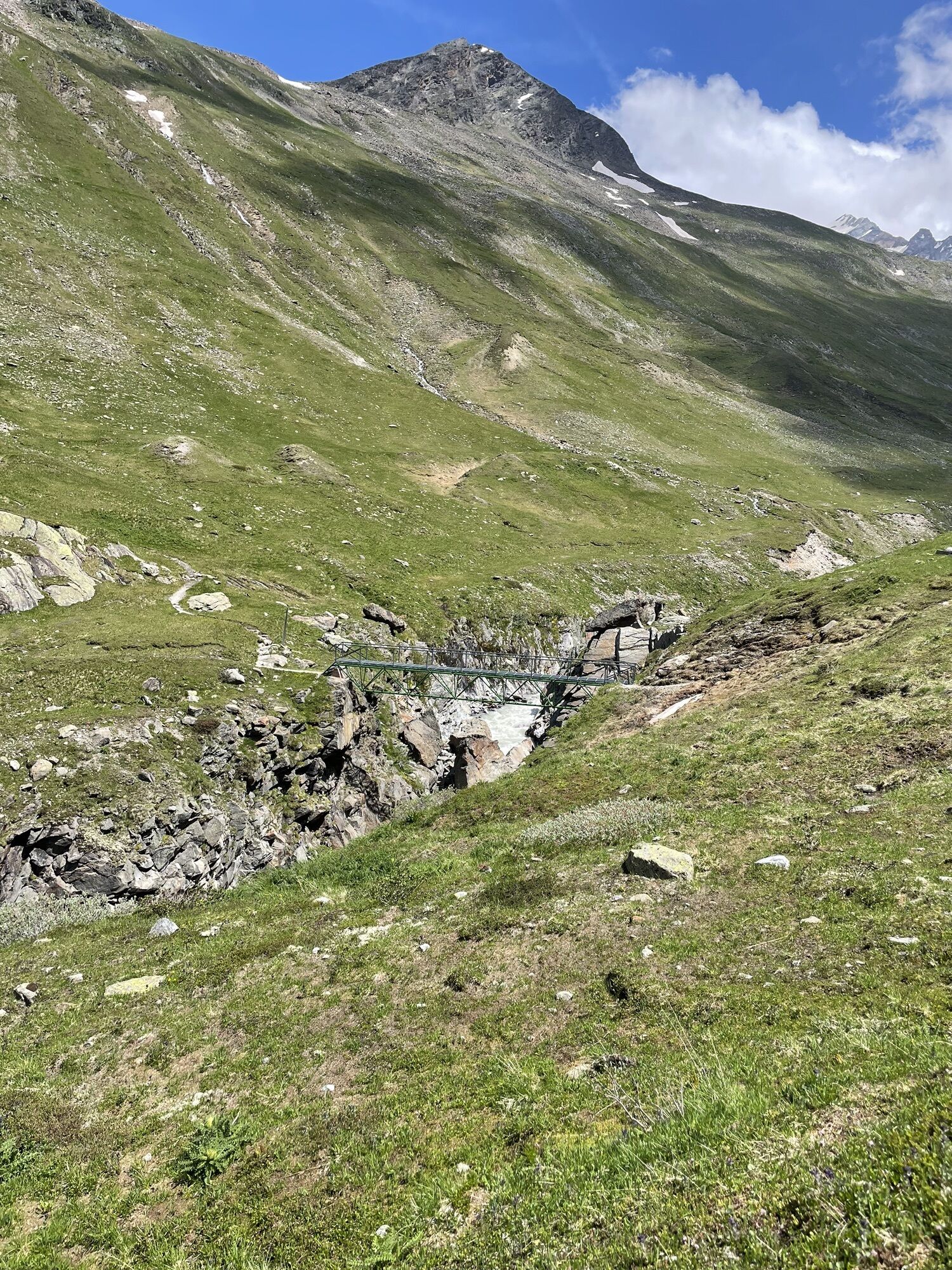

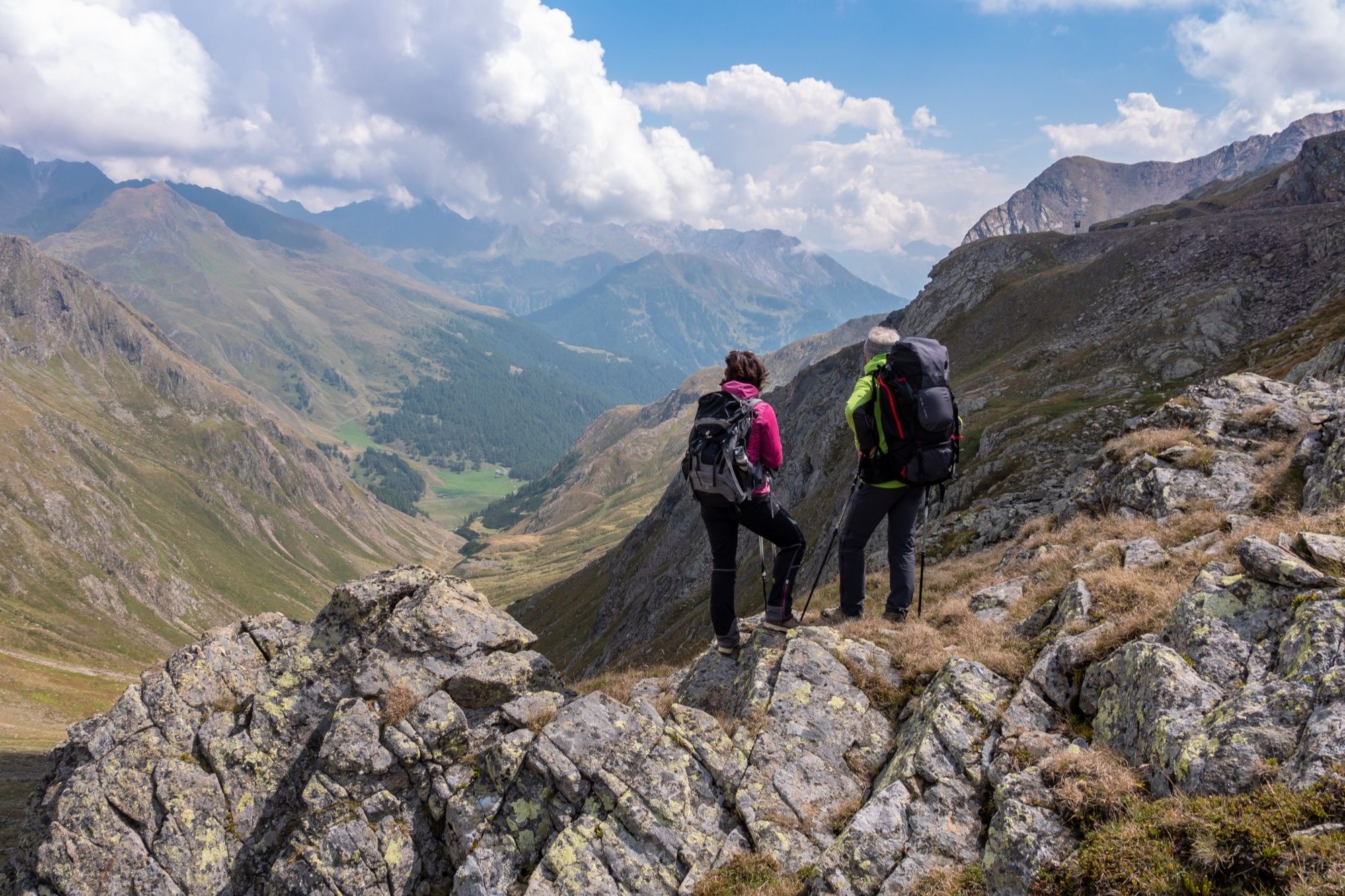
This E5 segment in high-alpine terrain is physically challenging and full of scenic highlights. Starting in the mountaineering village of Vent, a rather steep trail will take you across the Ramoljoch saddle...
Opis
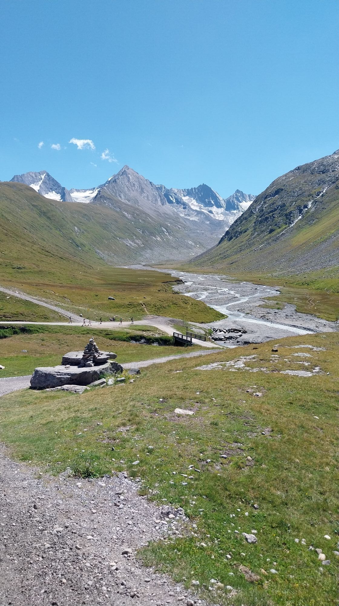
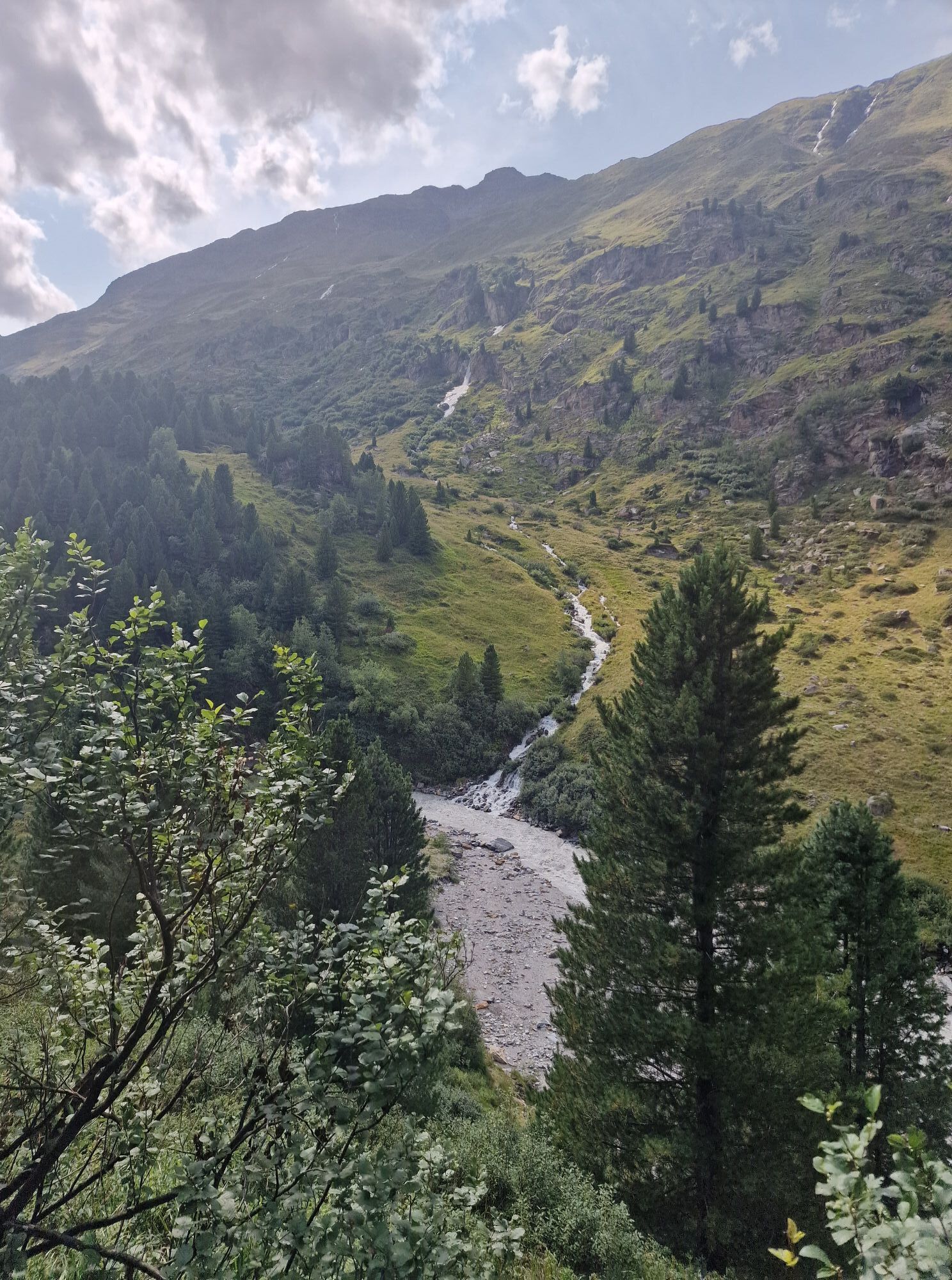
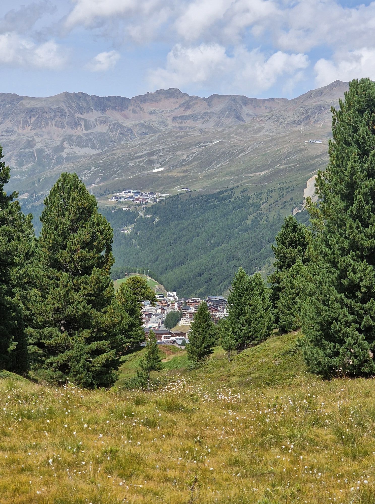
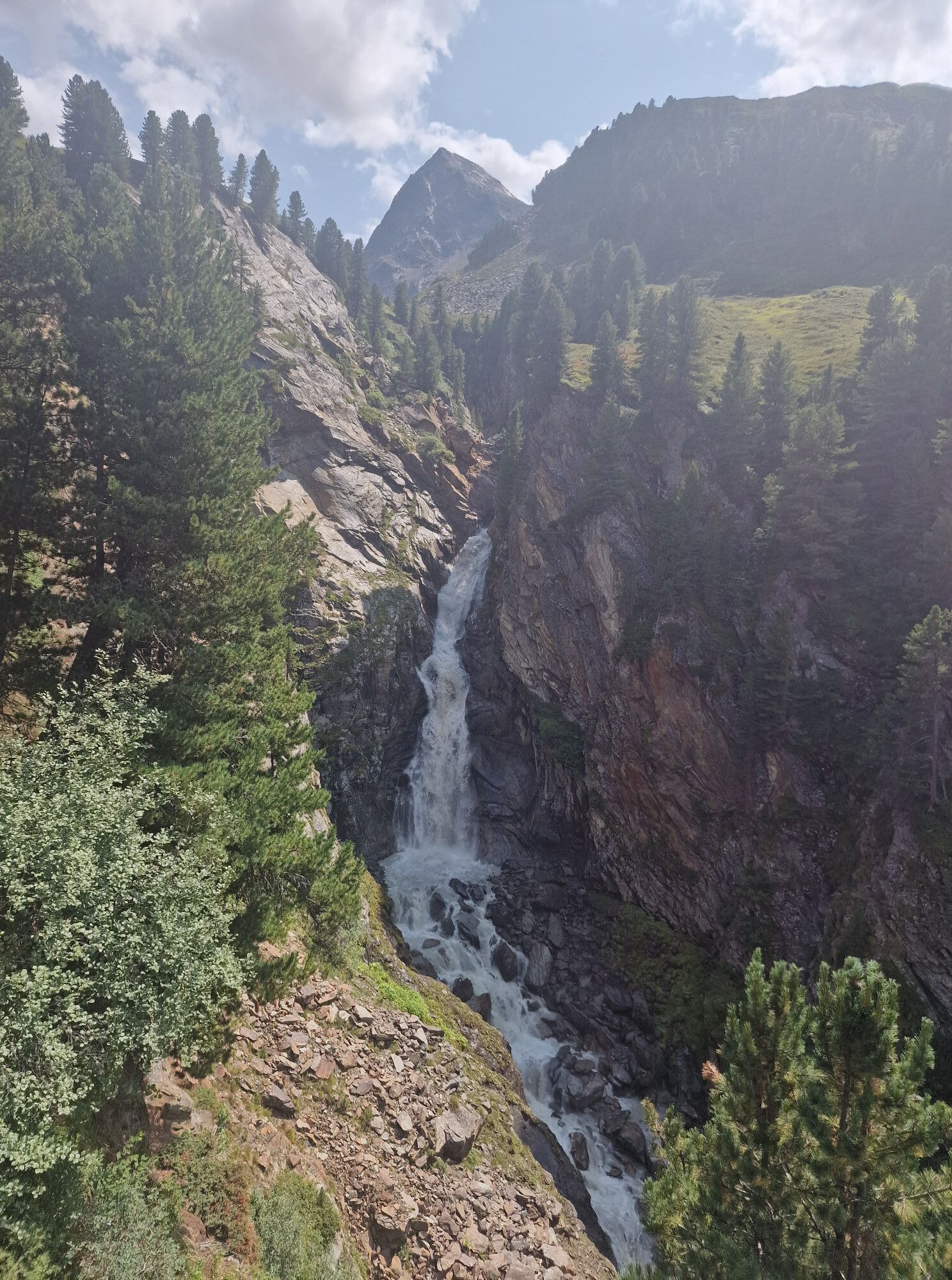
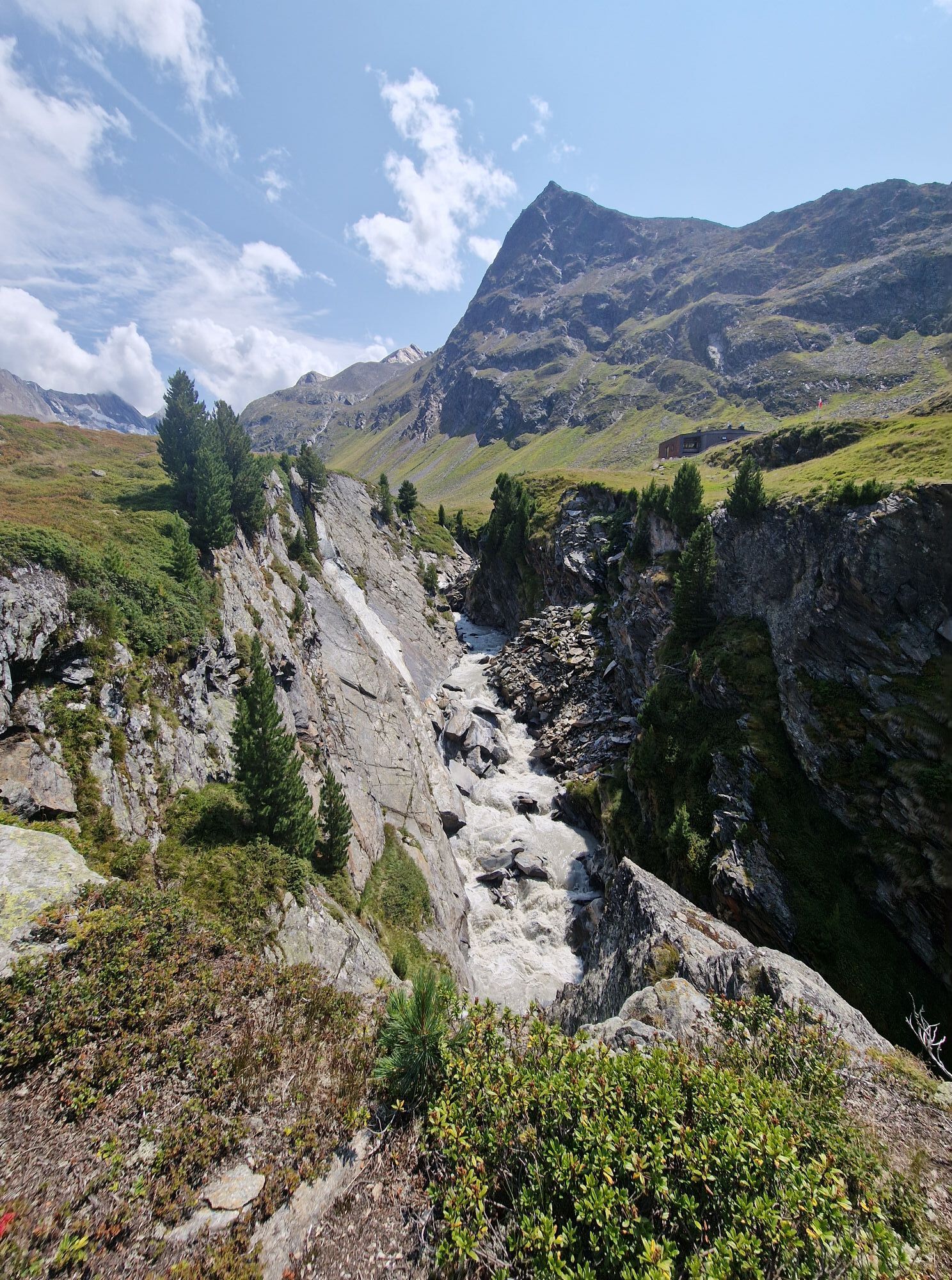
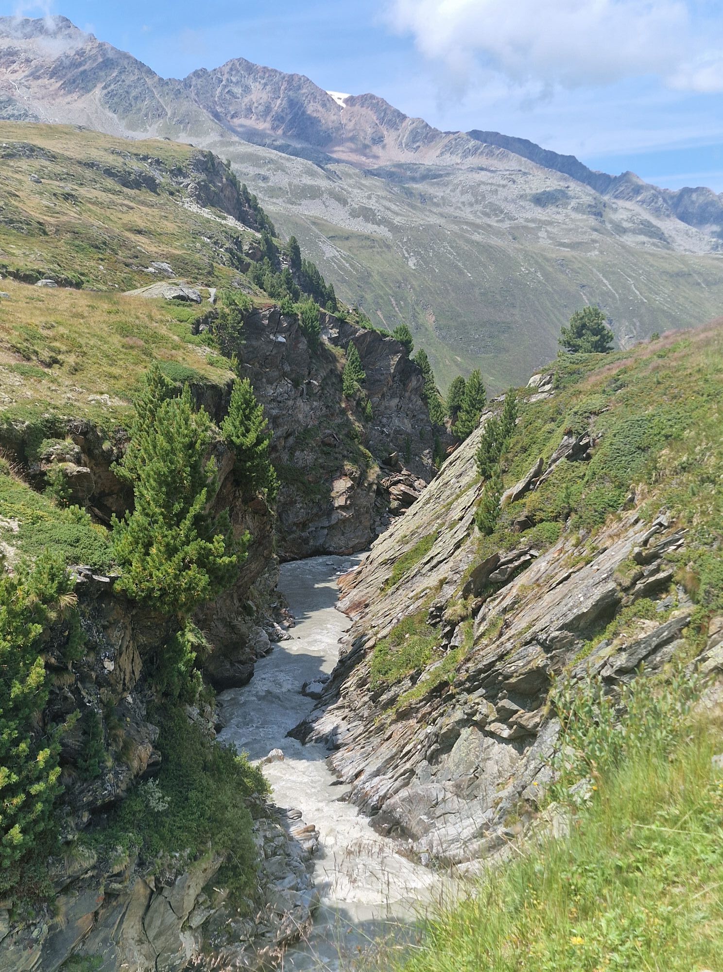
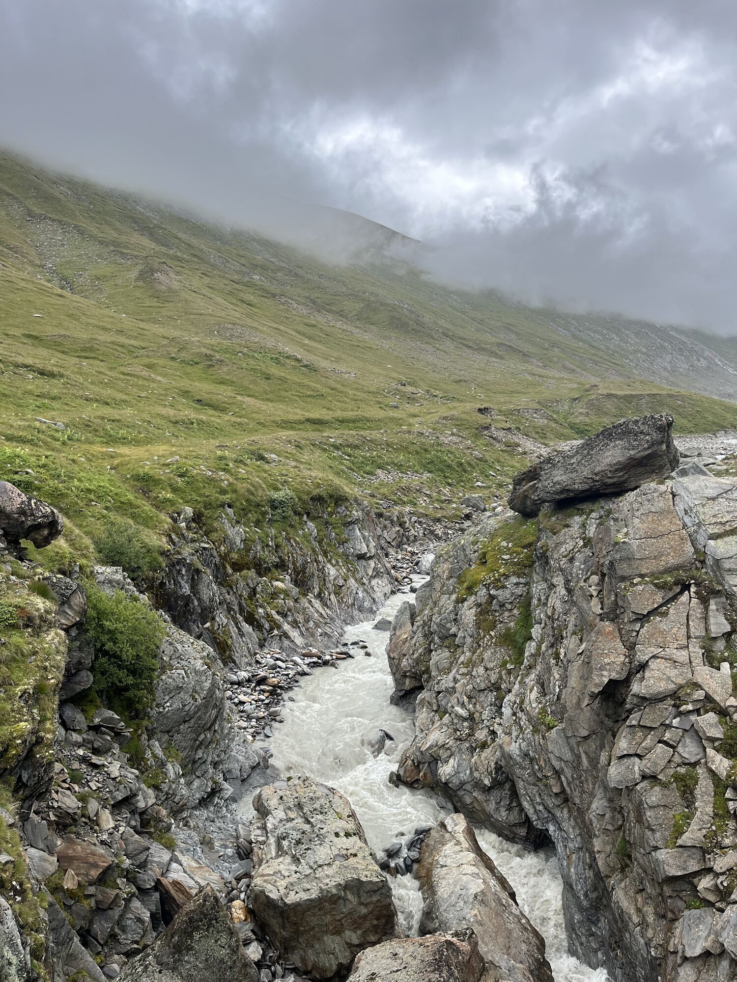
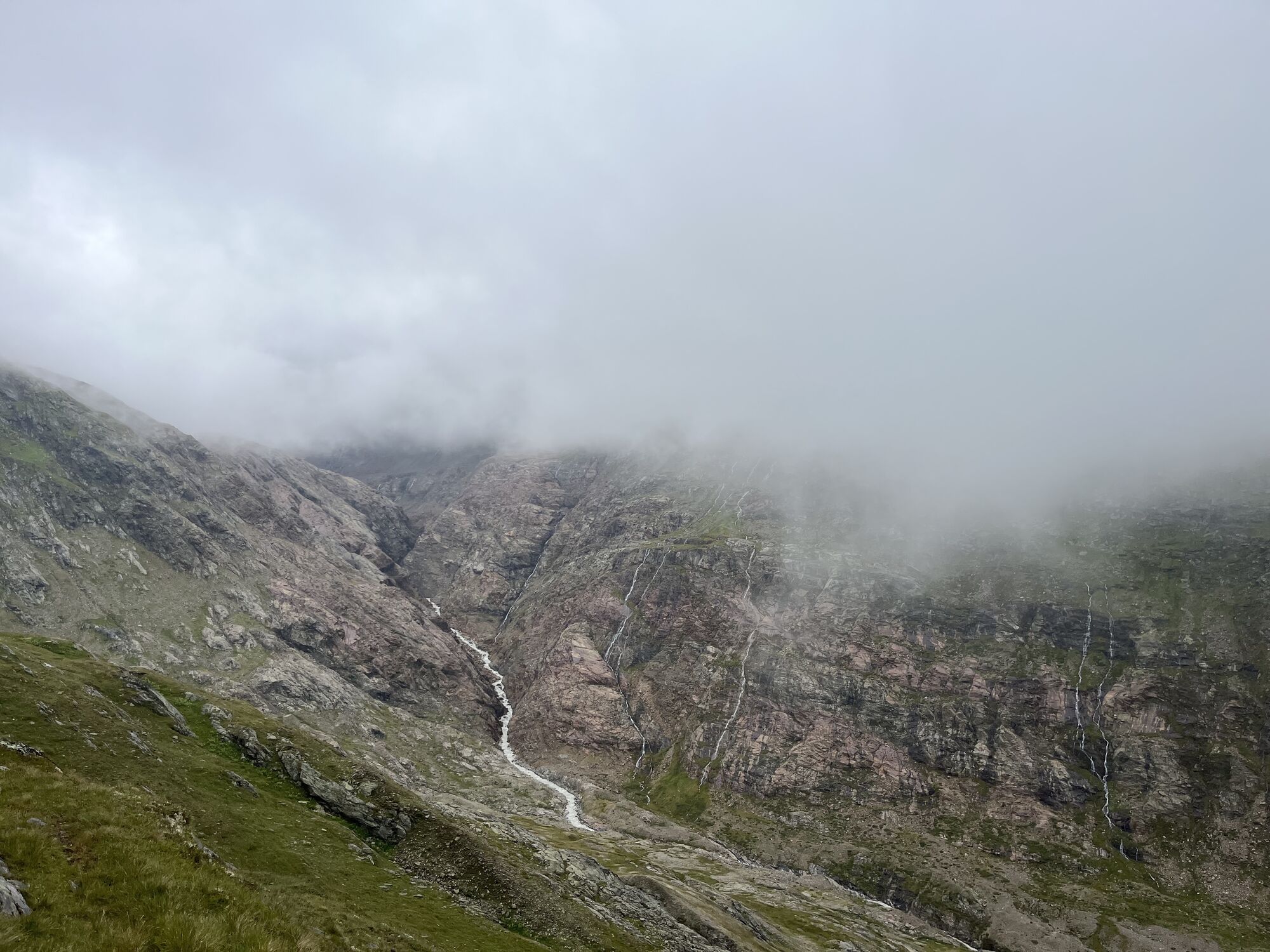
This E5 segment in high-alpine terrain is physically challenging and full of scenic highlights. Starting in the mountaineering village of Vent, a rather steep trail will take you across the Ramoljoch saddle (3,189 m) to Obergurgl. Right below the Ramolhaus Hut, there is the Piccard rope bridge across the Gurgler Ferner gorge. You will also be passing the Langtalereck Hut along the way. Make sure to stop at the viewing point on your way down. The views of the Gurglertal valley and the massive peaks at the end of the Ötztal valley are absolutely breathtaking. This challenging hike goes through the Ötztal Nature Park and the mystical Arolla Pine Forest before ending in Obergurgl, the highest Austrian village with a church at 1,930 m.
Pot
Vent
(1.883 m)
Vas
0,2 km
Kapelle in Vent
(1.885 m)
Kraj čaščenja
0,4 km
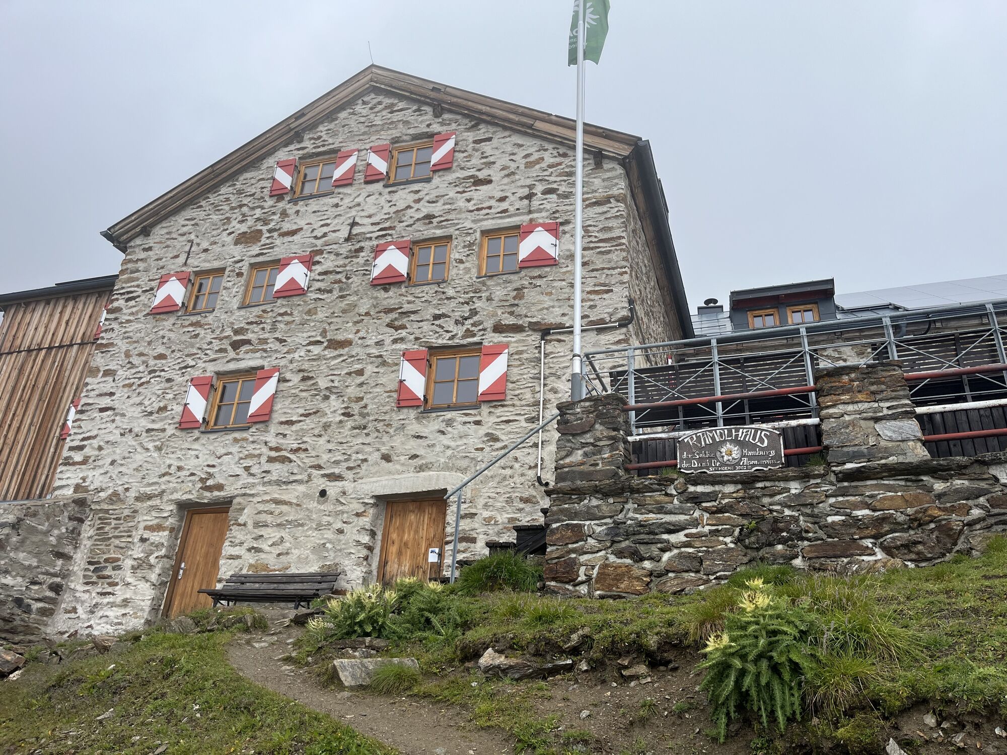
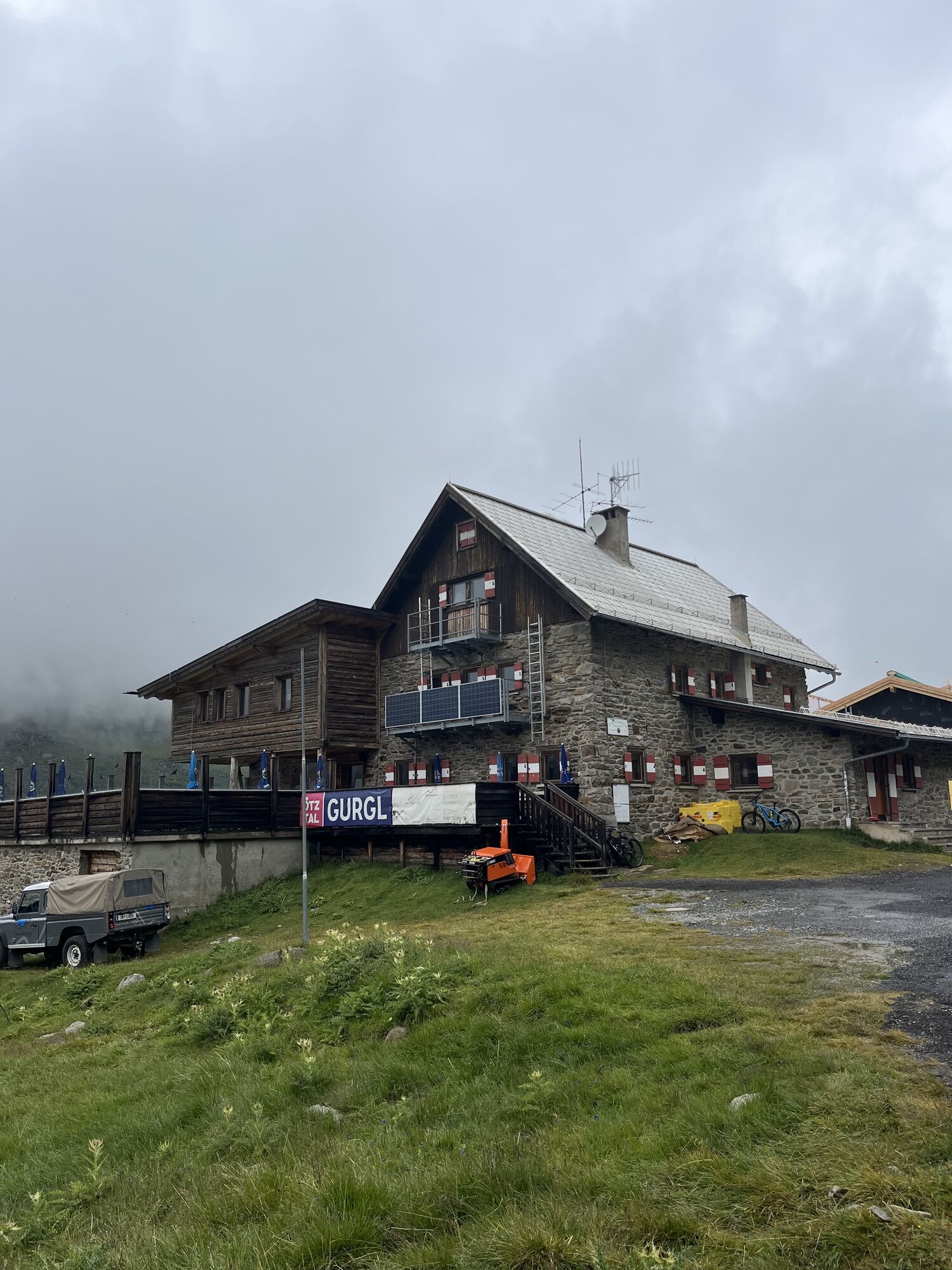
Ramolhaus
(3.004 m)
Zavetišče
7,9 km
Langtalereckhütte
(2.430 m)
Zavetišče
12,6 km
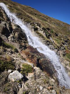
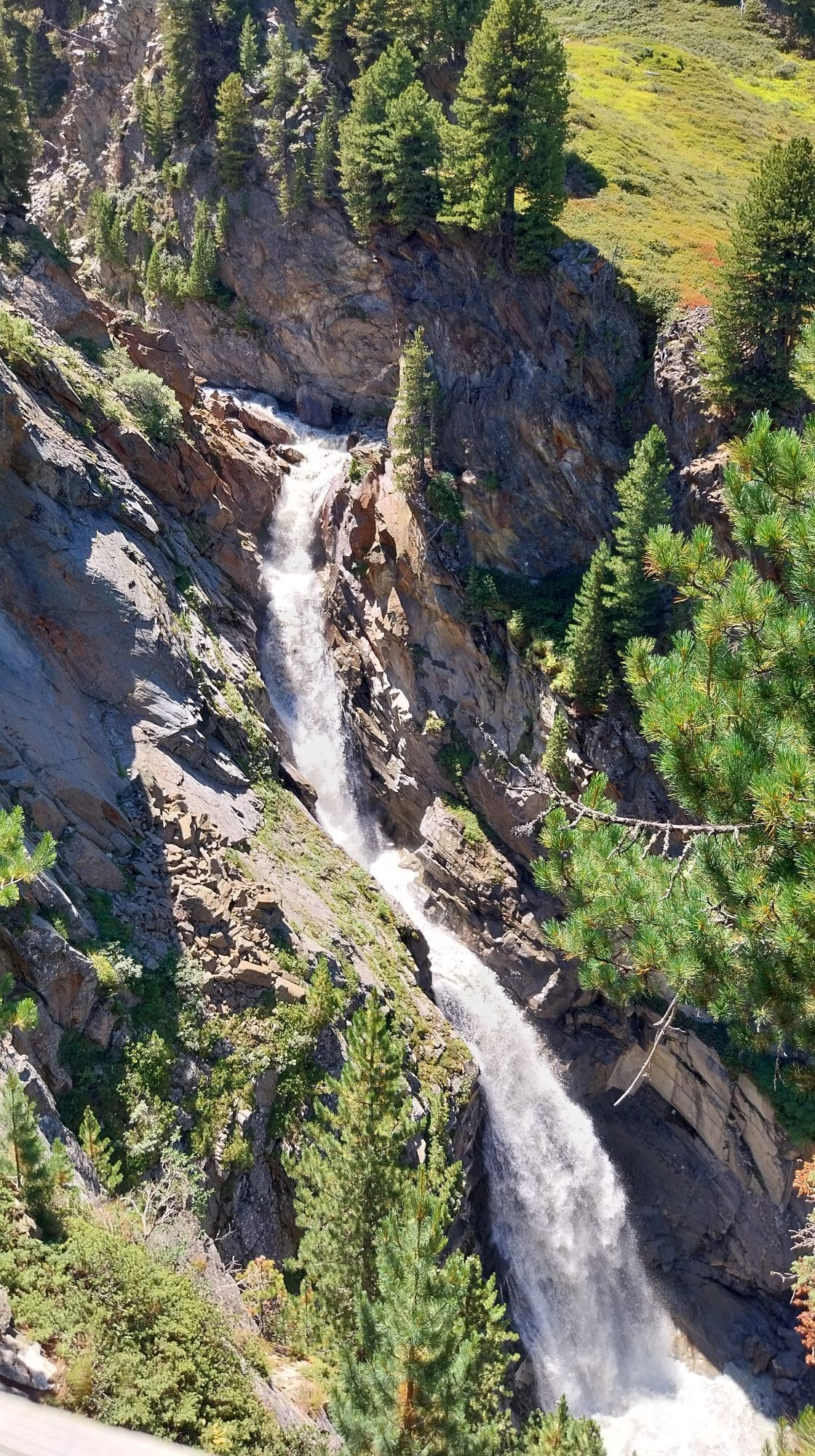
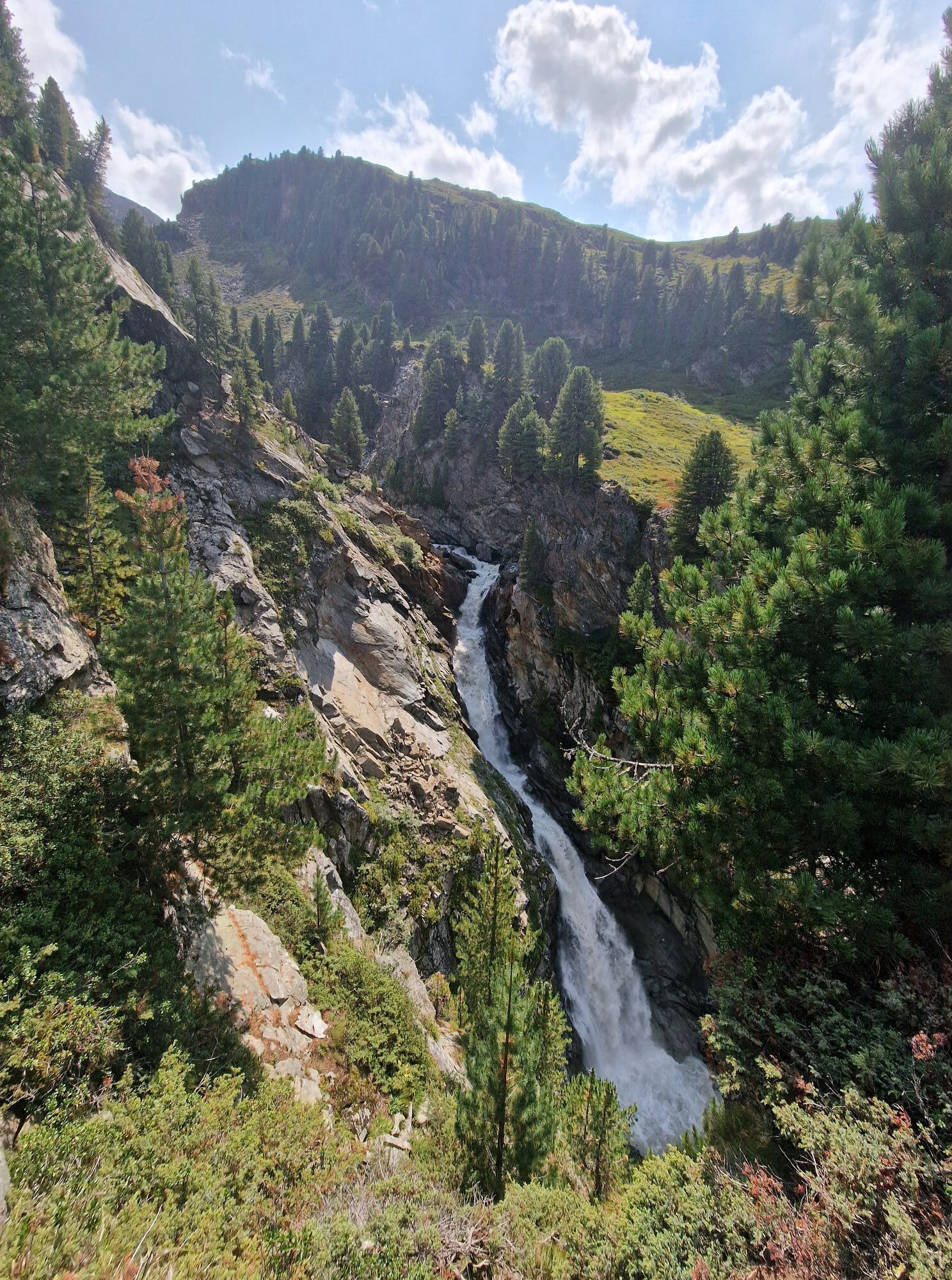
Rotmooswasserfall
(2.116 m)
Slap
17,2 km
Obergurgl
(1.907 m)
Vas
20,2 km
Hl. Johannes Nepomuk
(1.907 m)
Kraj čaščenja
20,2 km
Pot
European E5 long-distance hiking trail – King's Segment – Vent to Obergurgl (alternative route)
težko
Pohodništvo v daljavo
20,24
km
Wildspitze
(1.883 m)
Postaja gondole
0,2 km
Vent
(1.883 m)
Vas
0,2 km
Gampenlift
(1.892 m)
Postaja gondole
0,2 km
Kapelle in Vent
(1.885 m)
Kraj čaščenja
0,4 km
Gasthaus Pension Obervent
(1.892 m)
Restavracija
0,4 km
Ramolhaus
(3.004 m)
Zavetišče
7,9 km
Langtalereckhütte
(2.430 m)
Zavetišče
12,6 km
Schönwieshütte
(2.265 m)
Restavracija
15,9 km
Rotmooswasserfall
(2.116 m)
Slap
17,2 km
Zirben Alm
(1.954 m)
Restavracija
19,0 km
Obergurgl
(1.907 m)
Vas
20,2 km
Hl. Johannes Nepomuk
(1.907 m)
Kraj čaščenja
20,2 km
Avtor
Zagotavlja Ötztal


Informacije o prihodu
Prihod
The Ötztal is a southern side valley of the Inn valley. For your arrival by car, you can plan the best route from your home town with the route planner online at www.google.at/maps
Javni prevoz
Enjoy a both comfortable and relaxing train ride to the train station in Ötztal Bahnhof. You get off the train in ÖTZTAL Bahnhof where you change to a public bus or local taxi. The current bus schedule can be found at: http://fahrplan.vvt.at
Dodatne informacije in nasveti
Stopnja težavnosti
T4
Vrednotenja
5
(1)
4
(0)
3
(0)
2
(0)
1
(0)
Spletne kamere s turneje
Obergurgl
Hochgurgl
Venter Seilbahnen - DSL Wildspitze
Obergurgl
Alt Vent
Geierwallihof - Rofen/Vent
Gaisberg
Vent
Top Mountain Crosspoint Hochgurgl
Top Mountain Crosspoint Hochgurgl
Top Mountain Crosspoint Hochgurgl
Top Mountain Crosspoint Hochgurgl
Top Mountain Crosspoint Hochgurgl
Vent
Vent
Obergurgl
Obergurgl
Obergurgl
Obergurgl
Obergurgl
Obergurgl
Obergurgl
Top Mountain Crosspoint Hochgurgl

Priljubljeni izleti v okolici
- 4,3
Vorderkaser - Eishof / Texelgruppe
svetlobaPohodništvo 4,83 km - 4,8
Vent - Kreuzspitze
Pohodništvo 20,6 km - 4,4
Hochtour Wildspitze, 3.768m
srednjaVisokogorska tura 9,75 km - 3,1
Tiefenbachglacier - Mountaineering Village Vent
srednjaPohodništvo 10,8 km - 4,5
Vent - Wilder Mann - Breslauer Hütte - Stableinalm
srednjaPohodništvo 7,25 km - 4,9
Pfossental - vom Vorderkaser auf die Stettinerhütte
srednjaPohodništvo 23,7 km - 4,4
Hochwilde - Pfelders
srednjaVisokogorska tura 22,1 km - 5,0
Obergurgl - Ramolhaus
Pohodništvo 7 km - 4,8
Spronser Seen lakes: At the heart of the Texelgruppe Nature Park
težkoPohodništvo 15,1 km - 5,0
From Vent to the Similaun at 3,606 m
težkoVisokogorska tura 29,2 km
Pohodništvo in sledenje

Zaradi več kot 550.000 predlogov izletov, podrobnih zemljevidov in intuitivnega načrtovanja poti je aplikacija obvezna oprema za vse ljubitelje narave.

Ne zamudite ponudb in navdiha za naslednje počitnice
Naročite se na novice
Napaka
Zgodila se je napaka. Prosimo, poskusite znova.Zahvaljujemo se vam za prijavo
Vaš e-poštni naslov je bil dodan na poštni seznam.
Izleti po vsej Evropi
Avstrija Švica Nemčija Italija Slovenija Francija Nizozemska Belgija Poljska Lihtenštajn Češka Slovaška Španija Chorvátsko Bosna in Hercegovina Luksemburg Andora පෘතුගාලය අයිස්ලන්තය එක්සත් රාජධානිය අයර්ලන්තය ග්රීසිය ඇල්බේනියාව North Macedonia Malta Norway Montenegro Moldova කොසෝවො හන්ගේරියානු සමුහාණ්ඩුව San Marino රුමේනියාව එස්ටෝනියා ලැට්වියාව බෙලාරස් සයිප්රස් Lithuania Serbia බල්ගේරියාව Monaco ඩෙන්මාර්කය Sweden ෆින්ලන්තය