


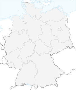


Moselsteig Detour Graf Georg Johannes route
The namesake of this Moselsteig detour - Graf Georg Johannes - is the most famous descendant of the Counts of Veldenz, also because in 1563 he married a daughter of King Gustav I of Sweden. The lineage...
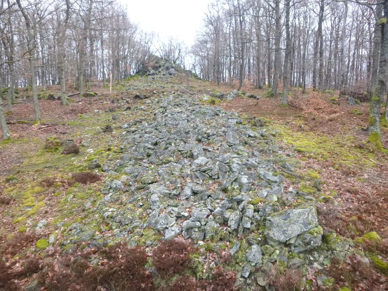
The namesake of this Moselsteig detour - Graf Georg Johannes - is the most famous descendant of the Counts of Veldenz, also because in 1563 he married a daughter of King Gustav I of Sweden. The lineage history of the Counts of Veldenz is repeatedly highlighted along this approximately 14 km detour. The residence of the former count, Veldenz Castle with its ruins, can also be admired from many viewpoints along the path. A roughly 90-meter-long stone wall, the remains of a former Celtic refuge fort, also impresses on the route.
The start and end point of the route is the romantic town of Veldenz. The hiking trail winds along the hillsides of the Veldenzer Bach and Hinterbach. The stream is crossed twice. Then you have to prepare yourself for the ascent again!

The starting point for the Graf Georg Johannes route is in the heart of Veldenz near the Villa romana. The path crosses the Veldenzer Bach within the town and will do so several more times before returning to Veldenz. From the outskirts, it continues on the Sonnenweg into the valley. The Mühlgraben babbles beside you, and soon the path will reveal for the first time a view of Veldenz Castle, which majestically towers on the rock in the middle of the valley.
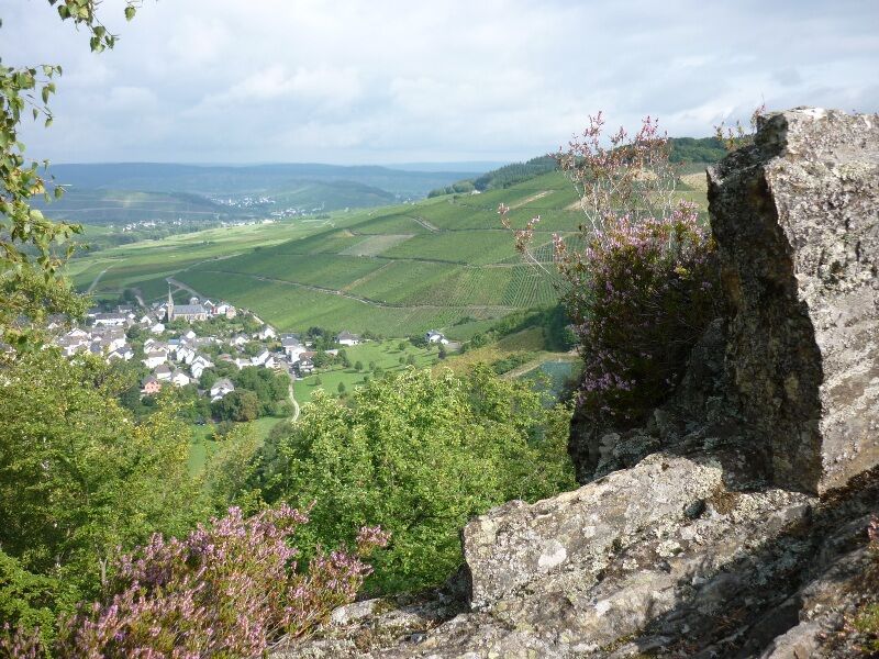
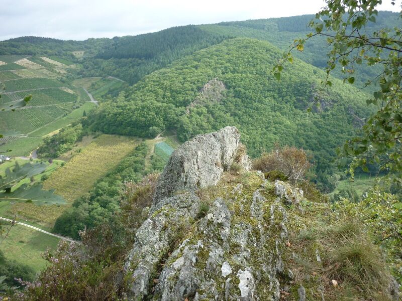
The path now runs above the Mühlgraben through the forest. After a few meters, the hiking direction changes and the path ascends steeply. After a short section of trail, you reach a wider path, which shortly after arrives at Runder Hammer rock. A brief detour to the viewpoint rock is worthwhile. In one direction, you see the houses lined up in the valley of Thalveldenz with the castle on the hill spur, and in the other direction Veldenz with the adjoining vineyards. Not far away is the Langer Hammer rock, which also offers a beautiful view.
Steeply ascending, the path leads through the lower oak forest. After a short flat section, you reach the next viewpoint. Exactly opposite Veldenz Castle, the path has now reached the height of the castle. An impressive slate rock flanks the next viewpoint. Veldenz Castle is visible again, this time you are already higher than the bergfried (keep). From here, the path briefly leads downwards to the main path. It then gently ascends again, first through coniferous forest, later through deciduous forest. At the top, you reach a large meadow with an open view towards the Mosel hills.
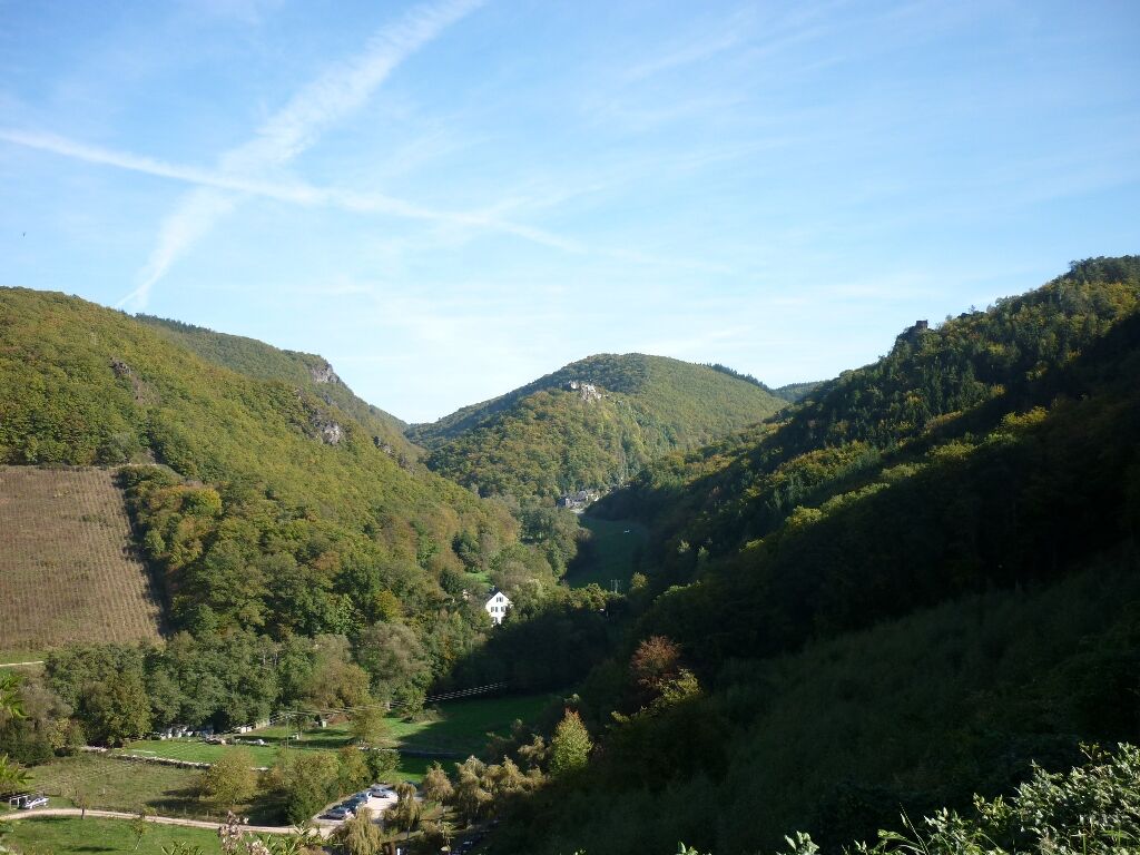
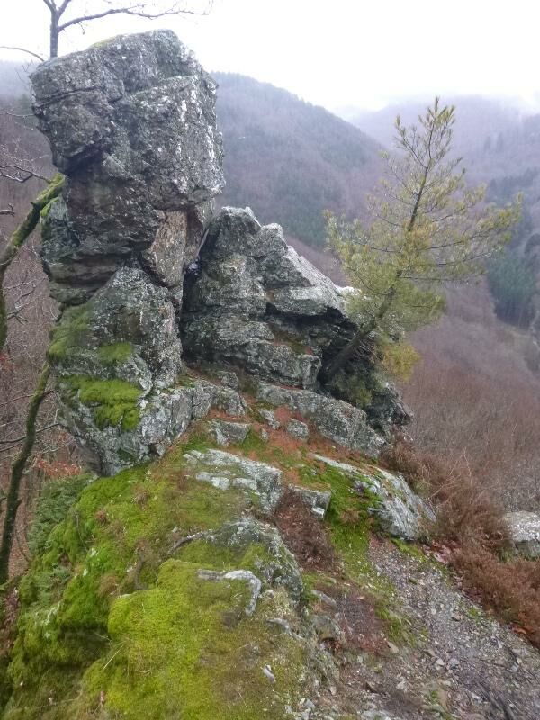
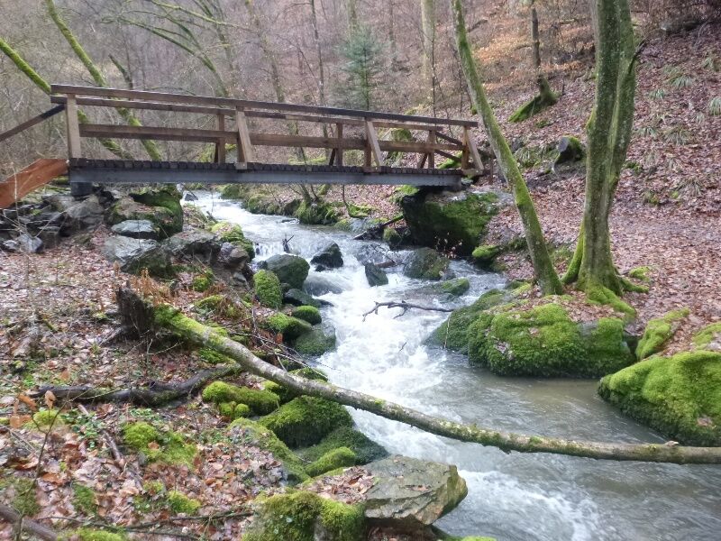
The first really big ascent is done! Now you hike for some time without major elevation changes through the forest. A path then runs through lower oak forest along a steep slope studded with slate rocks. A fantastic path! After a bit of up and down on the slope, you reach a free-standing rock that again offers a free view into Hinterbachtal. From here, the path only goes downhill, sometimes on a trail, then again on a forest track, and lastly very steeply. Along a small side stream, the path finally reaches the valley floor of Hinterbachtal. The Graf Georg Johannes route now leads directly along the rushing stream. The path winds sinuously through the forest and crosses two bridges built especially for the Moselsteig route detour. At a shelter, you can stop right in the untouched nature. The only sound here is the rushing of the Hinterbach. The hiking path continues on the forest track past an impressive rock. In the valley of Hinterbach, several mills once stood. From the Kaffeemühle (coffee mill), the building and water wheel are still preserved. Shortly after, you also reach the Thielenmühle (refreshment possibility).
At Thielenmühle, the detour crosses the Hinterbach one last time. Then it goes uphill again. For quite a stretch, the Graf Georg Johannes route follows the forest track. A small forest meadow provides a change of scenery before you reach the "Heidenmauer" at the height. A large rock and a wall made of gathered slate stones are the remains of a Celtic refuge fort. Along the stone wall, it goes downhill. Further below, you reach the Kalmbach, where slate rocks also line the path. Along the Kalmbach, continuing downhill on a path finally leads you to the first houses of Thalveldenz. From here, a path leads as a detour to Veldenz Castle. Unfortunately, the impressive castle complex can only be visited as part of guided tours.
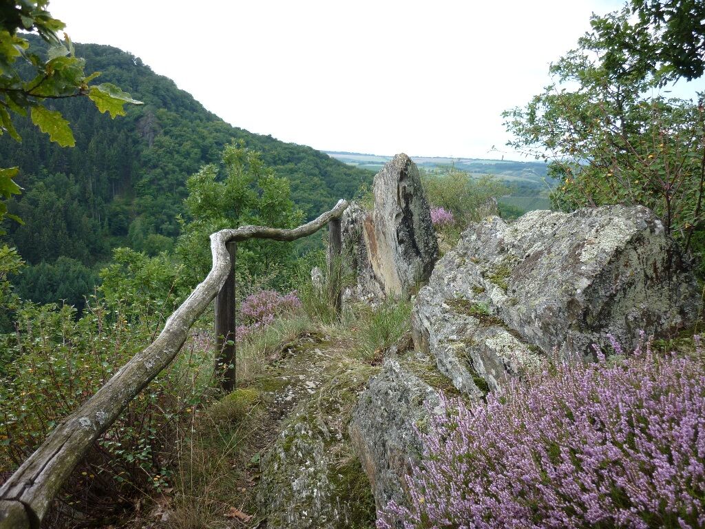
It goes uphill again on a forest track. After the ascent, the path becomes narrower and finally leads as a trail through the steep slope. The rocky viewpoints of Rittersturz and Josephinenhöhe are definitely worth a detour. Veldenz, the Veldenzer Bachtal, and Veldenz Castle lie at your feet. You also have a nice overview of the distance covered. The following path leads the detour hiker steeply downhill in many switchbacks towards Veldenz. Passing the Protestant church, you reach the town. On the main street, the circle closes again for detour hikers on the Graf Georg Johannes route.
Da
Caution is advised on the rocky sections when wet. In Hinterbachtal, sections of the path can be impassable during floods.
B 53 between Bernkastel and Brauneberg, in Mülheim (Mosel) the K 88 branches off to Veldenz.
Veldenz can only be reached Monday to Friday by bus line 333 (Bernkastel-Neumagen). Stop: Veldenz, town.
Small parking lot on Hollandstraße behind the tourist information, large parking lot on the outskirts at K 88 (from Mülheim), motorhomes also possible
Da
Mosellandtouristik GmbH
Kordelweg 1, 54470 Bernkastel-Kues; Phone: 06531/97330
Tourist Information Ferienland Bernkastel-Kues
Gestade 6, 54470 Bernkastel-Kues; Phone: 06531/500190
Make sure to pack food for your backpack. The route offers beautiful picnic spots (e.g., the meadow on the height west of Mülheimer Forest or Josephinenhöhe).
Priljubljeni izleti v okolici
-
5.0
Traumschleife Hunolsteiner Klammweg
težkoPohodništvo 11.9 km -
5.0
Moselsteig Stage 11: Bernkastel-Kues - Ürzig
srednjaPohodništvo v daljavo 17.1 km -
4.7
Star route around Bernkastel-Kues - Route 2: Circular route on the Mosel Cycle Route via Trittenheim to Bernkastel-Kues
svetlobaKolesarjenje 57.0 km -
Moselsteig (entire route). Your way to experience more.
srednjaPohodništvo v daljavo 348.8 km -
4.5
Moselsteig stage 12: Ürzig – Traben-Trarbach
srednjaPohodništvo v daljavo 15.1 km -
4.0
Moselsteig side route Leiermannspfad
srednjaPohodništvo 10.9 km -
5.0
Moselsteig stage 13: Traben-Trarbach – Reil
srednjaPohodništvo v daljavo 15.3 km -
4.0
Mosel cycle path (entire route): From Perl to Koblenz
težkoKolesarjenje na dolge razdalje 247.9 km -
5.0
Traben-Trarbach - Bernkastel en terug
srednjaPohodništvo 17.2 km -
5.0
Moselsteig Stage 08: Leiwen – Neumagen-Dhron
svetlobaPohodništvo v daljavo 14.1 km

Pohodništvo in sledenje


Ne zamudite ponudb in navdiha za naslednje počitnice
Vaš e-poštni naslov je bil dodan na poštni seznam.