


CESANA T.SE La Coche-Punta Rascià-Colle Bercia-Valle Gimont Loop
The loop route starts in the locality La Coche in the municipality of Cesana T.se; in the first section it follows the “Sentiero degli Alpini” crossing a wonderful forest made mainly of conifers with a...
The loop route starts in the locality La Coche in the municipality of Cesana T.se; in the first section it follows the “Sentiero degli Alpini” crossing a wonderful forest made mainly of conifers with a lush undergrowth rich in flowers and shrubs of all kinds; the trail, bordered by precious dry stone walls, after several zigzags along the slope, reaches the ridge section offering a very wide panorama. There are numerous demolished military positions and some structures resulting from the modern tourist vocation of the locality. Then it continues on a comfortable dirt road winding through alpine meadows and forest, but always in open and panoramic surroundings.
Technical support and description by Barbara Demonte - Environmental hiking guide.

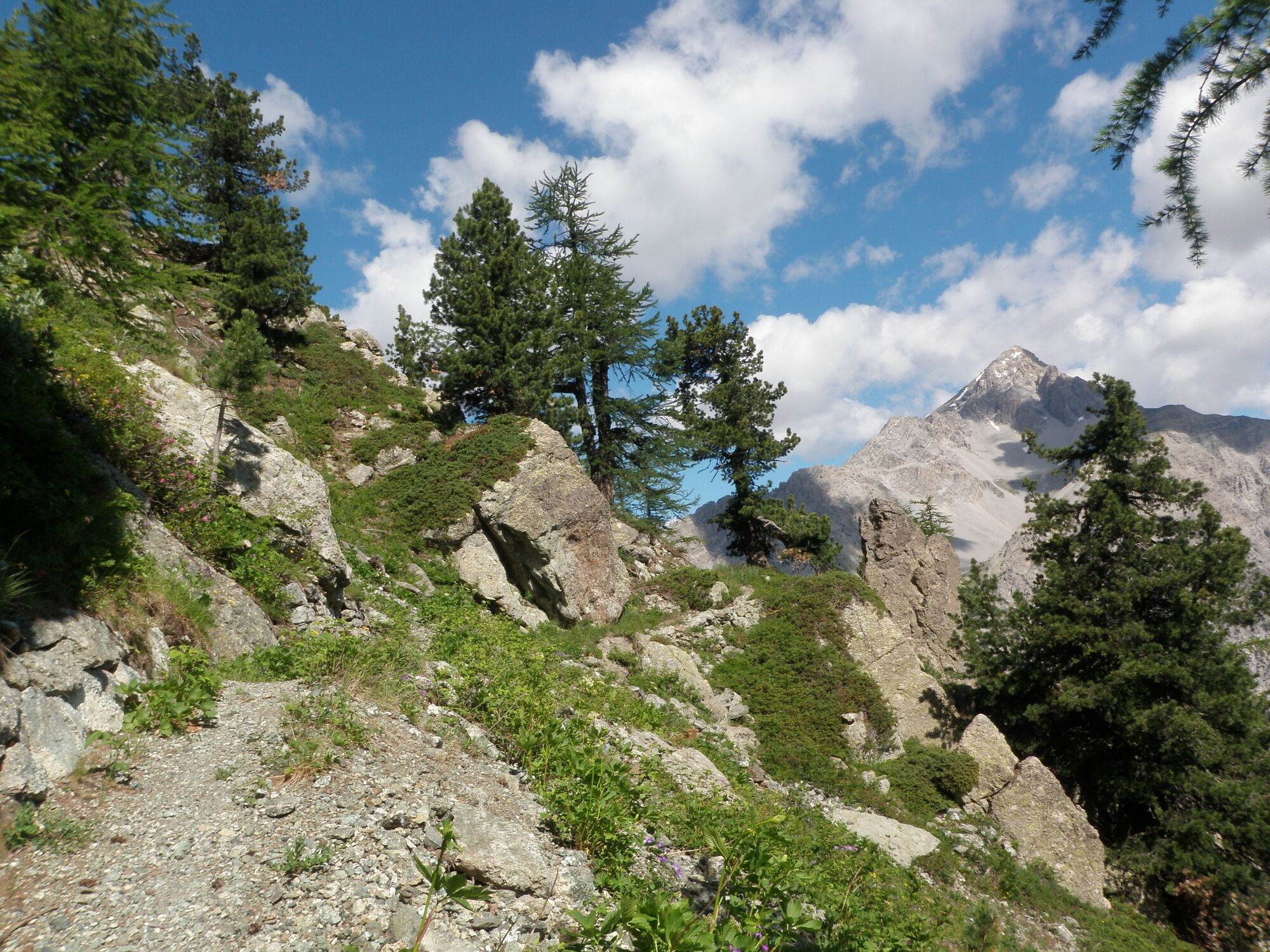
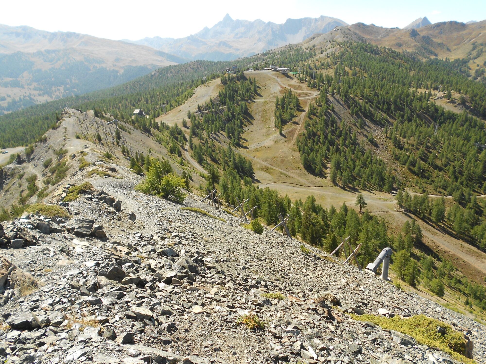
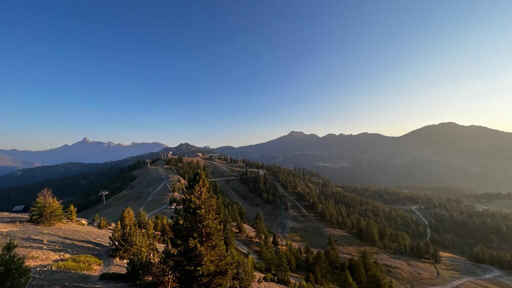
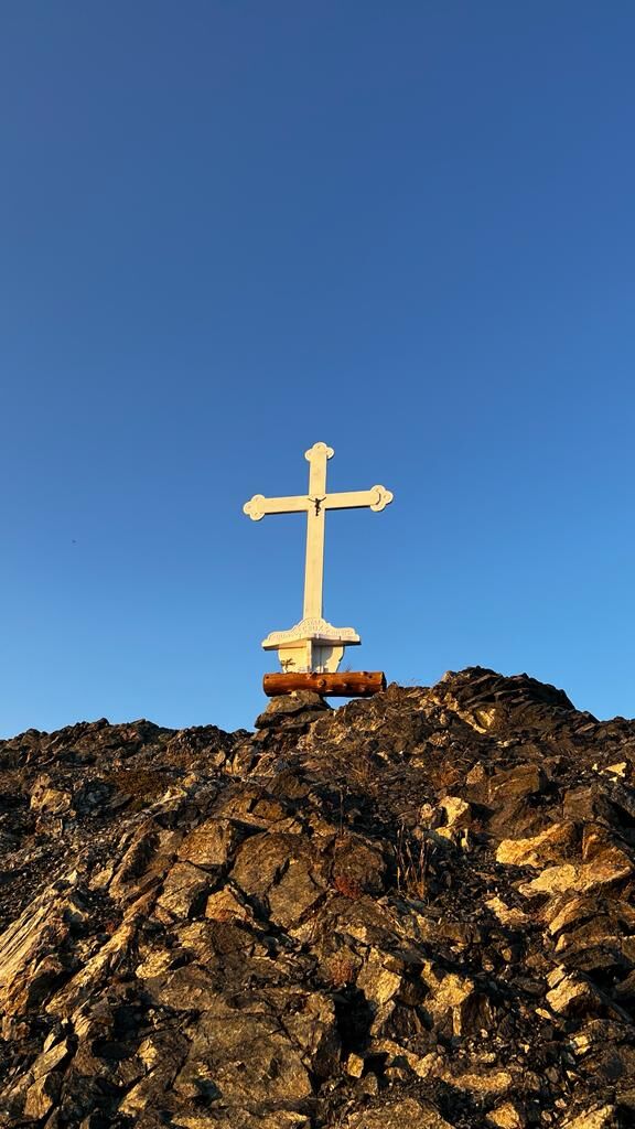
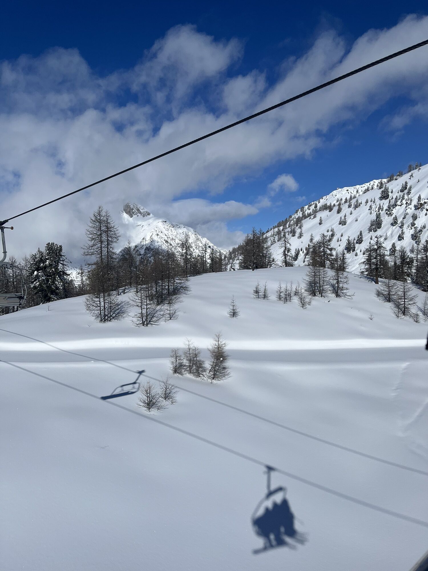
The route starts in the locality of La Coche at an altitude of 1,920 m, reachable on foot via trail no. 1, or by car following the road, partly asphalted and partly dirt, starting beside the Church of the Visitation of Mary in Claviere (TO); due to the characteristics of the road surface, the use of off-road vehicles is recommended and caution in any case; parking is available near the two restaurants. Continue on the road towards Sagnalonga for about ten meters after Baita La Coche, finding the sign indicating Punta Rascià high on the right; reaching it, you join a track climbing along the contour above the road for about 400 m until, at about 1,950 m where the track turns sharply right, abandon it heading towards the large wooden sign slightly down and to the left, indicating Punta Rascià and the Alpini Trail. Alternatively, from the restaurant you can follow the road to Sagnalonga, open to traffic, for about another 500 m and at a small widening on the left, ascend to the right to intercept the trail at the previously mentioned wooden sign. The route enters the dense forest, and at about 2,100 m begins the spectacular phase of the Alpini trail, along stone walls and panoramic hairpin bends. At about 2,200 m you pass in front of the entrance to a military cave; on some short sections the trail is steep, narrow or slightly exposed, so caution is needed. At about 2,310 m the trail passes the sign for a panoramic point on the small saddle to the right, continuing flat to the left. Continuing at the same altitude flanking the avalanche barriers on the slope toward Sagnalonga, you reach another fork with signs: follow the right sign to reach the very close ridge and shortly Punta Rascià at 2,344 m; alternatively, to avoid the ridge path which is never difficult but certainly more technical, you can follow the other sign going straight along the contour line still flanking the avalanche barriers and arrive at the Bercia Pass. From Punta Rascià, continuing on the ridge, follow the track that begins to descend passing at about 2,290 m near a large white cross, to finally reach Colle Bercia at 2,250 m in the municipality of Cesana Torinese, where the Alpini Trail ends.
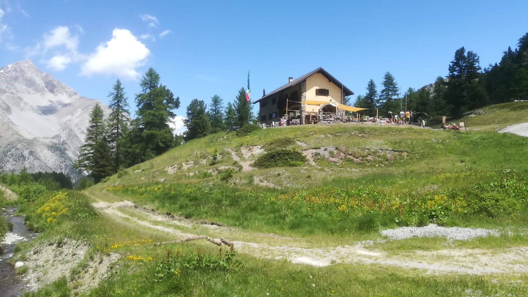
From the pass take the dirt road descending north towards the Gimont refuge; after some switchbacks the descent softens for a stretch passing next to a bog and shortly after, at about 2,180 m, near a ski lift. Continuing always on the dirt track and ignoring a small road at 2,090 m which to the left leads to Grangia Gimont, finally you reach the Gimont Refuge overlooking Lago Freddo (altitude 2,050 m).
From the refuge descend to Lago Freddo just below and take the dirt road going down on the right towards north, comfortably returning to Grange La Coche via a panoramic route; alternatively, preferring the forest, a trail starts on the left about 200 meters along the same road and after following along the stream for a long time, passing by the Cippo Vinçon monument, crosses a track and comes out just below Grange La Coche on the road leading back to Claviere.
Da
Wear clothing and footwear appropriate for the environment and season.
From Turin follow the signs for the North Ring Road towards Trafori - Frejus. Take the A32 highway towards Bardonecchia and exit the highway at Monginevro Sestriere. At the tunnel exit continue right towards Cesana and then Claviere, Monginevro/France.
Parking at Grange La Coche near the restaurants.
If you want to climb on foot from Claviere (trail no. 1), parking is along the provincial road near the Church of the Visitation of Mary, or near the start of the “Col Boeuf” lift by taking the path that starts beside the church and goes down into the basin below.
Refreshment points at Grange La Coche and Val Gimont
Be careful in the short slightly exposed sections along the ascent part of the Alpini trail.
Priljubljeni izleti v okolici
- 5,0
BARDONECCHIA Col des Acles - Passo della Mulattiera
srednjaPohodništvo 6,23 km - 5,0
SESTRIERE Monte Rognosa
težkoPohodništvo 6,42 km BARDONECCHIA - Loop Colle della Scala - Col de Montgenèvre - Colle del Sestriere
težkoCestno kolo 91,9 km- 5,0
CESANA T.SE Cesana - Fenils
svetlobaPohodništvo 4,60 km - 5,0
CESANA T.SE Thures - Cima Bosco
težkoSnežni čevlji 3,94 km - 5,0
BARDONECCHIA Chesal nature route
svetlobaPohodništvo 3,48 km CESANA T.SE Lago Nero - Seven Colors Lake
srednjaPohodništvo 3,51 kmGR® 5 La grande traversée des Alpes
srednjaPohodništvo 95,6 kmCESANA T.SE Val Thuras
srednjaPohodništvo 7,58 kmAscension du Col du Granon (2413 m)
srednjaMountainbike 11,3 km
Pohodništvo in sledenje


Ne zamudite ponudb in navdiha za naslednje počitnice
Vaš e-poštni naslov je bil dodan na poštni seznam.