


Gamseck summit and two via ferratas
Fotografije naših uporabnikov
 © BarbaraUstvarjeno na 25.04.2026
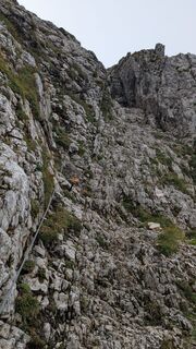
 © Martin TemmUstvarjeno na 07.09.2025
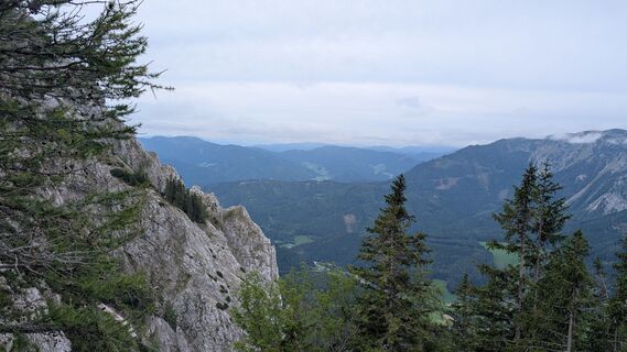 © Martin TemmUstvarjeno na 07.09.2025
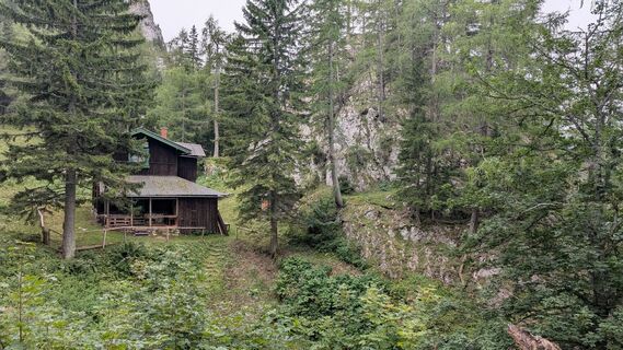 © Martin TemmUstvarjeno na 07.09.2025
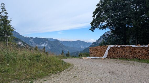 © Martin TemmUstvarjeno na 07.09.2025
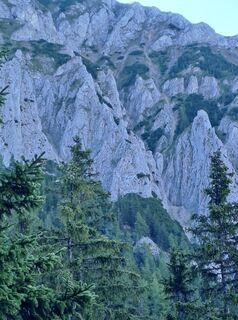
 © rene suliUstvarjeno na 24.08.2025
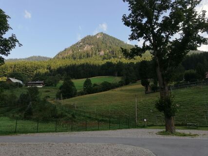
 © Helmut PachmanUstvarjeno na 14.08.2025
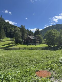
 © Emma ValekovaUstvarjeno na 05.08.2025
 © Emma ValekovaUstvarjeno na 05.08.2025
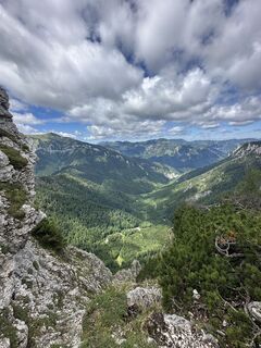 © Emma ValekovaUstvarjeno na 05.08.2025
 © Emma ValekovaUstvarjeno na 05.08.2025
 © Emma ValekovaUstvarjeno na 05.08.2025
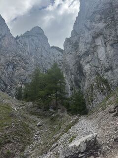 © Emma ValekovaUstvarjeno na 05.08.2025
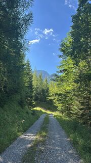 © Emma ValekovaUstvarjeno na 05.08.2025
 © Emma ValekovaUstvarjeno na 05.08.2025
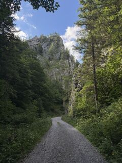 © Emma ValekovaUstvarjeno na 05.08.2025
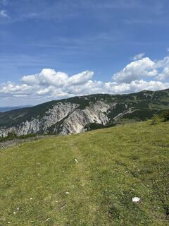
 © Luca PirkerUstvarjeno na 20.07.2025
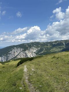 © Luca PirkerUstvarjeno na 20.07.2025
 © Luca PirkerUstvarjeno na 20.07.2025
 © Luca PirkerUstvarjeno na 20.07.2025
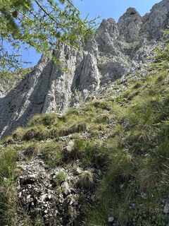 © Luca PirkerUstvarjeno na 20.07.2025
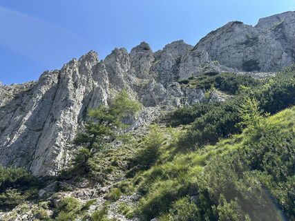 © Luca PirkerUstvarjeno na 20.07.2025
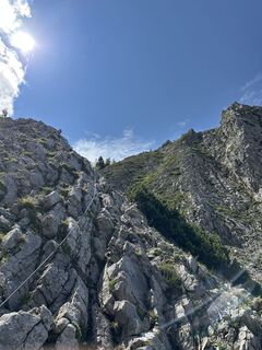 © Luca PirkerUstvarjeno na 20.07.2025
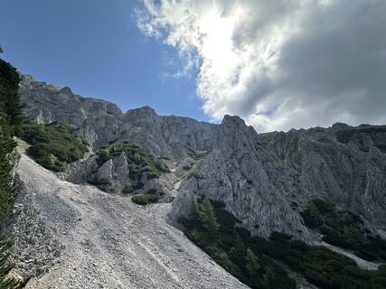 © Luca PirkerUstvarjeno na 20.07.2025
 © Luca PirkerUstvarjeno na 20.07.2025
 © Luca PirkerUstvarjeno na 20.07.2025
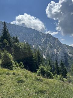 © Luca PirkerUstvarjeno na 20.07.2025
 © Luca PirkerUstvarjeno na 20.07.2025
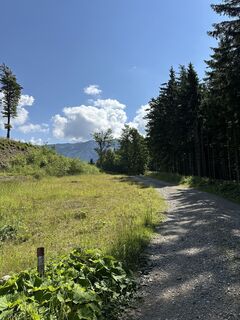 © Luca PirkerUstvarjeno na 20.07.2025
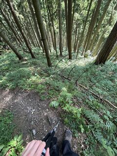 © Luca PirkerUstvarjeno na 20.07.2025
 © Luca PirkerUstvarjeno na 20.07.2025
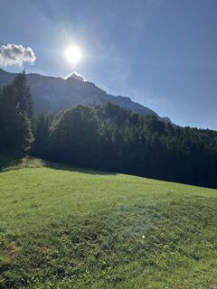 © Luca PirkerUstvarjeno na 20.07.2025
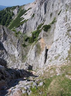 © DavidUstvarjeno na 15.06.2025
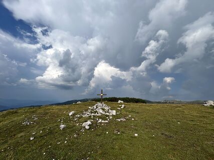
 © Stefan PlankUstvarjeno na 28.08.2024
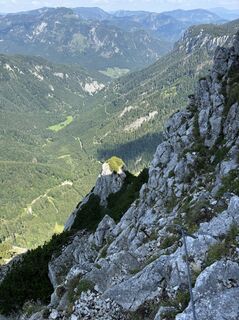
 © Robert KremlickaUstvarjeno na 03.08.2024
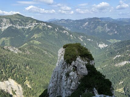 © Robert KremlickaUstvarjeno na 03.08.2024
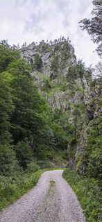 © Martin TemmUstvarjeno na 06.07.2024
 © Martin TemmUstvarjeno na 06.07.2024
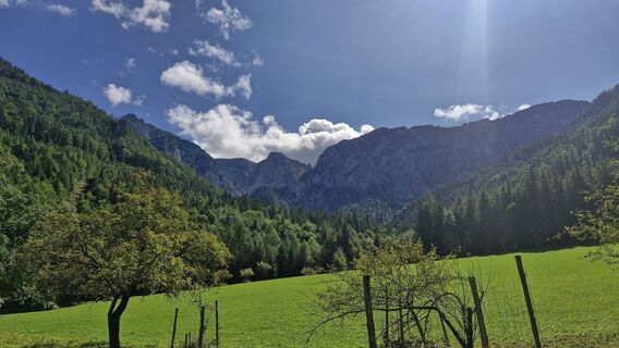
 © SebastianUstvarjeno na 03.09.2025
 © Aga MUstvarjeno na 27.04.2025
 © Aga MUstvarjeno na 27.04.2025
 © Aga MUstvarjeno na 27.04.2025
 © Aga MUstvarjeno na 27.04.2025
 © Aga MUstvarjeno na 27.04.2025
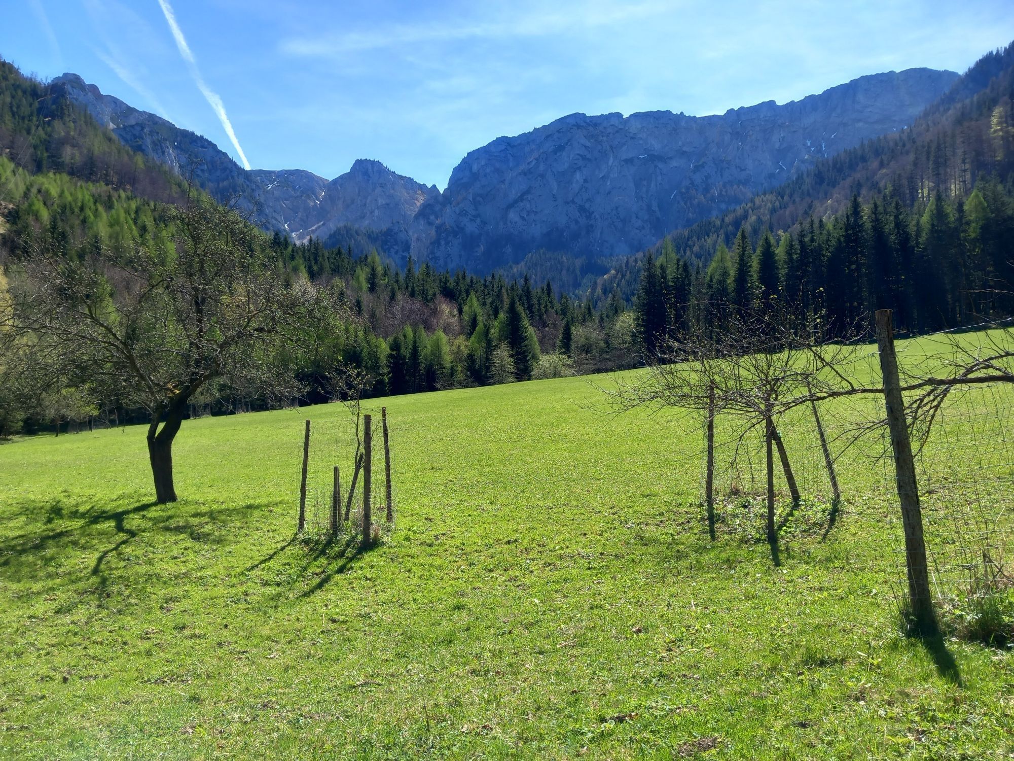


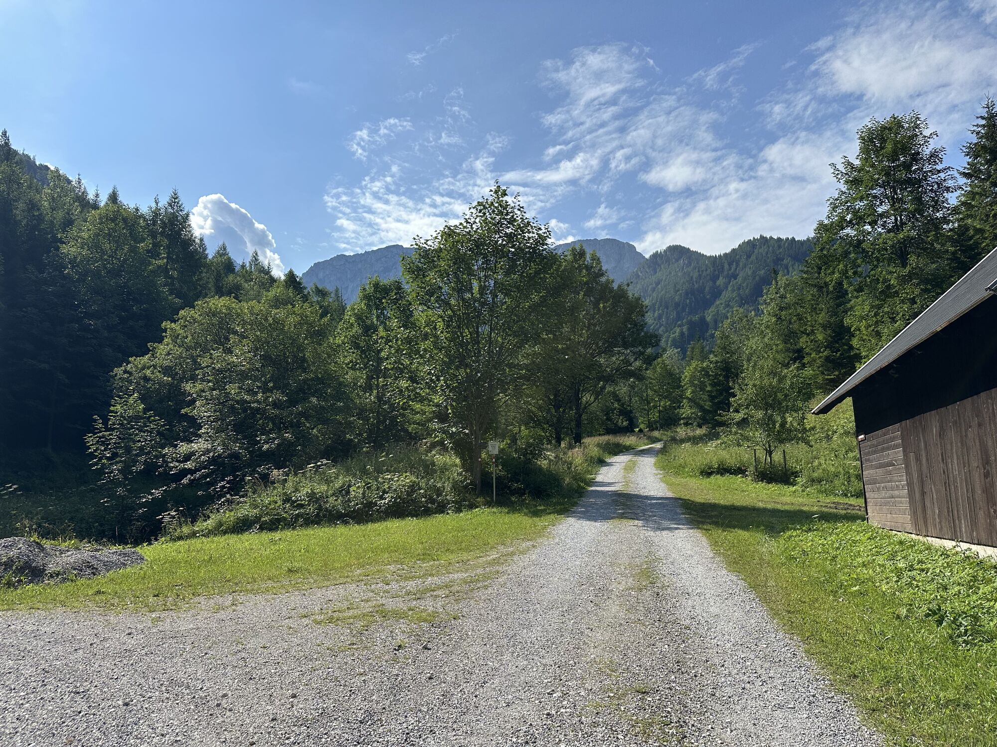


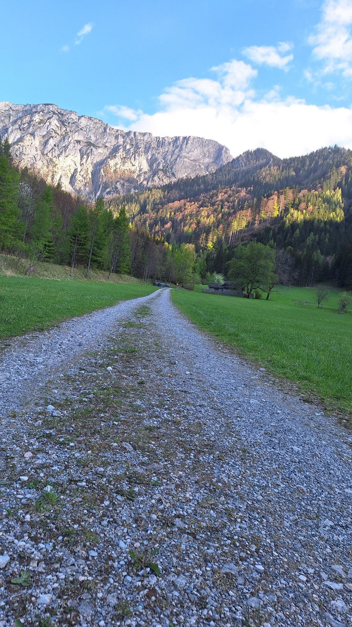
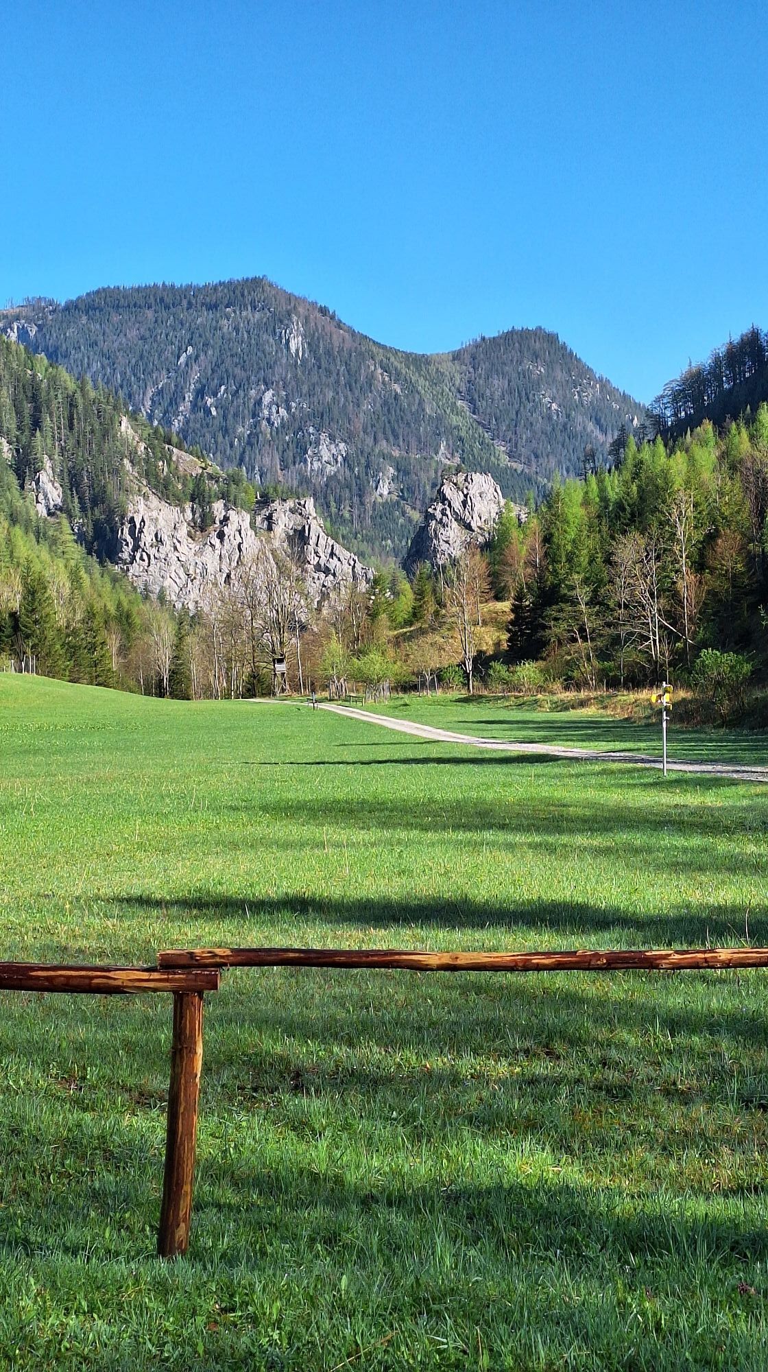
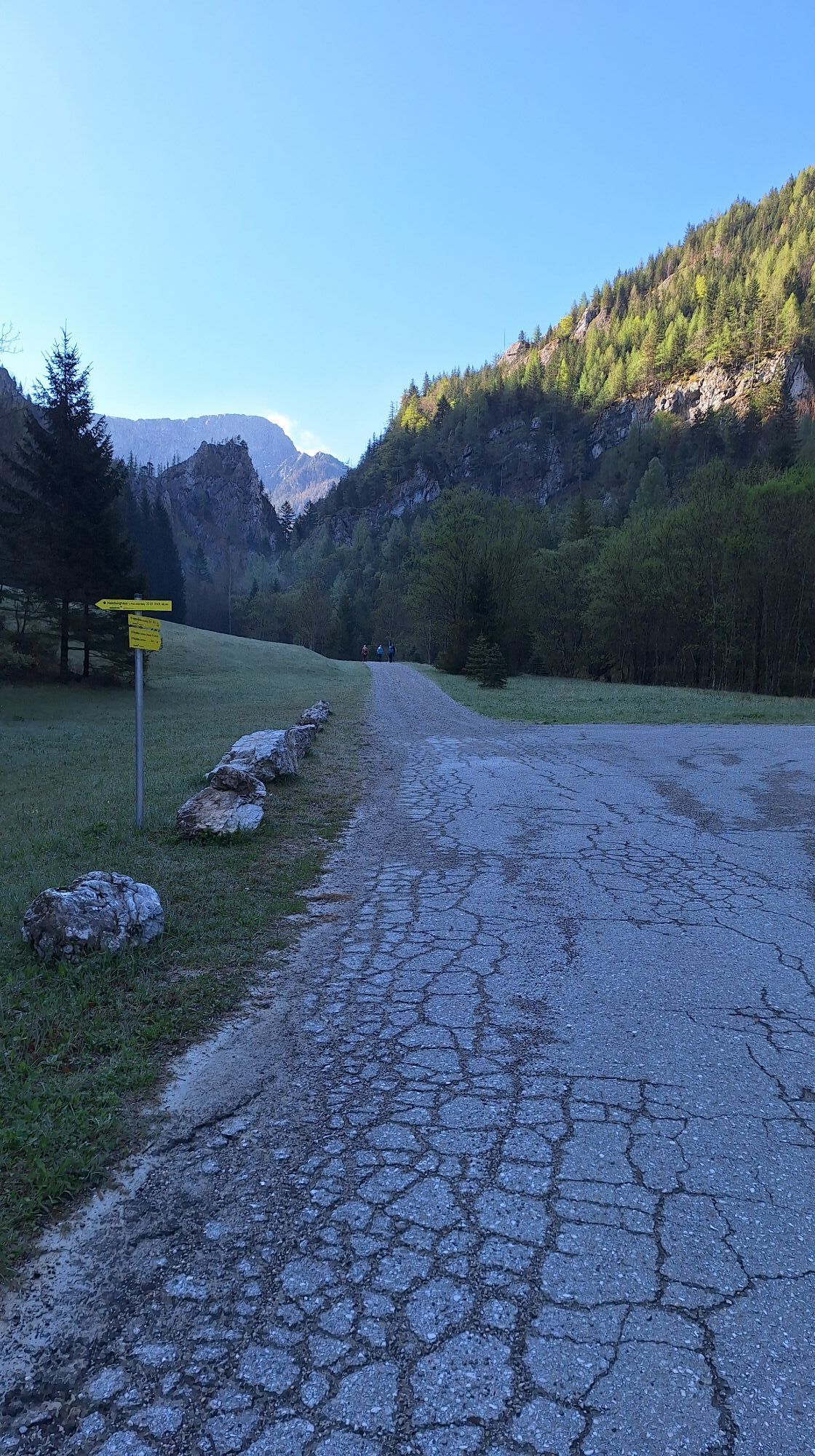
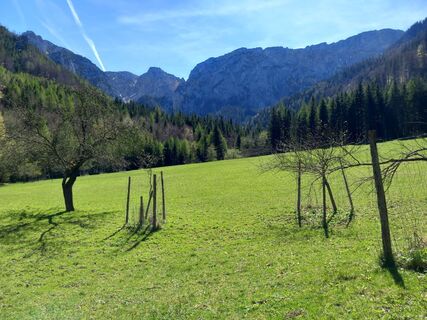
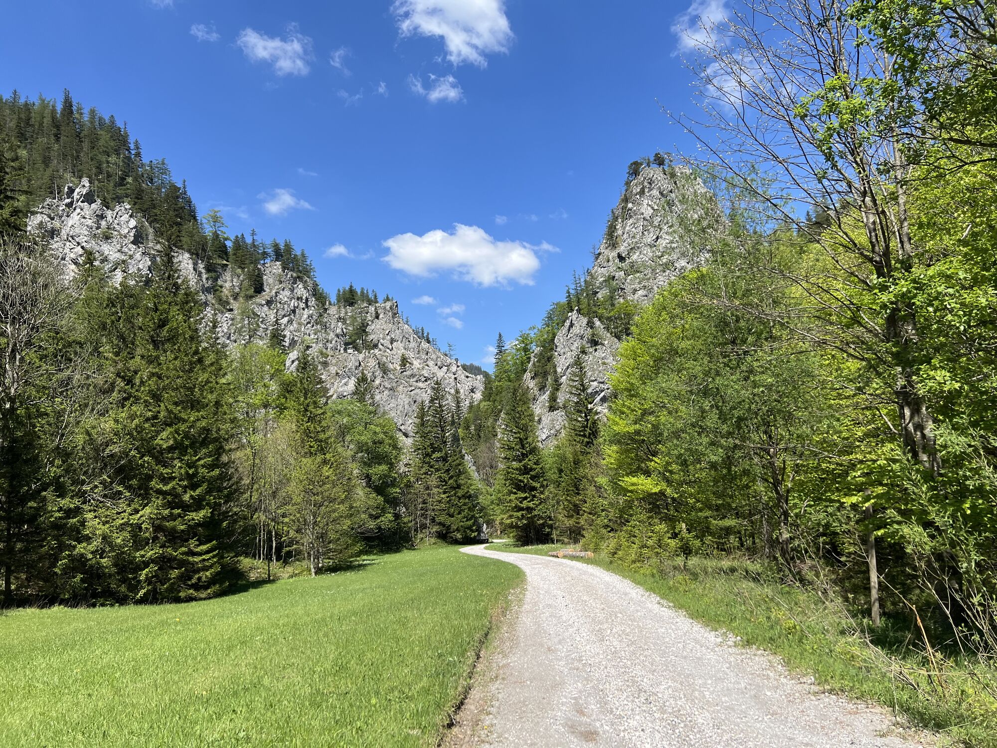
The starting point for the hike is the parking lot in Hinternaßwald, a small town at the northern foot of the Rax massif. From here follow the signs “Habsburgerhaus” or “Wildfahrt” into Reißtal. On a road...
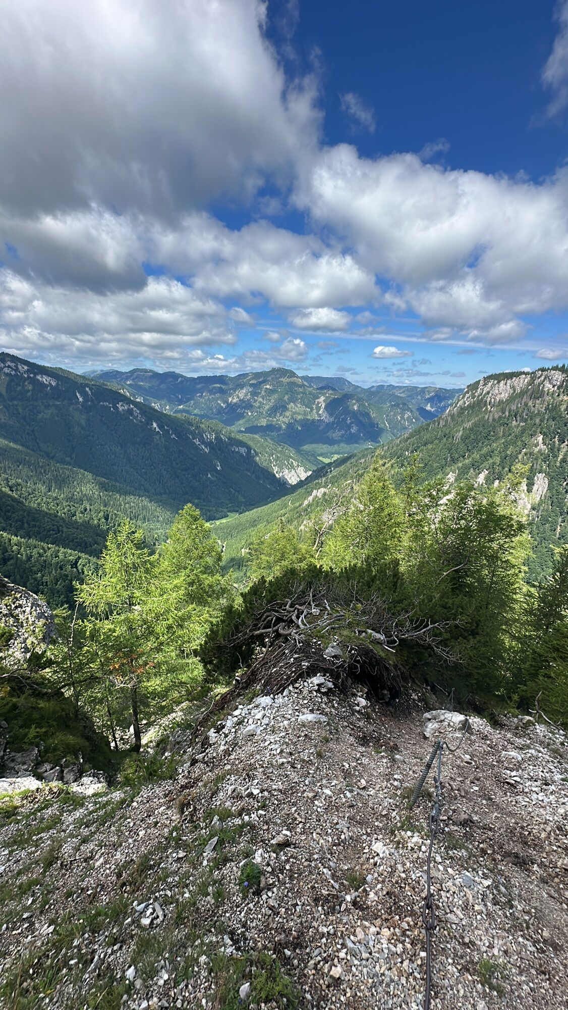
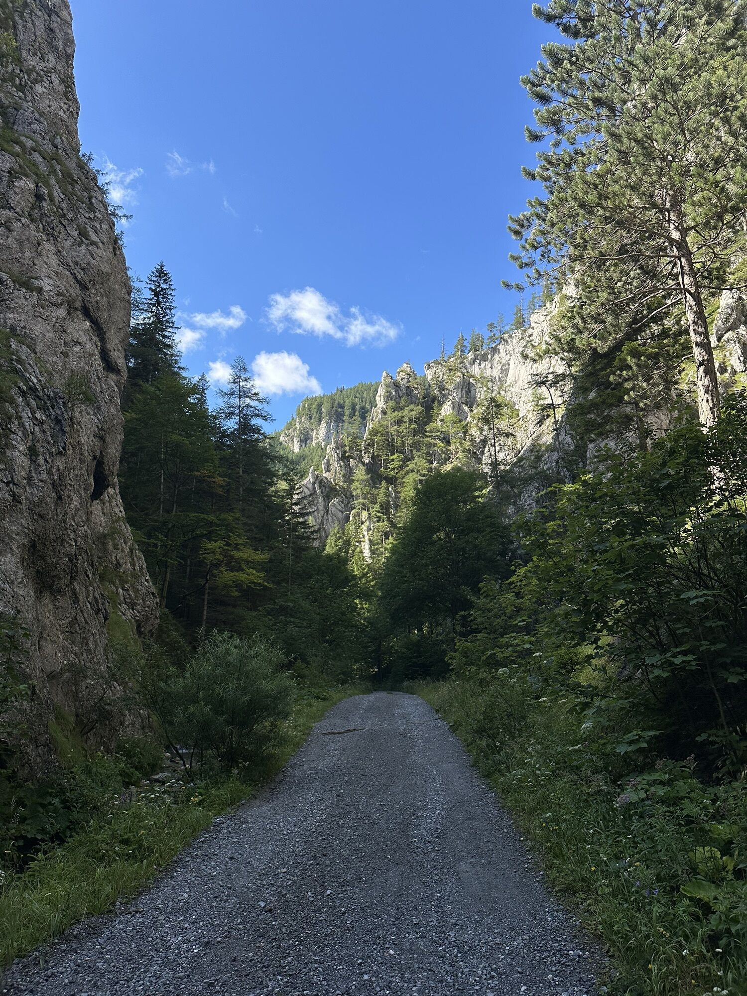
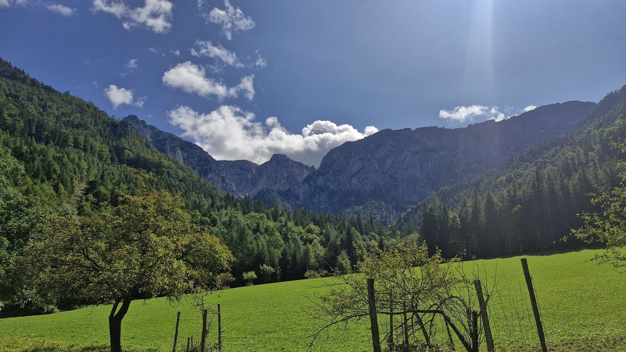
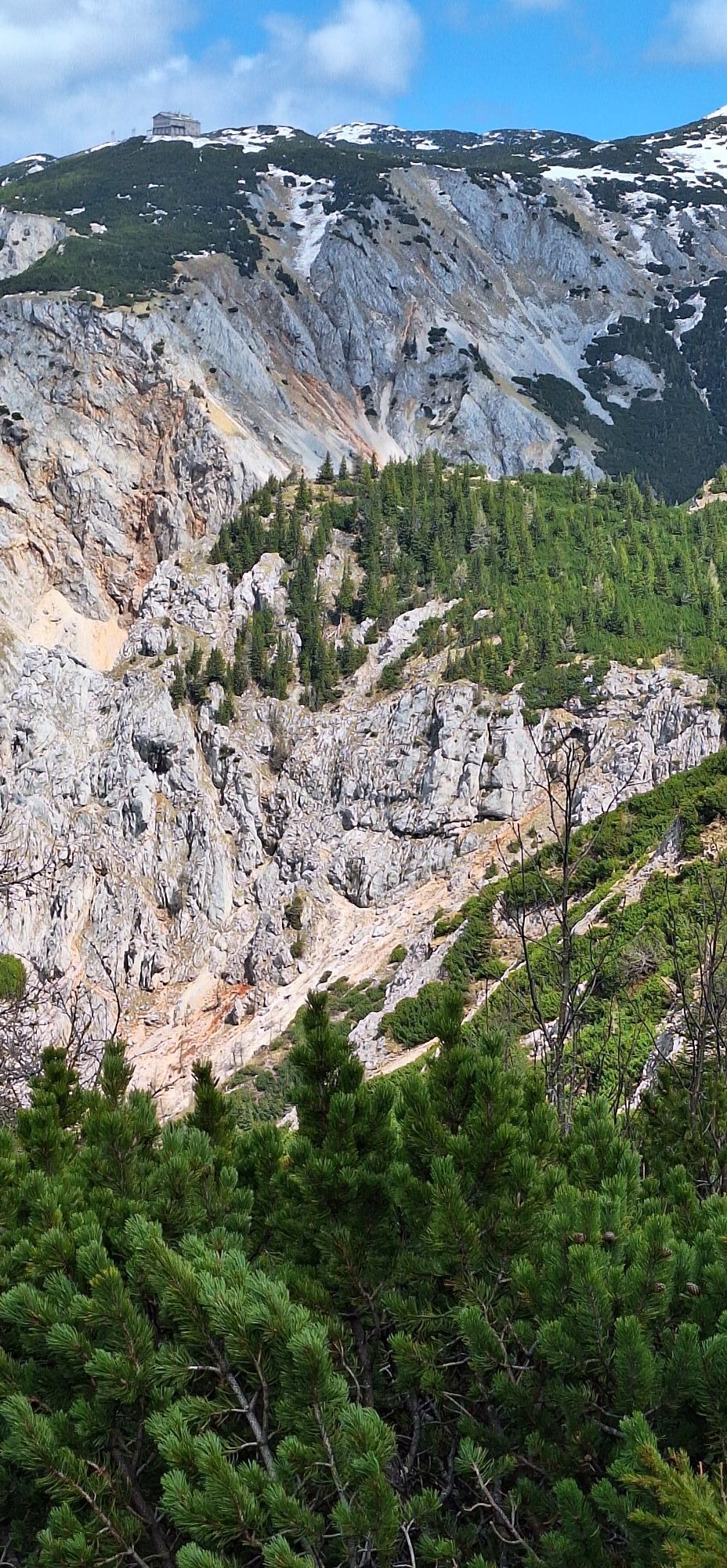
The starting point for the hike is the parking lot in Hinternaßwald, a small town at the northern foot of the Rax massif. From here follow the signs “Habsburgerhaus” or “Wildfahrt” into Reißtal. On a road that is first asphalted and then gravel, the climb is barely noticeable. After about 15 minutes, the path meanders close to the torrent through a narrow passage between steep rock faces, the Reißtalkklamm. The valley then widens again and for the first time reveals a view of the “Kahlmäuer”, as the striking rock faces on this side of the Rax massif are called.
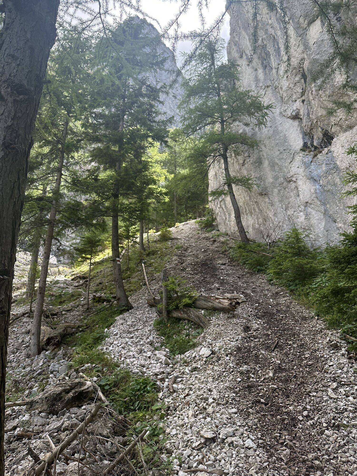
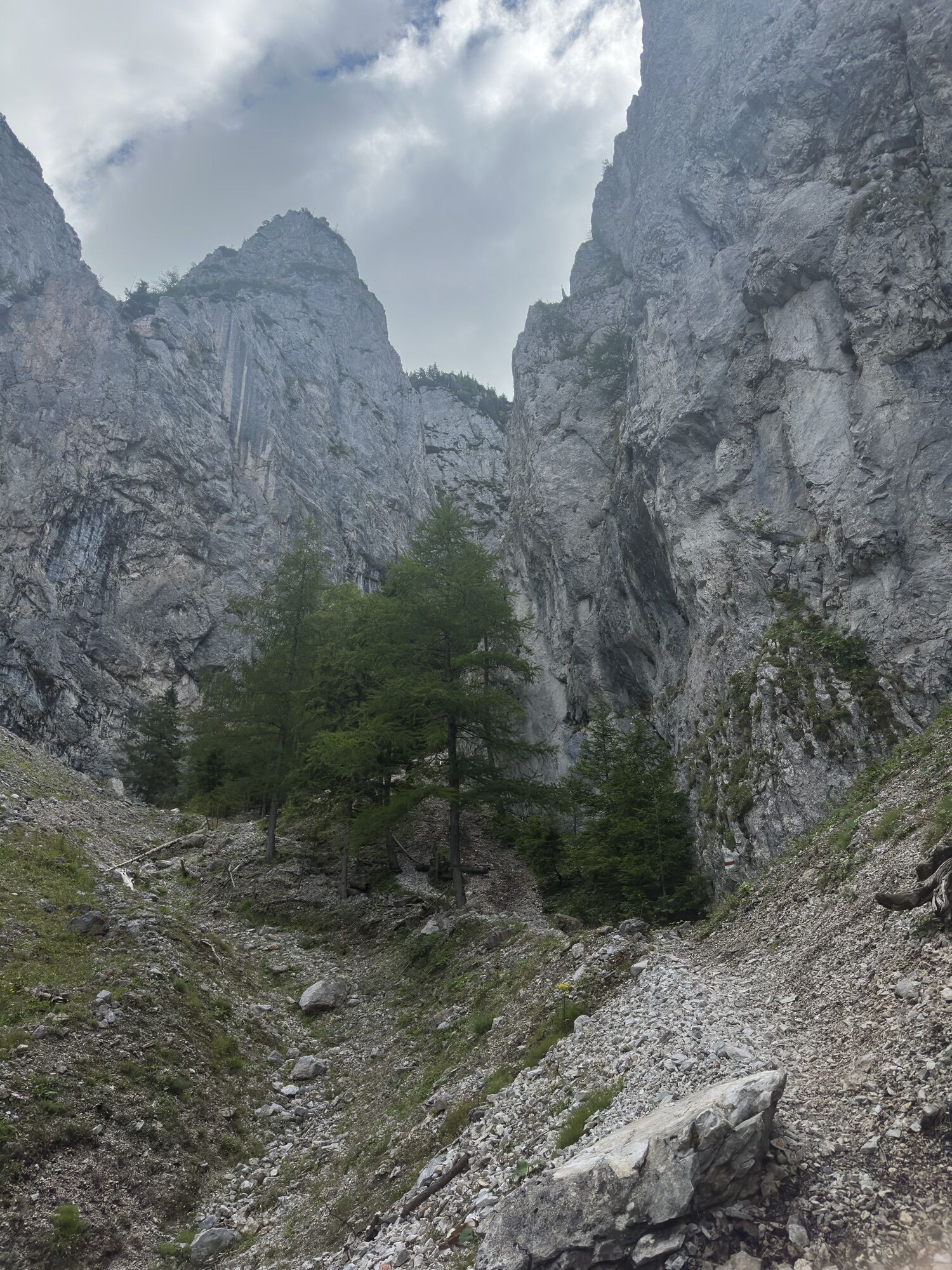
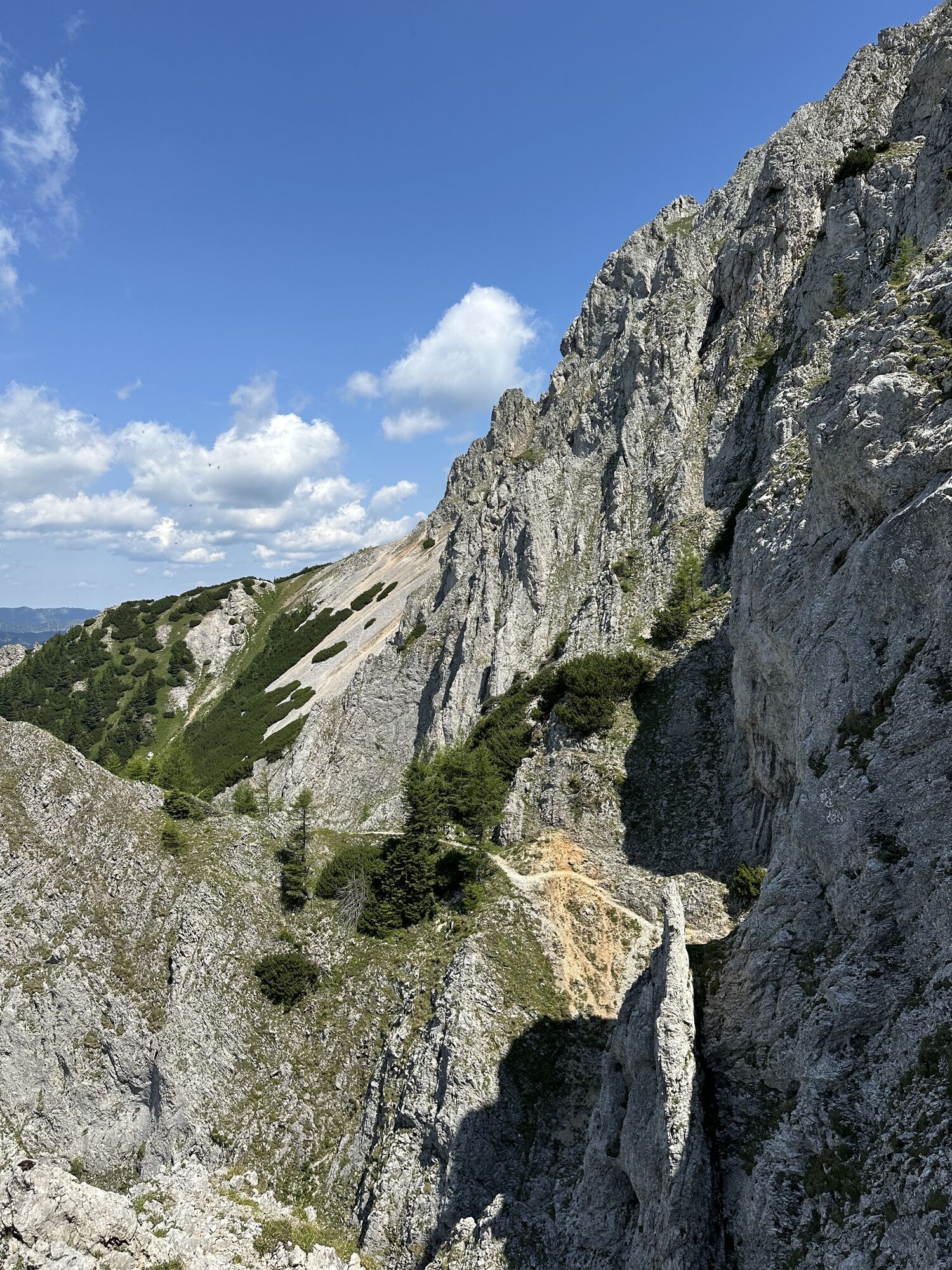
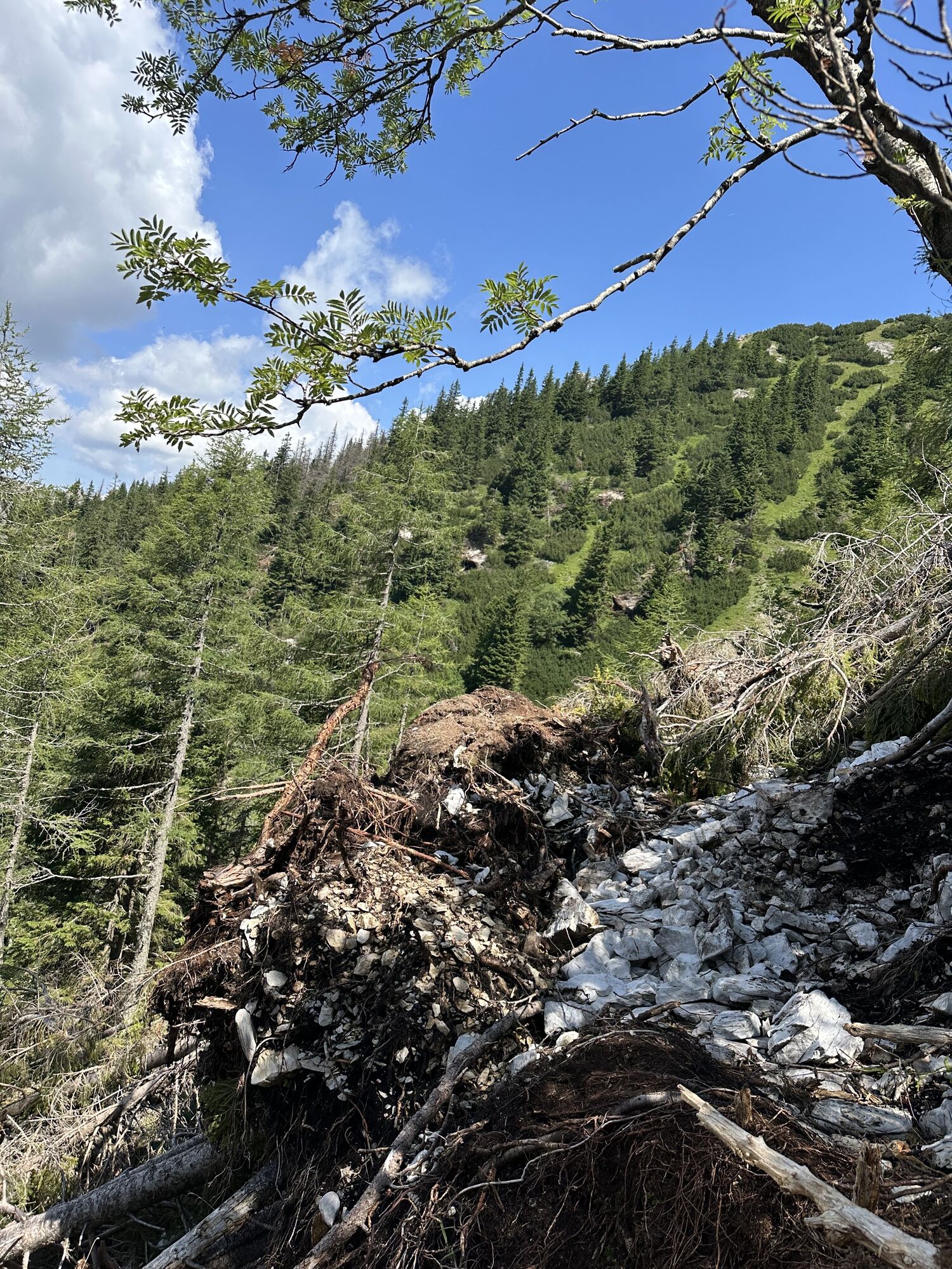
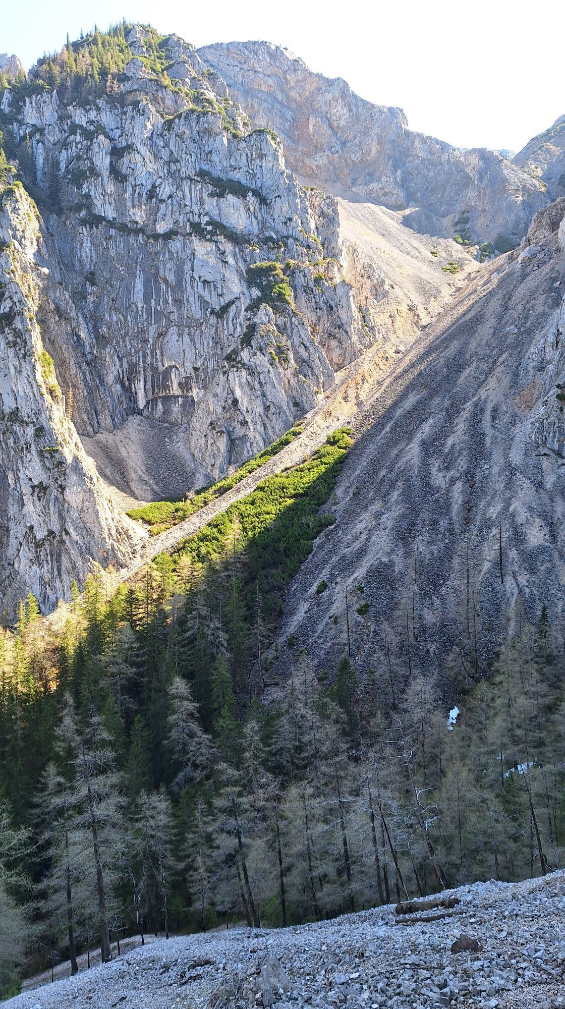
After about 30 minutes, the end of the gravel road is reached and the path turns slightly left into the forest, becomes a little steeper and after a few minutes' walk leads to a forest road, which you follow uphill for almost 1.4 km. At this point a signpost points the way to the right into the forest to the “Wildpfade”. The path becomes noticeably more uncomfortable. It goes steeper over scree through the forest and finally up to the foot of the rock walls until you finally reach a huge cone of debris.
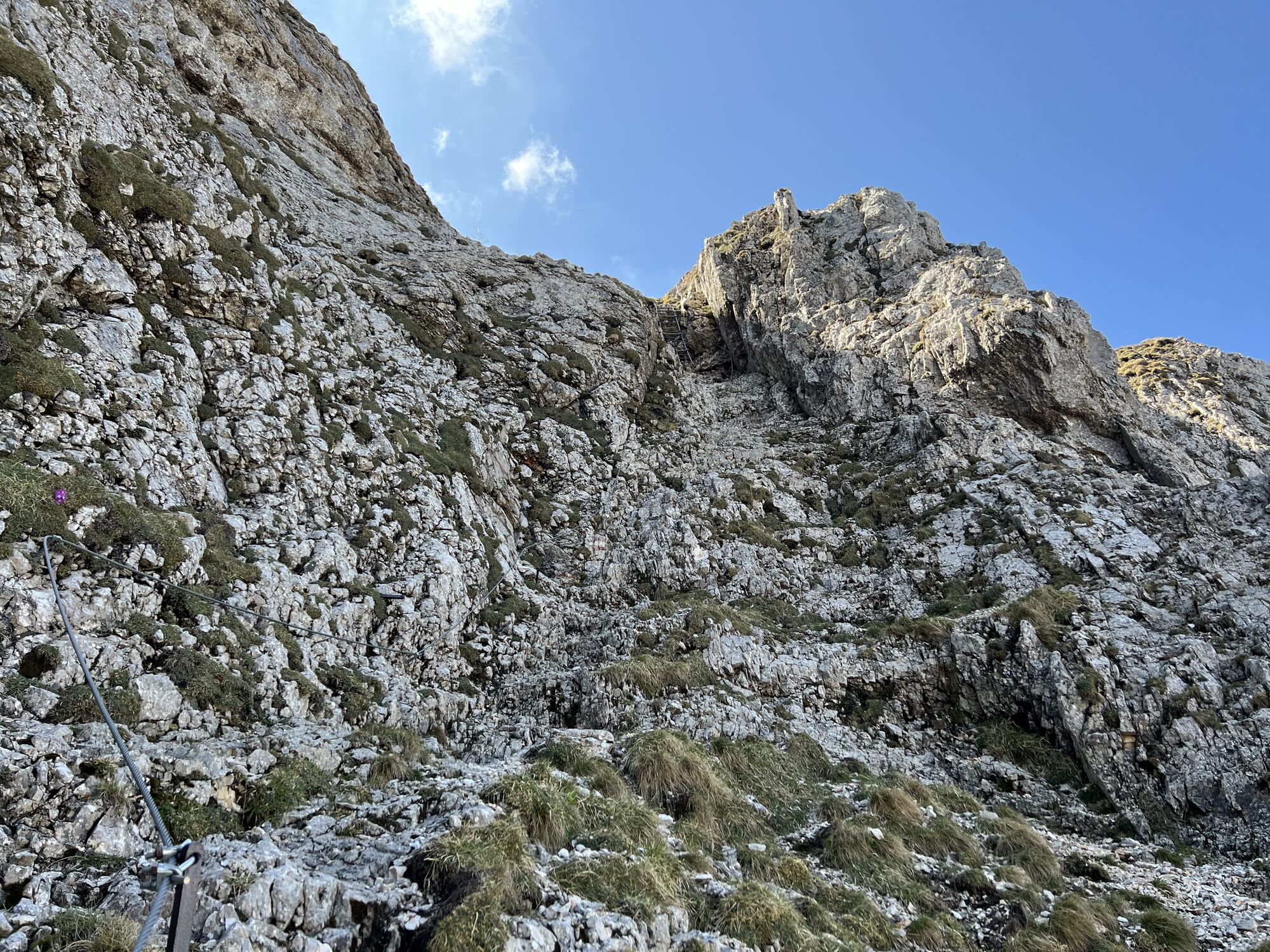
Entry into the "Wildfährte" (B)
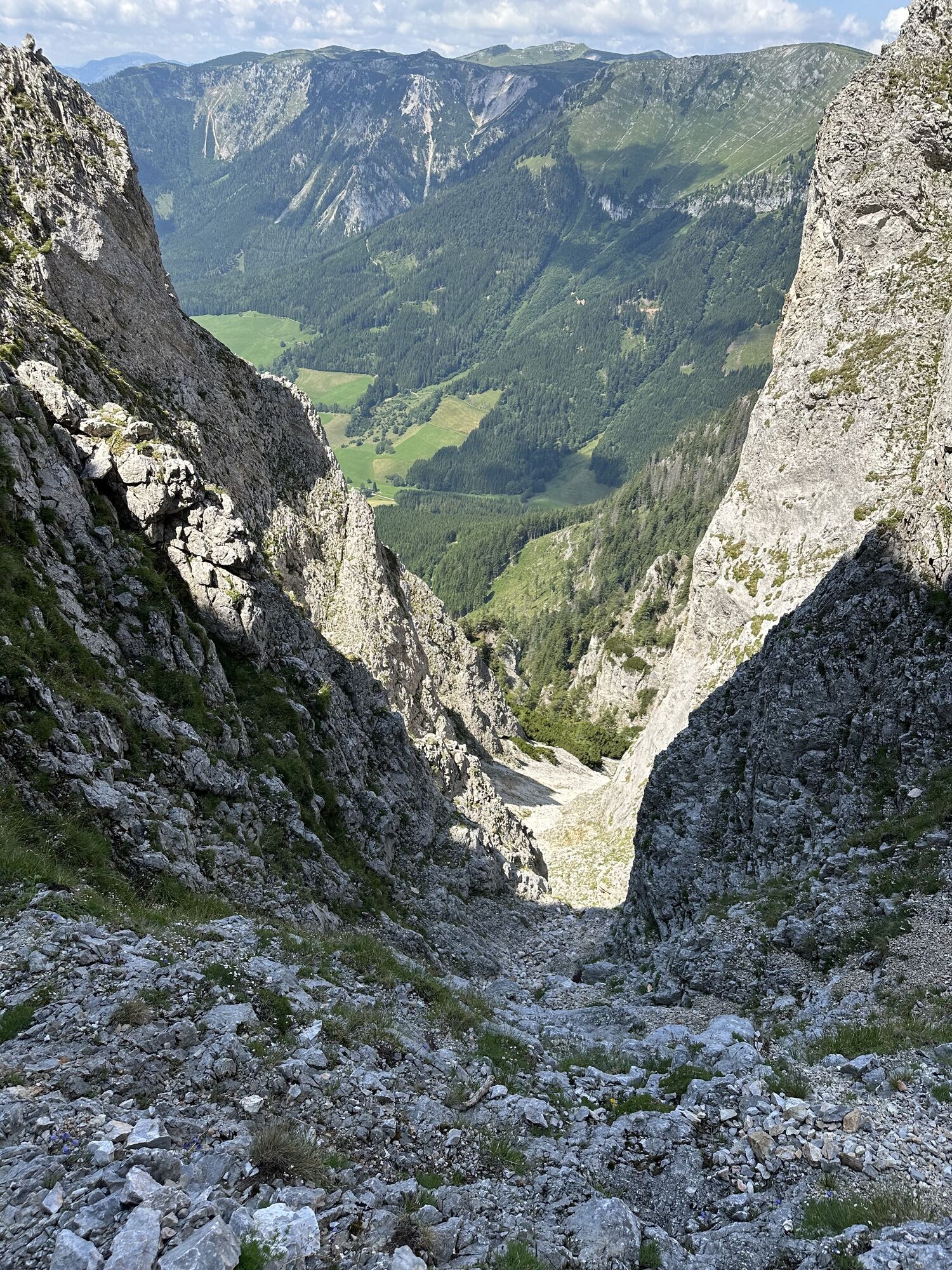
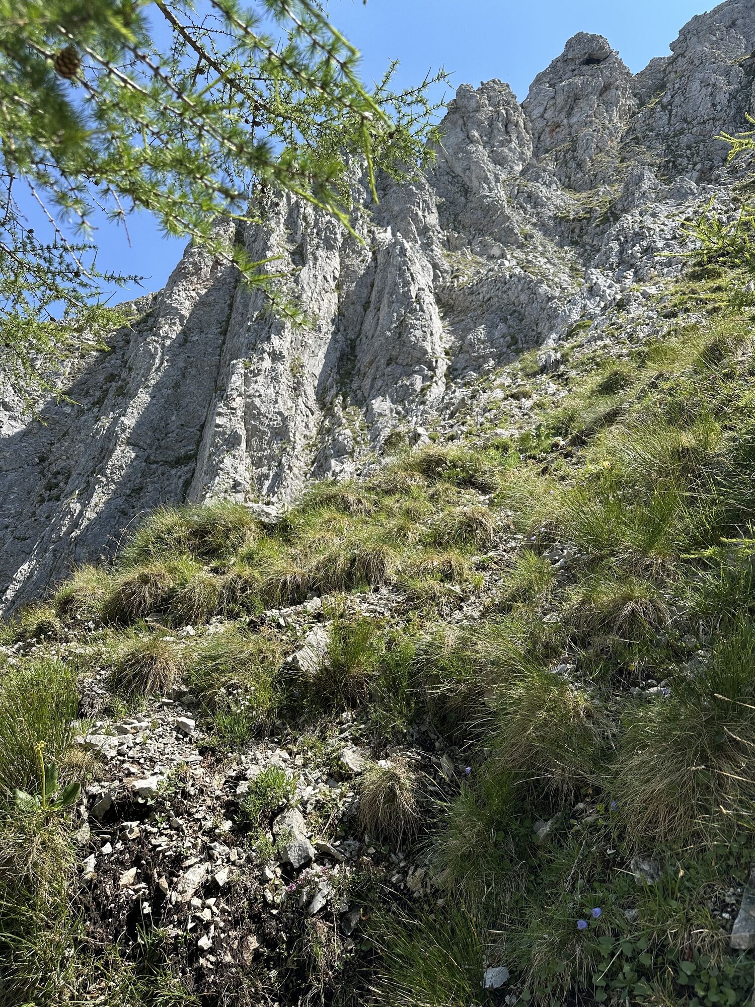
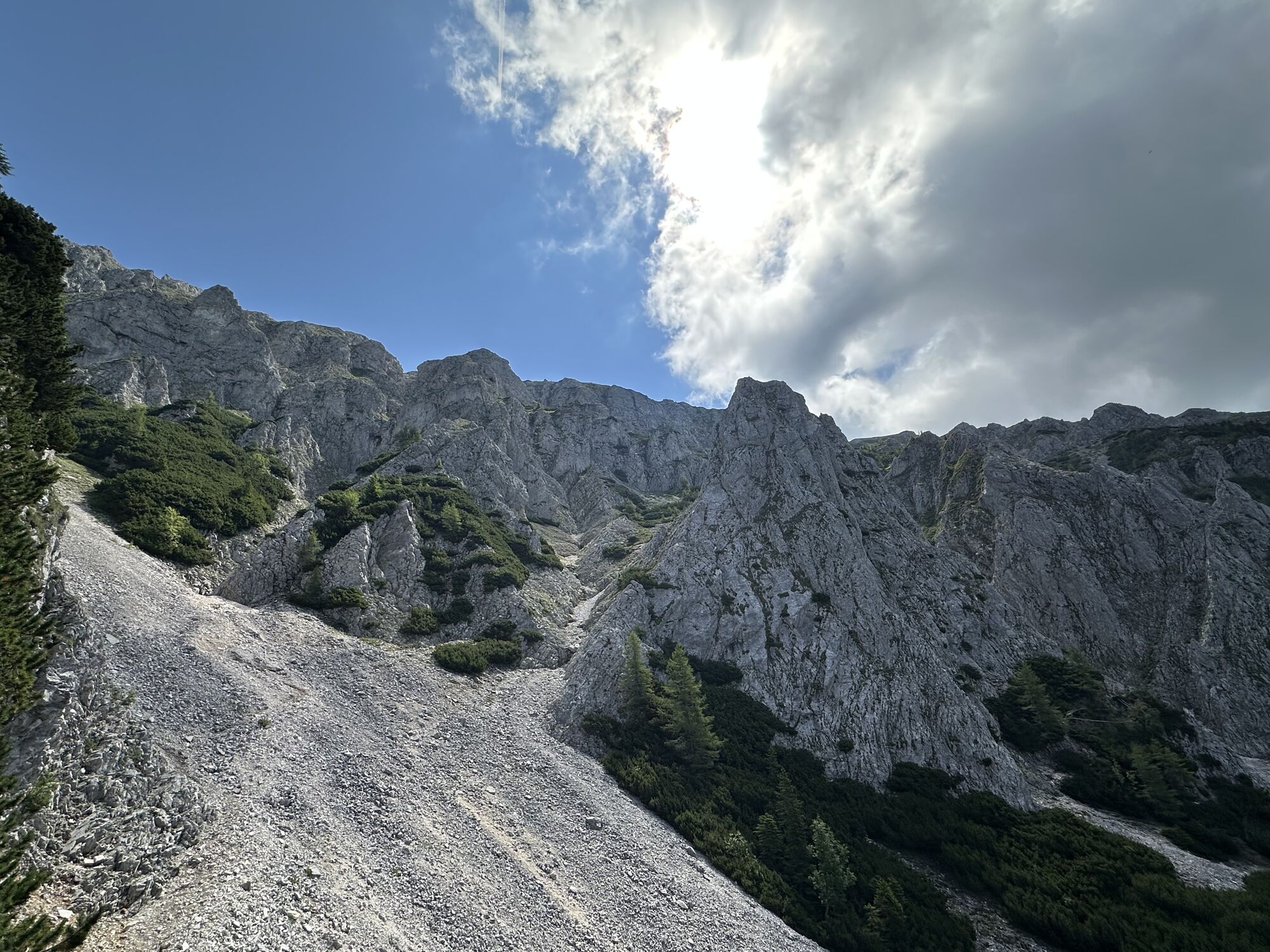
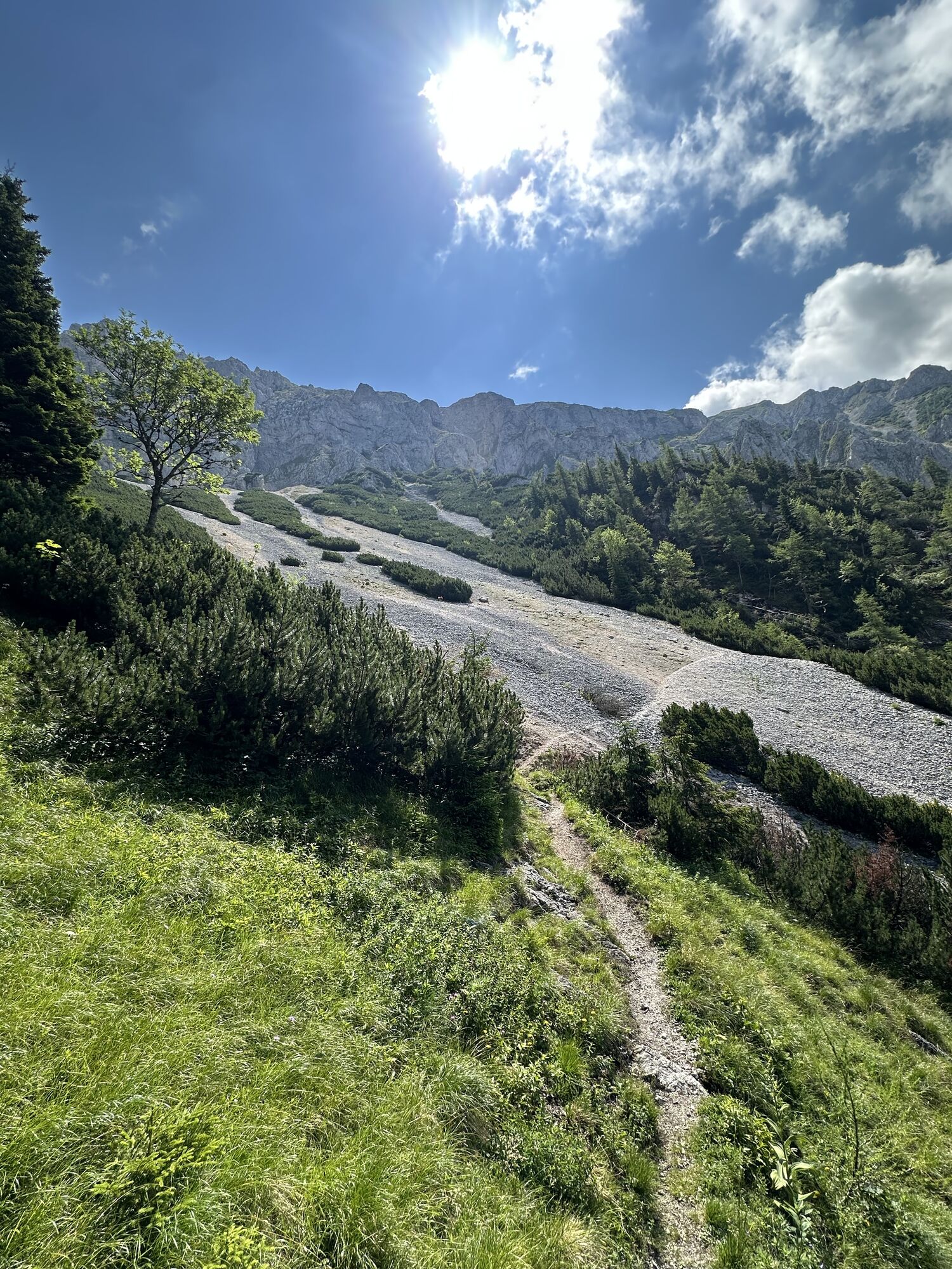
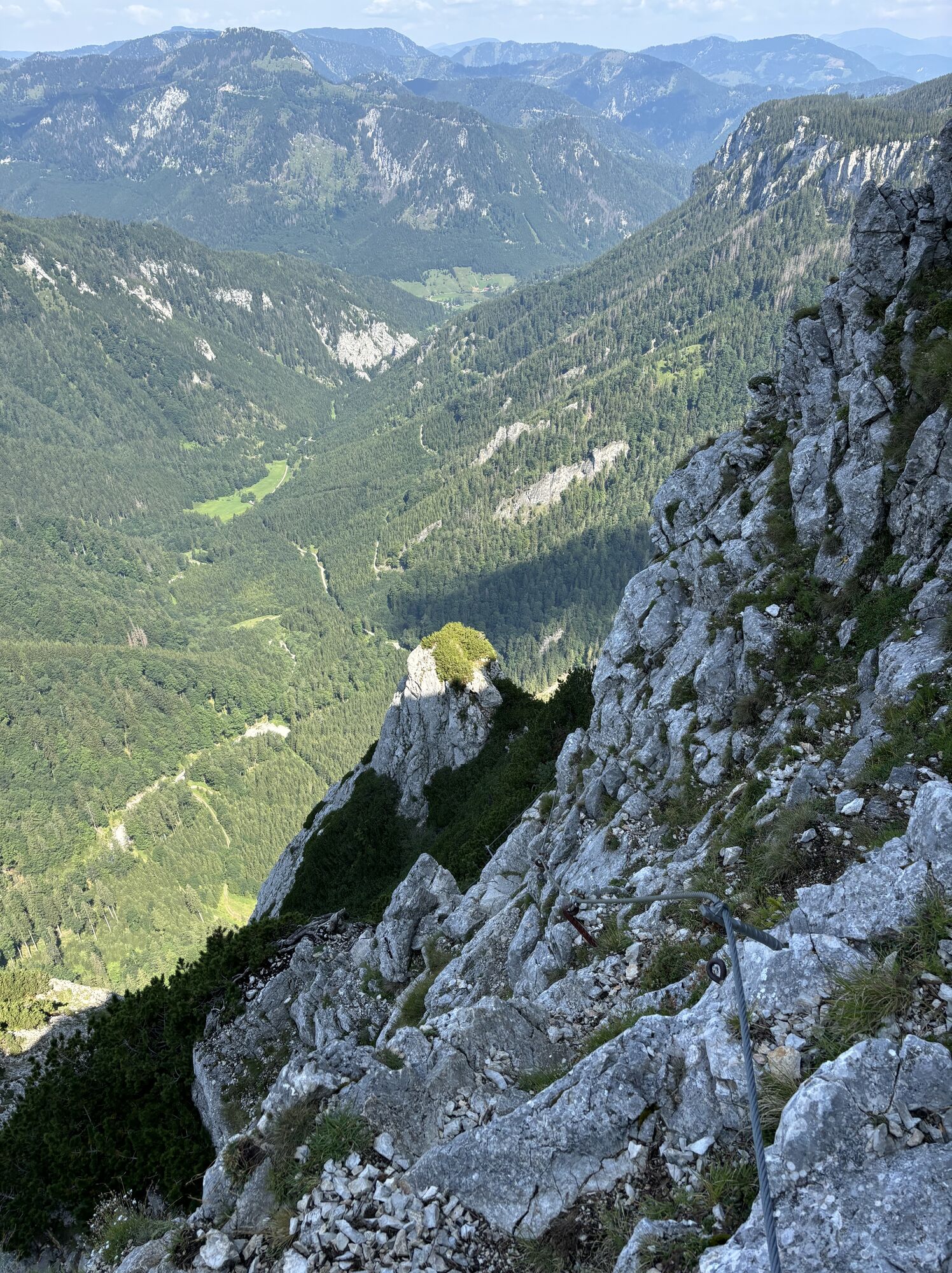
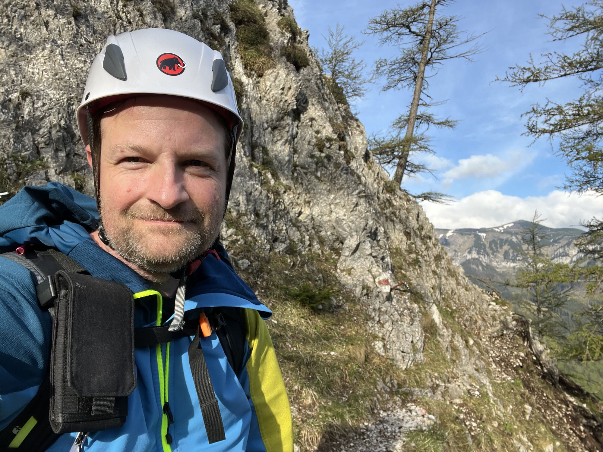
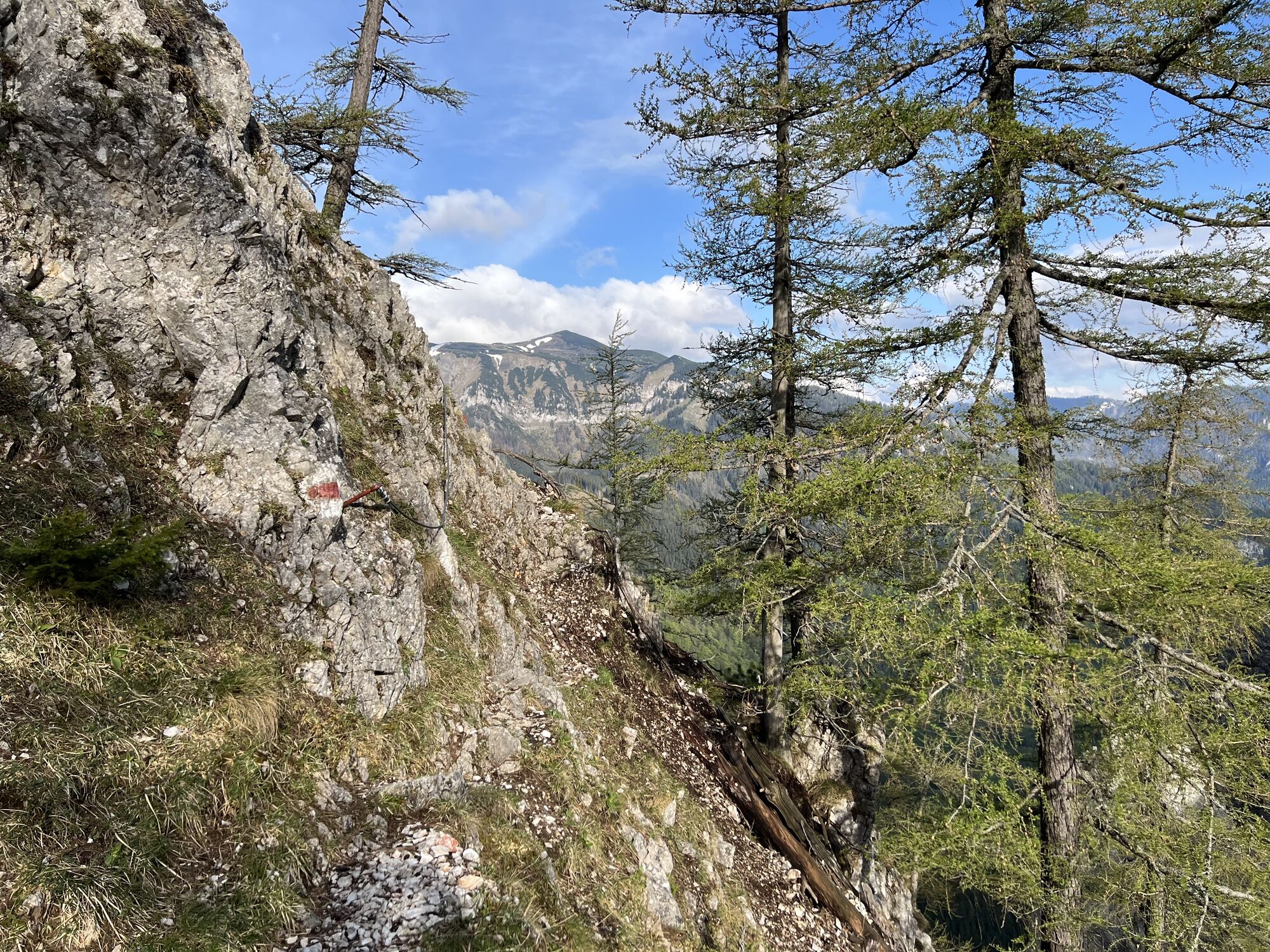
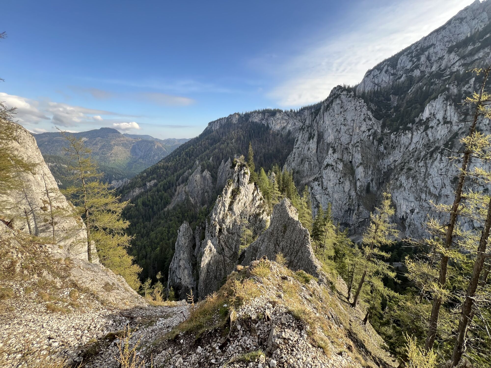
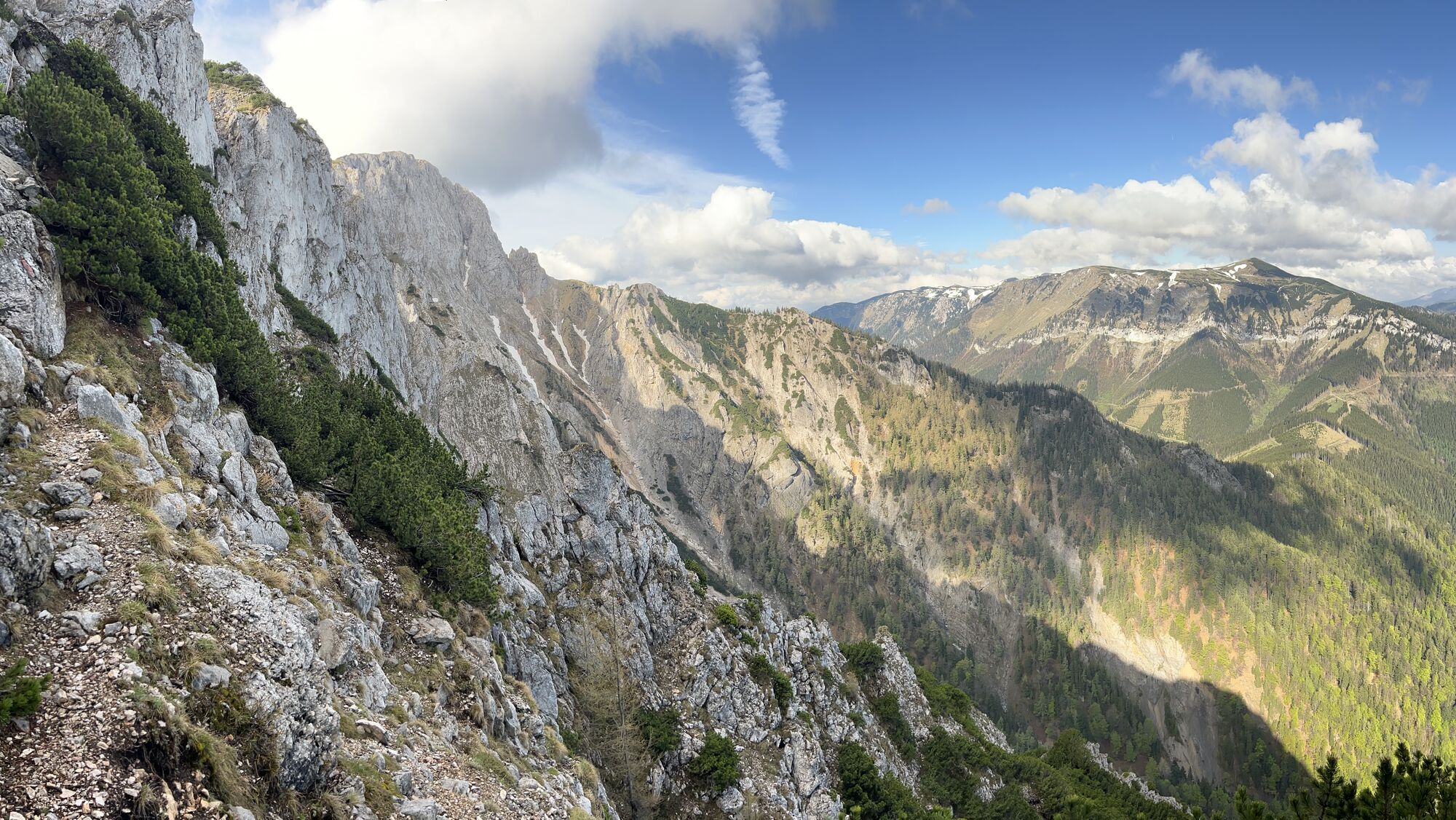
At the upper end of the cone of debris is the entrance to the “Wildfährte” (difficulty level B). In the lower first difficulty level (UIAA I-), the path leads up the first steep step over a gully. Soon afterwards, the first passages secured with fixed steel ropes are reached, which alternate with walking terrain. Impressive rock formations dominate the picture in a wildly romantic landscape. After a somewhat exposed transition, a gap and another gully, the “Bärenlochsteig” branches off to the left. The “Wildfährte” continues to a long and comparatively wide ramp. The path leads continuously and steeply upwards over loose rock and lots of scree. The first level of difficulty (UIAA I) is never exceeded. At the end of the ramp you have already noticeably gained height and the high plateau already seems close enough to touch. There are only a few exposed and steeper passages left to overcome, which are secured with fixed steel ropes.
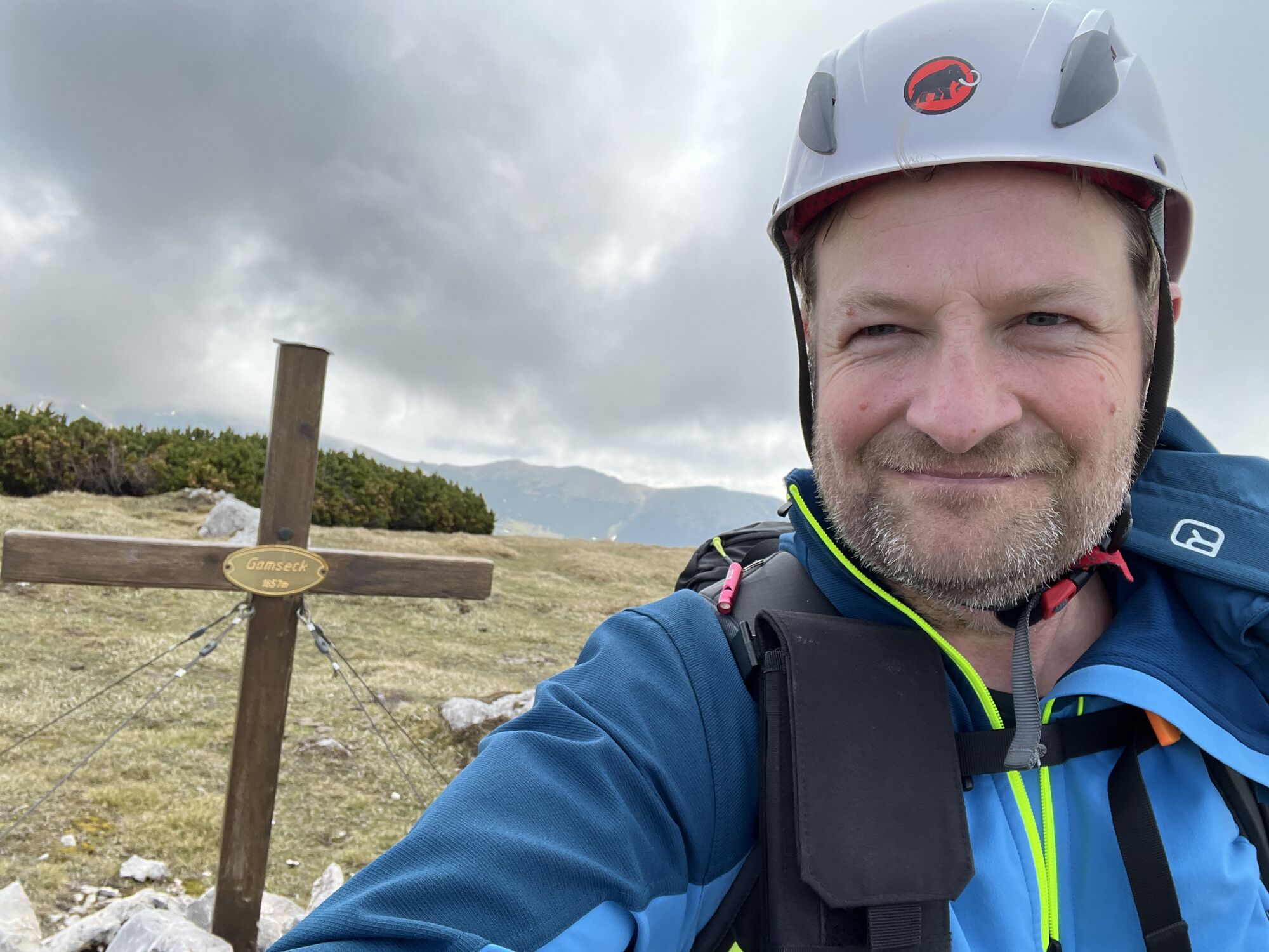
Continue to the Gamseck summit
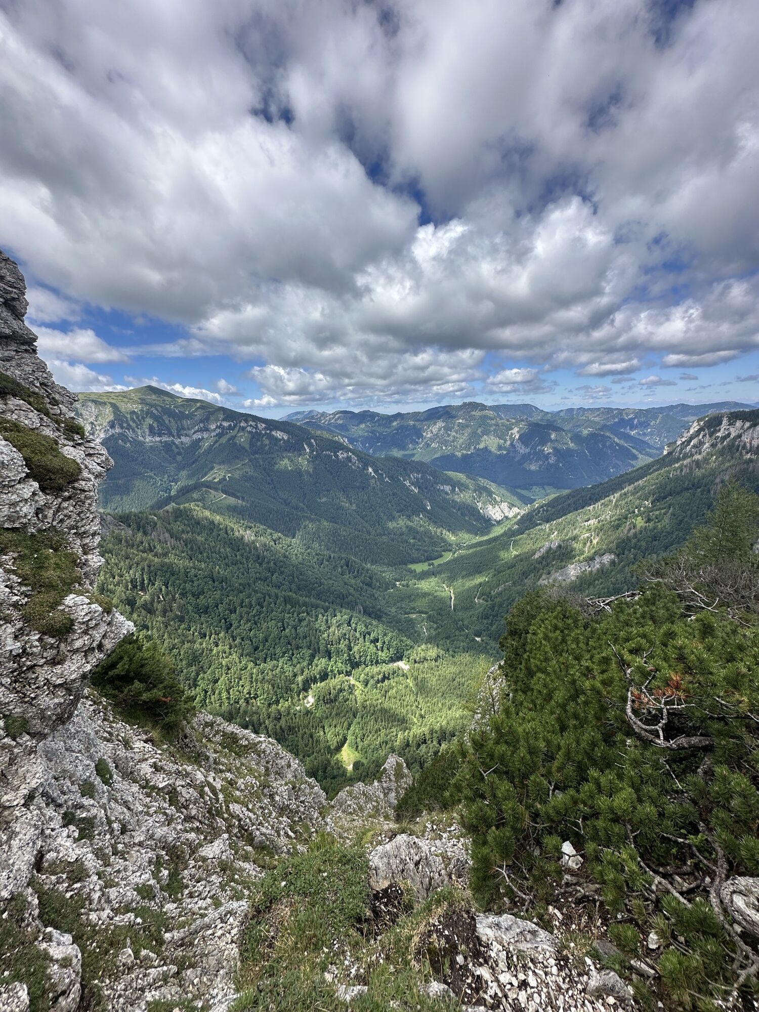
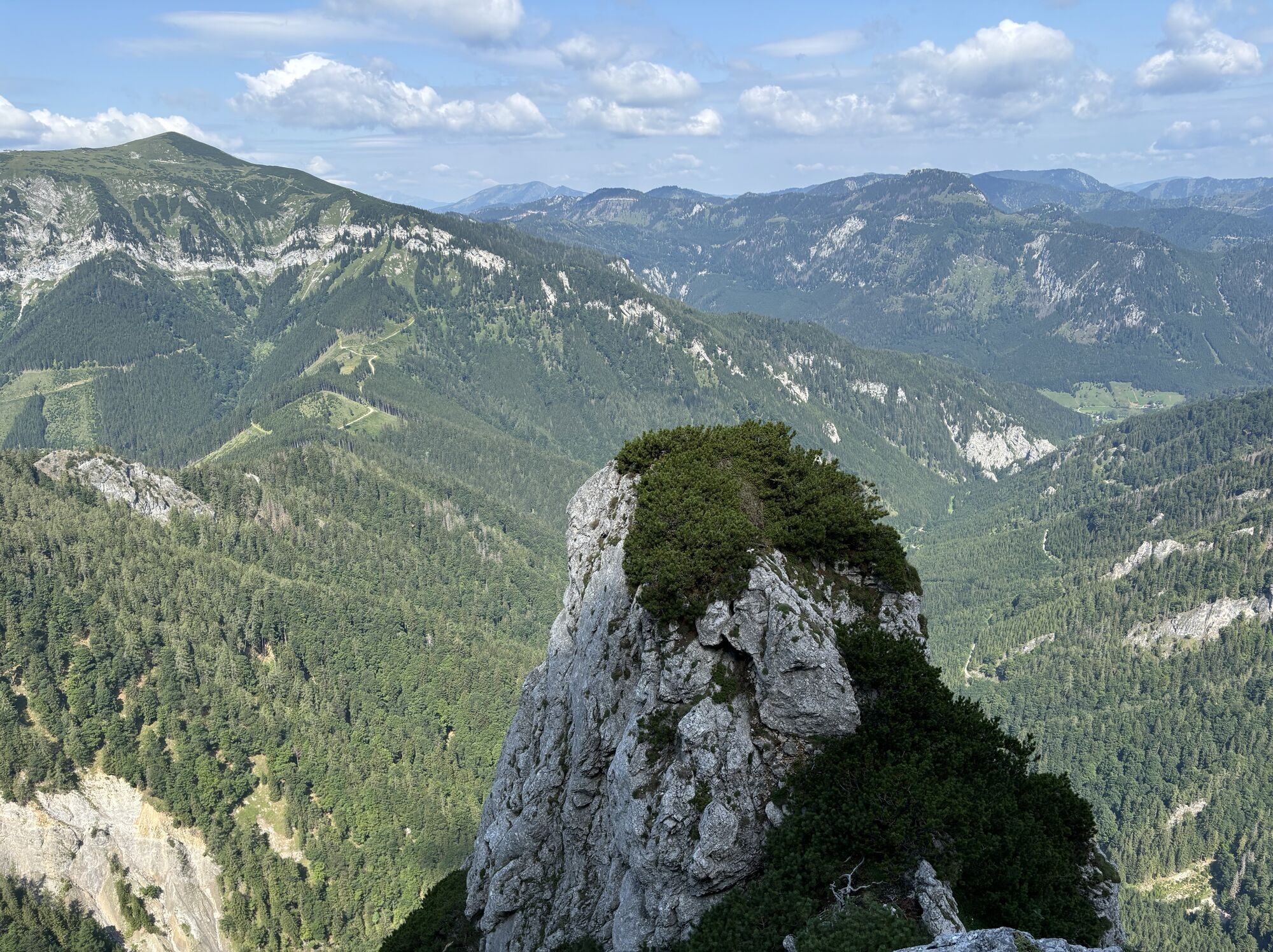
Once you reach the high plateau, you will have a wonderful view of the alpine pastures and peaks of the Rax. On a well-trodden path that is repeatedly marked, we continue more or less along the cliffs towards Gamseck, the destination of the tour. After about 1.6 km a well-worn path branches off to the right. This leads directly to a small summit cross that marks the highest point of the Gamseck (1857 m).
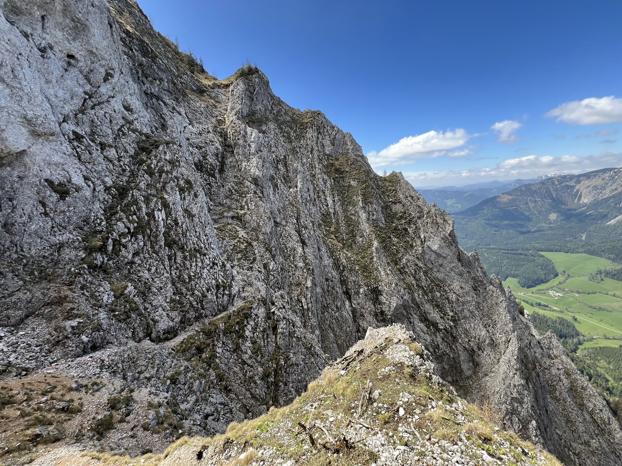
Descent via the Gamsecksteig (A)
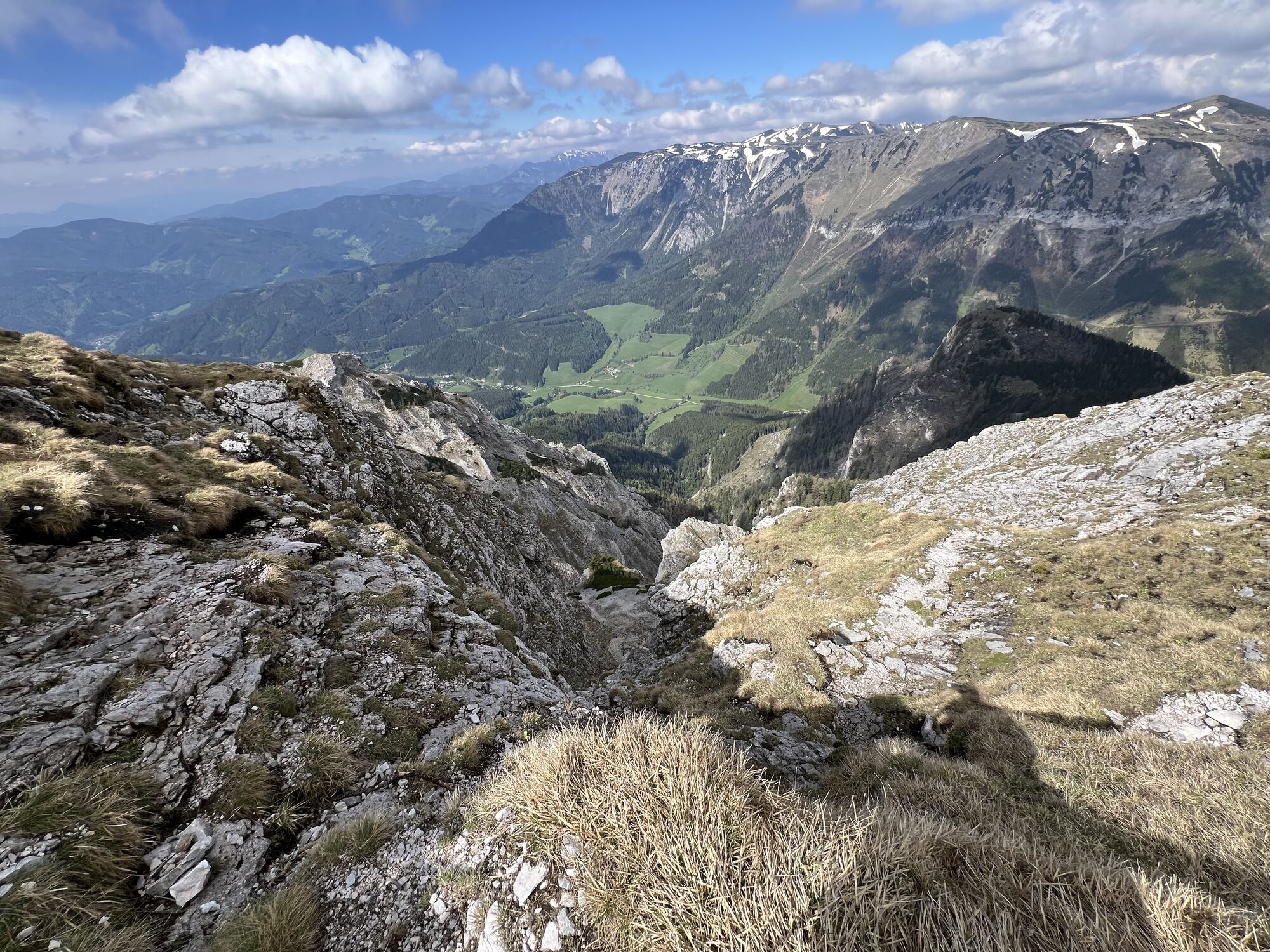
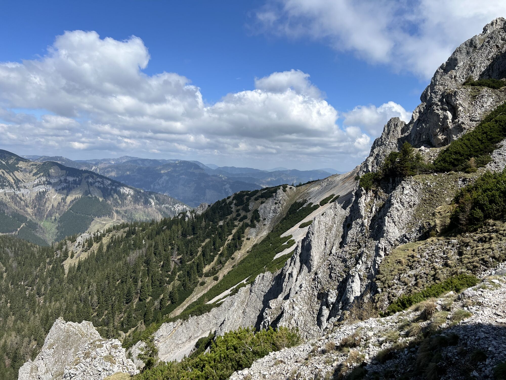
From the summit we took the same path back to the fork in the road and then continued on the path we had previously taken. After a few minutes, a sign shows the way to the Gamsecksteig and the Nasskamm. Now the descent begins on hiking trail 801. The view of the neighboring Schneealpe in the west is magnificent. The “Gamsecksteig” (difficulty level A) is actually an alpine route, the more difficult and exposed sections of which are secured with fixed steel ropes. The descent leads through a beautiful rocky landscape. As with the ascent, sure-footedness and a head for heights are absolutely necessary. Finally, the path joins a narrow path through the forest that leads directly to the Gupfsattel (the saddle between Grabnergupf and Gamseck). From here you have a great view of the Gamseck walls and the paths leading through them.
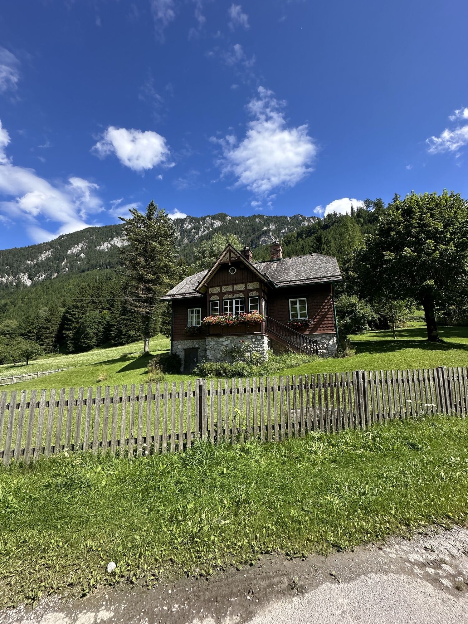
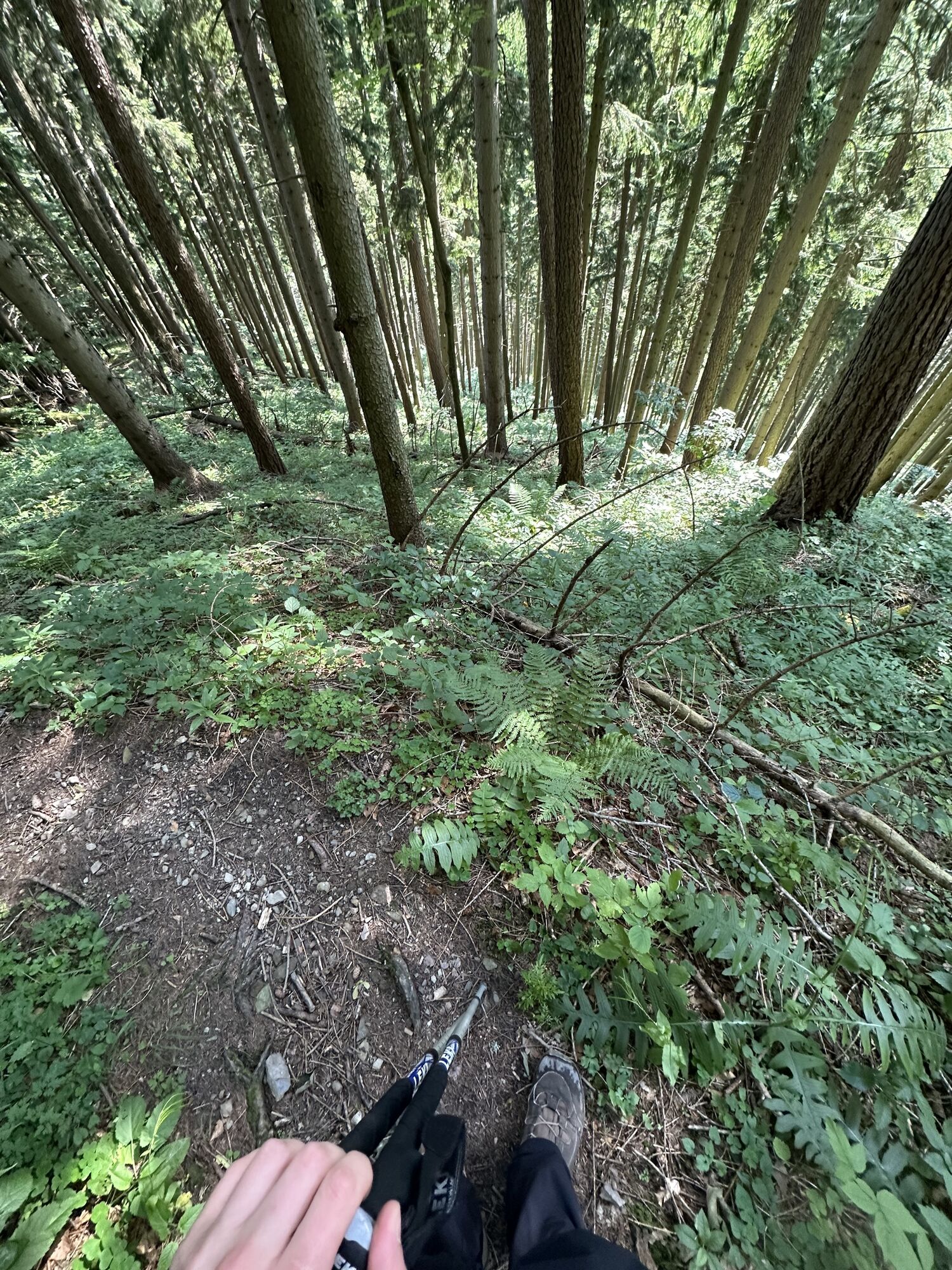
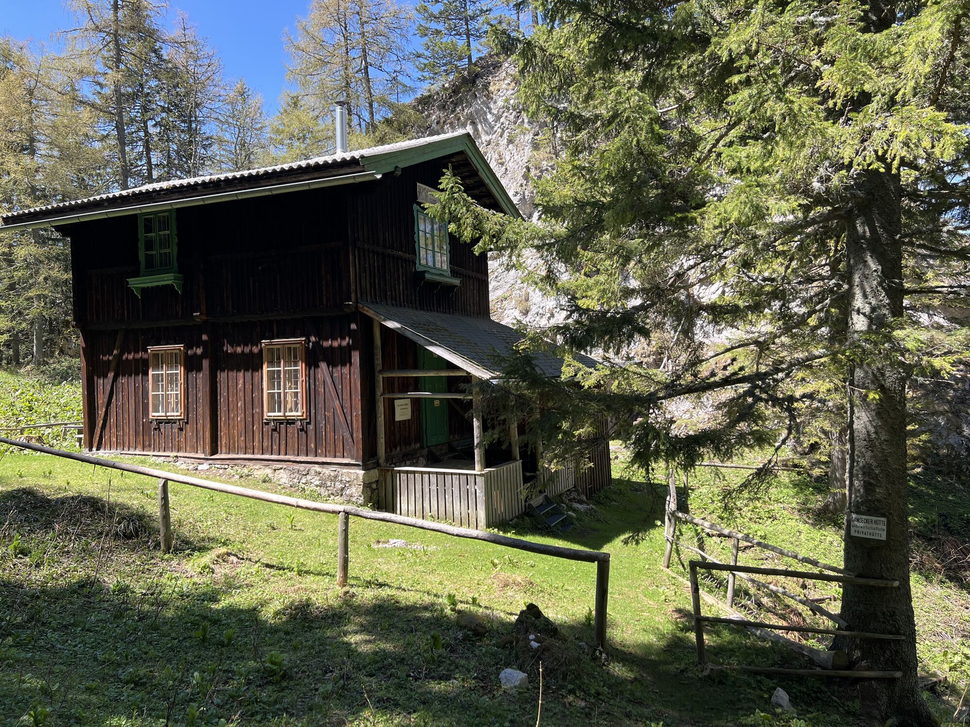
Now perhaps the most arduous part of the tour begins: the relatively steep and anything but knee-friendly descent over the Nasskamm back into the Reißtal. The romantic Gamseckhütte, an unmanaged mountain hut, marks the end of the first steep section. Along the ridge the path follows a forest road that is a little flatter and comparatively relaxing. Here too, hiking trail 49 back to Hinternaßwald branches off rather inconspicuously from the forest road to the right into the forest. Now it's getting really uncomfortable. The path leads steeply along a mountain ridge through the forest in sometimes narrow serpentines back to the Reißtal, where the path finally joins the ascent path at the point where the forest road ends. The remaining path along the gravel road is more like a leisurely stroll and is a welcome change after the steep descent from the Gupfsattel. The landscape is enchanting. Once again we go through the shady Reißtalklamm. Then it's just a few minutes' walk back to the parking lot.

Da
Da
Da
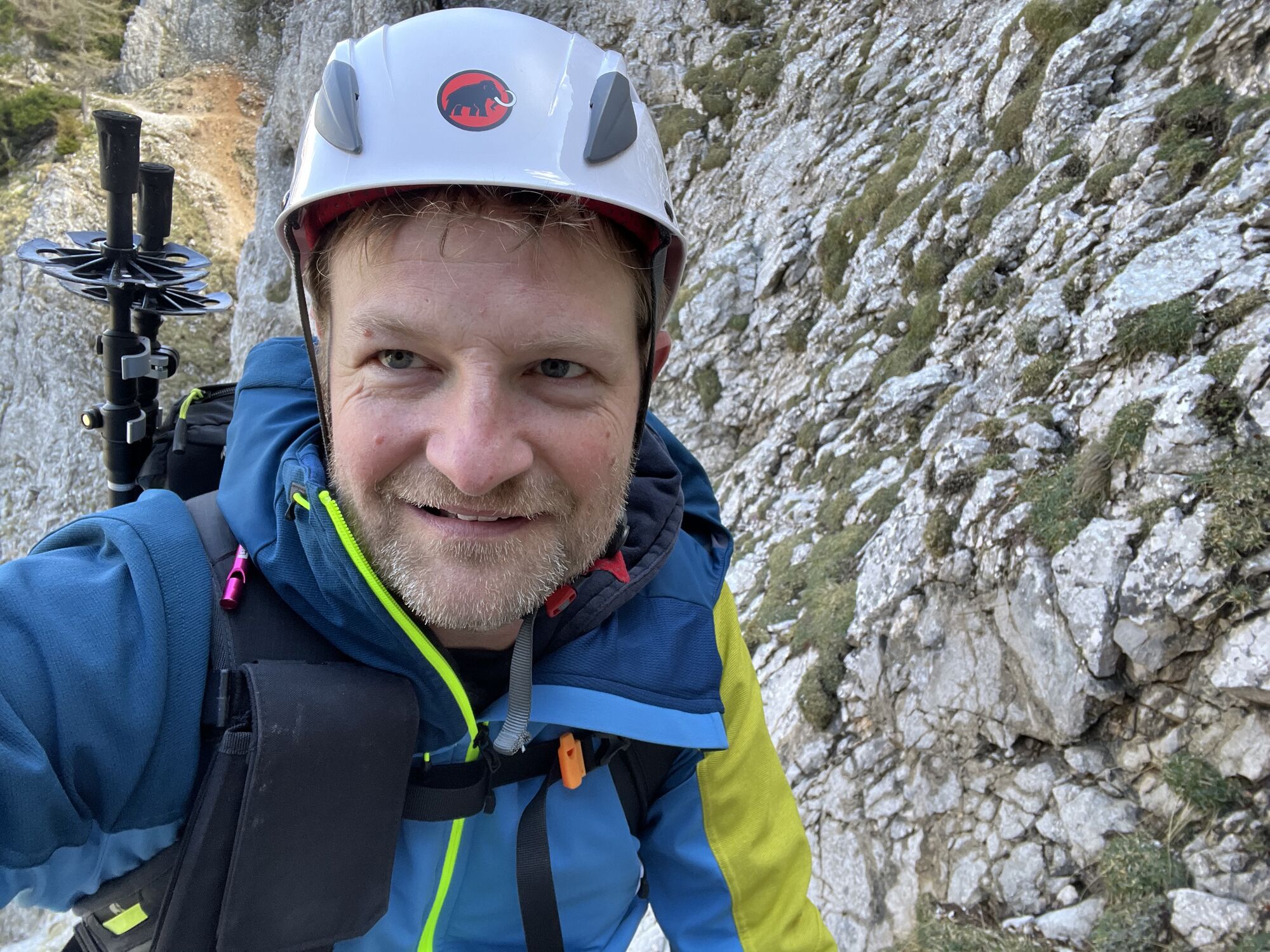
Helmet to protect against falling rocks, via ferrata set
Helmet to protect against falling rocks, via ferrata set
parking lot in Hinternaßwald

Priljubljeni izleti v okolici
- 4,6
Losenheim: Edelweißhütte - Fadensteig - Fischerhütte
srednjaPohodništvo 11,5 km - 4,7
Zahnradbahn und Wandern am Schneeberg - Plateauwanderung
srednjaPohodništvo 6,90 km - 4,8
Rax - Heukuppe
Pohodništvo 15,6 km - 5,0
"Weichtalklamm" über Stock und Stein durch das Höllental - Weichtalhaus - Kientallerhütte 1340m
srednjaPohodništvo 14,0 km - 4,8
Cultural walk Payerbach-Reichenau
svetlobaPohodništvo 7,43 km - 5,0
Reißtalersteig und Gretchensteig
težkoPohodništvo 8,10 km - 4,9
Insider tip: Schneeberg via the Novembergrat
težkoPohodništvo 13,5 km - 4,9
"Schneealpe" - "Windberg 1903m" Rundkurs
srednjaPohodništvo 14,3 km - 4,4
Familienwanderung auf die Schneealm im Naturpark Mürzer Oberland
svetlobaPohodništvo 9,86 km - 4,9
SCHNEEBERG Losenheim Nandlgrat Klosterwappen Fadenweg 28.09.2017
težkoPohodništvo 15 km

Pohodništvo in sledenje


Ne zamudite ponudb in navdiha za naslednje počitnice
Vaš e-poštni naslov je bil dodan na poštni seznam.