Ferlach: Tscheppaschlucht

Logotip Ferlach: Tscheppaschlucht
Datumi turnej
9,3km
529 - 717m
Distanz
199hm
Ascent
03:00h
 
Trajanje
Kratek opis

Romantische Schluchtwanderung, die allerdings Trittsicherheit erfordert!

Ocenjevanje
Tehnologija
Kondicija
Pokrajina
Izkušnje
Izhodiščna točka

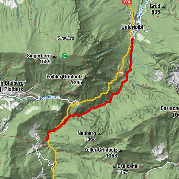
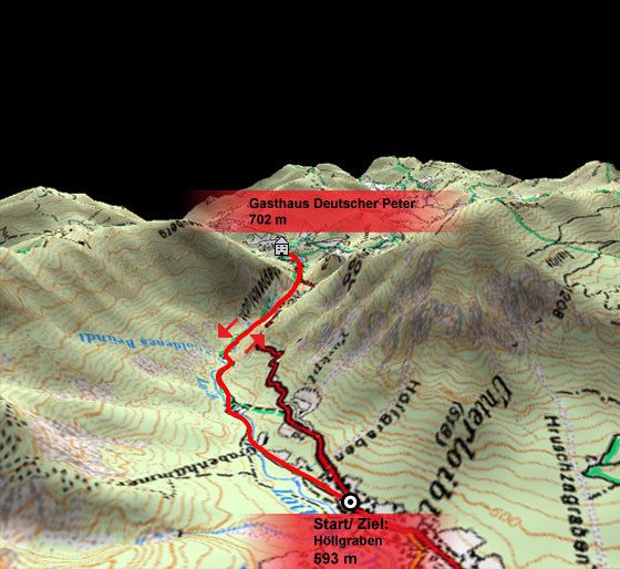
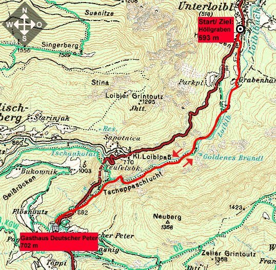
Höllgraben (ca. 593 m)

Pot
Unterloibl
Deutscher Peter
4,5 km


Najvišja točka
717 m

Počitek/Umik

Gasthaus Deutscher Peter

Gradivo za zemljevid

Informacijski telefon

04227/5119

Link

2,0
Splošna ocena

5

0

%

4

33

%

3

0

%

2

0

%

1

67

%

GPS Downloads
  • GPX GPS Exchange Format (XML)
  • KML Google Earth, Google Maps
Kode za prenos QR za mobilne telefone

Razmere na poti

Asfalt
Gramoz
Meadow
Forest
Rock
Razkrita stran
Več izletov v regijah

Priljubljeni izleti na območju

Hochobir

Pohodništvo
2,68km | 540hm | 03:00h

Klagenfurt hut

srednja Pohodništvo
6,86km | 486hm | 03:00h

Von Zell-Pfarre auf den Freiberg

težko Pohodništvo
8,14km | 936hm | 04:30h

Auf`s Ferlacher Horn von Zell-Winkel über den Franzbauer

srednja Pohodništvo
8,78km | 892hm | 04:30h