Villach - Genottehöhe - Möltschach - St.Johann

Pohodništvo
Datumi turnej
9,5km
495
- 599m
94hm
03:30h
- Kratek opis
-
großteils eben bzw. leichte Steigung
Gesamtstrecke ca. 12 km
Gehzeit ca. 3 Stunden - Ocenjevanje
-
- Izhodiščna točka
-
Rathausplatz Villach
- Pot
-
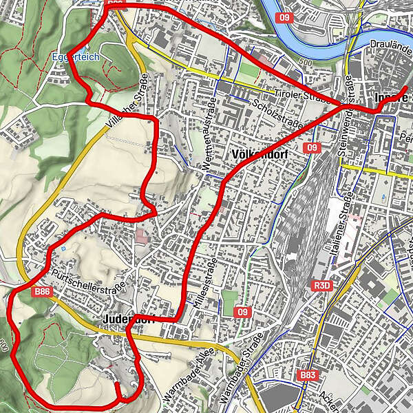
Innere StadtVillach (501 m)Villach Mosque0,1 kmDuomo San Giacomo0,1 kmVölkendorf1,1 kmJudendorfer Marterl2,7 kmGasthof Genottehöhe3,3 kmGenottehöhe3,4 kmMöltschach5,0 kmSankt Johanner Kirche6,3 kmSt. Johanner Höhe6,3 kmSt. Martin8,3 km
- Najvišja točka
- 599 m
- Počitek/Umik
-
Diverse Einkehrmöglichkeiten in der Innenstadt von Villach
Wirt in Judendorf
Gasthof Genottehöhe
Gasthaus Johannishöhe
GPS Downloads


Razmere na poti
Asfalt
Gramoz
Meadow
Forest
Rock
Razkrita stran
Več izletov v regijah