

© Projektbüro Saar-Hunsrück-Steig, Klaus-Peter Kappest

© Tourismus Zentrale Saarland, Frank Polotzek

© Stadt Wadern, Martin Vorreiter

© Stadt Wadern, Martin Vorreiter

© Alexa Kirsch Fotographie

© Projektbüro Saar-Hunsrück-Steig, Klaus-Peter Kappest

© Saarland - Frank Polotzek

- Kratek opis
-
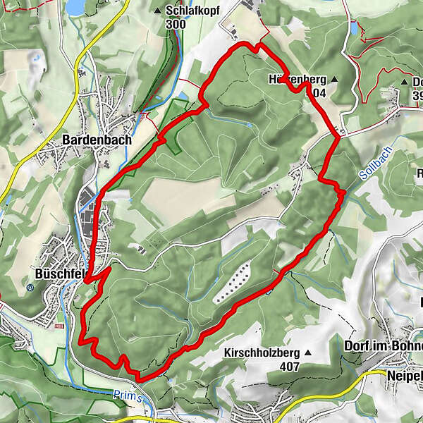
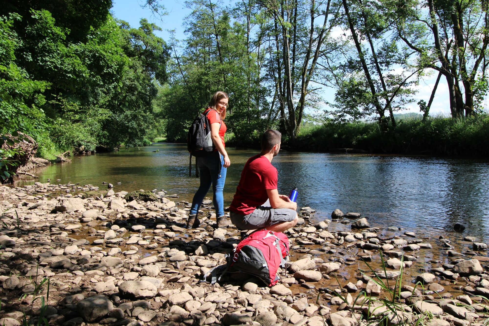
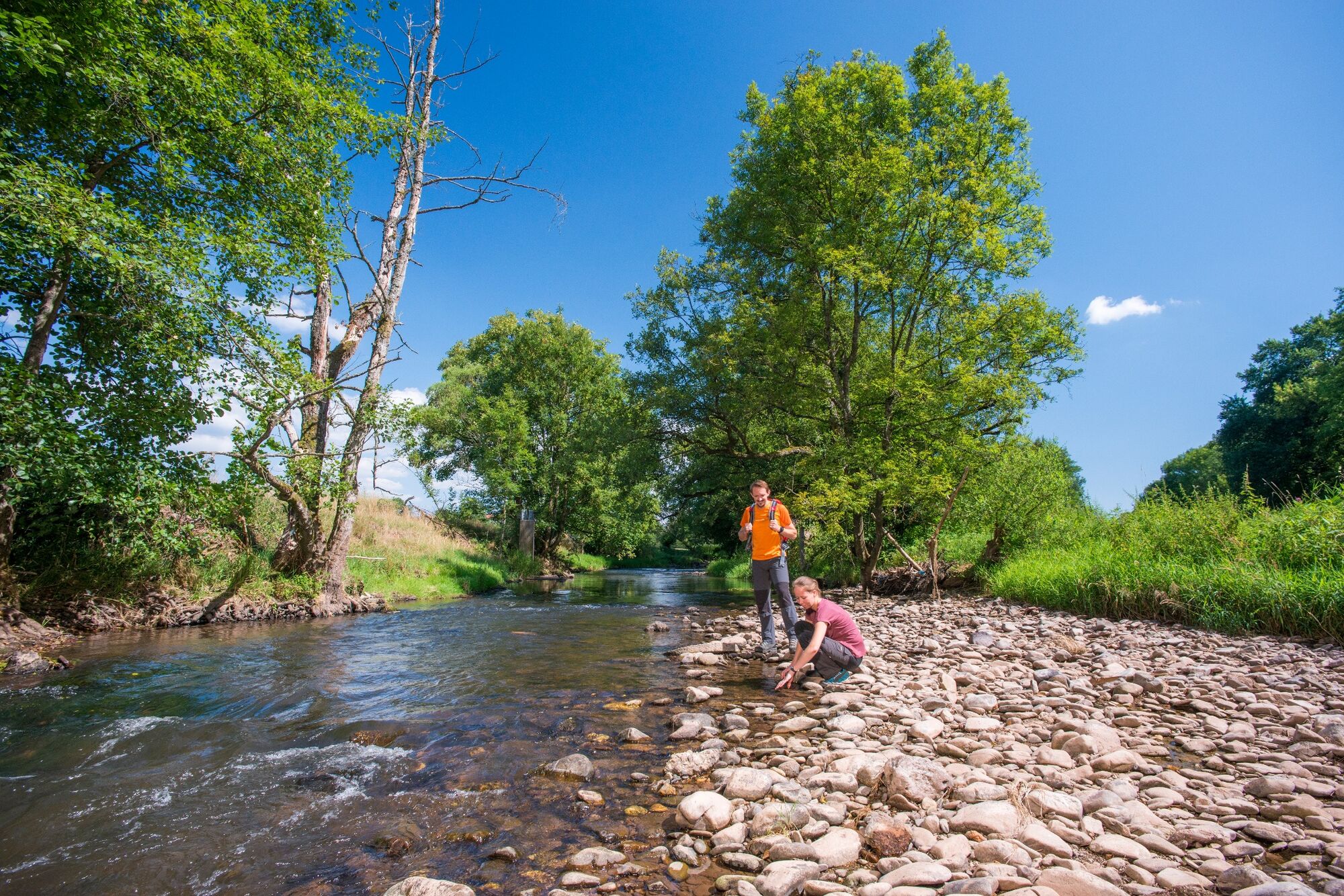
You’ll immediately see why this route is called ‘Water Trail‘ because there’ll always be some gushing springs, picturesque ponds or idyllic rivers and creeks around you. While following the way of the water through wild romantic landscapes you’ll also come across some natural monuments and rock formations.
- Težavnost
-
srednja
- Ocenjevanje
-
- Pot
-
Büschfeld (246 m)0,4 kmAussichtspunkt "Kälberfels"1,6 kmHeinenborn3,4 kmButtnich9,6 kmBardenbach (261 m)11,9 kmBüschfeld (246 m)13,0 km
- Najboljša sezona
-
janfebmaraprmajjunjulavgsepoktnovdec
- Najvišja točka
- 395 m
- Profil nadmorske višine
-
 © outdooractive.com


- Avtor
-
Turneja Water Trail uporablja outdooractive.com na spletni strani ..
Vsi pregledi
tatjana werten
06. Apr. 2024
Toll
GPS Downloads


Splošne informacije
Postanek za osvežitev
Obetavno
Več izletov v regijah
-
Hochwald Ferienland
386
-
Eppelborn
55


