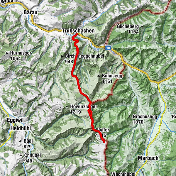
Höhenweg Entlebuch Emmental - Etappe 4: Trubschachen – Grosshorben

Pohodništvo

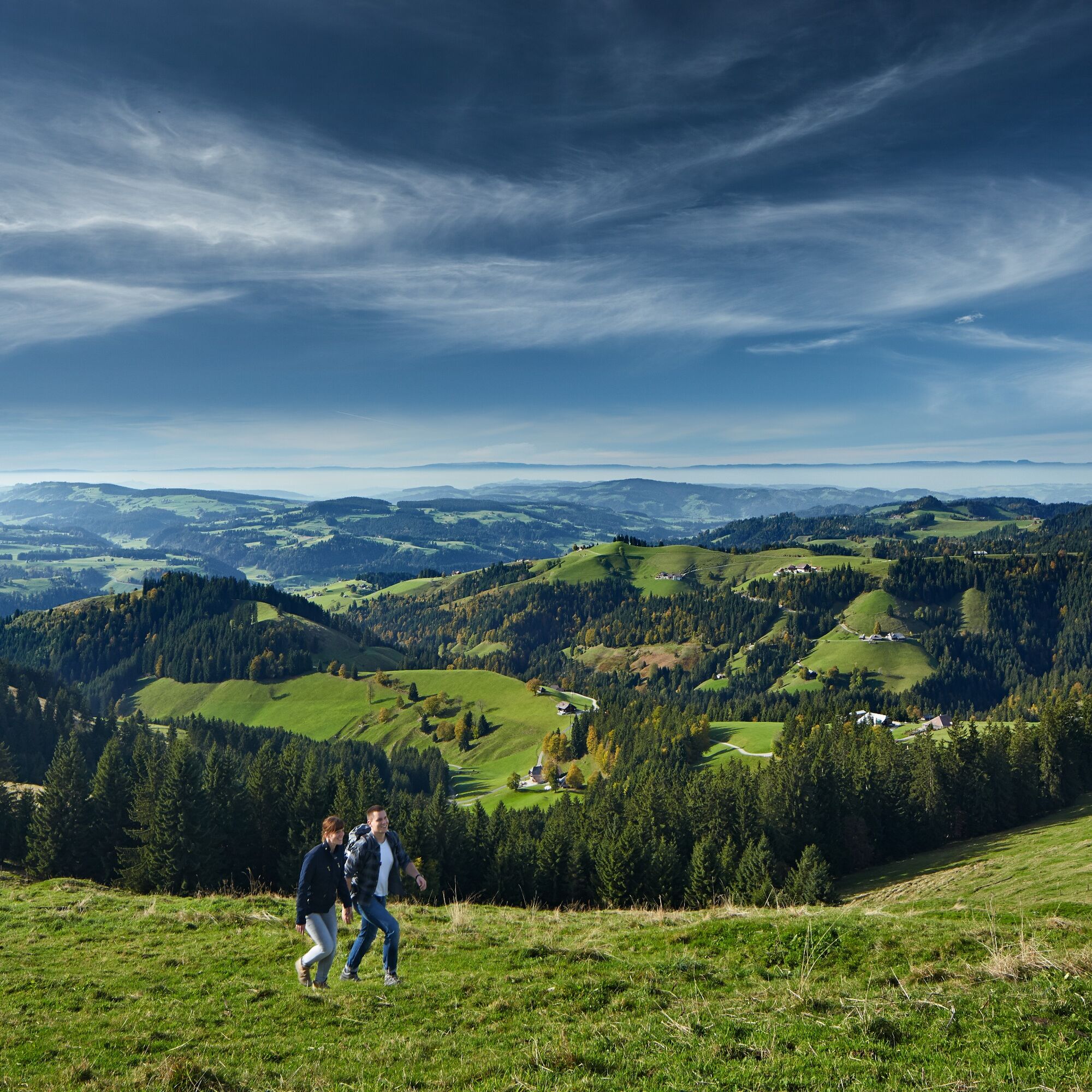
© Emmental Tourismus - Fabienne Röösli

© UNESCO Biosphäre Entlebuch

© Emmental Tourismus

© Emmental Tourismus
- Kratek opis
-
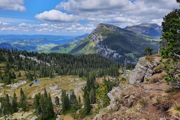
Die vierte Etappe führt über die Emmentaler "Höger" und bietet fantastische Ausblicke.
- Težavnost
-
srednja
- Ocenjevanje
-
- Pot
-
TrubschachenChäserenegg (1.269 m)5,1 kmRämisgummehoger (1.300 m)6,8 kmHinter Rämisgummen7,5 kmPfyffer (1.315 m)7,9 kmBrunnenboden8,6 km
- Najboljša sezona
-
janfebmaraprmajjunjulavgsepoktnovdec
- Najvišja točka
- 1.296 m
- Destinacija
-
Grosshorben
- Profil nadmorske višine
-
 © outdooractive.com


-

-
AvtorTurneja Höhenweg Entlebuch Emmental - Etappe 4: Trubschachen – Grosshorben uporablja outdooractive.com na spletni strani ..
GPS Downloads


Splošne informacije
Postanek za osvežitev
Flora
Obetavno
Več izletov v regijah
-
Obwalden
2014
-
Emmental
550
-
Trubschachen
159