Route des Grandes Alpes - From Val d'Isere to Termignon (6)

Cestno kolo

© TILT COM’SEIL - Brice Milbergue
© TILT COM’SEIL - Lionel Terrail

© Outdooractive – 3D Videos

© TILT COM’SEIL - Lionel Terrail

© TILT COM’SEIL - Lionel Terrail

© TILT COM’SEIL - Lionel Terrail

© TILT COM’SEIL - Brice Milbergue

© TILT COM’SEIL - Brice Milbergue
Datumi turnej
54,62km
1.299
- 2.761m
1.076hm
1.573hm
04:18h

TILT COM’SEIL
- Kratek opis
-
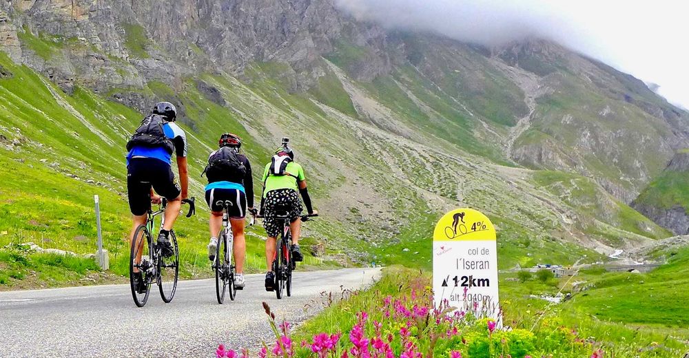
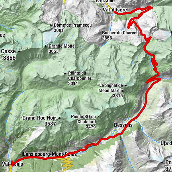
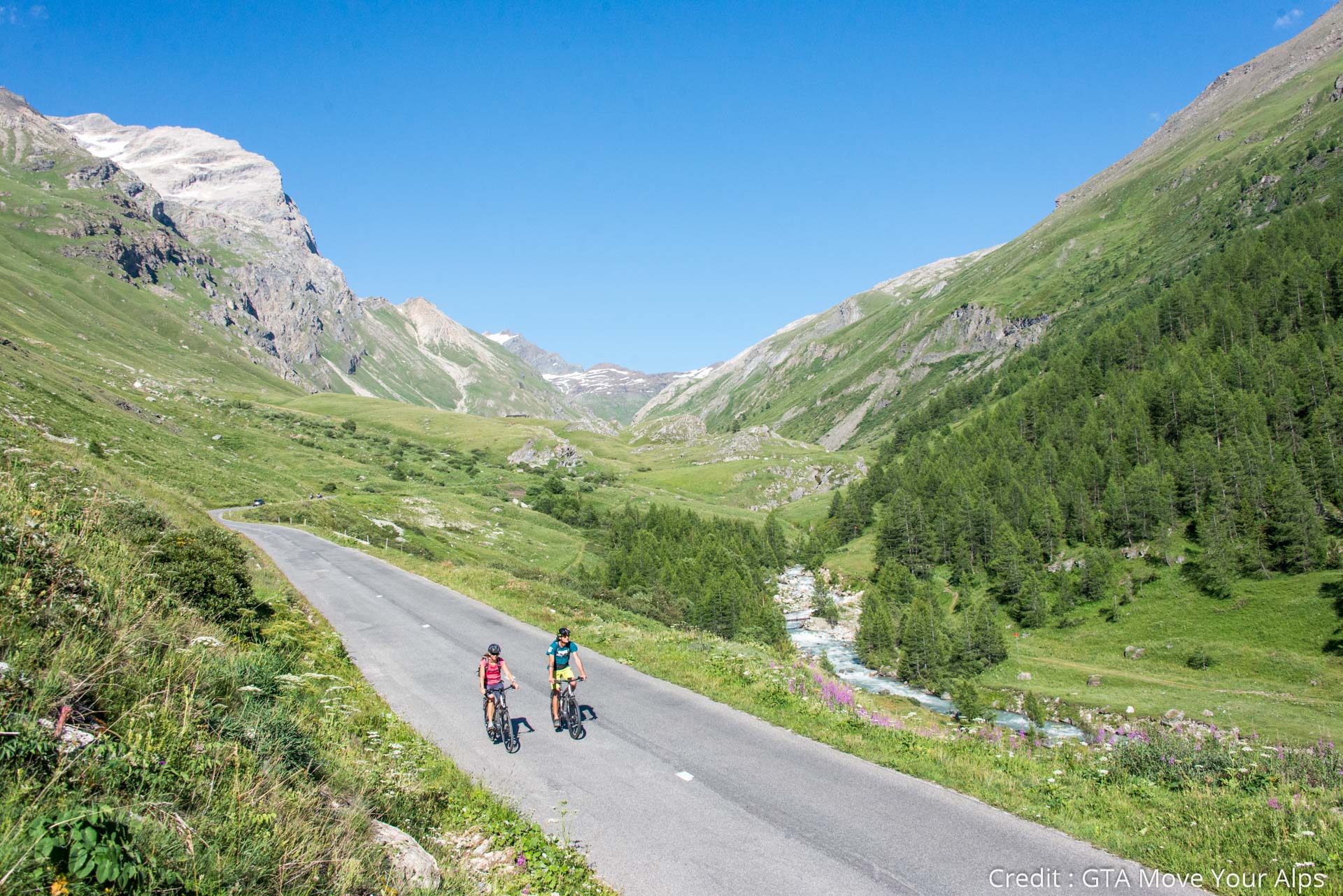
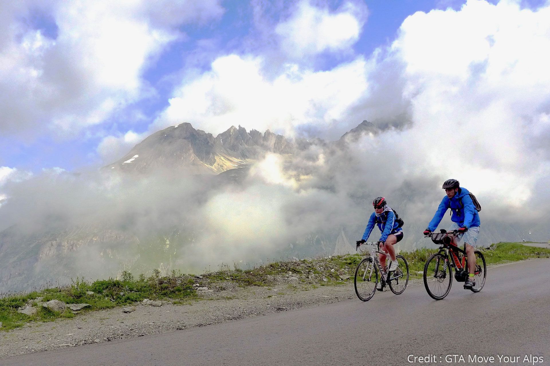
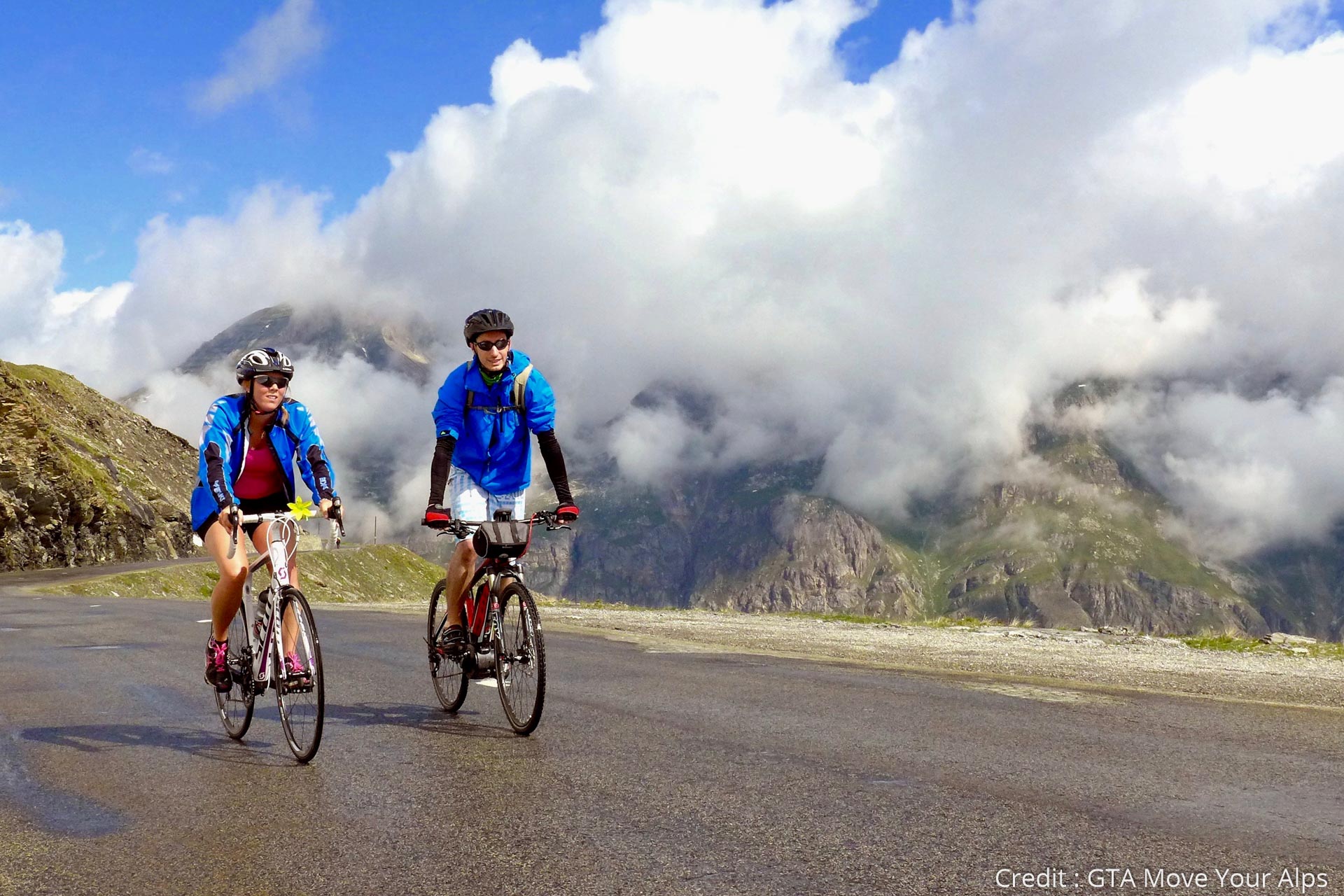
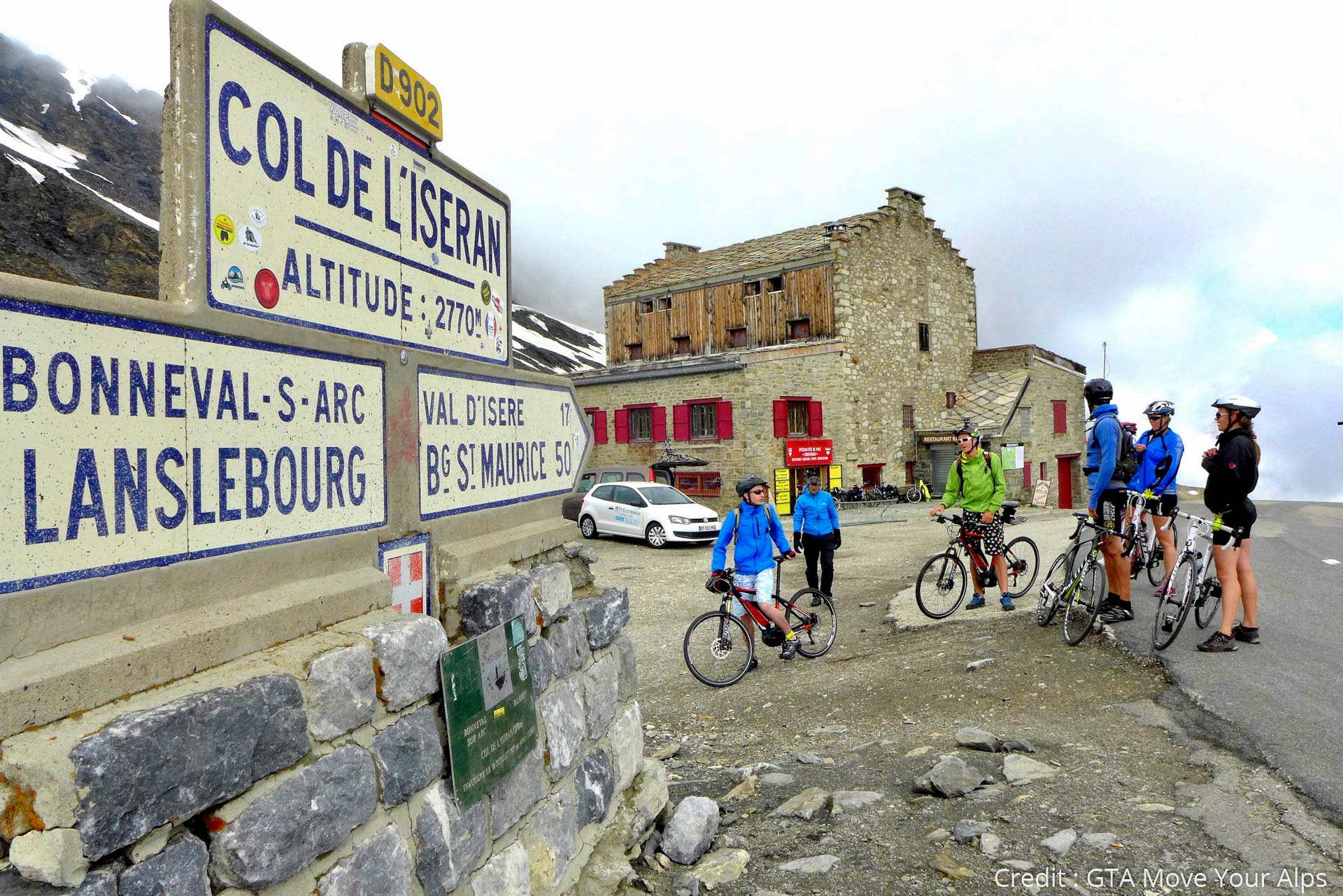
This 6th stage takes you to conquer a giant! You will climb Col de l'Iseran (2764m), the highest road pass of the Alps, before descending to the picturesque village of Bonneval-sur-Arc at the beginning of the Maurienne valley.
- Težavnost
-
težko
- Ocenjevanje
-
- Pot
-
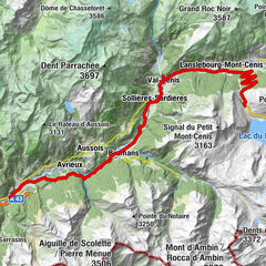
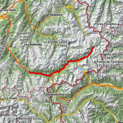
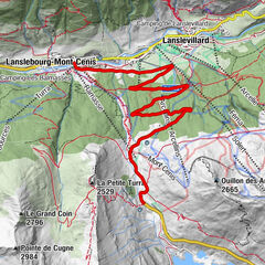
Val-d'IsèreChapelle Saint-Roch0,1 kmL'Adroit0,4 kmLe Laisinant1,2 kmChapelle Sainte-Lucie1,6 kmL'Atelier d'Edmond2,4 kmChapelle Sainte-Marie-Madeleine2,4 kmLe Fornet2,6 kmLes Crozets2,6 kmLe Signal8,7 kmPré Chemin12,9 kmRestaurant du Col de l'Iseran16,1 kmCol de l'Iseran (2.770 m)16,1 kmChapelle Saint-Barthélémy24,5 kmPré du Vas28,7 kmPré Catin28,9 kmBonneval-sur-Arc29,5 kmLes Conchettes36,4 kmBessans36,9 kmPré Clos42,8 kmLa Croix45,0 kmLes Terres Grasses45,2 kmLe Mollaret45,5 kmL'Adroit45,7 kmChapelle Sainte-Anne45,7 kmLanslevillard45,9 kmLes Champs46,8 kmHerbefin47,2 kmLanslebourg-Mont-Cenis48,9 kmÉglise Notre-Dame de l'Assomption48,9 kmTermignon54,2 kmVal-Cenis54,2 km
- Najboljša sezona
-
janfebmaraprmajjunjulavgsepoktnovdec
- Najvišja točka
- 2.761 m
- Destinacija
-
Termignon
- Profil nadmorske višine
-
 © outdooractive.com


- Avtor
-
TILT COM’SEILTurneja Route des Grandes Alpes - From Val d'Isere to Termignon (6) uporablja outdooractive.com na spletni strani ..
GPS Downloads


Več izletov v regijah
-
Savoie
39
-
Haute Maurienne Vanoise
39
-
Bessans
12