North South Long Distance Trail 05 through Styria

Pohodništvo v daljavo

© TV Hochsteiermark - Ute Gurdet

© Outdooractive – 3D Videos
© Tourismusverband Leoben - copyright Foto Freisinger - Ute Gurdet

© Tourismusbüro Lipizzanerheimat - Tourismusverband Lipizzanerheimat
© Berg- und Naturwacht Bezirk Voitsberg - Robert Cescutti
© Skiinfo & Bergleben

© Smac GmbH

- Kratek opis
-
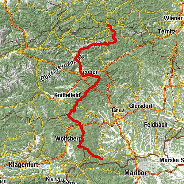
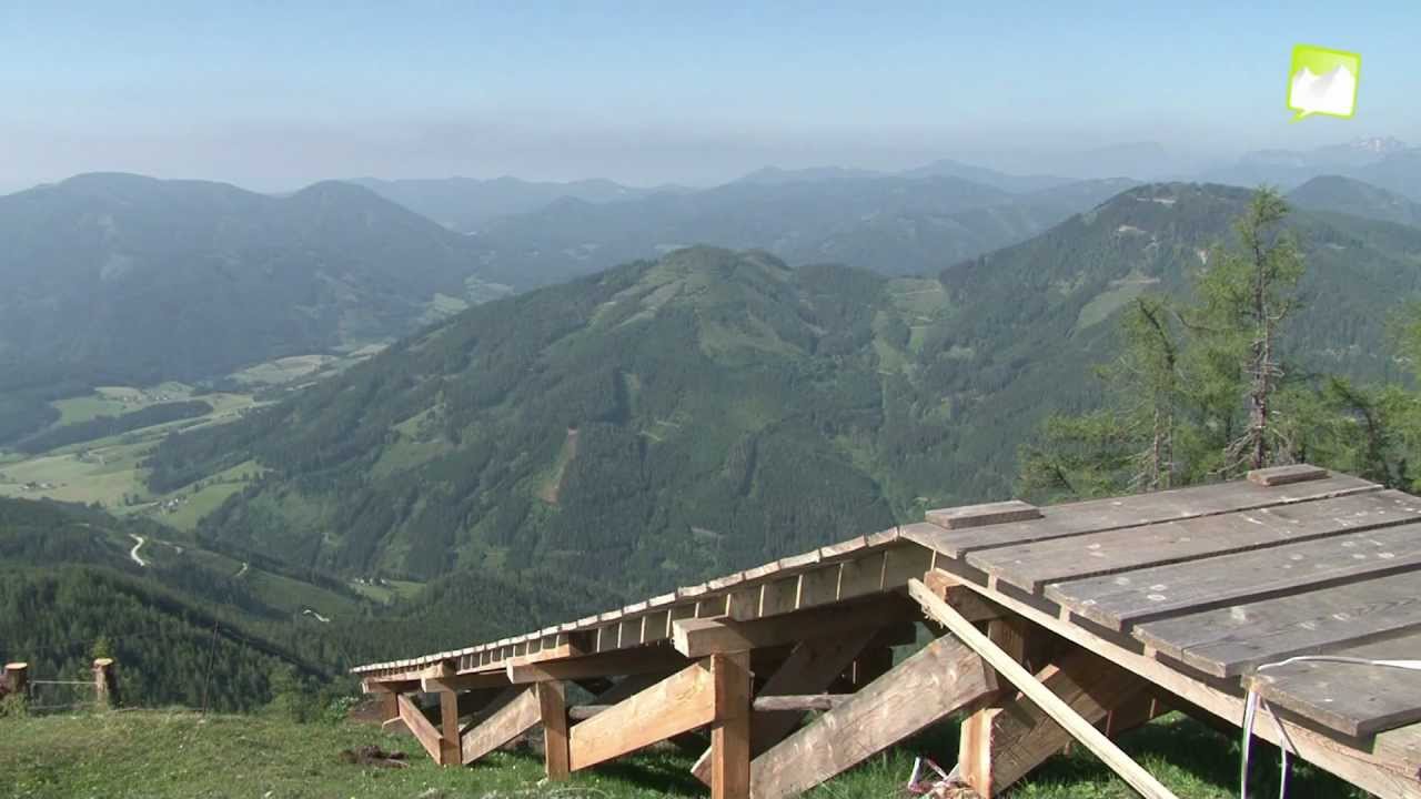
The North-South Long Distance Trail 05 was opened in 1970 and is one of the oldest long distance trails in Austria. It starts at the 1,017 m high Nebelstein in the upper Waldviertel and runs largely in a southerly direction into the Styrian wine country to Eibiswald. On its way it touches the manifold landscape forms and encounters cultural assets of Austria. Except for the area of the Hochschwab and the Eisenerzer Reichstein (here, surefootedness and a head for heights are required in some places), it can be considered a long-distance hiking trail for the whole family.
- Težavnost
-
težko
- Ocenjevanje
-
- Pot
-
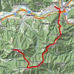
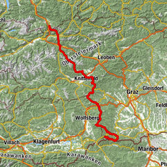
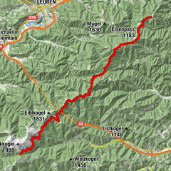
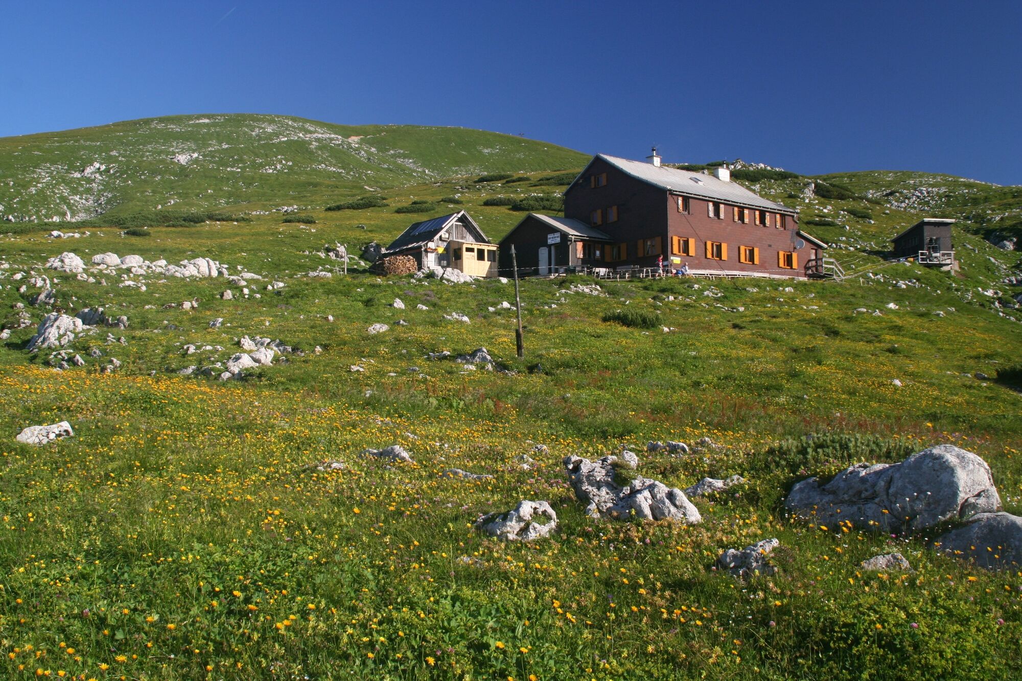
Mariazell0,1 kmMichaelskapelle0,2 kmSt. Josef0,2 kmGasthaus "Zur Weinperle"2,6 kmMooshubenwirt5,3 kmHerrenboden (1.402 m)13,2 kmHalterhütte Ochsenboden14,7 kmWeißalm15,9 kmWetterl16,9 kmWetterinalm Sennhütte17,5 kmBerggasthof Plodererhof18,4 kmHohe Veitsch (1.981 m)24,6 kmGraf Meran Haus25,0 kmTeufelssteig25,7 kmRotsohlalm27,4 kmGöriacher Alm34,6 kmStrobl-Hütte34,7 kmSeebergalm37,5 kmKatholische Pfarrkirche St. Leonhard Seewiesen39,7 kmSeewiesen39,8 kmHotel Restaurant Seeberghof40,1 kmFlorlhütte (1.284 m)45,3 kmHöllkampl (1.449 m)46,4 kmVoisthalergasse47,5 kmKleiner Hochschwab (2.248 m)52,1 kmHochschwab (2.277 m)52,4 kmG'hacktkogel (2.213 m)53,4 kmHäuslalm Hütte59,5 kmSackwiesenalm (1.450 m)60,0 kmSonnschienhütte62,6 kmHörndlalm65,0 kmKulmalm66,9 kmHirscheggsattel (1.699 m)72,5 kmLeobner Hütte73,2 kmPolsterkar Höhle73,4 kmKnappensteig Alm74,6 kmPräbichl (1.226 m)76,4 kmPräbichlerhof76,9 kmReichensteinhütte81,3 kmReichenhals82,1 kmKrumphals (1.700 m)83,5 kmKrumpenbachfall84,8 kmTauchendsattel (950 m)90,0 kmKrumpen91,6 kmKranewitter Kapelle92,9 kmHafning93,6 kmKurzheim94,9 kmJausenstation Gößbachstüberl95,5 kmTrofaiach97,9 kmObergausendorf98,7 kmGausendorf99,0 kmWaasen113,0 kmLeoben113,5 kmSt. Alfonskirche113,6 kmSpitz Christi118,5 kmMugelschutzhaus123,6 kmMugel (1.630 m)123,6 kmTrasattel (1.304 m)125,8 kmHochalm (1.580 m)128,6 kmAlmwirt (1.170 m)131,9 kmPöllasattel (1.270 m)133,6 kmFensteralm (1.642 m)137,3 kmPolsterkogel (1.608 m)140,1 kmPolstersattel (1.505 m)140,5 kmEiblkogel (1.831 m)142,4 kmKreuzsattel (1.583 m)144,4 kmLärchkogel (1.894 m)146,2 kmSpeikkogel (1.988 m)148,8 kmGleinalm Schutzhaus150,0 kmMaria Schnee150,1 kmScherzberg (1.624 m)167,0 kmDr.Otto-Koren-Hütte (1.550 m)170,2 kmGaberl170,4 kmGaberl (1.551 m)170,7 kmGaberlhaus170,7 kmAltes Almhaus173,7 km1580175,5 kmRappoldkogel (1.928 m)177,9 kmHirschegger Sattel179,7 kmSalzstiegelhaus179,8 kmPeterer Sattel (1.745 m)183,3 kmHirschegger Alm (1.871 m)187,6 kmBernsteinhütte191,5 kmKnödelhütte194,2 kmSamerkreuz198,1 kmPack198,7 kmPfarrkirche hl. Martin198,9 kmFichtenhof und Hebalmranch206,0 kmWildbachsattel (1.605 m)214,7 kmWeberkogel (1.805 m)215,8 kmPauluskapelle217,7 kmWeinofenblick218,0 kmWeinofen (1.726 m)219,0 kmHühnerstütze (1.989 m)223,3 kmSeespitz (2.066 m)225,2 kmGroßer Speikkogel (2.140 m)226,0 kmKoralpenhaus226,8 kmKleiner Frauenkogel (1.861 m)231,6 kmDie Kramerin235,6 kmBrendlhütte237,4 kmSankt Oswald ob Eibiswald247,5 kmHöchwirth Kapelle252,1 kmAussichtsturm Garber254,8 kmBuschenschank Garber254,8 kmKreuzkirche258,4 kmPizzeria & Kebaphaus MEMO258,6 kmEibiswald258,9 kmHasewend’s Kirchenwirt259,2 kmPfarrkirche Maria im Dorn259,2 km
- Najboljša sezona
-
janfebmaraprmajjunjulavgsepoktnovdec
- Najvišja točka
- 2.263 m
- Destinacija
-
Eibiswald
- Profil nadmorske višine
-


-

-
AvtorTurneja North South Long Distance Trail 05 through Styria uporablja outdooractive.com na spletni strani ..
GPS Downloads


Splošne informacije
Postanek za osvežitev
Kulturni/Zgodovinski
Flora
Favna
Obetavno
Več izletov v regijah